- This topic has 8 replies, 6 voices, and was last updated 2 years ago by thenorthwind.
-
Issue 146: UK Adventure – Slymefoot Slide
-
slappyrickFull MemberPosted 2 years ago
Is it bikes or biscuits that hold this band of bikepackers together as they trial a new Northumberland route, the Slymefoot Slide? Words Rick Hamilton …
By slappyrick
Get the full story here:
MrAgreeableFull MemberPosted 2 years agoBoisterous drunk people on a Tuesday night eh Rick? Dreadful behaviour…
3thenorthwindFull MemberPosted 1 year agoBeing fairly local (Newcastle) it was nice to see this route in the mag, and I got the chance to check it out for myself over the last couple of days. A lot of it I’m already familiar with, but it’s always good to find new bits and link them up in a different way, so I followed the route pretty closely despite the urge to tweak it when looking at the map.
I was keen to get out and make the most of the last of the proper summer weather (for now) and use the opportunity to bivvy right up on the border ridge where the breeze would be welcome respite from the heat and midges, rather than something to get out of ASAP as it is 11 months of the year.
The route takes a more direct route out of Rothbury than I’d usually use, but it’s quite a pleasant climb… and how could it not be with views like this:

I took a shortcut off the Carriage Drive to take in some nice built trail in the woods – if you know, you know 😉
From there over to the Aln valley, there’s a lot of farm tracks, as expected – not unpleasant on a sunny summer afternoon, though had I been in more of a hurry to get to the good stuff, I might have just stuck to the quiet lanes.
There follows some nice wandering around the moors between the Aln and Breamish valleys, very much of the old school XC flavour, though there’s a very short but sweet section of slightly steeper woodland singletrack buried in there. It’s the sort of thing that would be unremarkable at your local trail centre, but feels all the sweeter for finding it in the middle of the countryside. You certainly earn it with the climb that comes after it too.


The route almost meets itself coming back at Alnhammoor, and it would have been tempting to cut this loop out given the cafe in Ingram would be shut by the time I got there, having not left Rothbury till 2.30. Besides the detour down the valley gave me the opportunity to refill my bladder at the toilets at Bulby’s Wood (“not drinking water”) – I’d already drunk all 2 litres in the heat, so it was good timing. The climb up the beautiful Breamish valley is tarmac for a long stretch, even when you leave the public road at Hartside.

Heading into Kidland Forest, I was keen to stick to the route of Salter’s Road and cross the Usway burn at Davidson’s Linn, a lovely spot and a good place to top up water supplies before the ridge, rather than following the fire road on its circuitous route round the top of the valley. I knew there was a risk that Arwen had left some obstacles, and a sign on the forestry boundary said there were path diversions, but there was nothing more where the old route leaves the fire road.
I filled up at Davidson’s Linn, already another litre down, about 8.30. I was still in short sleeves and legs since it was still warm, and the midges weren’t a problem as long as I was moving. At this rate, I should be on the ridge with plenty of time to find a nice bivvy spot and watch the sunset.
Then it all went a bit “adventure”. Climbing out of the little valley, I found the path completely blocked by mature trees. Not a hope in hell of getting around or through.

On a different occasion, I might have just bivvied there as it’s a nice spot, but I probably would have been chewed to the bones, so had little choice but to retreat back to the fire road. Nothing ventured, nothing gained. It’s a shame this route is still blocked though.
Speeding down the fire road, the midges had appeared to the point that they were collecting on my bare skin, so against my better judgement, I stopped to Smidge up and throw a layer on, despite the sweaty conditions. Within seconds a cloud had assembled and I had to abort and pedalled for my life. Not long after, I passed three blokes in a pickup coming the other way – I couldn’t think what they might be doing in the forest at 9pm, and I’m sure it was totally legitimate, but I didn’t fancy finding out, so I gave them no attention beyond a quick wave without missing a pedal stroke. Another reason to get out of the forest ASAP.
However, Arwen had other ideas. The route follows Salter’s Road out of the forest, so I assumed it had been cleared, although there’s mention of a folding saw. But there must have been more windfall since, because there was no chance of getting through, saw or none. There was a wide swathe of forest down, blocking the fire breaks and the other bridleway. I thought there was no option but to descend into the valley and climb all the way back up, but the fire road gets to within 50 yards or so of the forest edge, so by crawling and dragging my bike under the live growth by the road and blundering through the brittle understorey I managed to escape to the (dry, thankfully) tussock bog outside the boundary fence and yomp across to Clennell Street.
Sweatier, and with more twigs stuck to me than usual, I made the ridge about half an hour before sunset, where thankfully there was a decent breeze. I had a celebratory nip from the hip flash, made some food and put my tarp up (badly, it turned out, it flapped all night and kept me awake) on the flat bit of short grass right by the track junction, and just over the fence from Scotland – technically, had I crossed the fenceline, I would have had a legal right to camp there, but the distinction seemed fairly academic, so I took the better spot.


Not the best night’s sleep, but at least it was cooler than at home! I was up with the sun about 5, but had a leisurely early morning having coffee and porridge in bed, and generally relishing not being cold after a bivvy in Britain.

I set off down the hill looking forward to the descent of the Usway Burn. I might have headed back up to the Middle from Trows and gone over Middle Hill, but I suspect the nice woodland path down to Fairhaugh has fallen victim to the storms too, so I followed the route along the road and up from Barrowburn. The Usway Burn is still a delight, despite the ongoing forestry work at the top.

From Shillmoor I climbed over Pass Peth rather than the road way round, partly because I’m a sucker for punishment, and the bridleway down to the road is fast and flowy. The route takes a detour up into Harbottle Woods, but there’s a lot of forestry work going on here, and I suspect there wouldn’t be much to see beyond clear felled forest and fire roads, so I stuck to the road for another mile and crossed the Coquet by the footbridge to follow the bridleway along the north side to Hepple, rather than the road.

I did encounter a herd of cows with their calves along here, one of which I had to shoo off the bridge, enclosed on three sides, I needed to cross, before I cornered it. One of the cows was extra chunky, with a ring through its nose – cute! 😉

I’ve done the climb up to Chartners from Hepple Whitefield as a descent a few times, so it made a change to tackle it the other way. No gin for me though 🙁
Coming down through Simonside, I made used of the now-clear, slightly cheeky, walking trail for a bit of rocky, rooty fun, and took the bridleway over to Whitton rather than road. I dropped back into Rothbury in plenty of time for steak and haggis pie from the bakery 😀
1DracFull MemberPosted 1 year agoBloody hell I did a route for STW around 20 years ago, called it the same name. 🙂
Cracking route and write up.
2mtbfixFull MemberPosted 1 year agoGood write up. If Davison’s Linn is where I think it is then it’s one of the prettiest spots I’ve ever had the pleasure to stop on a bike. Whilst it’s nice to have my dad nearer these days, I do miss the trips up to Harbottle.
thenorthwindFull MemberPosted 1 year agoThanks both. I still don’t actually know where Slymefoot is Drac.
Davidson’s Linn is a really nice spot, I’ve had it in mind for a bivvy before, just not during midge season. It’s a real shame the old route through is blocked and you can only access it from one side.
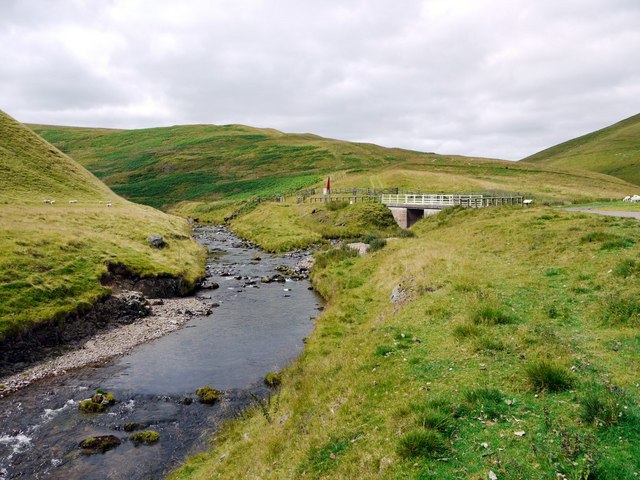
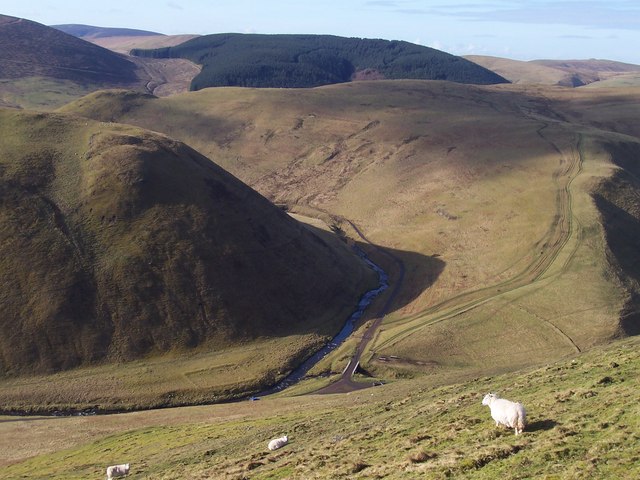
HedgehopperFull MemberPosted 1 year agoHa! I posted the geograph pages and it’s just printed the photos..
I believe Slymefoot was around where the Rowhope Burn meets the valley road grid ref NT859114
Edit: I think if you click on a photo it takes you to the relevant page.
You must be logged in to reply to this topic.


