Home Forums Chat Forum Map data people

Viewing 13 posts - 1 through 13 (of 13 total)
  • Map data people
  • matt_outandabout
    Free Member

    I have need for work for some reasonably accurate mapping, of school grounds, to calculate areas of habitat and surface type.

    Freemaptools uses google data and images, and they are out of date compared to OSM and OS.

    Both Open Street Map and OS GetaMap have (just) enough resolution.

    Can anyone suggest a site or programme that has tools to measure area?

    Stoner
    Free Member

    always used promap when I was doing proper chartered surveying stuff

    http://www.promap.co.uk/

    You get access to higher scale mapping, and can use their redline polygon tool for outlines and area measurements

    footflaps
    Full Member

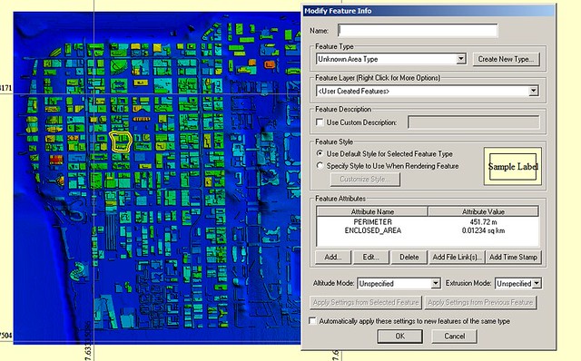
    Global Mapper?

    EDIT: Yep, you can add polygons and get the area etc, eg Downtown Chicago:

    Test by brf[/url], on Flickr

    Stoner
    Free Member

    there’s also tools linked to through the planning portal

    http://www.planningportal.gov.uk/planning/applications/plans

    SOme of them with boundary tools can probably do area measurements too.

    soma_rich
    Free Member

    quantum GIS might do what you need and its free

    ebygomm
    Free Member

    Qgis and openlayers plugin for aerial imagery

    Teetosugars
    Free Member

    Magic, or as Stoner Says, Promap are the best we use..

    http://www.magic.gov.uk/

    matt_outandabout
    Free Member

    Cheers, on it and sorting which one to go for. It needs to be accessible to colleagues and teachers in schools.

    soma_rich
    Free Member

    In that case I think you can do it in KML on Google Earth. somthing like this:
    https://productforums.google.com/forum/#!topic/earth/F_x3rwWP9bU

    ebygomm
    Free Member

    Have you looked at digimap for schools?

    geoffj
    Full Member

    Quantum and open layers is good but a bit of a learning curve.
    Magic will be shite for Scotland
    I’d suggest speaking to SNH (Inverness office) and see if their GI techies can help.

    matt_outandabout
    Free Member

    Ebygomm – yes, looked at digital, it doesn’t offer the resolution we needed. Planning portal type detail, ideally with satellite imaging is perfect.

    thats_not_my_name
    Free Member

    Digimap for Schools gives you access to Ordnance Survey MasterMap, which is the most detailed level mapping available and allows you to measure length and area. No aerial photography, though.

Viewing 13 posts - 1 through 13 (of 13 total)

The topic ‘Map data people’ is closed to new replies.