Home › Forums › Bike Forum › Epic North Pennines route – Advice please
- This topic has 23 replies, 7 voices, and was last updated 14 years ago by GaVgAs.
-
Epic North Pennines route – Advice please
-
 couldgetacarforthatFree MemberPosted 14 years ago
 Eating a mince pie and planning for a summer epic.
Planning to start in Knock.
Up long road to Great Dun Fell radar station
Across long wild moor to Garrigill and lunch at pub (if open)
Cow Green Reservoir
Back over simarly wild moor to High Cup NickIts a long way and I am conscious that this is probably as remote as England gets. Any comments or better suggestions are welcome. The only trail I can find suggests doing this the other way but riding down a tarmac road seems from Great Dun Fell seems such a shame considering the effort required to get there in the first place.
esselgruntfuttockFree MemberPosted 14 years agoTis a bastid of a climb that.
We’ve always started from Cow Green (handier) then gone across to High Cup, down to Dufton (decent descent) along the road to Knock & up said bastid climb, then following Trout Beck back towards Cow Green.However, I’ve never actually gone past the radar station & on to Gregs Hut which is basically what your’e doing. I’m certain I’ve been on the top of Cross Fell with the bike though.
Why don’t you start at Knock, up the bastid climb, follow Trout Beck till you come to the bridge where the Tees starts then keep on tarmac to Garrigill. Then pick up the b/way back to Cross Fell, go past (& into) Gregs hut, keeping on that b/way down to Kirkland/Blencarn/Millburn/Knock.
There, sorted.OR…you could go from Knock to Dufton, up to High Cup, follow the Pennine Way to Cow Green then hit the track that goes towards Garrigil. This would either bring out on the B6277 or you could heather bash across to the meeting point of the Tees & Trout Beck then carry on to Garrigil.
That would be reasonably epic.
couldgetacarforthatFree MemberPosted 14 years agoCheers mate the landscape reminds me of east falkland back in ’82.
One question. At top of bastid climb is it easy to lose trail to Troutbeck. Looking at Google Earth it looks very missable.
Its been a while since I last did any Yomping
esselgruntfuttockFree MemberPosted 14 years agoAs far as I recall, It was easy to spot, the Pennine Way went kinda straight on & the one you want went right-ish. When we 1st did it in 1937 the track was dreadful but they’ve kinda filled the bad bits in, last did it about 3 years ago.
I reckon if you did the xtended one I mentioned it’d be about 37-40 miles.
The only yompie bit would be from Trout Beck/Tees bridge over to the track to Cow Green or vice versa but It’s only about a mile.
esselgruntfuttockFree MemberPosted 14 years agoYeah 1937, we did it on Penny Farthings, me & my cousin Wilf. He’s dead now, died in a n abbatoir accident. 😆
Probly 1st did it in about 1993-4 TBH.
couldgetacarforthatFree MemberPosted 14 years agoFull ration pack and a bivvy I reakon. I regularly drive on the Alston road and got to say the view towards Cross Fell and back to the Eden valley has to be one of Ingerlunds best. Its just amazing.
Got wet knickers just thinking about it. Roll on summer
esselgruntfuttockFree MemberPosted 14 years agoHey look what I found in the photo album!


I’m not even in the photo’s cos I took em!
crouch_potatoFree MemberPosted 14 years agoIts a decent route in the dry or after a hard freeze. The climb isn’t bad and you can’t miss the turn off at the top. The singletrack sections along the river are prone to getting trashed by motorbike use from time to time which can make the best bits a nightmare after prolonged wet spells. I think the way you suggest is the best way round – the troutbeck singletrack is not much fun ascending, and the approach to highcup nick from the east never fails to disappoint., although if you do the reverse, the bridleway descents to the Eden from the high tops are mostly good if you don’t fancy attempting land speed records on the road.
Alternatives worth considering are to loop from Garrigill over either tees or tyne sources (the pennine way from cauldron snout can be a bit of a drag), or if you’re feeling up for a long day out, you can do a figure of 8 (ish) including the above that will still keep highcup nick in- (a tiring one- for the summer obviously).
couldgetacarforthatFree MemberPosted 14 years agoPhotos 2 & 3 show your cycling buddies to be true northern legends. Real men!
Photo 1 however is as camp as Christmas. Who’s the mush in the purple shorts and top combo? Even George Michael would think twice about wearing that.
No but fair dues well done. I’m really fizzing at the bunghole now
sporteusFull MemberPosted 14 years agoDefinitely a classic and better clockwise than anti-clockwise IMHO. Arriving at High Cup Nick from Cow Green is a pretty awesome experience. Certainly worth the tarmac flog from Knock up to Great Dun Fell.
Where you start probably depends upon where you live, but Dufton or Garrigill would be sound options. The George and Dragon in Garrigill has recently re-opened and will be doing bar food from Easter onwards. The Stag Inn in Dufton is also a good stopping point or end of ride place. Cow Green is definitely another option as a start/finish point and not too far from the Langdon Beck Inn, another classic North Pennines pub.
The riding is great as well, by the way. When you get near to the top of Great Dun Fell you can either head down Troutbeck to Tynehead and then to Garrigill or head along the ridge over Great and Little Dun Fells and Cross Fell to Greg’s Hut. (Not technically legal but mostly rideable).From there a good Land Rover track leads down to Garrigill.
esselgruntfuttockFree MemberPosted 14 years agoPhoto 1 however is as camp as Christmas. Who’s the mush in the purple shorts and top combo? Even George Michael would think twice about wearing that.
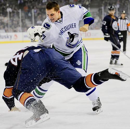
What, Steve? I know he’s a right fanny, here he is playing hockey for Vancouver a few years ago,
Then he fancied ‘rock climbing’ so i got a phot of him next to the Aguile Du Midi,
thats him on the right….

Then bugger me if he doesn’t have a go at trials riding!

Anyway he’s MTBing again,

If you can call it that!! 😉
GaVgAsFree MemberPosted 14 years agoIts a great area and I have done all of the trails in the area #cough# on a enduro bike as well as a mountainbike.
When I do this route I usually start at Blencarn,By starting here you have one of the Highest and longest, uninterupted decents in England to end the day on.
1 Travel along the lower eden valley road to Dufton,Head up the Pennine way Bridleway to High Cup nick.
2 Stay to the Lower (Southern side) of Maize beck and cross the river(at the footbridge) before the Waterfall.
3 Head onto the exellent Paved Bridleway to the decent into Birkdale Farm.
4 Have a look at the spectacular Cauldron Snout waterfall,its worth the short walk just below the Cowgreen Resevoir Dam
5 Follow the road on the Eastern side of CG Resevoir.
6 Turn Leftm along the old Mine track to the road at (B6277)Caution-This is not a permitted ROW although I have met gamekeepers (out of shooting season) and not had any problems).
7 Head North on the road for a couple of miles until you get to a “trikey to find” path/Bridleway/Boat heading Down to the South Tyne River. (A clue is the Trail Bike tyre marks in the grass!)This is known locally as the old North to South Coaching road.
8 After an amazing decent to “Tyne Head” Join the road to Garigill via Hill House/Pasture House.
9 I think the Pubs going to reopen in Garrigill, although it has been closed for some time.
10 Join the old Corpse Road Via Black Band to Greggs Hut and onto the Moor North of Cross fell summitt.
11 I prefer to acess the Little Dunfell decent to Blencarn from here (Cross fell summitt) as the more Direct Bridleway is very boggy and saps energy quickly.
12 Decend back to Blencarn from Little Dunfell/Option Great Dunfell Road.I would only do this route after dry weather/on a good visibility day, and not too late in the Summer, as the Bracken makes a hudge difference to the condition/visibility of the trail from Dunfell.It is one of the all time classic routes though,hth Enjoy!! 😉 (41 miles)
GaVgAsFree MemberPosted 14 years agoJust to add- the troutbeck Bridleway is very washed out and now impassable unless you carry in places,theres lots of lifting over the beck, and trudging through bogs.
Its best done in frosty, or drought conditions, from Great dunfell to Moor house as its slightly downhill.My route is arguably better done from Kirkland Anticlockwise,Or climbing via the road to Great Dunfell/Little Dunfell/Cross fell -(soon to be the Pennine Bridleway).
By doing it this way you get the amazing view onto High Cup Nick although the decent to Dufton is not quite as good imho due to the walkers and gates. 😥
GaVgAsFree MemberPosted 14 years ago
Cross Fell route from Kirkland

Marker stone on Bridleway between Crossfell and Little Dunfell
 Decending towards Blencarn 😀
couldgetacarforthatFree MemberPosted 14 years ago
Decending towards Blencarn 😀
couldgetacarforthatFree MemberPosted 14 years ago7 Head North on the road for a couple of miles until you get to a “trikey to find” path/Bridleway/Boat heading Down to the South Tyne River. (A clue is the Trail Bike tyre marks in the grass!)This is known locally as the old North to South Coaching road.
Thanks for detail GaVgAs. Followed your suggestion on Google Earth and I’ll do it your way. Need to know where this is first though.
samuriFree MemberPosted 14 years agoWhat, Steve? I know he’s a right fanny, here he is playing hockey for Vancouver a few years ago,
That made me laugh, thanks.
couldgetacarforthatFree MemberPosted 14 years agoI’m going for Sunday the 8th May. Got to plan well in advance due to family / work committments etc
Start at Blencarn at 9 am (unfortunately there doesn’t appear to be any immediately obvious parking spot)
Ride will be as per GaVgAs. Dress code will be as per samuri. Lunch will be at Garrigill
Anyone welcome to join me and my mate for what appears to be an amazing long anticipated ride.
GaVgAsFree MemberPosted 14 years agoHo Hum we might just join you.. 🙂 You can park at the end of the village on the green (dead end)
Dress code should be interesting..lol
I will have a look on google earth/Maps, and try to post something on here 😉
couldgetacarforthatFree MemberPosted 14 years agoNice one. Lets go gay for 2011!
Here is my email. james.hudson@bimkemi.se
Confirm later to see if May 8th is still ok weather wise etc
GaVgAsFree MemberPosted 14 years agoNuther go 🙄
This is where you turn Left off the Middleton to Alston road, It looks like theres now a sign post so it should be easier to find. 😉
The topic ‘Epic North Pennines route – Advice please’ is closed to new replies.