Singletrack's forums are sponsored by...

Topic starter
For bridleways in England specifically. It would be so nice to know if that dashed line is challenging to even walk, something you could do on a gravel bike, or something in between.
The best method I know of is to check the Bing maps aerial photos, which are the most detailed.
Classifications I would like: metalled track ok for a car with sump guard, semi metalled/rocky 4x4 track, short/grazed grassy way, long grass with no worn way through (ie not rideable), rocky footpath rideable, rocky footpath needing trials skills... Ok this system isn't going to work, but how awesome would it be if we had a classification system and the whole network classified like this?
It wouldn't just benefit MTBers, people could look and make an informed judgement of whether they might take their off road pram that way, could we take the kids for a ride this way to the beauty spot for a picnic etc.
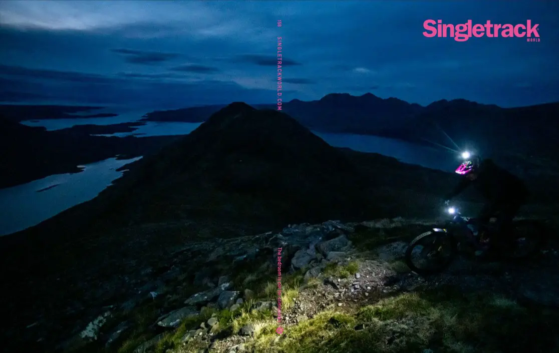
Totally messed up my ride duration over the weekend. But it was a nice memory and I got some nice sunset and moonlight photos.
Posted : 21/10/2024 7:40 pm
Classifications I would like: metalled track ok for a car with sump guard, semi metalled/rocky 4×4 track, short/grazed grassy way, long grass with no worn way through (ie not rideable), rocky footpath rideable, rocky footpath needing trials skills…
I can think of another two classifications, the first one specific to the Peak District, the second one that applies largely to the Peak but also some other places:
Trail that used to be fine until DCC came along and dumped a shitload of rubble all over it in the name of "resurfacing".
Trail that rides brilliantly for about 3 days of the year but is an absolute bogfest if there's been the slightest hint of rain in the previous month.
Posted : 21/10/2024 7:44 pm
I've got plenty mapped out that definitely don't exist on the ground.
Following one will be a miserable hack through shoulder high brambles and ankle deep sheep poo, the other will take off the side of a mountain in a parabolic curve of despair. Both on the map as a right of way. Why anyone would want the right to travel them is a mystery.
It's a good idea to classify tracks and trails beyond simply being a right of way. I've started my own map of places I've ridden and walked that describes the different sections. Rideable up/ down... Good descent...not worth the climb etc. I feel like I've basically invented trailforks but it's come in handy when my memory fails me and I can't remember stuff.
Get onto OpenStreetMap and start recording such data as part of the path properties
How does one approach such a task? And how does one see such information added by others?
Posted : 21/10/2024 8:24 pm
Topic starter
Get onto OpenStreetMap and start recording such data as part of the path properties
That may well be the place for the data to live, but this literal suggestion wouldn't make a dent in the issue.
There needs to be a classification scheme, an easy way for interested (but non enthusiasts) people to submit data, an easy way to view it for leisure users (not viewing some obscure property on OSM), an initiative to get a decent % coverage of the network done. On OSM, paths would likely need split up as the classification would vary along the way, e.g. into 1km sections.
Posted : 21/10/2024 8:26 pm
qtip reacted
Topic starter
I feel like I’ve basically invented trailforks
Except you've done the hard work i.e. making observations and judgements on the ground.
As with many online platforms (e.g. Komoot too), they're just doing the easy bit which is making a website for users to enter the data into.
Posted : 21/10/2024 8:29 pm
supernova reacted
not viewing some obscure property on OSM
But OSM properties aren't obscure. Lots of software like talkytoaster and openvttmap and even garmin use it for routing and marking grading. There is also a sort of standard although it does depend a bit on the country
For paths
https://wiki.openstreetmap.org/wiki/Tag:highway%3Dpath
For surface types:
https://wiki.openstreetmap.org/wiki/Key:surface
It's a difficult problem but OSM is the place to put the data because various tools exist to do it depending on how sophisticated you want to be. Then you later just wait for your favourite tool to update with what you have added. Personally for simple edits I do it directly on openstreetmap.org but for bigger edits use JOSM
Creating a map that is specific for your needs is a more difficult ask.
Posted : 21/10/2024 8:32 pm
supernova reacted
an initiative to get a decent % coverage of the network done.
Councils are struggling to even classify and accurately record the trails that are there - many of which are not on maps or, if they are, are listed inaccurately.
https://www.cyclinguk.org/2026scrapped
Since trail conditions can change almost daily in some places or forever in areas such as working forests, an accurate and up to date way of noting the actual ground conditions seems optimistic!
This is really where local knowledge comes in, it's something that just can't be ascertained from maps and Strava. That said, OSM remains probably the best / most appropriate place for updates such as trail conditions.
Equally, there's the situation that some trails (regardless of their legal status) are brilliant if done at crack of dawn or on a weekday but a nightmare on a Bank Holiday Monday.
Posted : 21/10/2024 8:39 pm

Geograph paints a picture quickly.
You have to interpolate for season your in Vs the season then photo was taken in
Posted : 21/10/2024 8:52 pm
Ordnance Survey maps mark trails on the ground as well as rights of way. Not in as much detail, but a single black dashed line is singletrack on the ground, double is doubletrack.
Not always 100% accurate and obviously depends on how old your map is, but handy when route planning.
Like this bridleway in the Moors - shows pretty accurately where the real trail goes Vs the right of way.

Posted : 21/10/2024 8:54 pm
wheelsonfire1 reacted
If you just use a larger scale map it's really obvious
https://m.youtube.com/watch?v=yZT-wVnFn60&pp=ygUOQmxhY2thZGRlciBtYXA%3D
Posted : 21/10/2024 10:38 pm
Topic starter
Somebody needs to invent OpenStreetMap
I'm aware of OSM but thanks for people who posted detail of how it works.
I'm not debating what underlying tool the data should be stored in. I want the stuff I described in my OP, as an end user. How could it be made to happen?
Ordnance Survey maps mark trails on the ground as well as rights of way.
I'm aware of the OS types.
In my experience, doubletrack is pretty reliable but anything else can be anywhere between janky footpath and suitable for a gravel bike.
Posted : 21/10/2024 10:52 pm
Given trails and conditions change all the time I'm wondering whether a better solution would be to correlate activity and weather data that's been gathered over time.
Presumably, locals who ride tracks close to them tend to avoid bad ones when it's been wet.
Might also be able to differentiate by rider preference (e.g. who tends to ride gnar, or who prefers just light xc)
Posted : 21/10/2024 11:01 pm
It sounds like what you are missing is a map styled in the way that you want, prerably with doubletracks highlighted in a different way from other sorts of janky footpath. The way you do it in openstreetmap is first to go to the place you want to map in openstreetmap.org and take a look at how those routes are tagged. If they have actually been tagged in a way that is useful to you then you can use a program called mkgmap ( https://www.mkgmap.org.uk/) to create a file that is styled the way that you want and that you can then load into your garmin. It's a bit of a steep learning curve but once you are there you can produce the maps you want from OSM data
If you go to openstreetmap.org and the area you are looking at isn't tagged in any useful way then you are stuck unfortunately 🙁
Posted : 21/10/2024 11:03 pm
Topic starter
Given trails and conditions change all the time I’m wondering whether a better solution would be to correlate activity and weather data that’s been gathered over time.
Presumably, locals who ride tracks close to them tend to avoid bad ones when it’s been wet.
Might also be able to differentiate by rider preference (e.g. who tends to ride gnar, or who prefers just light xc)
I doubt it would be better, but perhaps would be more feasible. See my previous comment about online platforms doing everything except the real hard work of getting good data too.
It sounds like what you are missing is a map styled in the way that you want, prerably with doubletracks highlighted in a different way from other sorts of janky footpath.
Yep the data to do what I want doesn't exist, nor does the framework (e.g. suitable classifications, per-km attributes) nor incentives for it to be collected.
Posted : 21/10/2024 11:07 pm
the framework definately exists, the other two probably don't for where you are. Going back to where you started with Bing photos, that is exactly what humanitarian teams do when there is a disaster. There are various organisations that supply high res satellite (and other) images of the disaster area and then there are 'mapping parties' where groups of volunteers use those photos to get the data into OSM so it can be used by teams on the ground. That sort of incentive doesn't exist for your use case unfortunately. Which reminds me that they can use QGIS to produce maps (not Garmin ones) and that is an easier way, but it doesn't help you if the data isn't there in the first place
Posted : 21/10/2024 11:10 pm
Topic starter
Right, yes on the expert level, and not quite to the MTBers gnar level classification. But as an end user, it might as well not exist because there's no end user product and there's no data, and nobody's going to change that.
Posted : 21/10/2024 11:17 pm
openmtbmap propose an end user product that is styled for MTBers and suggest a way of tagging routes according to gnar level. But, it's up to folks like us to tag the trails they care about and that isn't widespread as you have discovered
openmtbmap.org/tutorials/participate/
(sorry, I'm a glass half full sort of person. I see the possibilities but agree that data is sparse in lots of areas)
Posted : 21/10/2024 11:20 pm
bikesandboots reacted
Has anyone asked the 'whats wrong with existing tools?' question yet?
You can get a huge amount of clues off the Strava heat map, plus also segment data, particularly when during the year they were ridden. (E.g minimal attempts during darker months means it's probably a swamp)
Relying on people to expend their own time and effort updating stuff is never going to be reliable and kept up to date.
The beauty of the heat map and Strava data generally is that all it needs is for the punters to press 'record' then 'save' which seems a lot more reliably achievable
Posted : 21/10/2024 11:28 pm
bikesandboots reacted
OS maps are fantastic.
i find anything else a pain in the bum because i am so used to OS maps.
was talking to a mate recently, he like may reckons you could drop either of us in a location on a OS map, blindfolded. and with the map at hand, nothing else, we could tell you where we are in a very short time.
not because we are awesome map readers, but becuase the details on the maps are usually pretty spot on with what is on the ground.
Posted : 22/10/2024 12:28 am
Given that Google must have spent (and continues to spend?) hundreds of million of dollars producing Streetmap images/ data which can vary from "very recent" (a few months old?) to, what, 5/6/7 years old (?) for roads, then the OPs suggestion is completely impractical!
And given that most mountain bikers can't even be arsed maintaining existing trails, I can't see any way of incentivizing thousands of mountain bikers to diligently record trails in any database in a comprehensive, methodical and agreed way.
But if @bikesandboots can mobilize such an army, they are a much better leader than I would ever be 😉
Having said that, I'm not disagreeing that such a need doesn't exist. I tend to use Trailforks as there are generally (just) enough users who will write reports outlining any issues with specific trails.
If that doesn't work, I'll look up segments on Strava then look at a few recent rides for that segment to see whether those riders have posted any photos or comments about their route (detailed leaderboards is the single reason I pay for a Strava subscription). I'll even reach out to people by commenting on recent rides if needed.
The flipside of having such highly detailed knowledge of a trail before you ride it, though, is that it dilutes the "exploration" feeling of trying new trails.....
Posted : 22/10/2024 1:16 am
Much as I would like to see more detailed mapping for trails I think we should start with pavements. You can’t even know whether you can walk somewhere without getting mown down in some parts of the country. So if you could add that in to your project…
Posted : 22/10/2024 7:36 am
lesshaste reacted
A dynamic map that integrates the last 2 weeks or last months worth of weather and is able to display likely trail conditions as a result of recent rain/ evaporation rates shouldn't be too big a step.
( Well it would be too big a step for me obviously as I have no idea how to even dream of creating it.)
Posted : 22/10/2024 7:52 am
I like el-boufadors's idea - use what data is already available to create an approximation of what we need - which is some kind of guide as to which lines on the map are going to be rideable this weekend in real life.
If you aggregated regional Strava ride data and used them to create a heatmap of local trails, you could then layer in a slider control to select the season you're in, or plan to be riding in, to see which trails are heavily- or hardly-ever used in that season.
It would lack the granularity you ask for in the OP, but the important questiuon is mainly 'can you ride it?' rather than 'is it tricky because of deep ruts or wet chalk' etc. You could extrapolate from the relative heatmap scores that some areas are more likely to be better or worse than others for any given season. Fuzzier but more realistic to implement. Possibly.
edit, oh, which is exactly the same as the post immediately above this one I think, sorry
Posted : 22/10/2024 9:34 am
Isn't it half the fun going out, following a route you ploted on the map and discovering what's there?
Some of the best days out involve carrying your bike across trackless bogs and finishing in the dark.
Posted : 22/10/2024 9:45 am
faustus and el_boufador reacted
... I suppose I do see part of the fun of route planning as taking a guess as to which trails might or might not be ok given what you can glean from the map, like level of exposure, proximity to farms / civilization / other bridleways that you're familiar with / probable land use, etc. Obvs you're gonna make mistakes but as someone said up there, a muddy trudge or the occasional diversion has always been in the game.
edit: what Bruce just said
Posted : 22/10/2024 9:46 am
While i'm sure there is scope and appetite to layer more and more data to seemingly create more detailed mapping, I actually don't ever desire this, and I don't think others should seek it to the nth degree either. Here's a brief philosophical explanation of why: https://en.wikipedia.org/wiki/Map%E2%80%93territory_relation
What you describe is the idea of creating a digital simulation of the world to see what might be ridden on a bike, when part of the joy of riding is the unknown; what you'll see, what is rideable, and what conditions have changed etc. Taking your idea to a logical conclusion, and it becomes this absurdist world where there is a world of digital data that still doesn't ever match reality, will never do so, and would suck all the joys of the activity you seek to do.
There are enough tools already available, and likely data will deepen, but it's only ever a rough guide, and that's all it should ever be. Deal with what you find on the ground as you find it, and what you learn will help you more than any amount of digital mapping or surveillance. The Map:territory relation has been dealt with by a number of interesting figures, not least in the fiction of Lewis Carroll who wrote a little fable about a 1:1 map, and concluded it with characters saying "So we now use the country itself, as its own map, and I assure you it does nearly as well." Amen to that!
Posted : 22/10/2024 9:57 am
I’m not debating what underlying tool the data should be stored in. I want the stuff I described in my OP, as an end user. How could it be made to happen?
Download QGIS,
Link to the OSM database.
Edit the symbology to read the attribute you are interested in.
Its quite easy and very cheap ie free
You can take it a step further and generate extra layers like where lines cross, so you can pick up potential gates, potential fords, etc. or get the line to read the underying ground coverage to take a stab at the condition.
Posted : 22/10/2024 10:15 am
(thanks for that link Faustus, very interesting)
Posted : 22/10/2024 10:31 am
The flipside of having such highly detailed knowledge of a trail before you ride it, though, is that it dilutes the “exploration” feeling of trying new trails…..
I mention the same thing here, while discussing a new "guide" book.
(at about 7:45)
Posted : 22/10/2024 10:57 am
Its a balance though isn't it.
Like you use a map to plan a route, i at least read the route and how options intersect the contours, whether the river has a bridge close by or it will need forded etc. what's the difference about wanting to have an idea of the surface?
Posted : 22/10/2024 11:24 am
I feel like I’ve basically invented trailforks
Except you’ve done the hard work i.e. making observations and judgements on the ground.As with many online platforms (e.g. Komoot too), they’re just doing the easy bit which is making a website for users to enter the data into.
Not sure it's that "easy", but the only realistic way you could have what you want is for everyone to settle on one platform and users to contribute - no organisation is going to take the job on.
Trailforks is probably the best option for this, and I've certainly used it to decide whether or not to bother with BWs in some locations.
Posted : 22/10/2024 11:27 am
For bridleways in England specifically. It would be so nice to know if that dashed line is challenging to even walk, something you could do on a gravel bike, or something in between.
I kind of like the uncertainty, it makes things feel more like 'exploration' and I can delude myself that I'm doing something vaguely adventurous. I get there would be a lot of practical advantages, but equally it does seem terribly modern to want to know everything about everything in advance.
On top of that, plenty of my local tracks veer around different notional 'categories' depending on the season and prevailing weather conditions. I'm not sure how the omniscient trail map would cope with that or year on year changes. Or subjectivity - hello, my idea of a pleasant rideable track could be your idea of an impassable hell-scape.
But mostly I think we should live with and enjoy the uncertainty. Next you'll want an electronic device that replaces a compass and tells you exactly where you are on your map...
Posted : 22/10/2024 11:34 am
I also think Trailforks could be the way to go.
having used it in the states we are under utilising it in this country.
it works well in trail centres and ‘accepted’ bike singletrack areas.
but bridleways (if loaded as a trail at all) often just get the purple fire road grading.
great for Surrey hills, golfie etc where you just want to use it as a climb to some singletrack; but in a national park type area the bridleways are the fun bit.
I guess we’d have to agree on how to utilise the colour scale for difficulty, such as:
purple - semi metalled firetrack
green - gravel bike ideal
blue - easy on mtb, gravel bike doable but you’d rather have an mtb for this bit
red - challenging singletrack, mainly doable both ways if fit and skilled
black - impossible to ride uphill
then you have users able to give a green yellow or red rating
green - running well
yellow - significant issue
red - closed (which id guess we’d have to agree meant temporarily unridable/miserable?)
people can also add comments and descriptions, although obviously these can be very subjective. Go look at the beast in the dark peaks if you want a laugh.
Posted : 22/10/2024 12:07 pm
I kind of like the uncertainty, it makes things feel more like ‘exploration’ and I can delude myself that I’m doing something vaguely adventurous. I get there would be a lot of practical advantages, but equally it does seem terribly modern to want to know everything about everything in advance
This topic all feels like it's part of the "Game-ification" of riding a bicycle.
There is a limit to what you can find out from online maps/databases/blogs and guides before just heading out to see for yourself. Perhaps Garmin/Strava/Komoot/Trailforks/etc have given people some false expectations that all aspects of a ride can be known in advance and possible inconveniences fully mitigated.
TBH I do worry sometimes that I might become too reliant on that little black rectangle on the bars and perhaps stop exercising my own (already limited) logic/judgement/navigational skills.
I do get it, people have finite time for pissing about on bikes and don't want to waste it all discovering that some of those lines on the maps aren't what they expected and either require an undignified stomp through some undergrowth or a 2 mile detour on an A-road...
But then isn't that part of the risk/reward calculation for actually exploring rather than just riding the same, already known routes, or heading to a trail centre? (both of which are perfectly valid choices too); You might have a shit time, you might get out of your depth on unexpected mega-Gnarr, or worse have to ride something a bit dull, but you might also find something new and interesting...
Posted : 22/10/2024 3:31 pm
BadlyWiredDog reacted
Having multiple track classifications is so nuanced and dependent on relative skill levels etc it might end up a dogs breakfast.
Tracks also change with time and erosion, they also get repaired.
Are all the classifications on an ebike my rigid singlespeed.
Just go out and ride explore have fun, everything does not have to be laid out for you.
Posted : 22/10/2024 3:52 pm
Having multiple track classifications is so nuanced and dependent on relative skill levels etc it might end up a dogs breakfast.
Agreed, there's not even a consensus about grading at trail centres around the country, never mind other tracks.
but equally it does seem terribly modern to want to know everything about everything in advance.
Yes, it does. Who would I complain to when the torrential rain-shower that we've just had floods the bridleway that's marked as being ridable and spoils my day?
Posted : 22/10/2024 4:29 pm
Its kind of mind blowing to me how much gatekeeping is going on here.
I can be out my door and cycle straight into hills and woodland, i have no dependents and no real time commitments, i rarely plan, don't own a GPS and unlikely to carry a map. I am happy to let my nose lead the way when off piste. I can work out an escape plan as i know who i can phone, where the bus that takes bikes goes.
Yet i can see for some people it might be nice that have to drive for an hour might like some idea whether there guessed route might be a goer before they get there. Sure if things go awry it could still be fun but there are bits where a ride can quickly become extremely unpleasant if you find out you are going to be pushing or carrying over tussocky boggy slope. And thats your one pass for the month gone.
Posted : 22/10/2024 4:34 pm
Heat map is good if you want to find cheeky tails on a hillside. If you are trying to make an all day backcountry loop, you are going to be so zoomed out you will probably get so many roadie rides on the adjacent country roads that anything off-road literally fades into uselessness.
Posted : 22/10/2024 4:44 pm
Its kind of mind blowing to me how much gatekeeping is going on here.
Like none whatsoever? No-one's saying that people shouldn't be allowed to follow maps or demanded their abolition. A few people - me mostly I think - have said that they quite like the uncertainty of not knowing everything about a trail's nature in advance. Others have queried whether it's a thing that could be practically done anyway.
I don't see how any of this is 'gate-keeping'. That would be more along the lines of 'Hell no! The trails will be over-run by people following these new-fangled, super-detailed 'nice maps showing what's actually on the ground' and that would be terrible...' No-one's said that, have they? Personally I'd like to see lots of people enjoying riding mountain bikes and if some sort of mapping that showed trail types clearly helped do that, then great.
Personally though I'm quite happy with existing Ordnance Survey and other mapping because it helps me to preserve the illusion that I'm some sort of bold adventurer adrift in the wilderness. That doesn't mean I think everyone else should follow suit. On the contrary in fact. Is that gatekeeping? Maybe I've misunderstood the term? Will all the gates be clearly marked on the new mapping?
Posted : 22/10/2024 4:53 pm
Taken to the nth degree, what about capturing the best tyre types for each trail with some sort of algorithm to figure optimal tyre pressure based on users metrics (obviously based on weather conditions over the previous two weeks).
Similarly, based on users metrics, recommend fork and shock pressure and rebound/compression setting (with a premium option to fire data from your £££ Garmin head unit to your £££ Flight Attendant) in real-time on the trail based on geo-coordinates.
And a platinum lever subscription for e-bikers which calculates (again based on user metrics) energy likely consumed that can link all the trails in your route and figure out whether your battery will last (or divert you to charging stations). Or recommend a route based on all that data so that you get back to your Audi just as the battery expires!
What a time to be alive that would be!!
😉
Posted : 22/10/2024 5:12 pm
thegeneralist reacted
Personally though I’m quite happy with existing Ordnance Survey and other mapping because it helps me to preserve the illusion that I’m some sort of bold adventurer adrift in the wilderness.
yep, that's all part of the fun, well it is for me anyway 🙂
Posted : 22/10/2024 5:20 pm
The Harvey's map of the Cairngorms has a nice feature in that it shows the tracks that are intermittent on the ground.
Posted : 22/10/2024 5:40 pm
Vlad - it should be straight forward to get the algorithm to look at recent Strava times from other people along segments to assess if trails are running fast or slow currently
Posted : 22/10/2024 5:40 pm
vlad_the_invader reacted
Harvey’s map
I do like Harvey's maps, I like the cartography, and also like orienteering maps the way they identify different terrains, the maps are made by surveying too, so I guess that accounts for being able to identify 'intermittant' tracks and paths, the sheetI have in front of me is the Harvey 'Dales North' aimed at MTBs, it's a shame they discontinued these 1:40k scale sheets for the Dales, they seem hard to come by now.
Posted : 22/10/2024 5:48 pm
Having recently planned and completed an offroad (as much as practical) from Plymouth to London using Strava heat msp, os map, komoot in combo I'd be happy just to have had trails on a map that were bridleways that a) existed in reality and b) were passable with needing a rock crawler or crampons!
Some of the "bridleways" in Plymouth / Devon were a joke! i walked / carried 6 miles in my first two days alone.
Let's not get distracted by what tech / platform before we have some basic, well maintained and evidenced trails. I do a little maintaining of trails here and there but suspect many don't.
The nirvana of surface and ridability (if such a word exists) today is a wonderful idea but ... never going to happen.
I've not complained about Hampshire / Sussex trails since I did my ride, in comparison they're fabulously maintained and signed (not great but exponentially better than Plymouth / Devon).
James
Posted : 22/10/2024 5:53 pm
The easy way to do it would be to use speed of travel which any garmin/strava/etc data set already contains.
Posted : 22/10/2024 6:02 pm
Trailforks already calculates average travel time
Posted : 22/10/2024 6:19 pm
Topic starter
But if @bikesandboots can mobilize such an army, they are a much better leader than I would ever be
Hey, it's ok to think big and wishful 😉
Some of the best days out involve carrying your bike across trackless bogs and finishing in the dark.
As I found out! But it was a bit down to luck too, could have ended up with a ruined day, turning back, finishing in a storm at night etc.
Deal with what you find on the ground as you find it, and what you learn will help you more than any amount of digital mapping or surveillance.
Sometimes I'd just prefer not to really. Like 2ft deep water.
Having multiple track classifications is so nuanced and dependent on relative skill levels etc it might end up a dogs breakfast.
It works for climbing.
Yet i can see for some people it might be nice that have to drive for an hour might like some idea whether there guessed route might be a goer before they get there. Sure if things go awry it could still be fun but there are bits where a ride can quickly become extremely unpleasant if you find out you are going to be pushing or carrying over tussocky boggy slope. And thats your one pass for the month gone.
That's approximately me.
Posted : 22/10/2024 7:28 pm
I tend to find that a mix of OS 1:25k mapping, satellite view and geograph give a pretty reliable view on life. I've only really had one bum result on that from Bynack Mor to Fords of Avon and out towards Bob Scotts, it was pretty big and ended up with a monster HAB because it was way rockier than thought.
Posted : 22/10/2024 7:37 pm
Page 1 / 2
Next