Home › Forums › Bike Forum › Cairngorms Inner Loop – conditions, bike choice, potential for death?
- This topic has 34 replies, 18 voices, and was last updated 7 years ago by thenorthwind.
-
Cairngorms Inner Loop – conditions, bike choice, potential for death?
-
thenorthwindFull MemberPosted 7 years ago
I’m in Newtonmore this weekend. Considering doing the inner bit of the Cairngorms loop in a day: starting from Feshibridge – Glenmore – Ryvoan – Fords of Avon – Linn of Dee – Glen Feshie.
What are conditions like at the moment? I’m guessing possibly pretty wet in the glens.
Full-suss or rigid monster-cross? Would hire a fat bike from Bothy Bikes again but it’d limit how early I could start.
62 miles plus potential linking miles. I’m pretty fit and used to big days, but it sounds like a lot given the terrain, though it’s mostly in the glens rather than over the tops, with one big exception. Will I die?
SpinFree MemberPosted 7 years agoPotential for icy tracks this weekend especially on the higher bits. Valley frosts and a freezing level floating around 500m.
bri-72Full MemberPosted 7 years ago1 day seems hugely optimistic this time of year. Pre-book mountain rescue.
thenorthwindFull MemberPosted 7 years agoYeah was thinking I’d need lights. I’m swaying towards the rigid bike because I’ll be able to carry more gear (food, clothes, etc.) in case I get into bother.
shortbread_fanylionFree MemberPosted 7 years agoGlenmore to Linn of Dee would be murder on a monstercross bike! Rough enough on a hardtail. Unless it’s frozen solid the Geldie watershed will be very wet. Lights would be mandatory and a sense of humour!
scotroutesFull MemberPosted 7 years agoWet, wet, wet.
You’ll likely get some snow cover over the top of Bynack Mor.
The section between there and the Fords of Avon is pretty tech and you’ll be on/off the bike. The river crossing could be impassable. More on/off stuff up to the top of the Lairig an Laoigh at which point you’ve a lovely decent to Derry Lodge.Linn of Dee to White Bridge should be fine.
The Geldie-Feshie watershed will be knee deep bog in places. Once you reach the bridge over the Eidart and descend to the wee howff, the track improves a lot. When you get to Feshie, don’t cross the river, stay up high on the right, carry over a couple of wee landslips.
Take a note of the condition of the bothy on your way past and let us know how the renovation is coming along.
Watch out for the Allt Coire Garbhlach – it’s a bit of a lift/carry/push since the major landslip (but should be fordable).
Then watch out for the lovely fast path that suddenly ends several metres above the River Feshie (I put a line of boulders across it so don’t try to bunny-hop them).
Quite a lot for March. As above, you’ll need an early start and lights.
As luck would have it, I’m going down to Glentress on Saturday or I might have been able to arrange a ride with you 🙂
metalheartFree MemberPosted 7 years agoI did that route in late Oct and it took a 7.5 hour and 8.5 hour day…
(See this thread http://singletrackworld.com/forum/topic/joining-the-bandwagon-275-bike-packing/page/2 )
Geldie to Feshie was boggy shite (mostly walking). Holes lurking under black puddles ready to swallow a front wheel.
Bynack Mor is mostly a walk. Them dreaded water bars, on a loaded bike your on/off all the time.
Fords of Avon could be interesting, be prepared to turn back here… 🙁
L&L in the wet is another trudge to the saddle….
Also, if you cross the Geldie, you’ve missed the turn off… 😳
chickenmanFull MemberPosted 7 years agoI did it in a 11 hour day in May a few years back. made the mistake of going anticlockwise. From the climb up to the LAL along to the Bynack shoulder was on-off for miles (only just made it across the ford with all the meltwater!) and I pinchflated twice on the Bynack descent necessitating a 3 mile hike before another rider came by and gave me a spare tube. Echo the comments about the Geldie-Feshie watershed and add that it is also the dullest bit of scenery in the entire national park!
thenorthwindFull MemberPosted 7 years agoThanks for all the tips. I’ll see if there’s a way I can shorten it, perhaps with lifts depending on what pals are doing, or get up stupid early and slog it out. Holidays? Pah!
Garry_LagerFull MemberPosted 7 years agoYou could rifle through Glen Tilt to Blair Atholl instead of the Geldie swamp, could you not? That was good going last I did it (years ago like), then train or a lift back up to Newtonmore.
thenorthwindFull MemberPosted 7 years agoSaturday.
Glen Tilt is not a bad idea. Still a long route (need to plot it out) and would rather avoid train hassle but I’ll look at it.
I may just start in Aviemore and do Ryvoan – Bynack Mor – Fords of Avon – Linn of Dee and back down Lairig Ghru. Lairig Ghru’s supposed to be pretty good right? I rode a small bit as an out and back from the north end last year.
scotroutesFull MemberPosted 7 years agoDO NOT GO ALONG THE LAIRIG GHRU.
The wee bit from Rothiemurchus lodge down to Coylumbridge is nothing like the rest of it.
Unless it really, really has to be a loop, have a look at Aviemore to Tomintoul and back.
kcalFull MemberPosted 7 years agoha ha ha
I’ve never been really tempted to walk / hike the Lairig Ghru; not all of it anyway.
A bike ? /shudders/fergalFree MemberPosted 7 years agoThis is getting good….oh the horror.. please post war stories of how you killed a stag and slept in the carcass to survive the night.
whitestoneFree MemberPosted 7 years agoThe Beinn a Ghlo circuit is worth doing: Glen Tilt up to Tarf falls then across to Fealar Lodge then back along that lodge’s access track to Daldhu and pick up some nice moorland singletrack from Loch Loch back to Blair Atholl. Does get to 600m on the last bit so might be in the snow at that point.
As noted above, a lot depends on temperatures: if things warm up then there’ll be a lot of melt-water and the burn crossings will be “interesting”.
scotroutesFull MemberPosted 7 years agokcal – Member
ha ha haI’ve never been really tempted to walk / hike the Lairig Ghru; not all of it anyway.Aye, but some of us just won’t listen to reason.
fifeandyFree MemberPosted 7 years agoDO NOT GO ALONG THE LAIRIG GHRU.
I walked it as part of a walking trip in my teens – from what I remember, this may be one of the best bits of advice you’ll read anywhere on the internet 🙂
josemctavishFree MemberPosted 7 years agoIt will probably be doable depending on how committed you are – probably a long day though. The cold weather might help you through Glen Geldie as it will firm up the mud, but the Lairig an Laoigh path ends up as a river of ice with little rock and stone islands, from memory of my winter crossings. The thread below will give an idea of the tracks involved on that exact loop:
thenorthwindFull MemberPosted 7 years agoHaha, OK, not Lairig Ghru then. It had stuck in my mind from somewhere and I over time I must have mis-remembered reading good things about it. Either that, or it was a sarcastic thread on here along the line of a Northumberland love-in!
I’ll have a look at Tomintoul – would that be down Glen Avon?
highlandmanFree MemberPosted 7 years agoOk, I’m not saying that it cannot be done. However….
I hate to throw cold water on this idea but I think this is a high risk route for a solo rider in winter. There are significant sections above the current snow line and there will be a lot of ice from recent snow melt, so that sections which would normally be challenging but rideable will instead be a slow, careful walk.
Plus, getting across the Avon could be risky or impossible, as referred to above and for large parts of the route you have no out, no phone signal at all and no chance of rescue. Trying to walk out solo with a broken wrist or collar bone will probably lead to you ending up feeding the crows and foxes.
Please do something else, like the Beinn a Ghlo/Tilt loop from Blair Atholl mentioned above.scotroutesFull MemberPosted 7 years agoAviemore -Ryvoan – Nethy Bridge – Eag Mor – Dorback – Glen Brown – Tomintoul. It’s basically the route of the northern section of the Cairngorm Loops. Expect wet feet in Glen Brown but the rest should be fine with some good tracks and excellent views.
daveatextremistsdotcoukFull MemberPosted 7 years agoForget the idea and just do the Burma Road loop including Ryvoan Bothy.
thenorthwindFull MemberPosted 7 years agoI’m well aware of the risks of doing something like this and, though my words may suggest otherwise, I don’t take something like this lightly. I realise that conditions will be challenging, and that in particular, snow melt means some of the burns and rivers might be quite high. However, the risks are presumably part of the appeal. Very few things worth doing are without risk. I do appreciate your concern though.
Burma Road is one that’s on my to-do list and I’d forgotten about it, so I’ll revisit that. Adding on a loop out to Ryvoan might not be a bad idea.
thenorthwindFull MemberPosted 7 years agoThanks Colin. I’d already had a quick search and come up with this but if you have any alternative recommendations, my email’s in my profile. Cheers.
iaincFull MemberPosted 7 years agoBurma road isn’t what it used to be, smooth landrover track now from not far past the bridge after the big descent. Still a nice spin, but nothing technical.
thenorthwindFull MemberPosted 7 years agoIt turns out the seatpost I thought I had to fill in for my dropper while it’s off being turned magically into a new dropper by Fishers (hopefully), isn’t the size I thought it was 😳
This means I’m limited to my rigid drop-barred bike. I could buy/borrow a post but it’s not such a bad thing as it helps make a decision about route.
Given iainc’s comment, Burma road might be a good outing for it. I might also do a bit of out and back up either Glen Feshie or Glen Tromie and then play in Inshriach Forest ’til it’s time to go in for my tea.
So stop worrying about me you lot 🙂
thenorthwindFull MemberPosted 7 years agoOh and Colin, I missed your bit about riding together before – maybe next time 🙂 I’m coming from Newcastle ironically – like ships passing.
SannyFree MemberPosted 7 years agoI can highly recommend Ryvoan Pass, Braes of Abernethy, Loch Garten, Boat of Garten and back to Aviemore for a quick spin in stunning scenery. Great on a drop bar bike!
scotroutesFull MemberPosted 7 years agoThe bit along the river Dulnain on the Burma Road loop will be testing but not over-technical on your monster-crosser. If you pop out on NCN 7 at Carrbridge, then take a track through Carr woods to Boat of Garten, you can pick up the Speyside Way to Nethy Bridge. Riverside trail out towards Forest Lodge then head back via Ryvoan. Once at Glenmore you can head straight back down the Old Logging Way or round the back of Loch Morlich, left then right to Piccadilly and the Cairngorm Club Footbridge and Loch an Eilean, then back via the Polchar to Aviemore.
A lovely ride and in some wonderful scenery, even if I don’t stop to look at it often enough.
scotroutesFull MemberPosted 7 years agoC’mon man, where did you go and how was it?
(And are you wishing you’d delayed 24 hrs?)
thenorthwindFull MemberPosted 7 years agoSorry to disappoint everyone, but I did in fact survive 😀
I rode from the door in Newtonmore, road/sustrans path to Drumfish, across to the bottom of Glen Feshie via Baileguish, up the Glen till I came to a ford I didn’t fancy (which I think was avoidable on a higher track, but was ready to turn round anyway) a km or so short of Cream Bheag, back down and across Coire Chrion-alltain (could of inches on top) and back into Inshriach Forest where I had a bit of an explore before riding up to the crag and down the ridge to the lochans, out the end of the forest and back on the road. Home in time for tea.
No major dramas, apart from helping a load terrier find his owner in Inshriach Forest.
45mi in all, but at least 12 on the road.
Will post some pics of there’s any good ones on my camera. Haven’t had chance to look yet as I’ve been in the garage straightening my mech hanger 😳 and picking bits of heather out of my drivetrain.
The weather was pretty dreich. It was continually raining, sleeting or snowing, depending on elevation. I probably wouldn’t have attempted a longer ride even if I’d planned to.
Sunday was a cracking day (though heavy snow in Newtonmore first thing) but sadly I wouldn’t have had time to do much of a ride before driving back to Newcastle.
thenorthwindFull MemberPosted 7 years agoWell I promised some pictures, so here goes. Not many because I forgot my spare camera battery and the one I had was so low that I had to take it out and keep it in a pocket to keep it warm between shots. Also photography in the rain is a PITA and there was bugger call to see.
I stocked up the minibar. I was excessively pleased when I found the (presumably) intended use for the mesh pockets on my frame bag.
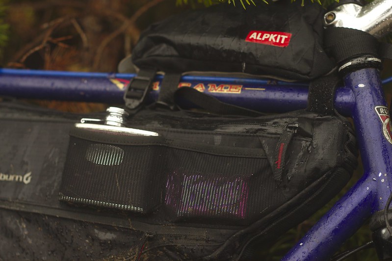 IMGP4032 by Dave W[/url], on Flickr
Thankfully, only this guy got legless. Still, he pointed me in the right direction.
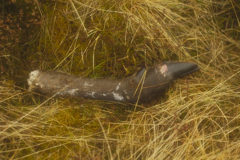 IMGP4039 by Dave W[/url], on Flickr
Not much to see above the valley floor.
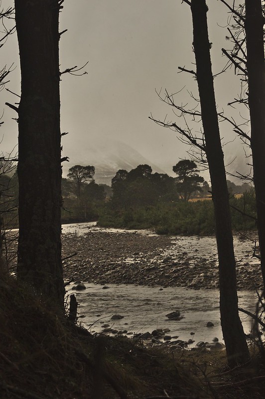 IMGP4035 by Dave W[/url], on Flickr
I made use of the local bike rack.
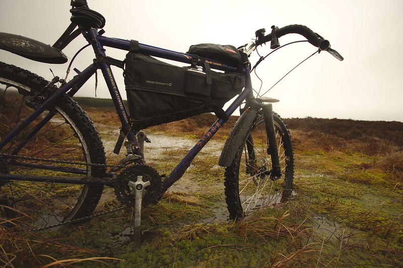 IMGP4043 by Dave W[/url], on Flickr
Then I had under a tree and ate a pie.
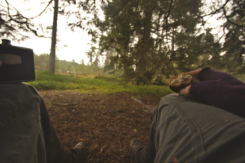 IMGP4046 by Dave W[/url], on Flickr
For balance, this was the day after:
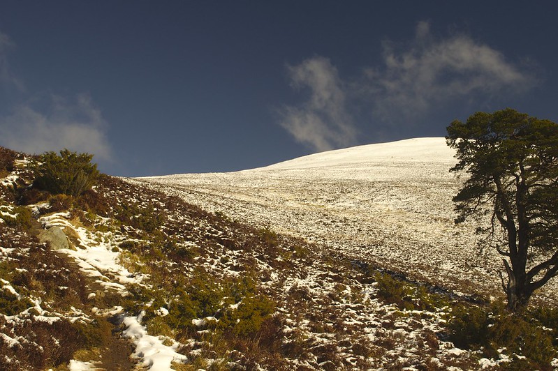 IMGP4086 by Dave W[/url], on Flickr
C’est la vie, as they say in Scotland.
The topic ‘Cairngorms Inner Loop – conditions, bike choice, potential for death?’ is closed to new replies.
