
Are you navigatin’? Because we’re askin’. Is modern tech leading to a route finding revival?
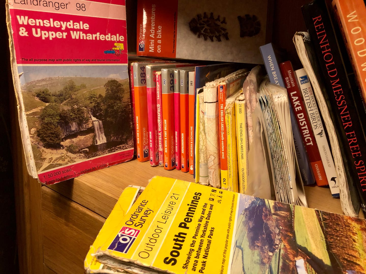
Who remembers the good (bad) old days of mountain biking when trail centres and bike parks didn’t really exist? When the only way of finding new places to ride was following route guides from magazines or books? Stopping every few minutes to unfurl your OS map to check your progress and next steps.
Basically it was a right PITA and I, for one, am glad to see the back of such faff and frustration.
But we all still want to ride new stuff, don’t we? The issue is: how?


Personally speaking, my main modus operandi for local-ish stuff is scouring Strava Heatmap and using an ebike to have a nosey. If I’m daring to head into territory further afield (ie. a few hours drive away) then there’s a bit more at stake. No one wants to waste their time (and petrol money) on disappointing terrain. This is why we find ourselves riding the same old stuff all of the time! Typically I try to tap up anyone that I know lives near the target area and probe them for pointers to the Good Stuff (they do the same to me).
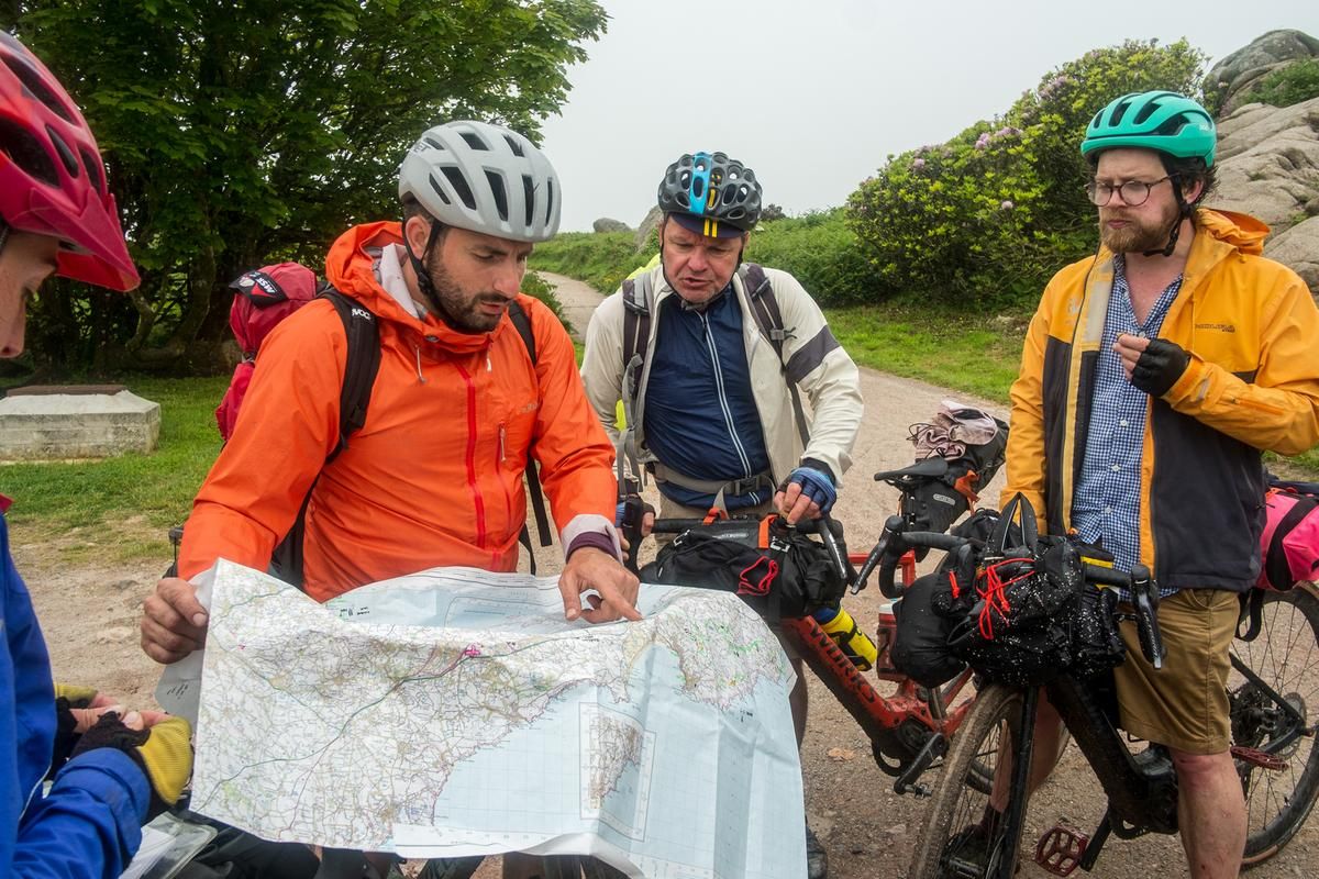
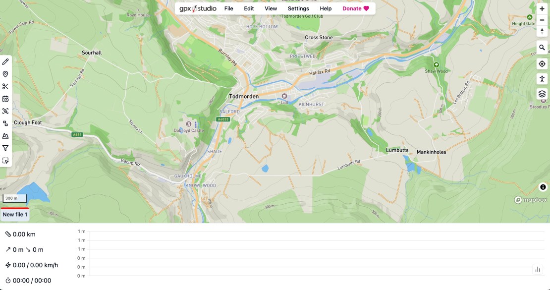
Anyway… once you have got a hitlist of trails – or a complete route – in mind, how do you go about navigating your way on the day? Typically I either create and/or then download a .gpx into my phone and open it in GPX Viewer app. I create .gpx files in GPX Studio by the way.
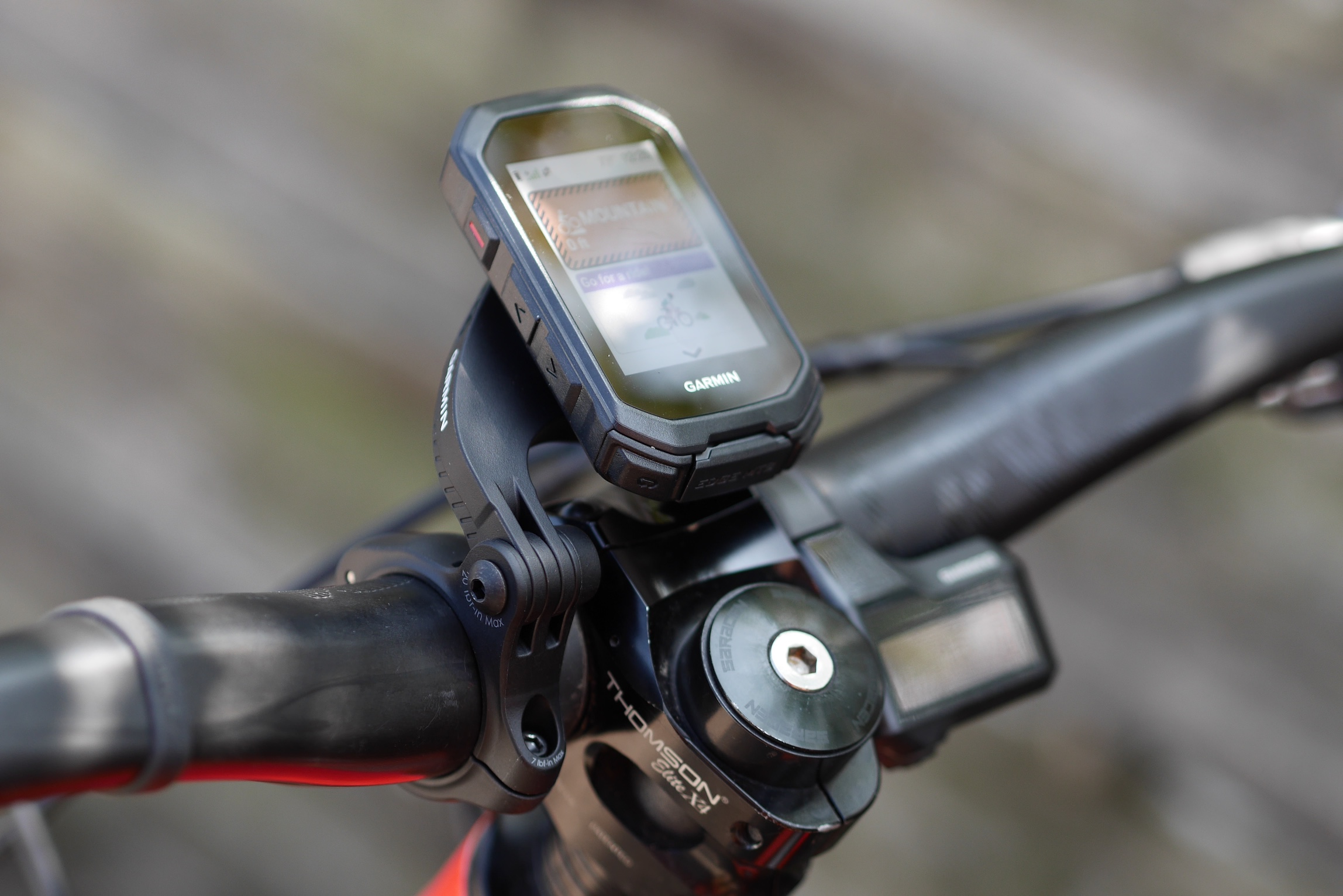
Very occasionally I mount my phone on my stem to reduce the amount of stopping and faffing to get phone out. I have also just got a Garmin Edge MTB to try out, which looks promising. There are also GPS watches as an option, which some people are fine with but I have concerns of route legibility and battery life.
How do you do it?
Over to you. What are the ways you find – and follow – new places to ride? Or if you don’t, do you want to? What sort of info – and technology – would you be interested in? Has the era of ebikes had an effect on people’s willingness to explore new stuff?
To relate to stuff we’re talking about in Singletrack HQ, should we think about bringing back route guides? How about tagging photos with their location (Google map pin? OS grid ref?)
Please leave your comments below. Ta!

Yes, please bring back route guides with an OS map snd downloadable gpx
I find new routes through bike, os map app, komoot, magazines and strava. These are probably the biggest improvement in off road cycling.
Oh that’s weird. I wrote that, but it came up as @Ben_Haworth
FYI i replied from the article not the forum
Tech is brilliant up until the point some magazine or website decides to go with Komoot because they’ve got the best marketing and they appear bloody everywhere sponsoring route guides etc and then everyone else is forced to join that platform and then everyone* discovers it’s crap.
So then you’ve got half a dozen competing platforms, most of which are on tenuous footing anyway in terms of finances (like Komoot, sold to a tech company) and who may at any point introduce a subscription to access the worthwhile features or simply disappear altogether and suddenly all your route guides and downloads are useless.
There’s a lot to be said for sticking to a basic OS maps route guide, a good description and a generic format gpx file, you know they’ll be good for years. And if I really want to cross-reference it all, a few minutes sitting down with a laptop, I can trace that route into any route planning software I want if required.
*I understand some people do actually like it, personally I can’t stand the stupid thing.
The same way I always have – looking at an OS map. Of course now I use the digital version, probably supplementing it with satellite imagery.
Either that or heading out and seeing where my nose takes me.
FWIW I don’t have any major issues with Komoot for actually creating GPX tracks to go on my Garmin. Switching off the Highlights layer makes the map a bit clearer. I can’t say I’ve ever used a Komoot recommended route.
Locally, just go out with OS Maps on phone and/or paper map and ride around like we did in ye thymes of auld.
If I’m going away to ride then a bit of map time (OS), Google maps & satellite imagery, internet searches for local ride guides/routes etc. plus maybe a bit of looking at Komoot.
The Komoot UI drives me round the (wrong) bend for route planning so if I need to make a gpx and am in the UK OS maps wins every time.
Road riding I use similar but am more prepared to fight the Komoot UI or Garmin’s mapping if out of the UK. In Holland I pick a town and follow the signs!
Have used Komoot to download other user’s routes to the Garmin a few times.
Also use MemoryMap to plan and transfer to Garmin.
My one wish in life was there was a plan on OS map (ie. MemoryMap) -> follow OS map on device (dedicated, not phone) option. I’d buy that!
Me too, usually supplemented by using Geograph to see if I can get any more information on whether a route is navigable.
Crazy legs is correct.
I despise komoot ever since I realised that some ( many?) of the routes hadn’t actually been ridden but we’re just AId up and then plastered on the site for human being to QA.
So many of them are just bollox
Strava (combination of heatmaps and segments) and Trailforks have been the main way I’ve used for a good few years now, OS maps aren’t of much use to me personally as the sort of trails I like to ride (mostly hand built/ off piste/unsanctioned trails, winch and plummet style riding) are not on an OS map. I’ve also been making a point of using the ebike for the first days riding in a new location as it allows me to cover more ground and decide if its worth going back with the trail bike. I’ve found a lot of trails by this method that I would never have found by just going and riding around new areas or looking on a map
Largely follow my nose, but in new areas, I’ll have a look at an OS map before going.
Saying that, I do nowadays tend to check a digital OS map when I’m out and wanting to double check I’m vaguely where I thought I was.
OS map digital version is great with the 3d fly through.
I’ve never used a pre-planned route that I’ve downloaded from.somewhere else…and the gpx files I’ve used I don’t tend to follow on my GPS, they are there so I can see the route on the digital OS map and compare where I am to where I’m meant to be.
I do do more planning on a map these days though, but it is still not much for my own rides.
I’m not sure what you’re getting at here. OS maps on a dedicated device that you can load routes on to? Garmin Etrex or Oregon/Dakota would do that. Maybe I’ve misunderstood.
I’ve evolved and then stuck.
– paper os 50, compass and reference points, quite a lot of backtracking
– early garmin extras, no maps but pos details and direction, a bit better
– Satmap 10, rolling os50 and 25, can upload/download/follow gpx, good enough for me
but in general for a new area use memory map 0s50 , make a route up in my head, then follow it on the ground via Satmap rolling os, mainly works, esp if you stick to boat/bridleways but I’ve been in some challenging terrain, where the hand of man rarely sets foot – missing bridges, nettle fests , 6ft tall shrubbery where you genuinely couldn’t see your front wheel, some of my old os maps have the word ‘unrideable’ scrawled next to some gems that I decided not to revisit.
If they display OS Landranger scale maps on screen and you can transfer routes planned on OS Landranger maps, then you’ve understood! I didn’t think Garmin were licensed to us OS. Could be wrong, so will check those options out. I use a Garmin Explorer currently.
EDIT: eTrex just shows basic lines by the look of it.
Ah, I see you can get OS for Garmin… like This! Didn’t realise that… but over 300quid.. hmm.
All of uk at 1:50k is £150, a list of compatible devices can be found in this link
https://www.garmin.com/en-GB/p/616572/pn/010-D0723-03/#devices
Same as @pothead for me to find enduro laps stuff.
Strava heat maps. Try to work out the general lay of the land – where are the well-used climbs to take you to the top, where are the main runs down.
I also use the segments – try to find a reasonably fast time in the last 6 months or so that you can click through to the trace of the whole route. It’s usually a local who knows what they’re doing. That’s usually a good bet.
When I’m there I just go with the general flow, usually try to do the tracks with most heat first, as they are usually the best ones.
Oh yeah and I usually take a screenshot of the heat map on my phone if signal is patchy.
I tend not to create any actual route for the above type of riding.
For pedally stuff, I still use the heat maps but also OS maps on bing too. Usually plot it on Strava on the web browser on a pc. This is linked to my Garmin connect and will upload the route to my Garmin 530.
I can also do this manually with gpx files
Mixture for us of maps and apps like Trailforks and Komoot. If we are in Europe most areas have apps to download.
I think probably the best is local knowledge. Where ever we ride It’s never been a problem as everyone seems eager to show you the good bits to ride.
Strava heatmaps are really good. It’s definitely an improvement on riding round the woods looking for tyre tracks!
Trailforks also. Bit more refined.
There are then various other mapping sites – Google is ok. That let you get an idea of what the ground might be like. Forest, open moorland, down the back of the local high street.
It’s great when you “discover" a new trail. Even if it is somewhere like a trail centre where you are just adding in some off piste to the main lines.
At that point I plot a route onto my Garmin and go explore in person.
I use a combination of things as I haven’t yet found one decent tool that does it all well.
The local county council has a really good and zoomable official map of trails (including closures), cross reference that with Komoot (don’t understand the lack of love above as it’s been painless for me even planning new 300 mile routes, but we’re all different.
Overlay that route with a Strava heatmap, but learnt to my cost it is at best indicative as the untrodded well ridden shortcut or footpath screws that up a treat!
OS maps I had for a while but found their route planning from section to section odd, and their distance / height calculation way off, so let that one go from premium to free to access and review the maps (plus use the codes from all the paper maps I have too).
I love making a route, entirely new, picking bits out and wondering if I can weave that in, seeing what others have put on Komoot (as saved rides in particular), web gpx files and more.
What you experience when you actually get to that trail can be a very different experience mind you as I discovered to my cost a few times.
Good old routes and gpx for the win I think as then whatever tech someone wants to use should take it.
James
I simply ride the same old trails over and over and every so often I do it badly and find a new trail
Guesswork. Today was 35km at FoD area and hitting new and different areas, some ok, some a bit dull. I’d get to a path, see a left and right and picked whichever I fancy. We never ended up more than a mile from where I’d hoped.
I don’t own a map or have any tech I’d use for guide, the fun is, just riding.
I tend to mostly ride enduro type stuff, so It’s a combination of Trailforks, Strava segments and other peoples recent rides on Strava (like el_boufador I’ll look for a top 10 rider on a segment and look through their recent rides).
Komoot’s my go-to and has been faultless for 3 years of use for MTB, gravel and hiking.
I still have a bunch of olde worlde guidebook printed on paper and everything, mostly the V-Publishing ones. I find them and OS mapping a pretty good start with the potential for, you know, looking at the map and adding/removing bits. Mostly trails and routes stay broadly the same over time. On top of that, there’s a thing called google I sometimes try: ‘Best mountain bike routes in Milton Keynes’ that sort of thing, which take you to assorted mapping / route resources, where mostly all I want is to download a GPX.
I find it really hard to get massively animated about apps, I have a legacy OS sub with Outdoors Active, but while the mapping’s good, a lot of routes stuff seems random and the UI is a bit of a mess. I’ll sometimes use it to translate a guidebook route into a GPX file. As far as paying for stuff, while I’d love people to create brilliant software and then let me use it for nothing in perpetuity, I also get that it’s not really a viable commercial model. I do sometimes download routes from Strava tbf.Mostly I ride local trails from the door which I file inside my head FOC. I find it increasingly hard to justify sitting in a car for hours just to ride a bike in a different place when I have really good year-round trails from my door and can still find new ones – aka footpaths – if I want something new.
This has become more of a thing for me since moving to Aviemore. I actually rode in more parts of the country when I lived in Edinburgh but now drive so much less as there’s so much on my doorstep. Road riding options are a lot more limited/repetitive though so I’ll sometimes drive for that.
I ask on here sometimes. And other times I just go and ride around looking for possible tracks that disappear off the side of trail, paths and other tracks. An ebike helps nowadays as it makes exploring easier and if I get down a deer path and it’s crap I can usually spin back up easily rather than pushing up like in the old days having wasted 45 minutes.