Home › Forums › Bike Forum › Aviemore Routes ~ Can you check these please?
- This topic has 18 replies, 11 voices, and was last updated 12 years ago by vorlich.
-
Aviemore Routes ~ Can you check these please?
-
P20Full MemberPosted 12 years ago
We’re heading up to the North Coast of Scotland for work this week and calling in to Aviemore for a few days on the way back for some riding. Its been a while since i’ve been biking that way, would you mind checking these routes. We won’t get them all done, just keeping options open.
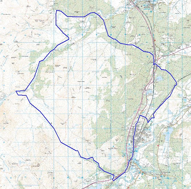 [/url]
Burma Road Long[/url] by ritcheyp20[/url], on Flickr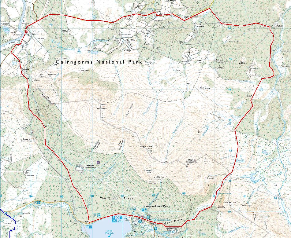 [/url]
Glen More[/url] by ritcheyp20[/url], on Flickr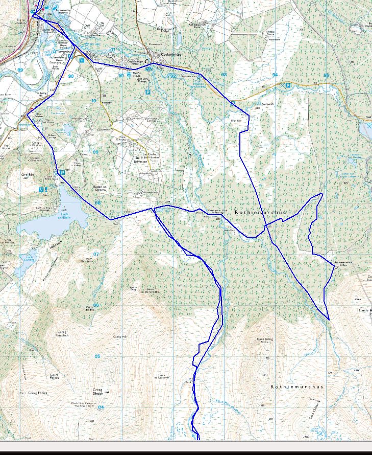 [/url]
Einich, Eileen and Larig Ghru[/url] by ritcheyp20[/url], on Flickr This one continues on to Loch Einich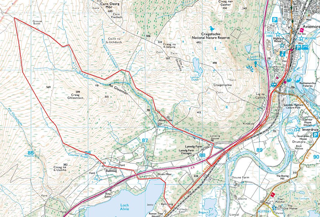 [/url]
Burma Road Short[/url] by ritcheyp20[/url], on Flickr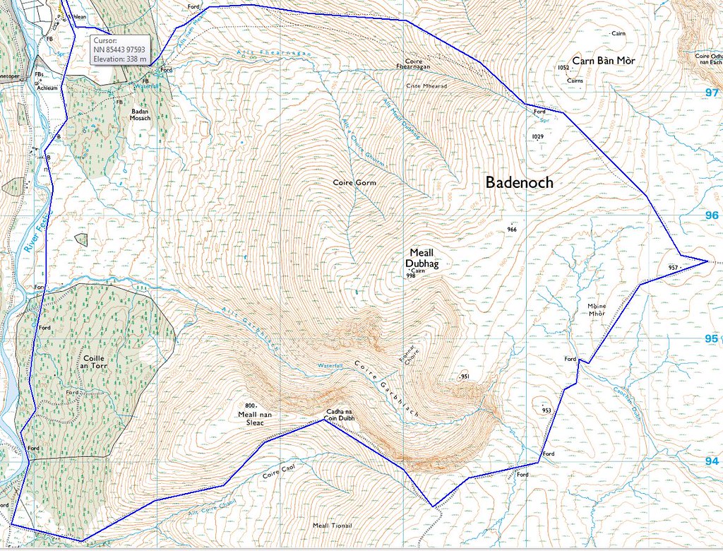 [/url]
Glen Feshie 2[/url] by ritcheyp20[/url], on Flickr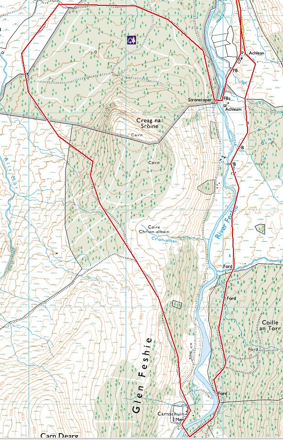 [/url]
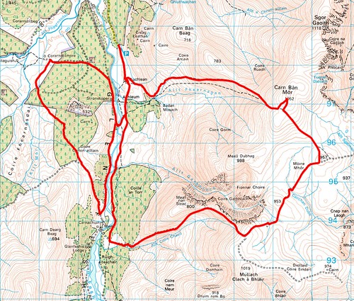
Glen Feshie 1[/url] by ritcheyp20[/url], on FlickrThoughts and comments please 😀
druidhFree MemberPosted 12 years agoDunno what you’re looking for…..
The top one passes through Carrbridge which has a lovely wee cafe in the main street. Good for soup and cakes. Assuming you’re starting at Aviemore and doing it clockwise, Carrbridge will be a good time for a break.
The second one can be extended up to Nethybridge, where you’ll find a hotel/bar and shop.
The third one will have a couple of river crossings, one of which may be deep/fast depending on how much water there is. The track up to Loch Einich is one of my favourites though. An easy-angled climb and a long descent out. Look out for one particularly nasty bend though. Miss it and you’ll be over the edge and in the trees. You can avoid the river crossing on the Glenmore road by heading all the way out to the end of Loch Morlich and cutting back South West from. there
That last one would involve a river crossing as the upper bridge no longer exists 🙂
P20Full MemberPosted 12 years agoThat’s the kind of info I’m after. It’s been a while since I’ve done some of, them, I’ve never done Burma Road. I did wonder about cutting back to Eileen instead of continuing down to the road, but couldn’t remember. Cheers for the advice about the bridge too!
flatfishFree MemberPosted 12 years agoAs onion said, no bridge at Carnachuin memorial.
Water level was quite low for me back in Oct but it was a bloody cold crossing with no shoes on. Pack a small pair of flip flops or something to make the crossing quicker and less painfull.
There is a bridge at Stronetoper.bluepilot76Free MemberPosted 12 years agoI have done the second route (Ryvoan Pass) probably 5 times, it is one of my favourites. I recommend doing it anti-clockwise. (Most people seem to do it clockwise for some reason).
liquid1000Free MemberPosted 12 years agoJust got back from two weeks staying in Boat of Garten so did a few of these. The Ryvoan route is great and very straight forward nice views as you drop into Glenmore and the final descent towards the Kincurdine rd on the speyside way is a great setting. The Burma rd route is technically straightforward with a fast long and wide descent. The long track back to carrbridge is really nice though I can recommend coming back over via general wades military road, note there is a small ford which last week you could peddle however in spate means a knee deep paddle possibly more. Have fun I didn’t see another sole on either of these routes! Can also vouch for cake in carrbridge and the mountain cafe in aviemore which really is something else. Oh and bothy bikes have moved to the dalfaber ind. Estate also in aviemore top folks so if you’d up need any advice or kit they are great.
P20Full MemberPosted 12 years ago@blue pilot, the route was from some magazine many moons ago and they showed it as anti-clockwise, though i only have the map and directions. There’s no description hence running them past some local knowledge on here.
Kit, it is an option to combine them both, depends on how fit we’re feeling!! I’ve done the eastern loop a few years back and from memory its a cracking descent.
Having said all of this, the forecast is pretty bad… 🙁 🙄
bluepilot76Free MemberPosted 12 years agoThat will be why then. I still recommend doing it anti-clockwise. The main reason is that by far the best part of the route is the Ryvoan Pass. The southern side of the pass is much higher than the northern side. Going anti-CW it starts with a short climb, occasionally steep, from Glenmore Lodge. During this section the views are fantastic, and it is good to stop at The Green Loch, there is a couple of slightly tricky boulder strewn climbs. Good fun and quickly walked past if not everyone is into it. Then at the Ryvoan Bothy you start a very long winding descent. It can be very fast and very fun, and seems to go on forever. I have tried it the other way (clockwise) and it feels like a long haul up to the pass followed by a far too short very fast and rocky descent.
The other pass on the route (Sluggan?) is not that interesting, its mostly commercial forestry and not so pretty. However there are some good short singletrack paths on the eastern side of the valley, up from Badaguish. They dont really play any part in a XC route though unless you have a lot of energy left over.
The route you have mapped looks pretty much how we do it. It gets tricky in a couple of places in the woods at the northern end of the Ryvoan Pass, generally stay on the most obvious path. If you do go wrong you will probably just find yourself somewhere just as interesting. Its all good around there really.
deepoFree MemberPosted 12 years agoI’m gonna have a bash at your glenmore route, cheers for posting.
daveatextremistsdotcoukFull MemberPosted 12 years agoWhy not do the Burma Road route clockwise, but when you get back to the A9 go across to Boat of Garten and Abernethy Forest then pick up the Ryvoan Pass trail into Glen More followed by easy track back to Aviemore. A really satisfying route and not too technical considering the part of the world you’re in.
vorlichFree MemberPosted 12 years agoI have my Cairngorm map open in front of my right now, so I’ll be using these for ideas. Good job.
vorlichFree MemberPosted 12 years agoBluepilot, I’m looking to do the Abernethy/Glenmore route sometime next week.
You mention the route near Glenmore, but the trail maps I got from Bothy Bikes show two options here, one that runs past Glenmore Lodge, the other a bit higher up? Which would you recommend?
vorlichFree MemberPosted 12 years agoFWIW, here’s the alt profile for the extended Glenmore/Ryvoan route [starting/finishing at Nethy Bridge]
Running CW profile is L->R
druidhFree MemberPosted 12 years agovorlich – the “higher” path is a narrow footpath. It is a signposted walk, so can be busy. The lower route is a wide path suitable for landrovers etc.
Oh – and I reckon clockwise works best. The Sluggan descent is a hoot that way. It also means that you have the mountains in view heading to Ryvoan.
vorlichFree MemberPosted 12 years agoCheers Druidh, narrower = more fun? Might be quieter midweek…
The topic ‘Aviemore Routes ~ Can you check these please?’ is closed to new replies.

 [/url]