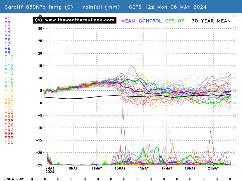
Well I’m always jealous of these pics – we had about ten flakes in Cardiff. However, I do like a bit of weather watching. There has been (or is underway) a Sudden Stratospheric Warming event which can lead to a very cold snap, including a Beast from the East pattern, although not always. The following graph is the GEFS ensemble plot for Cardiff. The numbers are the temperature at an altitude where the pressure is 850mbar which would be about 1500m of altitude ish, that’s where the temps are not affected by day or night. When the graph goes below -10, it means it’s a decent cold snap (by UK standards). The lines are individual forecast runs, and where they are close together there is a lot of agreement and hence high confidence. The numbers at the bottom are the numbers of runs that forecast snow (any snow at all) on that day.
I’ve been watching it, and since the SSW the trend has been for the temps to drop towards the end of Jan, and there are more and more runs dipping into the proper cold part of the graph, and the number of runs that forecast snow has been climbing.

Get your location from the links to cities at the bottom of this page: https://www.theweatheroutlook.com/twodata/gefs.aspx