My son had a day off school today so since [url= http://www.cyclepad.org.uk/listing/The-Sandstone-Way ]the Sandstone Way[/url] passes our door we thought we'd go and explore.
It's not Sustrans or Glentress and you don't need 6" of travel but we enjoyed the first bit up to Bellingham. Even though we know the area well and were never more than a mile from paths and roads we knew well the majority of the route today was on new ground with different perspectives on familiar scenery. There need to be a couple more waymarks but generally it's quite well signed.
Some of it is along field edges
[img] 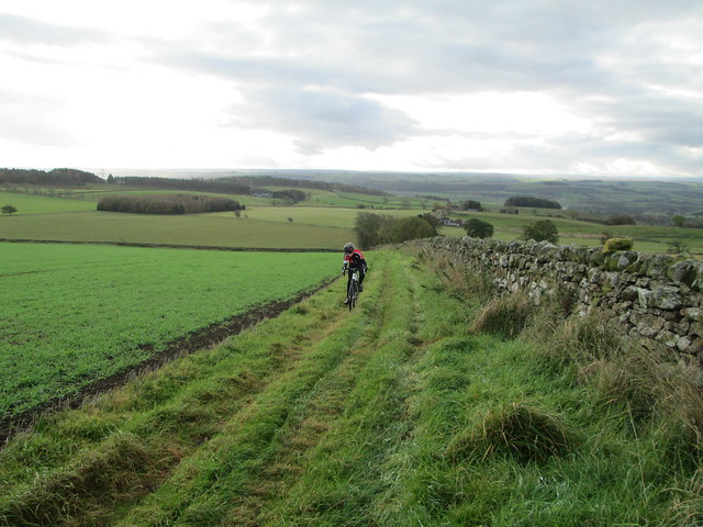 [/img]
Some of the signs are quite discrete
[img] 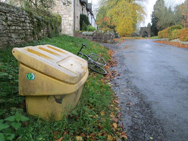 [/img]
We were on 'cross bikes and most was fine but there were some pretty rough, muddy sections. What I would call 'traditional' mountainbiking. 🙂
[img] 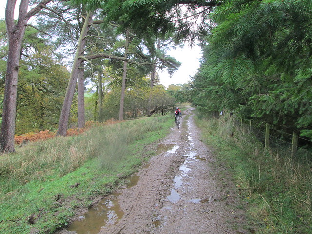 [/img]
[img]  [/img]
That's me in the sombrero 😉
[img] 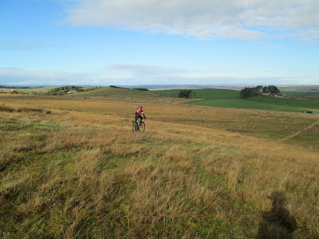 [/img]
This bit is shared with the Pennine Way.
[img] 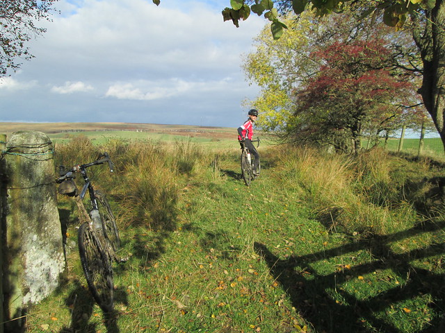 [/img]
[img] 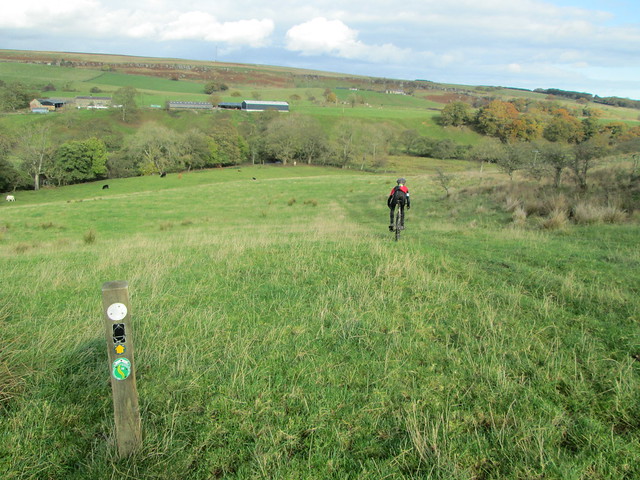 [/img]
There was even a ford. (And a bridge slightly upstream which we found afterwards!)
[img] 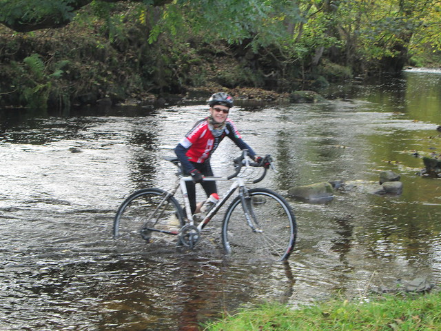 [/img]
Last hill before the cafe in Bellingham.
[img] 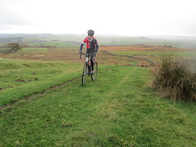 [/img]
They reckon it's a three day route but some will do it in a day. That would be a challenge, especially if wet. Looking forward to exploring the rest of it too now.
[url= https://www.flickr.com/photos/30189432@N00/sets/72157648539797250/ ]Sandstone Way on paul4stones flickr[/url]
Looks great, I'm looking forward to giving it a bash!
Looks great for CX bikes, might get myself over.
Awesome. I was wondering if this had been completed as I've had my eye on the website for a while.
Old school! I feel it in my bones that this kind of riding will be making a comeback.
Cheers for that. I fancy gving it a go in a oner sometime soon.
I think a bunch of journalists rode it a while ago, there's certainly going to be a write up in MBR.
Rich Rothwell has a write up:
http://www.richyroth.com/pain-cave-nice-cave/
Were you involved in signing it? There are some bits where you just follow an obvious path in hope then find a little green sign. Could do with one at Shitlington crag as it wasn't clear to turn left. Generally just enough though and I know it's supposed to be followed with a map.
I've cycled and run round here for years but I was amazed to be on a new path (to me) within 5 miles of home.
I reckon some of the other sections will be faster but it'd be a full day to do the whole thing.
More up to date info available on http://www.cyclepad.org.uk/listing/The-Sandstone-Way.
There are some issues regarding the signing..it's not like a Sustrans route.. the intention is that users should buy the route/gps files to navigate it..
There's also talk of including some local loops to allow users to make the most of their stay in Northumberland.
Very interesting. Like the look of St Cuthberts cave..
I thought it might make a good day out when I'm back at Christmas, probably not a winter outing though 🙂 Reckon I've probably walked most of it in my youth and certainly ridden the wooler to belford leg.
"Likes" post
Were you involved in signing it?
No, but I'll pass your comments on to Ted.
Thanks for this, op! I'm looking to do this in the next few months 🙂
Bit of feedback on the route signing and general info from Ted, the man behind it:
[i]The SW won’t be officially open until Easter 2015 tho’ it can be ridden now
Waymarking was done with minimum funding and according to a protocol – it will be topped up where req’d before the launch
The waymarks are to support navigation by map or GPS – not as a standalone means of navigation
The route is bi-directional and waymarked accordingly
The route had to be waymarked as low key as possible to prevent countryside clutter
New posts have had to be kept to a minimum and in any event cattle love to rub against them which causes problems
The SW will be managed and evolve each year
User payback will be sought to fund this – cyclists have to get used to the idea routes aren’t created by themselves (the consultation process is massive) and they don’t look after themselves
[u]Could do with one at Shitlington crag as it wasn't clear to turn left[/u] doesn’t indicate direction of travel. The map will have very mile marked from N to S which will make it easy to identify exact locations for feedback & for reporting concerns i.e. 73.7. If its the corner by the white house then I recall using what was there for locating waymarks (as always) but a local person or even cattle could have removed one or both waymarks.
By all means post this as a member of TVMTB which is being credited for researching the route and staying involved with the implementation process. [/i]
I'll be buying a map when they're published, but is there an accurate gps route available for now?
I don't think the official gpx of the route is available to buy yet.
But if you look here: http://www.cyclepad.org.uk/listing/The-Sandstone-Way
and scroll down, the route is on google maps. If you look at an OS map simultaneously, you can figure out where it goes: its mainly Sustrans routes, bridleways and BOATS.
cheers, ir_bandito!
Sorry I missed this yesterday.
To be more specific the 'missing' sign was at GR835802 heading South to North where the road comes up from Shitlington Hall and turns left to Shieldfield. We turned right briefly before we realised. I think the White House was further up and there was a sign on a telegraph pole way off to the left. Spotting them was a good game 😉
More than happy with the signage being discrete and to be used in conjunction with a map (which we were, an OS map). It was actually far better signed than I expected.
I'll meet Ted one day! Keep meeting people who know him, one who'd ridden another new route about to be signed near Dukesfield. He's a busy man. And features in the current Paramo catalogue.
Looks like you enjoyed it and I'll give it a pop, probably over two or three days because I'm lazy, slow and enjoy getting the camera and tripod out...
Ta.
It passes the end of our lane, the sign posting is somewhat random to put it mildly, stickers on grit bins being a very popular one. Why have they not used something a bit more permanent and obvious?
I'm guessing your lane is somewhere near Rothbury. May not be relevant but there was some discussion in the comments on the cyclepad site about a bit there - maybe different from what it looks like on their map.
Also
The route had to be waymarked as low key as possible to prevent countryside clutter
Like I said, it's not sustrans but it's not intended to be.
I'll meet Ted one day!
Did you see his letter in the Courant a couple of weeks ago? And the responses last week? Subtle, he isn't.
Interesting and pretty local to me - nice one op. 😀
First group we've seen report
"tracks in great condition, nice and dry..and nothing too challenging" 😀
They were aiming to do the trip in two days..
day 1 Berwick to Rothbury (o/night at Tomlinson's cafe)
day 2 Rothbury to Hexham....
trailer back up at prearranged meet-ups, as
"mobile signal is unpredictable out here"
Contrary to popular report I thought the route was well signed once you got into spotting the badges. After bellingham north to south it became a little harder to spot as the track wads not well worn. Particularly at mile 102 south, ride straight up the grass hill. Also after Hadrian's wall (mile 111) over the b6318 is not worn in so head 11 o'Clock after the gate to the next gate.
I would not recommend a hybrid due to some stoney paths. Also I would recommend off road tyres. You can get the front wheel thrown off rocks and boulders.
Whilst not technical it does have a full cross section of surfaces from rock to grass and sand (very little) to fire track.
I really enjoyed it over two days, but the ride to Rothbury did take a solid eight hours ride. Stepped up the pace a little the next day for five hours in to hexham. Three good Ford's to ride through too for a good laugh. Two have bridges near by if you don't want to risk embarrassment.
Completed 13th 14th June 2015. I would do it again.
