I am heading up to Dumfries and Galloway for a long weekend, and I was wondering if anyone could recommend me a decent non-trail center route?
Also anyone got a link to the coastal path extension to Dalbeattie? or is it fairly easy to work out with a map?
Easy with a map - sections are a bit sensitive though, especially on a busy weekend.
Can you tell where abouts you leave the normal Dalbeattie route? and where you get back onto it?
You can exit the forest via Colvend. There are some tall, brown marker post for walkers. I forget the names of the sections but there is an old bothy behind the trees as you exit the section before the Twin sisters(?). Behind the bothy there is a track through the trees to the left. This brings you to a turning point and a gate to your left. Follow this past all the houses till you come to the road and turn left.
You can return this way via Rockcliffe.
Or if you follow the Jubilee path all the way to Kipford you enter the forest at Branbarroch, again look for the brown walkers post. Here you can turn left uphill for a hundred mts or so and rejoin the trail on your right. Or you can turn right uphill and travel abit further to rejoin trail. Or there are some local bits to have fun on!!
You the head down the road to Portling. There is a ladder over the dyke on your right before you hit the Solway. Bit of a carry up through the gorses and sanwiched between this and a barbed wire fence
When are you coming up?
There are some very good hill tracks from Durisdeer. OS 78 again.
Don't mean to hijack the thread, but trekster do you have a .gpx file of the durisdeer routes? i have done all the trail centres, and walked a fair amount in the hills around moffat (white coombe side though).
now that the parents have been up there for a few years i wouldn't mind having a look up in those hills for some non-trail routes myself! last time i was up there i was thinking that the descent down grey mare's tail might be well worth a go, but don't know how i could bring it into a circular route, and without climbing up the same path that i want to descend.
richc, sorry for the slight hijack. but you have the right man on the thread (trekster) for the knowledge of the area!
don`t even have a gps sorry default still use the old fashioned method.
Not sure that there is much riding up on those hills. Having said that I have only walked the Mares Tail once.
The Durisdeer route/s are quite simple really, except for a couple of sections which are not marked on the map.
Clockwise from Durisdeer to The Daer Res, SupW back to Dalveen and then Roman Rd down(yippee)to Durisdeer. there are 2 ways up to the boundary fence/Daer descent.
1 is to take the dead end(on map)track left after the bothies. The other is to keep right at that junction and take another track up following the snow marker poles, again shown as a dead end track on map. This one is a bit peat bog the other has been created as a landrover safari trail by the estate.
Or arrange a date when I can show you the way?
richc
Just had a look at Dalbeattie map
When you come off Smithland Hill section at post 47 there is a bothy across the road.
Cross the area called Peat Hill aiming towards the White Loch. This will lead you to Colvend if you keep left when you come to the forest road. Through the gate and pass all the houses taking care not to crash into walkers, dogs, cars etc.
Re-enter forest at same place or at Barnbarroch junction 30 on the blue route. From there you have a number of options if you study the map. Do whatever the legs will allow.
cheers for the information, will have a look on the maps. how technical are the routes, or are they more scenic rides?
i am unfortunately not up that way at the moment, but will be back again in the summer. may have to take you up on that offer, and would also be interested in your alternative routing on the mabie red route.
and thanks again for the route advice- i hope it has been useful for the OP
If you want some of the best of the genre, swing by Kirroughtree for some top quality trail centre riding. Don't do anything less than the black though IMO - its sweet undulating singletrack with the occasional TTF - enjoy 🙂
Scenic
[IMG] 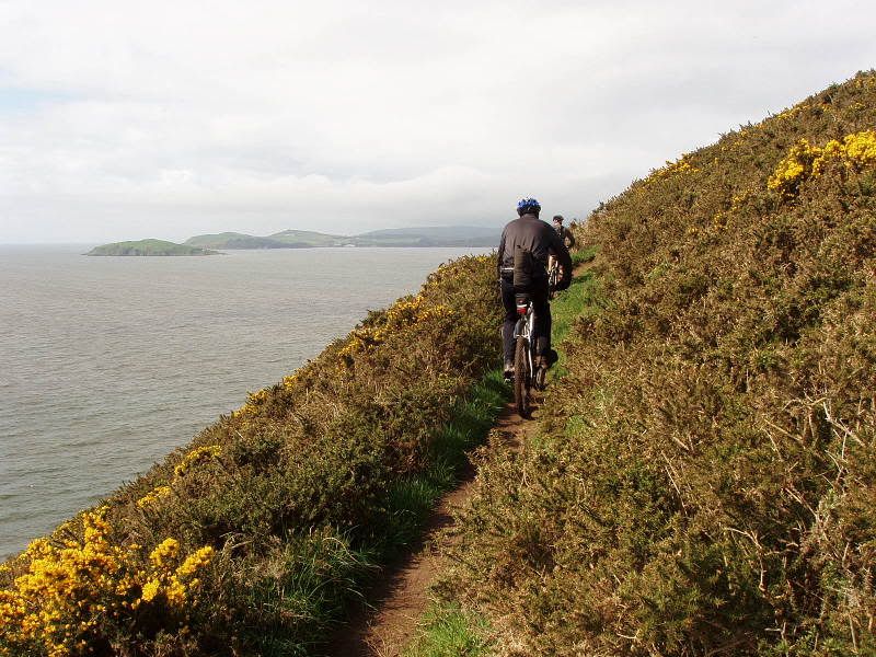 [/IMG]
[IMG] 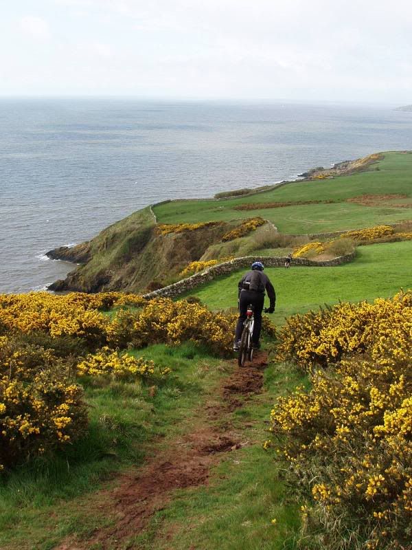 [/IMG]
[IMG] 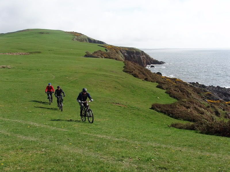 [/IMG]
A local trail
[IMG] 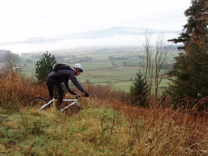 [/IMG]
Track behind bothy
[IMG] 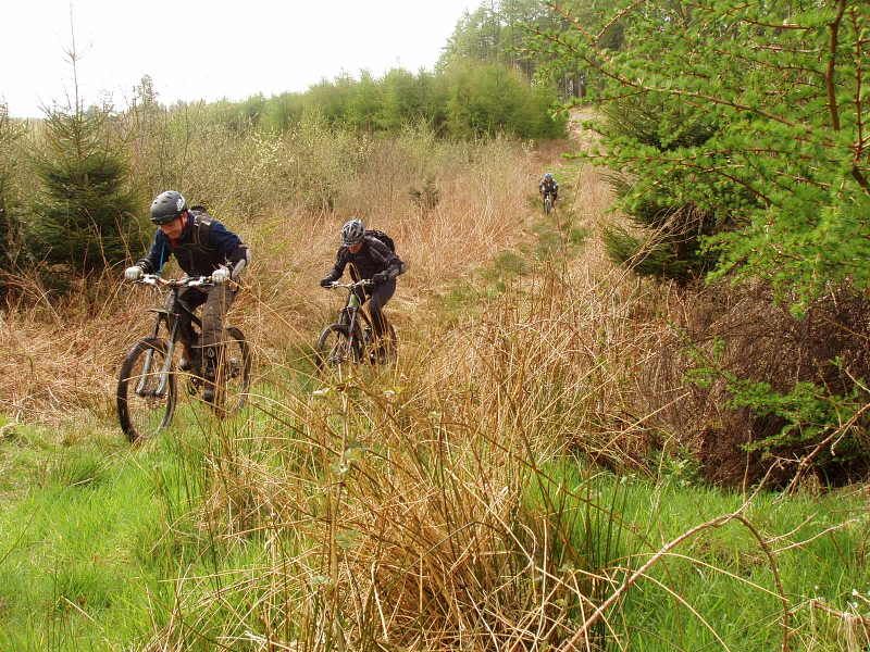 [/IMG]
df slipper, trekster speaks wise words about the durisdeer routes- may I say you would need to be extremely careful descending the grey mares tail path on a bike. If you fall to the right at certain points it is very likely you could die. Seriously. I was in the moffat rescue team for a short while and they had the unfortunate duty to take (dead) tourist walkers out of the gorge at the base of the waterfall. The hillside is very steep and it ends in a vertical drop onto rocks.
Otherwise enjoy 🙂
default.
Nothing technical. Just climbing, navigation, descending/speed, distance and remoteness makes it a big day out.
There is also a big day out starting @ Drumlanrigg, Durisdeer or Thornhill itself.
If starting at Drum/Duris you follow the river up to Twenty Shillling farm. Go along a small back road parallel to A76. Then cross over onto 76 and then take road up to Wanlockhaed. On the left there is a farm road, Auchentaggart. Take tis all the way through the farm and onto Auchentaggart Moor. Then pick up the SupW to Wanlockhead. Bit of a hike a bike section but well worth it 😀
Tea and cakes at the mining museum cafe before long haul up to the golf ball/radar station. Top up on water. Before you reach the radar station there is a track of to the right. Take this down a gravelly section and stop at the gate on the left under the telephone cables.
This is the Enterkin Burn, basically a shepp tarck marked as a track ------------ on the map. This is magic.
Then you have some options once you reach the Dalveen Pass road.
1 go into Durisdeer and head back to Drum/Thornhill etc
2 turn left up the Dalveen to take in the Roman Rd to Durisdeer.
3 make it a really big day and go for the SupW/Daer and over the top back to Durisdeer. Not tried this one yet!!.
Big country
[IMG] 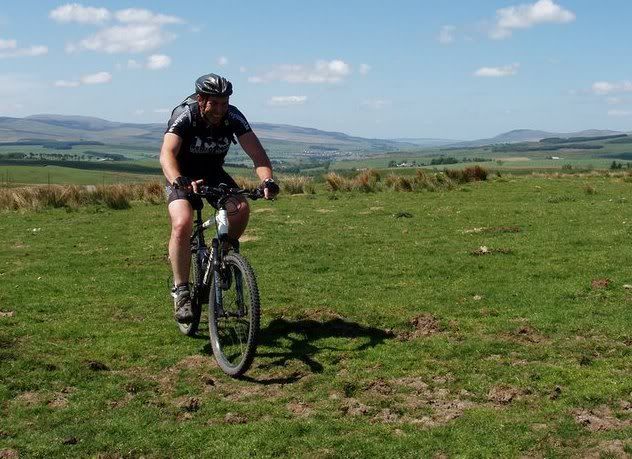 [/IMG]
[IMG] 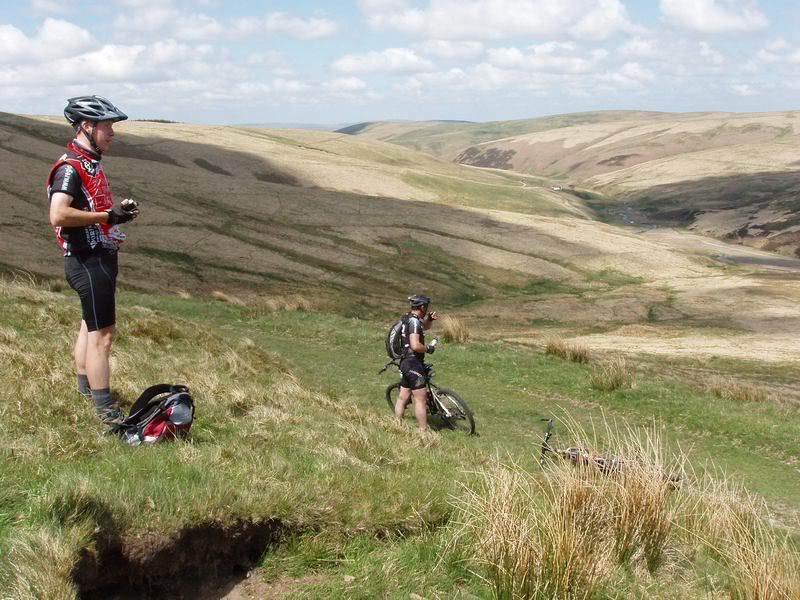 [/IMG]
[IMG] 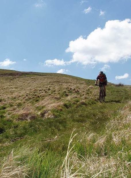 [/IMG]
Better descent than it looks
Hey Stew how things?
You still want a Steppingstanes shirt? Finally got them
We are off down Bowderdale/Calf/Sedburgh this coming Sunday. You fit?
kelticfringe
like all forests Mabie & Dalbeattie have their own little secrets to make them interesting
Kirry is THE best Stane I do agree
default
Got my trails and post mixed up a bit there 😳
Some of the SupW is quite techy due to erosion so will be different again from my last ride.
Moffat to Same Ling
[IMG] 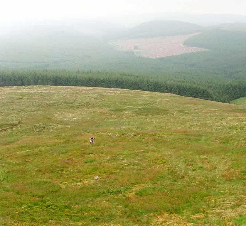 [/IMG]
Next time I am going the other way.
Down the above and down the below
[IMG] 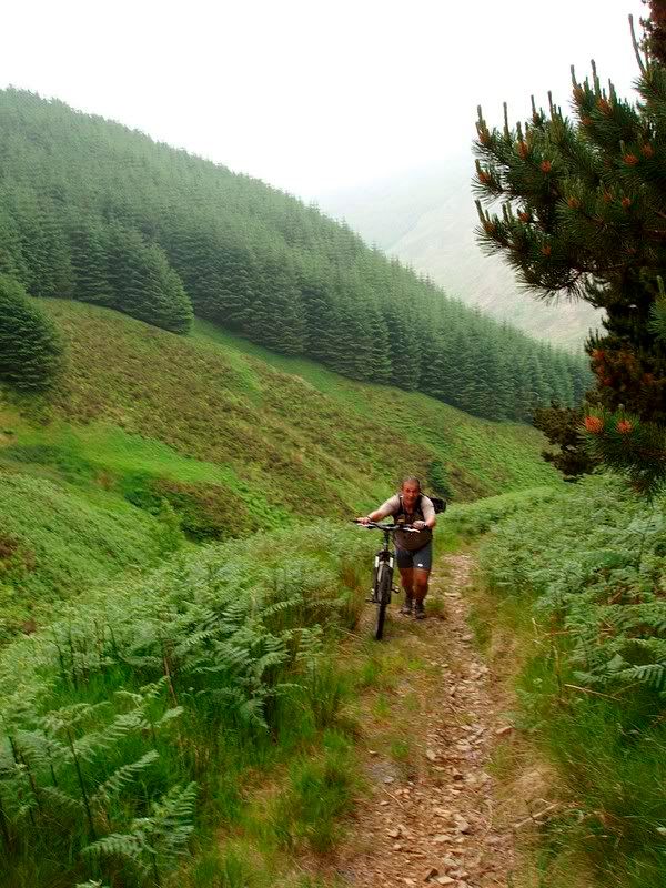 [/IMG]
the views do look pretty good on all those rides so will definitely have a look next time i am up there and the weather is good. im bringing some friends up in a few weeks but i think kirroughtree and drumlanrig may be on the cards. perhaps i might look at a shorter version of the drumlanrig ride you mentioned above, but will have to take a look at the map.
scotabroad, yep have walked the grey mare's a few times so know about the steep drop; and family has always been local so also heard of quite a few serious/ fatal accidents down that way. will be taking care if i go there for sure.
cheers for the vast amounts of information, something to savour for when i return home!
Thanks trekster 😉 I am heading up on Friday for the Bank Holiday weekend and coming back on Tuesday
och. I`m working night shift Fri/Sat
Then of down south on Sun to ride Bowderdale/Calf
just a thought
could meet over a coffee and scribble some stuff on your map if you are up here early pm
Cool, whereabouts do you live as I could buy you a pint/coffee and bring my map and a pen 😉
I will be driving up early Friday so, Friday evening would be cool.
wish Fri eve was possible but I start work @ 6pm.
I live 2mls outside Dumfries.
I will be at DGone, our leisure centre(google DGone) till 11am(teaching special needs kids to swim) free thereafter. Mail for a phone number if you can fit it in after 11/before 6.
Hi Trekster, as I am going with a group, I can't be 100% sure what time I will make it up to d&g as its odds on that something or someone will go wrong/be delayed, and I don't want to piss you around as I know how valuable spare time is.
Thanks for all your help, its much appreciated.
know all about that!!!
I sometimes ride with this lot;
http://www.fanylionracing.com/reports/2009.php
have fun & enjoy :-).
Hi Trekster - still not fit for days out, might, just might, be up in Torridon this weekend anyway (with walking boots)....
