- This topic has 39 replies, 27 voices, and was last updated 8 years ago by .
Viewing 40 posts - 1 through 40 (of 40 total)
-
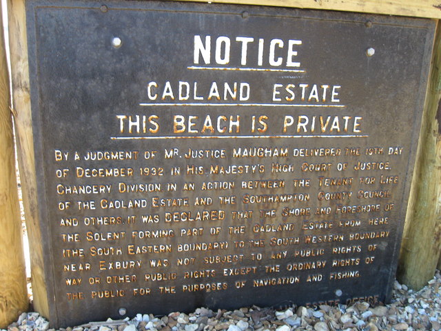
How far would a 'private beach' extend into the sea (fatbike content)
-


Viewing 40 posts - 1 through 40 (of 40 total)
The topic ‘How far would a 'private beach' extend into the sea (fatbike content)’ is closed to new replies.