- This topic has 16 replies, 10 voices, and was last updated 2 years ago by mrchrist.
-
Best way onto or off the SW end of the Carnedds?
-
thegeneralistFree MemberPosted 2 years ago
Found various threads about the area, but mainly old, locked and with broken links to promised maps etc.
I can see loads of potential ways onto or off the range at the NE end, either to the east or west but am really struggling to find a sensible way onto the SW, ideally Carnedd Daffyd or the one directly above Ogwen Cottage.Ideally I’d like to do the 3,000 ft hills in the range from SW to NE or vice versa. But the ways up seem like heinous hike a bikes and the ways down non existent.
(Paging @summittopler if he’s still about)
Anyone able to assist?
mrchristFull MemberPosted 2 years agoI did it once with a bike. Type 3 fun.
Parked at Capel.
Went up past Ludwyg resr then NW up to Llwellyn then on to Daffydd. Switchbacks are steep after the resr and at one point I needed to use 2 hands and balance my bike on my rucksack.
We then headed SW on to Pen yr Ole Wen then for some reason due east which was a carry down (wtf) to Afon Lloer.
The riding on the top was heavy going of loose slabs. Don’t remember much being fun to ride.
At Daffydd you could head SW and keep going down the ridge Y Braich. I have run up that. Be ok to ride down. You would stil need to negotiate that scramble I described above.
the_kenburgFull MemberPosted 2 years agoWalked up there in August (in grimmish weather). At no point did I think “I really should bring the bike up here”.
ElShalimoFull MemberPosted 2 years agoI’ve walked and scrambled up there a good few times. There are some bits which are definitely ridable but I’d expect you’d be carrying or dropping the bike a lot. The Yr Elen spur and the Mynydd Du ridge from Dafydd back to Gerlan/Bethesda have sections you could ride but I can’t imagine it’s pleasant unless you’re a riding god.
slowoldmanFull MemberPosted 2 years agoor the one directly above Ogwen Cottage.
Pen yr Ole Wen? I’ve been up there a time or two (walking), directly from Ogwen Cottage or from the East via Ffynnon Lloer. I can’t imagine wanting to carry a bike up.
thegeneralistFree MemberPosted 2 years agoPen yr Ole Wen?
Yep, thought that was the name of it, but wasn’t sure. Yes the ridge up from Ogcottage looks utterly hellish.
Was thinking of the line to the east of Llyn Ogwen as well by Afon Lloer . Looks like 300m of rideable height gain then 300m of hellish hikeabike.
Ideally I need a descent around that area. The one into cwm llugwy looks more reasonable but probably still way too hard.
Hmmm
thelawmanFull MemberPosted 2 years agoIt’s all pretty steep onto Pen-yr-Ole-Wen from anywhere around Llyn Ogwen, and I’ve only ever heard of a couple of people daft enough to try walking/scrambling up directly above Pont Pen-y-Benglog itself at the lower end of the lake. They weren’t carrying bikes.
It might be possible to ride quite a lot of the way up by starting further down the Nant Ffrancon valley at Ogwen Bank just SE of Bethesda? Grid ref SH626656 approx. There looks to be a path which heads roughly SSE-wards and would put you on a ridge which then makes for Pen-yr-Ole-Wen. I’ve no idea what the ground is actually like, but a quick review of a few photos on Geograph suggests you might get lucky with close-cropped grass, or you might be flogging through extensive bogs in the lower parts. Either way, once you reach about 2000′, it steepens considerably and the last part would almost certainly be hikey-bikey. In fairness, it’s probably do-able as a descent, although it would deposit you miles from the honeypots of Ogwen if the car were there.ElShalimoFull MemberPosted 2 years agoThe path up P-yr-O-W from Ogwen cottage is very steep with lots of sheep trails that turn into dead ends or scrambles. It’s fine if you like the hands on stuff when walking but it’s no place for a bike unless you’ve got unbelievable skills and fitness. Whilst the Afon Lloer approach is not as steep, it’s still quite steep, a bit bouldery in places and the ridge has a couple of small scrambes too.
Someone must have done the High Carneddau 3000s on a bike but I reckon they came in from the north and went back out that way too. Maybe starting at Rowen, do the peaks then back down via Cwm Eigiau from Foel Grach would work. God knows what’s path and b-way up there as there are so many paths/tracks up high.
thegeneralistFree MemberPosted 2 years agostarting further down the Nant Ffrancon valley at Ogwen Bank just SE of Bethesda? Grid ref SH626656 approx. There looks to be a path which heads roughly SSE-wards and would put you on a ridge which then makes for Pen-yr-Ole-Wen.
Yep, but can’t see anything path like on the actual ridge itself. I agree with what Elshal and you have said that immediate vicinity of Ogwen looks like shit.
I have had a closer look on Google at the route from llywelyn down towards Llugwy reservoir and it looks brilliant ( famous last words) so will try to stitch together something around that if I can find a half decent weather forecast.
Many thanks
pedladFull MemberPosted 2 years agoWalked it as part of the welsh 3000s many moons ago. Obvioulsy was knackered by then so my view of it may be coloured but its a v steep slog up from Lake Ogwen and then on from there to exiting at the NE end I remember being pretty moorlike and boring. The memory doesn’t scream “I must go there with a bike” at me!
thegeneralistFree MemberPosted 2 years agoquick update as I have finally located my photos from Google….
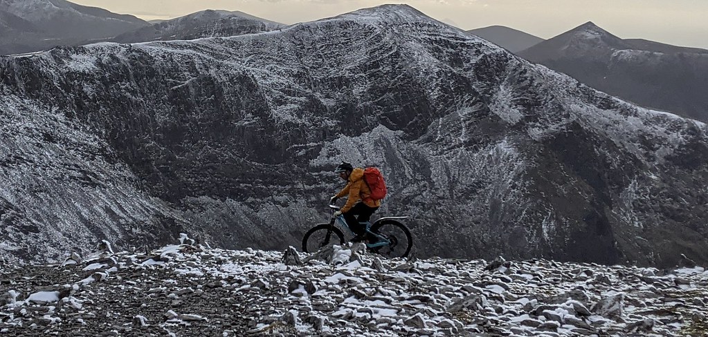
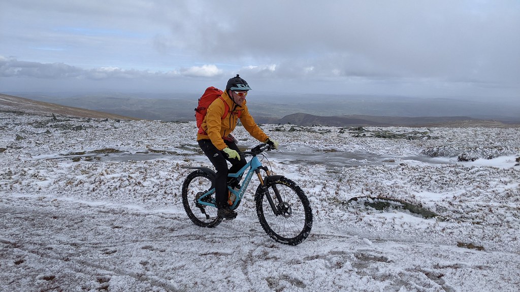
Went up a couple of weekends ago. The weather was very atmospheric, but not what you’d call ideal. Mix of slush and semi frozen snow damming up the areas of bog and making it very squelchy. Also quite intimidating from a YFYD perspective.
// actually scratch that, I’ve just read my Strava description, which reads:Utterly gubbed. Never have the raw stats* so singularly failed to accurately represent the effort and exhaustion from a ride. PS Llyn Colwydd is shit in that direction too
* 42k, 1500hm
But anyway, back to the beginning… I parked at the high carpark on the minor road above Rhiw. leaving the car at 418m asl was clearly a bad idea, but I was freaked by the conditions and wanted to get the scary stuff done first and leave the 1400ft climb to the end of the day when I was safe!
West towards the Roman Road, then up the LRT onto Drum
excellent. Not many 2500ft mountains you can cycle all the way up.
Then a nice undulating ridge southish and westish
Underwheel was hard going. Lots of water and semi frozen ground made it proper hard going.
Wind was big, and I knew that getting too sweaty was a bad idea, so I kept the pace very slow.
I managed 5 of the Cymros up onto Llywelyn.
I actually started across to Daffyd (the lovely looking ridge in the photo above) but the path had collected the windblown snow and was unrideable. It was also getting late, so I turned back and cursed myself for losing that height for no gain. I should have just pushed back to the summit of LLywellyn, but (as you do) I drifted rightwards to traverse around to the Cwm Llugwy path. As expected there were some hefty slabs of windblown snow accumulated there so I was keeping an absolutely solid hold of my bike in case I had to use a random spiky bit of it to self arrest!
Made it across to the path, after a huge amount of walking, but the path was again full of very soft snow so barely rideable. Then ended up on top of this, feeling a bit nervous!
Which is of course the scramble mentioned my whatsisname above, and casually mentioned by someone else whose notes I had read. It was big, steep and had a fair bit of snow. So it took quite a while for me to plan out a descent which I could do one handed whilst firmly holding on to my bike.
Went down this slab to skier’s left:
as ever the photos don’t do it justice.
Anyway, at the coll the path drops down in a series of rubbly eroded switchbacks, down which a group of elderly ramblers were carefully picking their way. Had it been earlier, with a solid group, and without the collateral damage waiting to happen I would have tried bits of it, but TBH not much. It was properly steep.
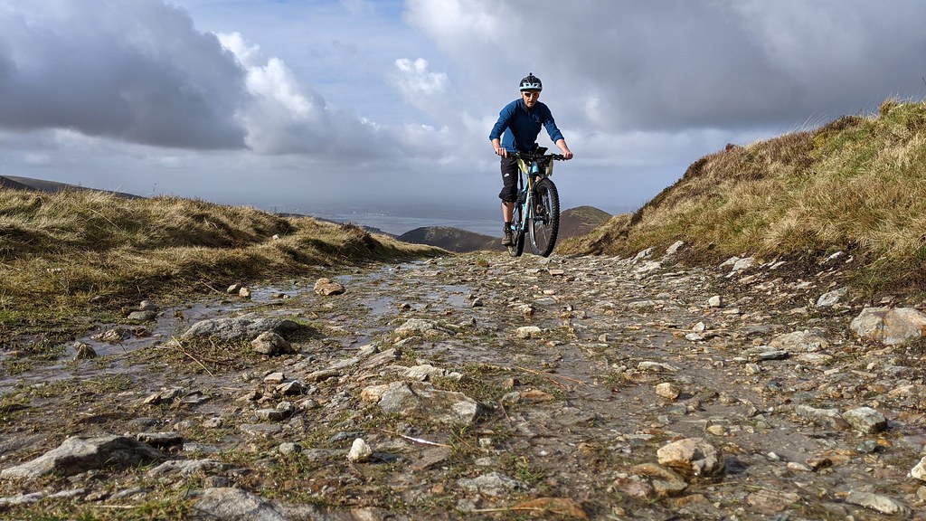
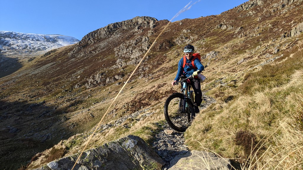
It flattened out a bit and provided a couple of nice bits…
But nowhere near enough to make it a classic. If you do it when there’s no snow, right from Llywelyn summit ( white bit in the picture above) then it would be a great first third and last third but still too hard in the middle.
Down the road to the Leat, traverse along that and then north along Llyn Colwyd. The missus had warned me against this, based on how shit it was the first time, but I couldn’t be arsed continuing to Capel, so took this option. OK, fair enough it was the middle of winter, piss wet, and I was knackered, but….. that Llyn Colwyd section was by far the worst part of the ride 🙂
Down the Hydro LRTs, along the valley and then 1700ft climb back to the van in the dark. The last bit took me ages, probably a good 90 minutes at around 3km/h.Absolutely shattered after that. But the brilliant thing is that partly due to temperature management on the ride (little sweat) and partly due to Electrolyte Tabs, I slept well for only the second time in 8 years after exercise. So really looking forward to pushing it some more soon.
So, in summary, excellent day out. Ridiculously hard work. SO glad I hadn’t asked Dave or someone else along or they’d have killed me. Did 5 of the 7 Carnedd 3,000ers, but not the last two.
Without the snow, and when a bit drier I reckon it is mostly rideable all the way to Daffyd. Next time I’ll come up the Roman Road from Bethesda direction, up Drum, Llywyd etc to Daffyd.
After that… not sure… perhaps backtrack to Carnedd Uchaf and then down the NW ridge past Drosgl…
molgripsFree MemberPosted 2 years agoAge 18 or so a mate and I carried our bikes up Carnedd LLewelyn. I think we must’ve ridden up the reservoir road and then carried up the side of the mountain. There was a small cliff on the way up which involved climbing part of the way up with the bike on our backs and then handing it to someone at the top. That was tricky. I think perhaps we rode across the top to Carnedd Dafydd, I’m not sure, we did ride about a bit up there. We wanted to beat the magic 50mph on the way down the reservoir road so one of us rode down and opened the gates for the other, then we swapped. Must’ve ridden or pushed up and down that three or four times each which is impressive, it’s a good 250 climb and pretty steep. Nutters we must’ve been.
ElShalimoFull MemberPosted 2 years ago@thegeneralist – Chapeau !!
That’s a bloody big day out in winter and good to hear that you survived unscathedthegeneralistFree MemberPosted 2 years agoI met a mountain guide on one of the intermediate peaks and had one of those hedgey slightly awkward conversations where he chats happily along trying to gather enough info about the other without coming straight out and saying ” you’re out of your depth, go home now”
He warned me that the scramble down would be tricky, but at that point a very cold couple appeared and needed to get directions on how to get down so I left them to it and continued on my way.
grahamt1980Full MemberPosted 2 years agoOnly route i can think that might be worth trying would be heading for daffyd from Bethesda and then ride the ridge round and descend via drum.
Going up from ogwen – i wouldn’t wish that in anyone. Have only done pen yr ole wen once walking from the cottage and won’t do it again. From near owgen mr base it might work but would still be a lot of carryingtillydogFree MemberPosted 2 years ago‘Kin ‘Ell! Fair play for doing that in winter!
I reckon they came in from the north and went back out that way too
Yup.
Not much riding S of Carnedd Dafydd. Nice view of Tryfan from Pen Yr Ole Wen
Routes onto the ridge are limited.
(P.S. Plural of ‘Carnedd’ is ‘Carneddau’ 🙂 )
mrchristFull MemberPosted 2 years agoSounds like an amazing day out that you will never ever do again:)
The sense of achievement is amazing.
Great work!
The topic ‘Best way onto or off the SW end of the Carnedds?’ is closed to new replies.


