Simple rules.
Image must be taken as a screen shot from Google Earth (any historical date that works).
Stick to the UK for now. Natural or man made locations acceptable.
Should be somewhere that will be known to at least someone on the forum (so a public space and not your own back garden).
No cheating by using image identification software/google eye......
No new images until the current one correctly identified or the origainl poster has given the location in the event that no-one can guess it.
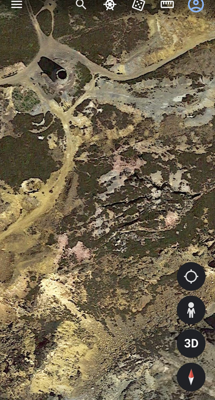
Potentially easy one to start with
[img]  [/img]
Penallta Pit Pony.
[url= https://i.postimg.cc/rpJGV6PG/Screenshot-83.pn g" target="_blank">https://i.postimg.cc/rpJGV6PG/Screenshot-83.pn g"/> [/img][/url]
Anyone know what this odd thing is on the beach/foreshore?
Some sort of fish/crab trap?
Research sampling trap?
If anyone can find and post a shadow of an aeroplane, that's cool. A few years ago I lost many hours searching for, and finding, plane shadows🤣
Anyway, that's powfoot in Dumfries & Galloway....
Alright, here's a nice easy one to suck people in.

https://www.thebeachguide.co.uk/photos/powfoot-4513403.htm
Yep, Powfoot tidal swimming pool, saves a huge trek across the mud to deeper mud water. Built in 1903 when Powfoot was being promoted as a resort town, but most used during WW1 when practically all the area from Annan to the border by Gretna was turned into a huge munitions complex to keep the shells flying over the trenches. Good little museum about it in Eastriggs. https://www.devilsporridge.org.uk/
Clifton suspension bridge, Brizzle?
[url= https://i.postimg.cc/284SXgSr/Screenshot-85.pn g" target="_blank">https://i.postimg.cc/284SXgSr/Screenshot-85.pn g"/> [/img][/url]
Deal Castle!
Should be easy 
To me it looked a bit lioke Mam Tor. So I checked on GE and it appears I was correct 🙂
Easy if you know it!
[img]  [/img]
Helvellyn....
yep
Try this one for a bit more of a challenge
[img]  [/img]

An Aberdeen driver has been snapped with his pants down by Google Maps on Don Street in the city.
Although the man’s face and car’s registration have been blurred by the company, his penis remained visible.
The image was snapped outside 83 Don Street by Google in June 2022.
It is believed the man was in the process of committing a sex act at the time of the photo. He can also be seen holding a mobile phone in one hand.
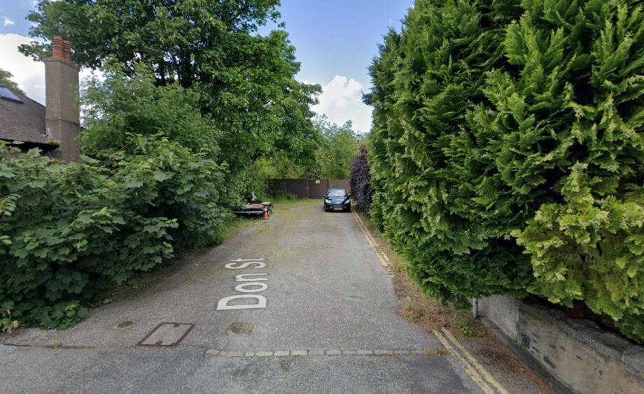 The spot on Don Street was surrounded by hedges at the time. Image: Google Maps.
Despite the secluded spot on the street being surrounded by nearby hedges, the man was snapped by one of Google’s high-tech mapping cars.
The X-rated image has gone viral on TikTok after eagled-eyed social media users spotted it.
The Don Street image appears as though it was snapped during Google’s routine drives through Aberdeen.
Automatic technology is used to blur faces and number plates captured by the tech firm. However, on this occasion, it did not spare the man’s modesty.
After being contacted by The Press and Journal about the image, Google acted swiftly to blur the man from its Google Maps tool.
Now the image shows the blue car but with extensive pixelation all over the front of the car.
Google thanked The Press and Journal for its inquiry.
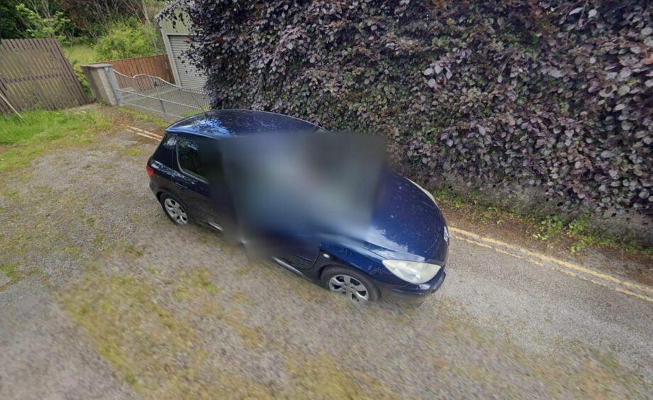 Google took swift action to prevent more people from getting a shock. Image: Google Maps.
One user joked on Reddit: “There he was just minding his own business and some car with a million cameras attached showed up.”
Another commented: “I wished they had unblurred his face so we could see his panic and blurred something else instead.”
A third wrote: “How people find these things is beyond me but I love it.”
Always one has to spoil the family fun! The last one must be a provincial airbase somewhere?
I apologise for my last entry as it broke one of my own rules! This site is not accessible to the general public and you would need to have some special interests to know where it was. With that in mind I would just ask you "what's the colour of the boathouse in Hereford?"
I could tell you, but i'd have to kill you.
Dering Lines
Close. But no cigar. Tis the SAS training site near Pontrilas. It's where they practice aircaft hostage rescue and have most of their live firing training. It is just over the hill from here.
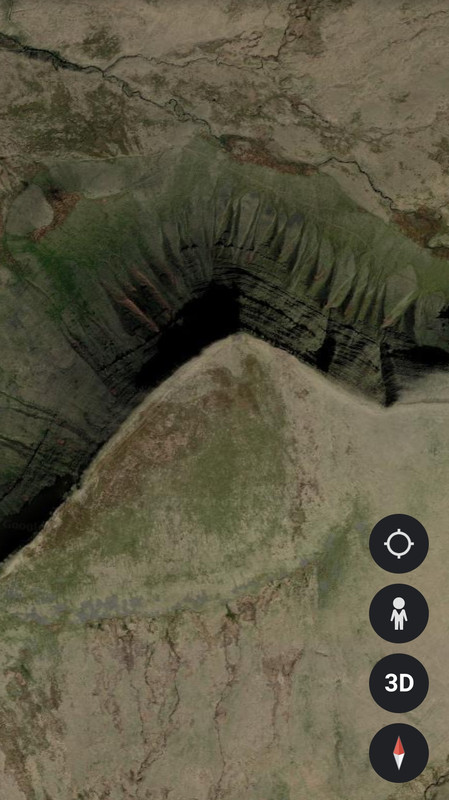
I'll try an easier one.
[img]  [/img]
Durdle Door
Is that The Worm* sculpture somewhere near Sunderland?
JMC and Plunkett rode it for MBUK back in the day?
*don’t know it’s proper name
Slightly tricky one. Knowing which county I live in would help.
The crosshairs are really there; not an image overlay.
Is that The Worm* sculpture somewhere near Sunderland?
JMC and Plunkett rode it for MBUK back in the day?
Yep. It's horrible to ride on as well, or it was back in 1993/4! It's the Lambton Worm sculpture.
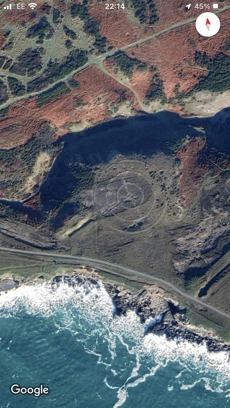
Nice one. I have walked that coastline from the chapel to Stackpole Quay. Didn't realise that compass thing was there. Wonder what it is for?
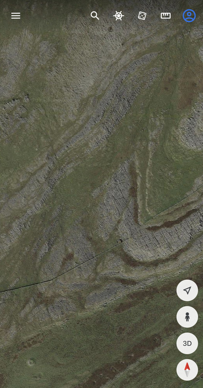
Somewhere in the Dales, bottom end of Ingleborough? Will have to have a search on GE see if I can pin it down
Moughton Scar?
Limestone pavement at Malham?
Same geology but a bit further to the NW. Near everyone’s favourite motorway service station.
Found it! Great Asby Scar Nature reserve.
Tough one. You seen one limestone pavement, you've seen them all 🙂
in a similar vein
[img]  [/img]
IYKYK.
[img]  [/img]
Oh that’s going to annoy me! Looks like a recurved palaeo coastline but I’m a terrible geologist and I’m stuck on where…
Dungeness? And thats not the woods behind.....the nationwide?
Yeah Dungeness for WelshFarmers last
Correct. No idea of Houns woodland shot. Is that a sewerage farm top right 🙂
Looking at the manicured grounds it is possibly somewhere in the Surrey Hills?
Oh of course…
(Hides head in shame - am a coastal scientist and use Dungerness as examples in my lectures…!)
Gallowayboy’s edit has it!
@welshfarmer https://coflein.gov.uk/en/site/407866/
It’s not very obvious on the ground unless you know it’s there.
Those are difficult.
@Houns - is that part of a county cricket ground?
@welshfarmer - somewhere in mid Wales or Shropshire?
Late again!
Ooh can I have a go?!?!
Yes!
Pen y fan?
Nope sorry 😞
Nope but quite similar
Somewhere in the Howgills?
No, that's too far North
Fan Foel. Just north of Ammanford I think?
Edit: nope Picws Du, just west of Fan Foel
Can I play?


The best bothy in the world?
Tillydogs has a definitie southern uplands vibe to it. Glentress area. I will have a good look on GE and see if I can match it. Listers Bothy is NW highlands somewhere at a guess. Skye maybe?
Mine is much further south...
I thought @Lister's might be near Uisinis (Uist), but having looked, I don't think it is.
(Apologies to Lister for diving in - I thought it had gone quiet.)
Deadwater Fell?
No - much, much further south. It's a very popular spot.
Moel Famau and Camus Fhionnairigh?
Moel Famau
Yes! 🙂
Camasunary bay. I knew i'd been there. But we're talking 35 years ago!
Well done fasgadh.
powfoot
i’ve been in that pool, about 50 years ago.
I come from Annan, which is a few miles away, and an aunt lives in powfoot.
@Houns By any chance, are those trees (or woods, if you will) behind a major building society's offices in a large town in Wiltshire?
Uber niche knowledge required for this one. Or just local.
https://imgur.com/a/9DNN7AI
Yep, Camasunary. Amazing place for a Kip.
I've worked out the arrow one from Rich_s with a bit of googling as I was familiar with a more famous one on Brean Down, it's to guide pilots to the bombing range, built WW2 era.
Fritham New Forest, north of the ridge bridleway between Fritham and Frogham
Yup and yup. Well done 👍
I've never been to the range (Ashley Walk), but was wondering if there was a crater from a grand slam or tallboy bomb drop I could put on here. Then I remembered that arrow!
Friend showed me on a ride a few years ago. Little oil pot holders in the arrow to show a flare path. I was told it was used to plan an attack on a submarine pen
Static caravans - check
Sea cliffs - check
Choo Choo track - check

Geoguesser is a favourite with some of my pupils. Best I ever got was 2 metres, Christ the Redeemer, Rio.