It does seem that there is a bit of sophistry going on. There are still Routes, it's just that they're not all part of the Network. 🤔
I had a Twitter Ad today from VisitScotland promoting cycling the length of the Outer Hebrides and linking to the Sustrans page. It's all on road, so is it, or isn't it, NCN780? If it isn't, who will be looking after the signage, reporting dangerous road faults etc?
Same question round my way where NCN7 runs. As a Sustrans volunteer, I'd previously been involved in litter picking, signing, status reporting, removing vegetation and even cutting a fallen tree. As far as I am aware, all of the local volunteers have now stopped this work, mostly due to the emphasis on urban travel.
I used to work for them. About 4 or 5 years ago - just as the old CEO retired - they were suddenly faced with a huge shortfall in funding (I mean, aside from the £42m handout from the National Lottery in 1995, and the Connect2 projects, they have never been well-funded).
They had to restructure (which involved many, many redundancies of which I was one, and many offices/departments closing) and re-focus: Instead of building infrastructure (v expensive) they chose to focus on 'behaviour change' (v cheap). Lobbying govt policy-making, and grass-roots campaigns to get kids cycling took priority.
Whilst they are all about all forms of sustainable travel, they viewed their National Cycle Network as the jewel in their crown. Sadly, however, austerity meant maintenance, upgrades and extensions of the NCN fell by the wayside. A few years ago they embarked on a massive survey (stock take) of their NCN and realised how bad it had become and how little of it was actually traffic-free.
It always baffled me how they could be proud of a National Cycle Network that was 70% on-road, and a great deal of the traffic-free stuff was 'MTB only'.
(However what really grips my sh1t is they amount of money they spaffed on internal bureaucracy over the years, and the countless (now overgrown) art installations along what few traffic-free trails they had. Where could that money have been better spent, I wonder?).
But if you sign off any old stuff, you get a reputation for being shit…
I don't think they do have a reputation for being shit. Some sections of routes are poor, yes, but I'm not aware of anyone within our 400 strong cycle club, or the 200 strong group of leisure cyclists I led before, where anyone said "Sustrans are shit because that section of path gets muddy or that section of road is steep/busy/potholed"
Again, some of these changes don't make sense. They still have the on road route into Stevenston but the off road path between Ardrossan and West Kilbride is missing, as is Hunterston to Fairlie.
It does serve to highlight how bad the infrastructure is though, it doesn't help that the only suitable roads out of Largs have never been "adopted" and any route planner tries to fling you over the A760 or up the A78 rather than over the U roads to the North. Or the f'n nimbys in Fairlie that did their damnest to block a multi use path away from the road.
This decision seems to be a massive own goal for Sustrans. I first read of this decision on another forum - the over riding emphasis was of "bikes have no place on our roads and look, now even sustrans agree".
Sustrans are likely playing politics here, but have shot themselves in the foot.
“bikes have no place on our roads and look, now even sustrans agree”.
I'd be hard pressed to argue against that given some of the roads. Their routes aren't fit for purpose and this is highlighting the fact. It's now up to LA's and national governments to pull their fingers out and stop papping any old shite off as a cycle route.
It became apparent a few years ago that Sustrans was reverting to being more urban-oriented. This makes a lot of sense. Campaigning for safe routes to school etc has a much higher impact than focussing on long distance routes for cycle tourists.
Agree, to an extent. However, we know rural roads can be more dangerous than urban ones and the existing network, both on and off-road is essential to commuters as well as leisure cyclists.
There is a legacy issue with many routes having been planned almost entirely around leisure cycling, and all too often taking an unnecessarily convoluted and inefficient route from A to B, but I think it's important not to underestimate how important the NCN is. I use it almost every time I plan a new route.
It’s interesting that the Hebridean Way is being cut. This was one of the most pleasant and courteous routes I’ve cycled in the uk. Even though it uses some ‘main’ roads, the level of traffic is pretty low and (nearly) everyone seemed chilled and patient.
Pleasant routes for experienced cyclists used to riding in traffic. The question is, would you allow your child to cycle there unaccompanied, which I think is the standard Sustrans are aiming for here?
I also think the ‘Paths for Everyone’ idea is fundamentally flawed. A route which is suitable for people pottering about with their toddler on a balance bike or walking the dog isn’t going to be much use to a commuter for example.
To be fair, we probably have an unusual idea of commuting in this country, where we get lycra'd up, the road bike comes out, and we smash out 15 miles head down into a headwind all the way to work, arriving in a sweaty mess. I went out on the bike this morning, and I watched somebody drive, literally about 300 yards to work. In fact my neighbour does the same. Everybody I know drives everywhere, regardless of distance. I can't remember the exact stats, but I think half of UK journeys are 5km or less? If we're to encourage commuting and utility cycling, these are the people we're aiming at. School kids too. In some of the Northern European nations, you're encouraged to cycle to school from the age of 6. A truly functional cycle network should be suitable for everyone.
Our ‘National Cycle Network’ is a bit of national embarrassment.
...
I sometimes wonder what European cycle tourists think when they roll off the ferry at Dover and on to NCN1...
I read that first sentence and my next immediate thought was NCN1 and its place in the Eurovelo network. How that ever got approved is a mystery.
I do hope Sustrans know what they're doing. It does sound like there are some political games being played. I would prefer some reclassification of existing routes, but it sounds like this is a push for something bigger. I hope it works out.
I wonder if they are also going to remove the signs from the removed routes ?
I wonder if they are also going to remove the signs from the removed routes ?
Apparently they are. Source: a comment on Twitter so make of that what you will.
I'd rather see an honest re-classification. Keep the routes but grade then like trail centres.
Green - segregated tarmac suitable for anyone
Blue - contains sections of towpath / gravel track, might be muddy after wet weather
Black - contains sections of busy road really only suitable for experienced riders.
etc
That way you could "shame" councils, landowners etc in to trying to get as Green a route as possible, almost like a rewards system. Hold them up as examples of best practice, standards to aim for. Just binning them off seems like a bit of an own goal, almost saying "that stuff we campaigned for, put our name to etc - yeah, it was all shit".
I see The Way of The Roses is now The Way of The Rose and The Way of The Other Rose now. Actually the chunck that's gone missing is the fast road over Greenhow from Appletreewick through Pateley Bridge as fas as the turn off near Brimham. Only place I got a flat when I did it, and I pushed and carried a few hundred yards to get to Stump Cross Cavern car park rather than sort it on the verge.
Long overdue in my view. NCN designation should always have guaranteed a minimum standard, to at least have included usuable by any bike, with any tyres, in any weather, and able to travel by trike or with a trailer without being blocked by gates and barriers. Traffic allowable if not scary fast roads, certainly not sharing A roads.
Once met a very unhappy Dutchman on the TPT who had assumed NCN would give him a nice easy ride from Hull to Stockport, he was a day behind schedule at Doncaster and ready to give up. We have a few recumbent and handcyclists near me, they've never gone anywhere near Sustrans routes.
The journey planner is part of a shake-up of the National Cycle Network (NCN) in Scotland by custodians, Sustrans, in their work to make the Network more accessible for everyone and provide a more consistent user experience.
Through their online mapping, the charity now promotes information for on-road ‘Named Routes’ best suited for an experienced, adult cycle-touring audience. These routes make use of the NCN but do not run wholly on the Network.
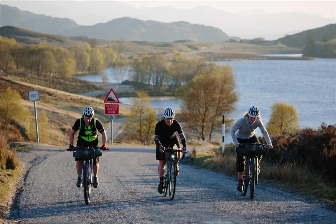
BTW - Loch Tarff in the background there. A nice bivvy spot if you want to watch otters and used as a backdrop in one of the scenes in the movie Local Hero.
Sustrans have sent an e-mail which says:
We're reclassifying some sections of the Network which are better suited to more experienced riders or for cycle touring. And removing a small percentage of routes from the Network map. These are sections which fall far too short of the high standards we aspire to, such as on those on the fastest and busiest roads.
Doesn’t really clarify much. Do they mean that reclassifying routes results in something that they will still have a map of & you will be able to follow signs on the ground? Do they intend to leave some routes orphaned in the middle of nowhere because a section is too fast? Makes BoJo look like a model of clear and unambiguous messaging
Looking in detail at what has been dropped and what has been retained, it makes even less sense. There's a very short section of B road near me which is no longer part of the network, yet the many miles leading up to and after it are. The road on the south side of Loch Tay is still considered to be part of NCN7, but the road between Dull and Weem isn't. The former is twisty and narrow, the latter wide and with good sight-lines. I know which one I feel safer on!
That South Road is really slow and not one that gets used particularly much, I'd be a lot happier using that than the north side which is the main drag for all traffic from Pitlochry. The only destinations on that road are the Crannog and watersports centre, both of which are at the extreme ends.
That South Road is really slow and not one that gets used particularly much, I’d be a lot happier using that than the north side which is the main drag for all traffic from Pitlochry. The only destinations on that road are the Crannog and watersports centre, both of which are at the extreme ends.
And all the campervans busily trying to spot stopping places 🙂
intesrting that that journey planner for the Loch Ness 360 still sends you the hike a bike way out of Foyers (from what I can tell). Keen to have another crack at the Caledonia Way some time too (another, in as much as last attempt never happened, trains booked, even guest house booked, route sorted - then you know COVID).
intesrting that that journey planner for the Loch Ness 360 still sends you the hike a bike way out of Foyers (from what I can tell).
The map shows both

https://lochness360.com/about/how-to-walk-the-trail/ describes the Glenn Lia option for cyclists.
It's well intentioned but it should probably include the removal of some of the more dangerous bits of path (for example, in Edinburgh, the NCR754 goes over Slateford Viaduct - the towpath here is barely a bike width and it's cobbled poorly rather than paved with a camber toward the water. Cyclists heading into town have to stop to let those going out of town by, whilst those heading out of town fight to avoid slipping off the edge if they're not experience. It's not safe at all for a kid riding on their own). And there'a lot of features on the NCN that are a hazard for inexperienced cyclists as well as users with kid seats, kid trailers, cargo bikes and, probably more importantly, mobility scooters and wheelchairs. My wife cycles to and from work every day but just cannot cope with the stupid motorbike barriers where you have to zigzag round them.
Hopefully this is Sustrans moving to a more user friendly model, and at the same time putting the pressure on for more funding (probably fruitlessly, mind you).
@scotroutes - I know - and I'd not willingly do the walker route again - but the VisitScotland click through for the Loch Ness 360 - for cyclists (as far as I can navigate) shows the orange line as the walker trail. I'm not able to download their GPX to verify.
This by navigating that planner link - https://www.visitscotland.com/see-do/active/cycling/national-routes/map/#/loch-ness-360
And all the campervans busily trying to spot stopping places 🙂
I don't remember any of that but I'll bow to your judgement.
Edinburgh, the NCR754 goes over Slateford Viaduct – the towpath here is barely a bike width and it’s cobbled poorly rather than paved with a camber toward the water.
I'd regularly see someone wheelieing along there - on a beat up old BSO.
ah well now its no longer ncn you couldn't possibly ride on it using your own judgement to join up the dots.
ive never looked for "cycle routes" when ive planned my rides in various parts of the world .
i just look for places i want to go and join the dots with roads that look like they may be safe.
Google maps has helped massively with this .
as i said ealier focusing on urban grass roots stuff makes sense get folk using them habitually before you concentrate on the town to town stuff.
garner support at a young age and you have a generation that will grow up in support rather than a few tourers from a different country ticking off your country on their map.
I’d regularly see someone wheelieing along there – on a beat up old BSO.
Nice boys can't wheelie.
Probably from Wester Hailes
I’ll bet he wouldn’t try it if the transvestite pusher-in was on the prowl.
@trail_rat unfortunately Google maps is utter shite at saving custom routes and in the first instance can throw in some utter howlers. That said, it's easy enough to use it to plan a route and break it up as needed.
As you say though, better to concentrate on grass root stuff and build a critical mass that can demand better later as a natural progression. And as I said, hopefully the new gaping holes will shame those in charge into filling them properly.
I’ll bet he wouldn’t try it if the transvestite pusher-in was on the prowl.
I've only had one run in with him once but have had to console a few folk who've been on the end of one of his tirades. I only ever see him on the aqueduct yelling at people.
i just look for places i want to go and join the dots with roads that look like they may be safe.
Google maps has helped massively with this .
I'm an obsessive route planner.
The technology we have to plan routes is amazing, but it doesn't replace the local knowledge and research that has gone into designing the national cycle network.
Some of the scariest experiences I've had on a bike have been on roads that looked completely harmless on the map.
Some of the scariest experiences
Some of mine have been on ncn routes deemed to be safe.
When I asked what they were playing at it was * deemed to be the least dangerous*
Pre awpr netherley road out of stonehaven for any one that cares and also pretty much the a92 between Montrose and just past inverbervie.
Deemed safe by someone they didn't have this "local knowledge" that's for sure.
Just as an exercise as I needed to go to Edinburgh 2 years ago I followed ncn to Edinburgh from home and id had so many fast close passes before st Cyrus I decided to revert to local knowledge and get to duck off that road before I was killed. S
^ Looking at the map, that's fair comment, I wouldn't ride that road either.
Where I am there was a nice flat 15 mile stretch of NCN 81 along the canal towpath.
This would be fine if maintenance is kept up. It isn't.
It is now on hilly 'B-roads'
I don't know why.
Sustrans is more of a lobbying organisation than effective implementer of cycle trails - I actually think their handbook on cycling route design is quite good.
Bear in mind there isn't much to go on.
What we need is more government money to build cycle lanes, raised from taxing polluters.
It also needs some courage to commit and see through a long-term strategy.
Coning off commuter routes for 6 months due to Covid is treating the symptoms, not the cause.
Looking in detail at what has been dropped and what has been retained,
Is there a list or map of this somewhere? Can't see anything on the sustrans site.
Imagine of all our roads, pavements or motorways had to be designed, funded and built by a charity and volunteers. Preposterous. And yet that's the way we've organised cycling provision.
