
MegaSack DRAW - This year's winner is user - rgwb
We will be in touch
Hello
With map in hand, I've been looking at a couple of alternative descents down what appear to be marked as bridleways off Skiddaw on it's southern flank. These are distinct from the main path up.
Has anyone done these and if so, what were they like?
Also, I'm looking for route suggestions in the Western Lakes. It's an area I really haven't explored but am keen to do so. Hikey bike is not an issue if it brings a downhill reward.
Cheers
Sanny
Tour of Was****er is a good one for the quiet routes, bit of hike-a-bike towards the end but worth it for the descent! Will mail you the route in a bit.
Skiddaw is crap. Go somewhere decent.
HTH. 😉
Skiddaw is crap. Go somewhere decent.
James is either pulling your leg or a tart (or both)
There's only one BW up and down Skiddaw. There are the BWs that go round it (through Skiddaw House) and around to Caldbeck way - all good.
There's loads of good riding in the west - Eskdale, Wasdale, The Duddon (especially), even Black Combe.
Cheers Crazy legs
Boxelder
Are you sure? What about the descent down via Bassenthwaite Common or the trail that drops down via Broad End and Grey Crags? I suspect the latter will be super rocky and may require some portage but both trails are marked as Bridleway.
Cheers
Sanny
I should also have asked if you can tell me more about the west riding you mention, Boxelder.
A rough idea of routes and where you go would be great.
Cheers
Sanny
[i]What about the descent down via Bassenthwaite Common or the trail that drops down via Broad End and Grey Crags? I suspect the latter will be super rocky and may require some portage but both trails are marked as Bridleway.[/i]
On my map these are marked as just footpaths,not RoWs. 😥
Could be fun though.....
I know the routes you mean Sanny - I've never ridden them, but looking up from Dodd, it's really just a steep scree valley with a stream down the middle coming from Broad End. The footpath down to Carl Side and over White Stones into Millbeck - that's a ride 😀 I remember Bassenthwaite Common being very boggy the one time I walked around that way with the mutt.
Oh - there is a trail goes over Sale How from near the summit of Skiddaw that's not marked on maps - brings you down to Skiddaw House. I keep meaning to try that one.
Oh - there's a trail goes over Sale How from near the summit of Skiddaw that's not marked on maps - brings you down to Skiddaw House. I keep meaning to try that one.
I've been up that way. Bit of a slog uphill, but should be a good descent. No rough stuff, so you should be able to fly down it. Starts near the fence near the summit. Indistinct at first, but improves lower down.
How'd you find the other end Fagus, say if you're facing the front of Skiddaw House ?
The Bassenthwaite Common (Ullock Pike) one is good, I'm told, though it's deffinately footpath, so I wouldn't ride it (in daylight) 🙄
Riding out west:
Find Burnmoor Tarn (between Wasdale and Eskdale). There are BWs heading down to Wasdale, down to Eskdale and also along the back (Illgill Head side) of the tarn. All of these are good.
Find Seathwaite in the Duddon Valley (great pub!). From there you can go up over Walna Scar to Coniston, or start up Walna then turn R (southish) and head towards the River Lickle and Broughton Moor, picking up the Stephenson Ground singletrack, bringing you back to the Duddon. Great riding south of Coniston village/Torver too (though this isn't really West any more!
Higher routes (with hike a bike) would be Ennerdale to Wasdale via Black Sail Pass or the tour of Great Gable, using Black Sail, Styhead Pass down to Borrowdale, Honister Pass to Buttermere, then Scarth Gap back to Ennerdale - to much pushing/carrying for me, but some see it as classic.
Facing the front of Skiddaw House we went to the right hand side. Bit of a push IIRC, but only a very short one. Very soon a good track appears that goes nearly all the way to the fence. There's a little bit of bog - in summer - but nothing to get too worried about. Once you're round the back of S H it all seems to flow naturally; we had no problems route finding.
It's no easier/harder than the tourist route in ascent, but could be better coming down because there won't be any walkers, but the track is not graded like the tourist route. Must be worth a look, especially when dry.
Can send you a .mmo if you like.
Fagus
If you like fast, mainly grassy descents, there's a flier off High Pike towards Caldbeck (tricky to get to though)
Fagus
If you like fast, mainly grassy descents, there's a flier off High Pike towards Caldbeck (tricky to get to though)
Yes I know it. Big smiles at the bottom.
Cheers Fagus - my email's parkedtigerATyahooDOTcom
Has anyone ridden much up above Wythop - I've been up Sale Fell in the past but was going to have a nosey around Ling Fell / Broom Fell / Embleton High Common on Sunday (maybe find a way onto Lords Seat eventually then drop down the North Loop and back into Thornthwaite). Looks like it could be wet though. I'm told there's a Corpse Road around there somewhere but it's not marked on the (ye olde) OS I have here at work.
YGM. If the .mmo doesn't open let me know and I'll send a .gpx instead.
There is a corpse road round where you say. It's marked on the map as heading due west from Eskin. Think it peters out. There's a similar track going east past the old ruined chapel near Kelswick. Easy riding.
By dint of there being lots of snow over the paths, I ended up on Fairfield Horshoe back in December and was treated to a marvellous techy descent on the path that drops you into Rydal. Yes it is a bit cheeky but has anyone else done it?
Re Skiddaw. I had a look on Streetmap and there appears to be more than one bridleway on Skiddaw unless the longer black lines no longer signify bridleways? Or am I going daft?
Any pics of the western routes to whet the appetite. I can't help get the feeling that there is a treasure trove of trails to be ridden which I've earnestly managed to ignore somehow. Doh!
Cheers
Sanny
unless the longer black lines no longer signify bridleways?
are you colour blind ? I don't know what colour BWs are, green or red or brown perhaps, but black signifies a track of unknown classification
had a look on Streetmap and there appears to be more than one bridleway on Skiddaw unless the longer black lines no longer signify bridleways? Or am I going daft?
Streetmap is hardly the best point of reference for off road maps. AFAIK there is only one bridleway on Skiddaw. The track over Sale How mentioned above is only a footpath. Everything else is a footpath, and if you understand what bridleways originally were - routes for horses - you'll understand why they are footpaths - routes for foot travellers.
" if you understand what bridleways originally were - routes for horses - you'll understand why they are footpaths - routes for foot travellers. "
Yes, but bikes can ride a lot more than horses, not everything a hiker could, but finding out what can/can't be ridden is where the fun/challenge is?
OK. If someone can explain this to me, that would be great!
The OS 1:50000 map legend shows bridleways as red lines with a longer dash, footpaths are red lines with a shorter dash. This leads me to ask what the longer black lines signify as they don't appear (unless I've simply not seen them)on the scale. If they are footpaths, why are they not marked with the shorter lines associated with foot paths?
If as Simon says they are a track of unknown classification, where does the English Law stand on bike access?
Link below to see what I'm referring to.
Cheers
Sanny
http://www.streetmap.co.uk/map.srf?x=326500&y=523500&z=120&sv=keswick&st=3&tl=Map+of+Keswick,+Cumbria+ [City/Town/Village]&searchp=ids.srf&mapp=map.srf
where does the English Law stand on bike access?
English law is miles away - go where you like :o)
Black lines aren't public rights of way at all. Some black dashed type lines are county/borough etc boundaries. The ones you're thinking about are probably 'other' tracks, but aren't necessarily there on the ground.
If you use Multimap instead of Streetmap you can select OS map and zoom in to 25k scale - on that you will magically find that some of your black lines become permissive paths or indeed cycleways - for a key to all these strange English symbols look here
[url] http://http://www.ordnancesurvey.co.uk/oswebsite/education/pdf/25knewEGMlegend.pdf ]undefined[/url]
25k is also a bit clearer on the bridleway/footpath symbols imo
and makes life negotiating by fences a lot easier - I find the 25k essential on trips south of the border - as I tend to a bit paranoid about where I am supposed to go - don't know why - my first MTB riding was in Wales and I went everywhere in glorious ignorance.
as I tend to a bit paranoid about where I am supposed to go
red rag to a bull 🙂
that [url= http://www.ordnancesurvey.co.uk/oswebsite/education/pdf/25knewEGMlegend.pdf%5D ]linky[/url] above [s]fixed[/s], well, I tried!
red rag to a bull
😉
[url] http://www.ordnancesurvey.co.uk/oswebsite/education/pdf/25knewEGMlegend.pdf [/url]
Think that's it now - must have better things to do on a Friday !!
http://www.ordnancesurvey.co.uk/oswebsite/education/pdf/25knewEGMlegend.pdf
interestingly, that legend is incomplete, and does not include the 2 path types: fine dotted black line, and heavy dashed black line (though similar to boundary lines) - you can tell the difference as boundaries go round things. Perhaps they're too embarrassed to admit they don't know the status of these paths?
Broad End, Grey Crags is a nice enough walk up, it's a nice steep climb up a scree field at the end, and a sort of path along by the stream for the rest.
It would probably suck as a ride, as you'd lose all the height on the stupid steep scree descent, which would be pretty dangerous too, then probably be pushing the bike for half of the bottom bit, I can't quite remember how distinct / rideable the path was there.
Joe
Sanny, there's a bit of obfuscation going on in the above posts (some of it probably willful 😉 ).
Basically, the lines you're referring to are the same as the ones you'd see on maps north of the border, and seemingly mean "route". As you probably know from following similar OS markings in Scotland, this can mean landrover track, sweet singletrack, fainter than nothing at all track, or grade I/II scramble. Under responsible access this means 'invitation to explore' down south it means nothing. Just as there might or might not be a track on the ground, there might or might not be a right of access. Whilst they might cross "open access" areas, this doesn't apply to anything other than pedestrians.
Usually, you'll find there is no right of access for bikes on these tracks, and unless you know better I'd advise against using them. I know it's not popular, but a lot of people on here have the means to ride in a different area every week, so if they piss off anyone or create conflicts between owners/user groups etc they don't have to deal with the consequences. AS the old saying goes, you wouldn't shit on your own doorstep...
Anyway, have fun, there's plenty of good riding, I don't reccommend Skiddaw particularly (slog up, probably all rideable though there is snow lying at the minute followed by a too-short blast down), going round is much more fun (though doubtless others disagree).
Sanny, head for the north side of Skiddaw.
Follow the bridleway up to the top of Sca Fell (no, not [b]that[/b] one!) and then the obvious track up to Knott. Take a right and head down Burn Tod.
[url= http://www.streetmap.co.uk/map.srf?x=328287&y=532512&z=120&sv=328287,532512&st=4&ar=y&mapp=map.srf&searchp=ids.srf&dn=847&ax=328287&ay=532512&lm=0 ]here[/url]
[img] 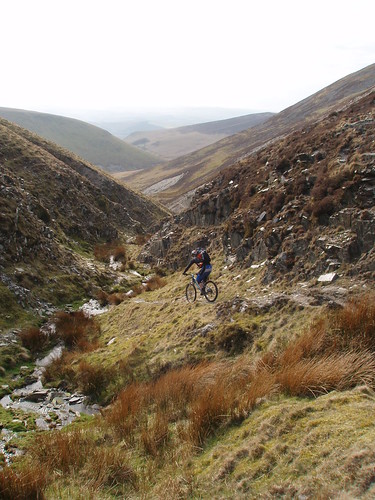 ?v=0[/img]
🙂
ir-bandito - is this the route you're referring to:
[img]  [/img]
Is there much carrying, does it get quite boggy in places, and how would the descents be for a friend on a fully rigid ?
Cheers.