NEW Cycling UK Route: Traws Eryri

by 62

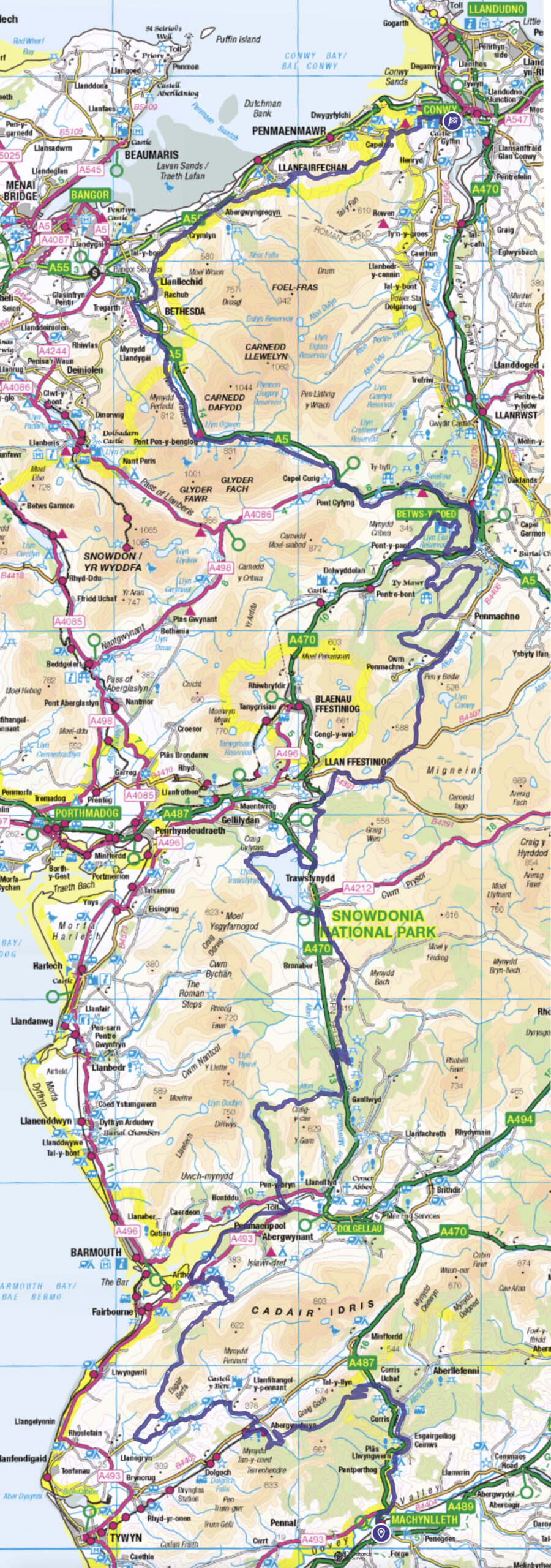
Traws Eryri, meaning Trans Snowdonia, is a new 200km predominantly off-road cycle route in Wales, connecting Machynlleth to Conwy. Ideal for a bike-packing trip or tour of some of the best riding Wales has to offer.

Image credits: Saski Dugon unless specified
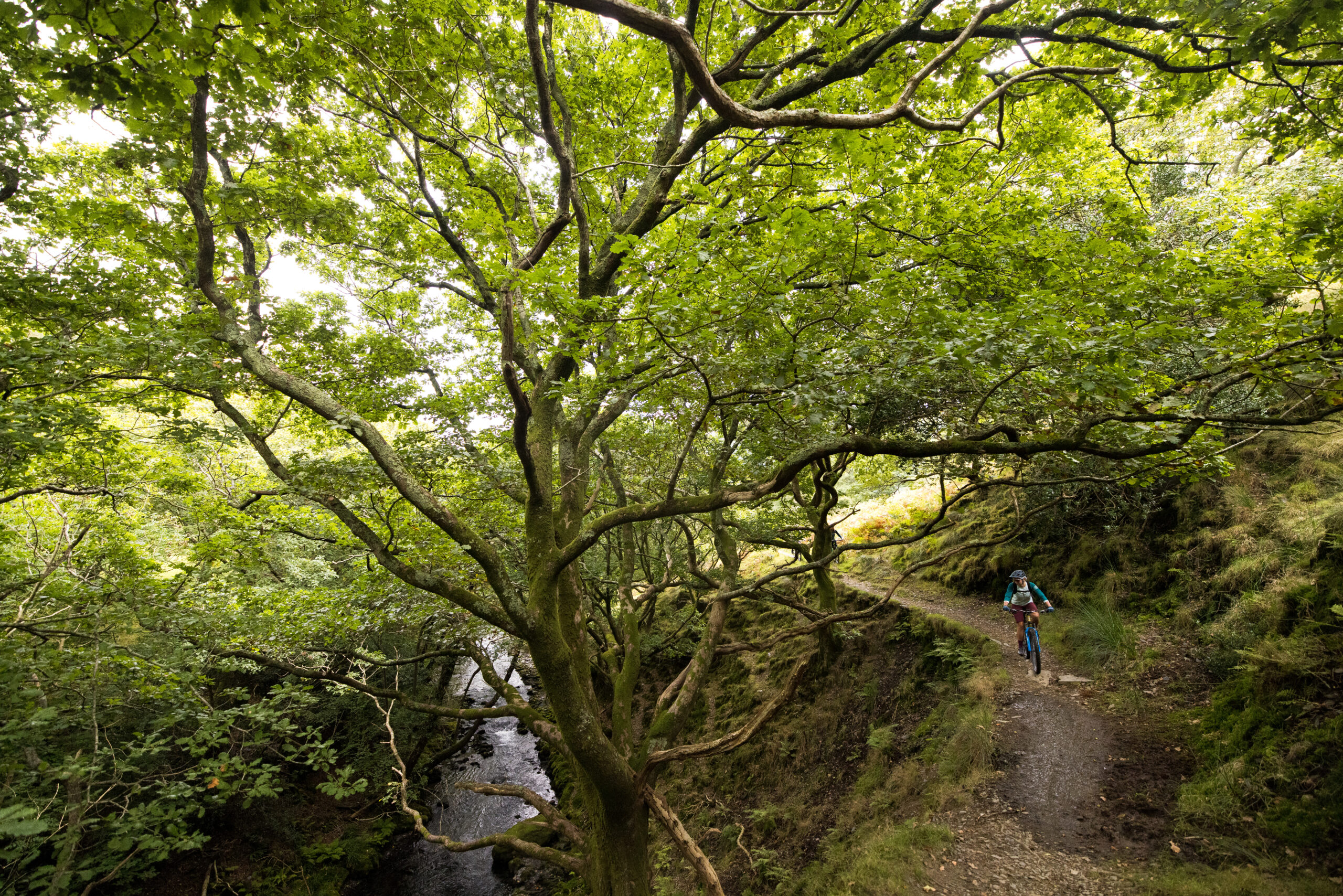
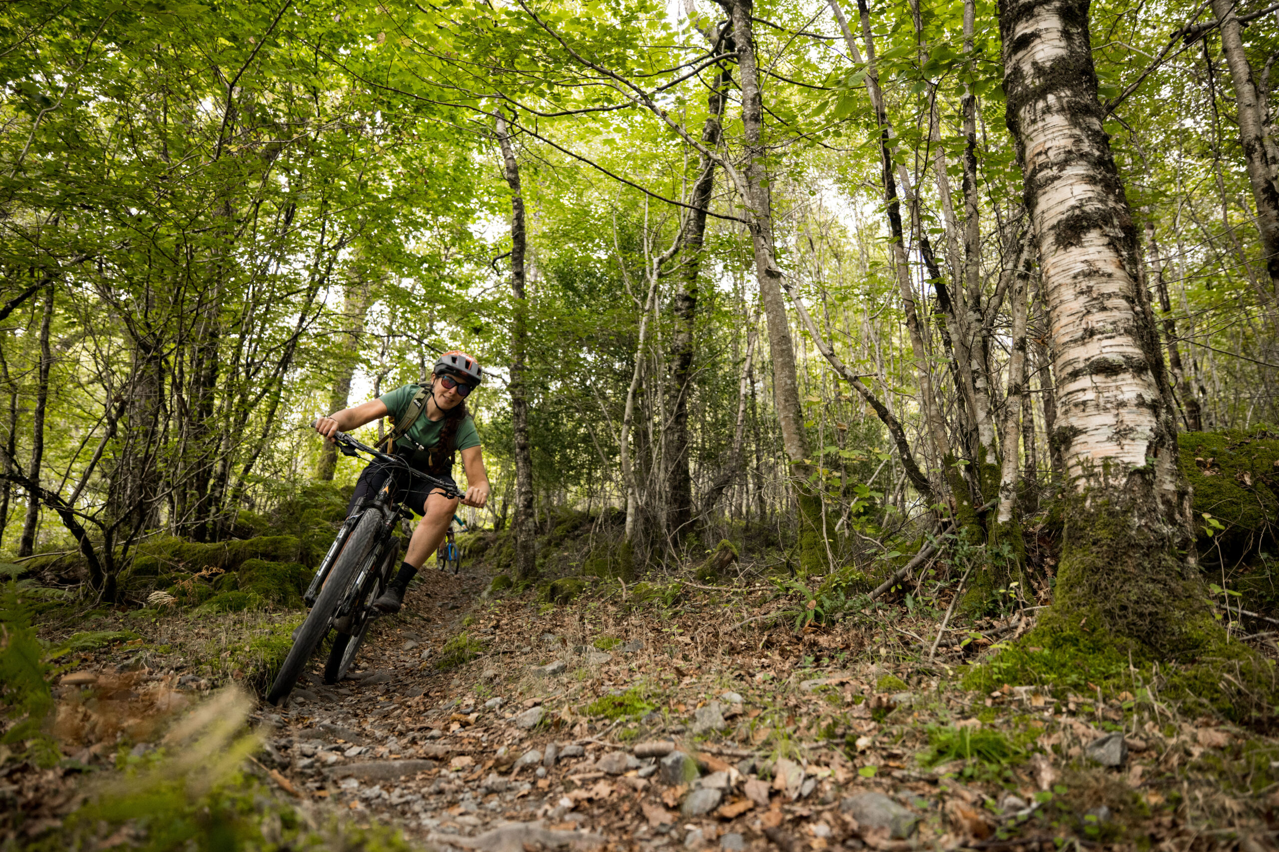
Riding through forest near Abergynolwyn

Traws Eryri Route Information

  • 200km
  • 4,755m
  • Estimated 5 days riding
  • Suitable for hardtails and full suspension MTBs

Guided tours of Traws Eryri are available with MTB Wales. Having ridden with Phill and Polly, I cannot recommend them enough for guiding. Extremely knowledgeable and considerate riders that are fantastic company with a wealth of knowledge of mountain biking in Wales. Very safe hands to be in.

Accommodation options along the route are plentiful, from campsites and YHAs to hotels and Air B&Bs, so you can choose whatever suits your needs (or the weather). When I sampled the route we stayed at Treks Bunkhouse in Llan Ffestiniog and The Rocks hostel in Capel Curig. Treks Bunkhouse is a remote, idyllic choice with all the amenities you could possibly need. The Rocks hostel is an absolute treat to stay in, and close enough to Capel Curig shops, pubs and cafés for you to turn up unprepared and needing to refuel. 

Maps/guides: OS Landrangers 135, 124 and 115. Head to Cycling UK for the route guide.

About Traws Eryri

It is estimated to take 5 days riding for a competent mountain biker, meaning you’ll either need to book a supported tour or carry your own kit. If you choose the latter, I’d recommend travelling as light as you can, as the riding covers forest tracks, bridleways, trail centre descents and technical challenges throughout, right to the very end in Conwy where you go up and over Maen Esgob.

The route begins in Machynlleth, navigates around Cadair Idris, explores the trails over to Llyn Cwm Mynach, a beautiful lake in an ancient woodland. It then heads east to Coed-y-Brenin forest, where it follows bike trails but there is nothing stopping you from exploring more of them. Going north you arrive at Llyn Trawsfynydd and do a clockwise lap of the lake, and then continue north to Llan Ffestiniog. Penmachno is next, offering yet another opportunity to deviate off the route to further explore the mountain bike trails before contouring around Pen-y-Bryn and eventually arriving in Betws-y-Coed after a generous section of forest trails.

From Betws you travel west to Capel Curig, awestruck by scenery the entire way, and now have the inviting option of booking accommodation at Plas y Brenin and enjoying the outdoor activities the huge lake has to offer. From Capel Curig you follow the Roman Road toward Tryfan, a very striking mountain to bait you forward as your legs are no doubt feeling the miles at this stage.

Conwy is creeping closer, you can start to dream about what you’ll order from the chippy on the promenade, but not before tackling the low consequence yet highly entertaining trail over Maen Esgob.
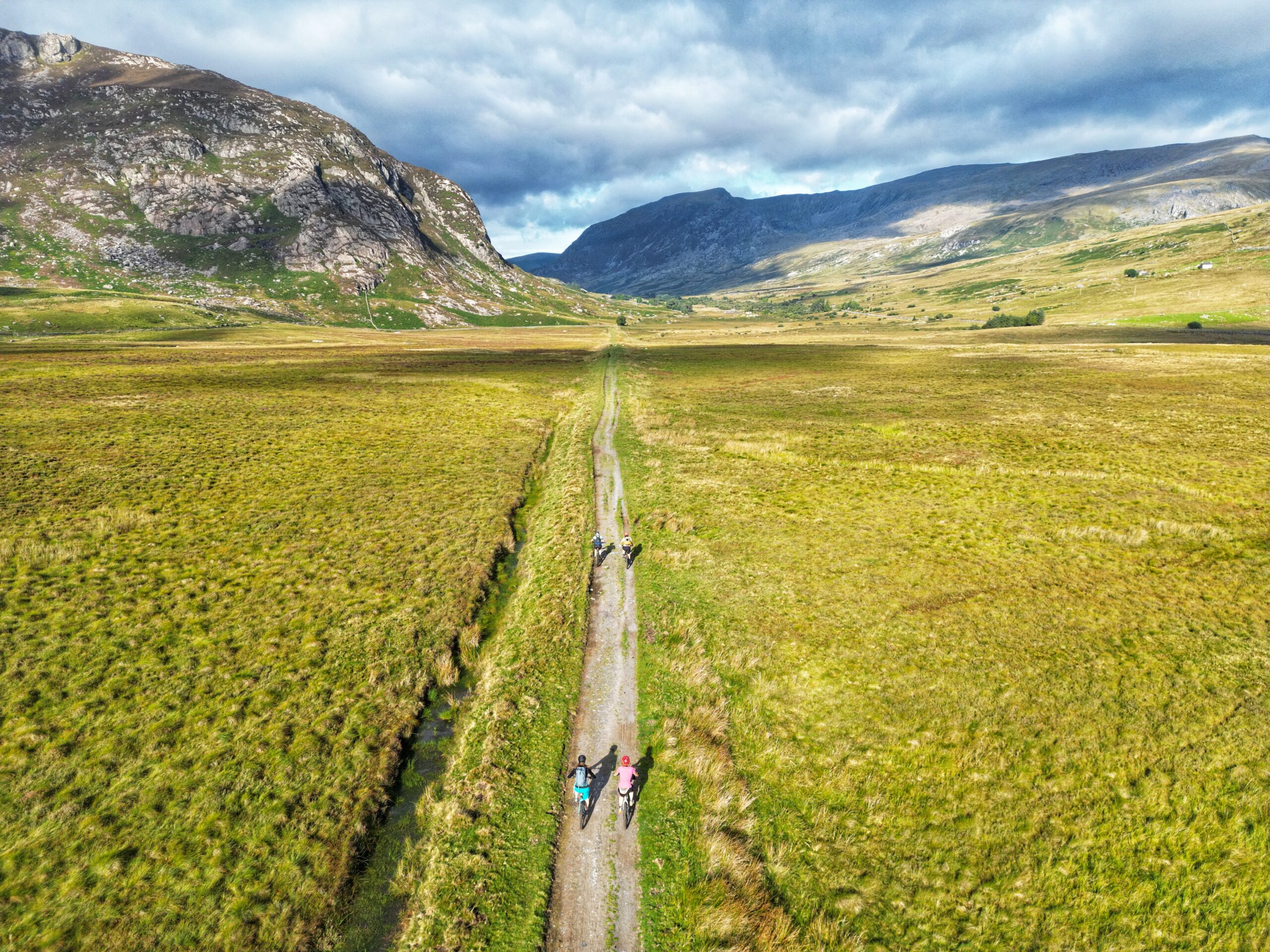
Ridiculously picturesque Roman Road after Capel Curig. Credit: MTB Wales

Why Bother?

There’s no denying that I’m an advocate for mountain biking in Wales. It is a beautiful country with a vast amount of trail centres, so many in fact that I can never choose where to go. This route gives you a taste of the trails through ClimachX, Coed Y Brenin, Penmachno and Gwydyr Forest. It also samples terrain in Dyfi Forest, Cadair Idris, Ogwen Valley, Conwy Mountain and plenty more along the way. You can adapt the route and include a full loop of Coed Y Brenin if time allows, or book some secure accommodation in Capel Curig and have a recovery day at the lake. This route took a lot of hard work and research from Cycling UK and has been meticulously planned, and the result is a tour of some of the best Wales has to offer. The hard work is done, you just need to find time to go and ride it. Da iawn, Cycling UK!
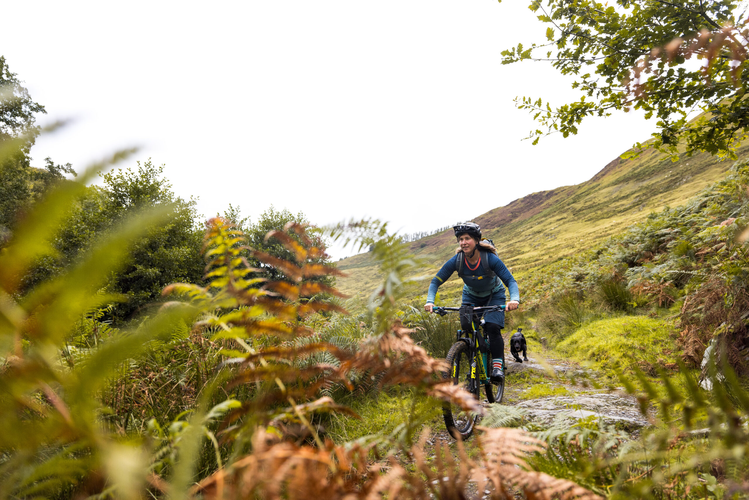
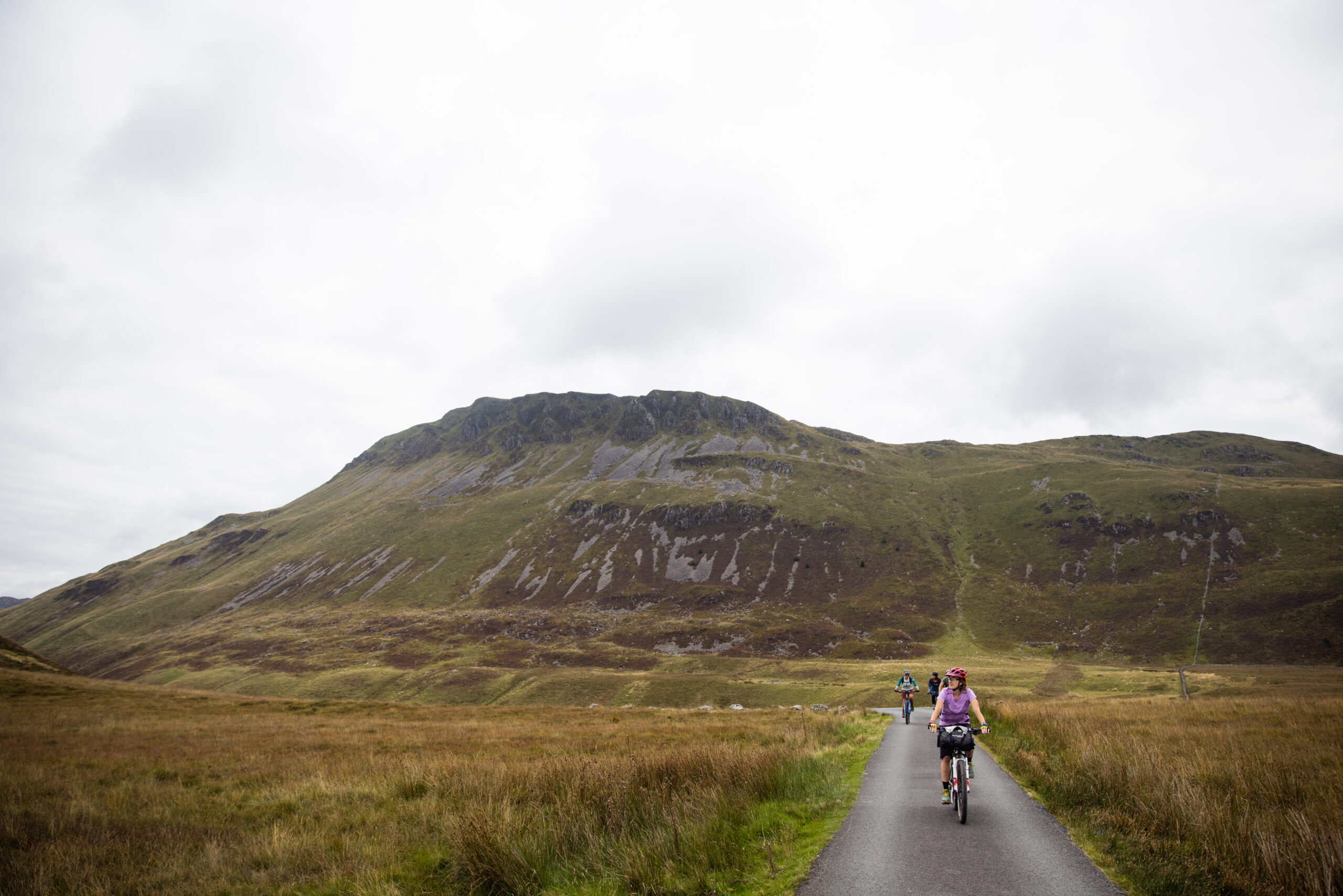
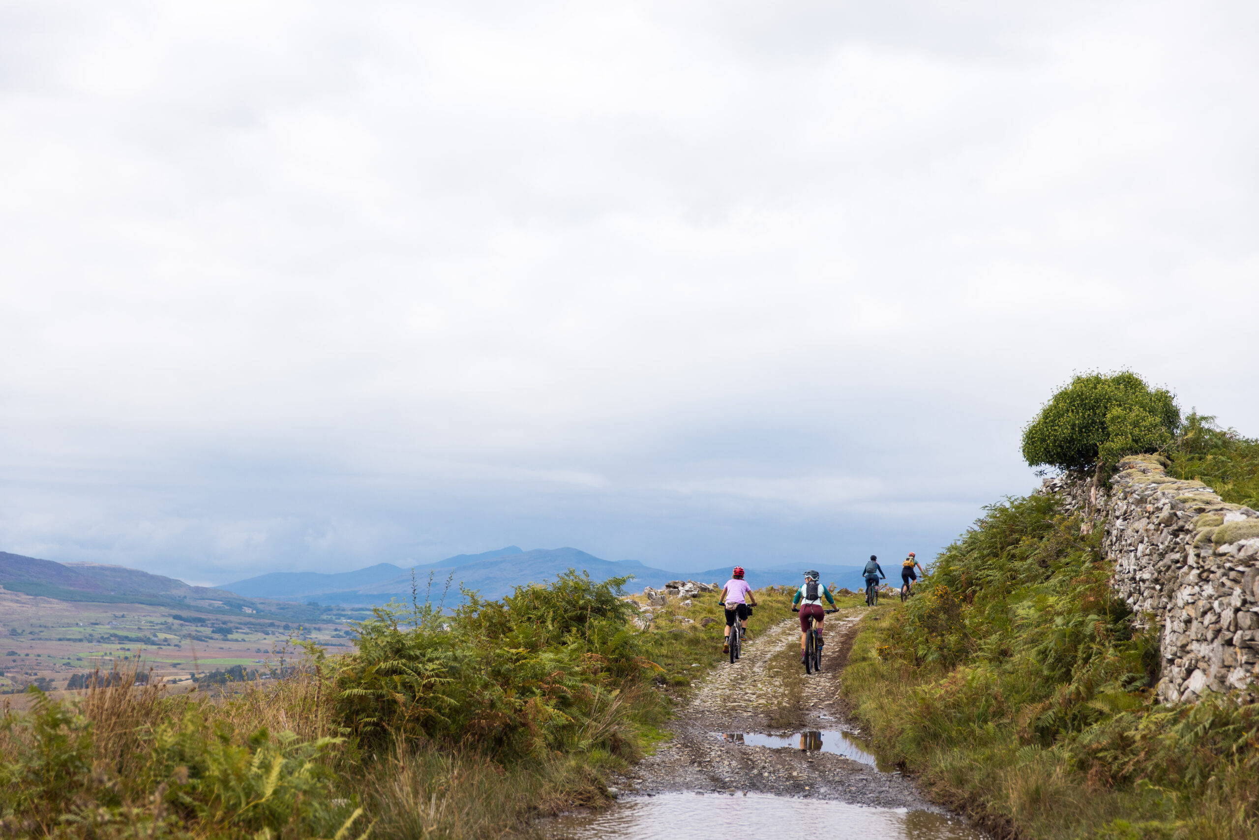
Polly from MTB Wales rolling through the hillside near Cadair Idris
Road towards Llynnau Cregennen, with Tyrrau Mawr/Craig-las in the background
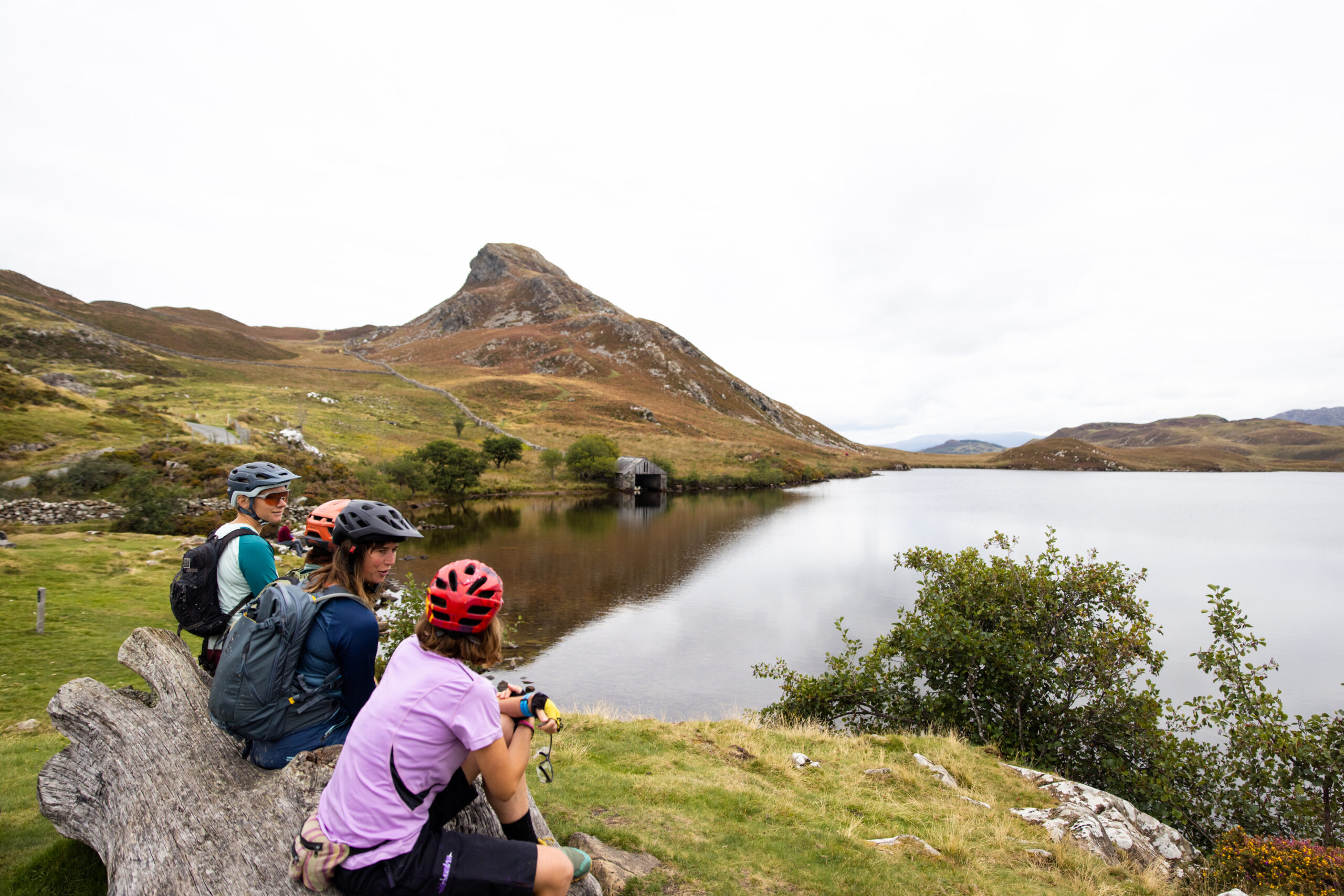
Llynnau Cregennen
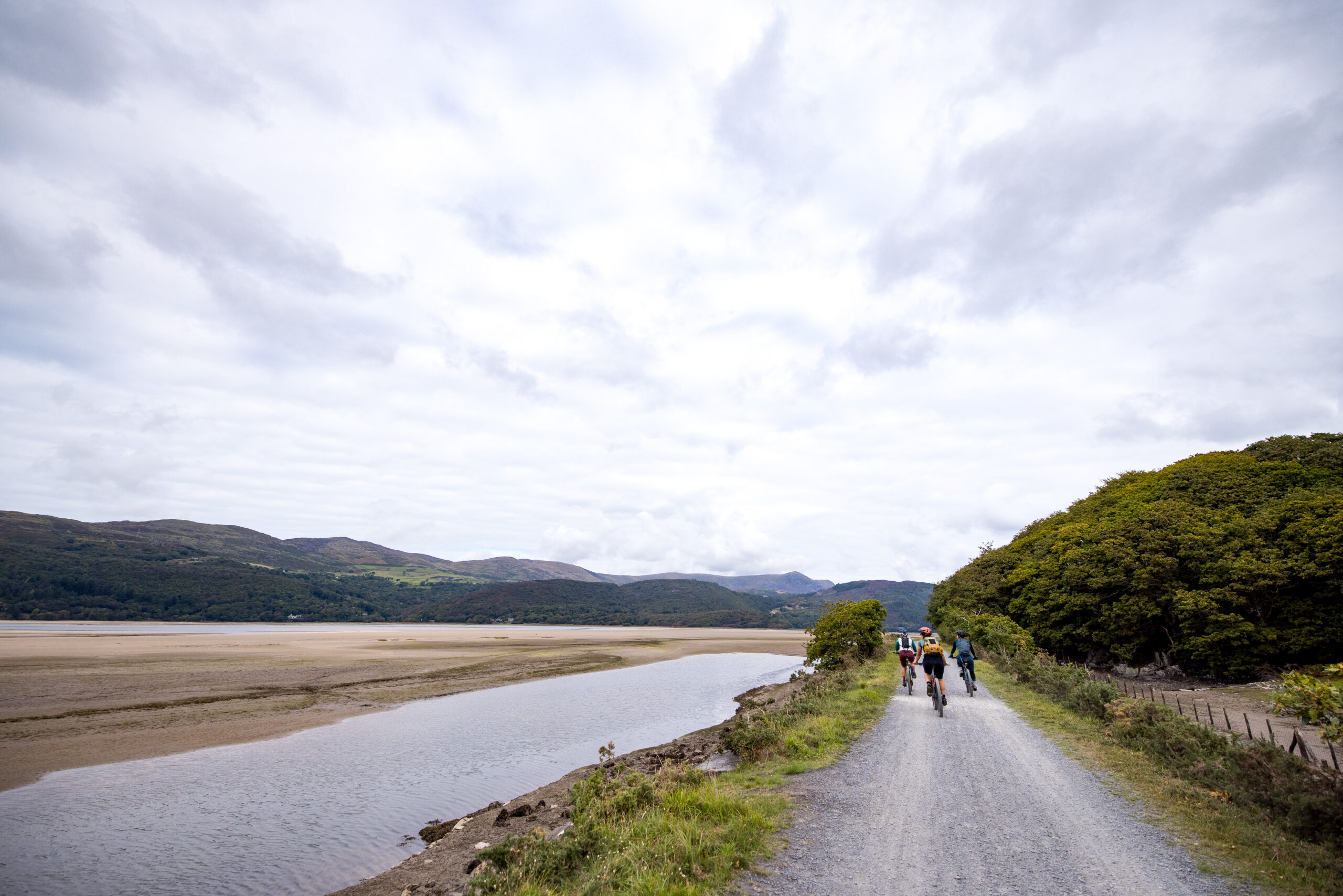
Riding along the Mawddach estuary trail
Exploring mountain bike trails around Coed-y-Brenin
Forest tracks around Coed-y-Brenin
Views heading up Cwm Teigl from Llan Ffestiniog

Singletrack Weekly Word

Sports Newsletter of the Year finalist at the Publisher Newsletter Awards 2024. Find out why our newsletter is different and give it a go.

Author Profile Picture
Amanda Wishart

Art Director

Amanda is our resident pedaller, who loves the climbs as much as the descents. No genre of biking is turned down, though she is happiest when at the top of a mountain with a wild descent ahead of her. If you ever want a chat about concussion recovery, dealing with a Womb of Doom or how best to fuel an endurance XC race, she's the one to email.

More posts from Amanda

Home Forums NEW Cycling UK Route: Traws Eryri

Viewing 22 posts - 41 through 62 (of 62 total)
  • NEW Cycling UK Route: Traws Eryri
  • phil5556
    Full Member

    I’d hate to climb so far only to limp back down on a rigid gravel bike.

    Oh.

    IMG-0497

    We set off for Wales tomorrow. Trans Cambrian for 3 days followed by the TE over 3 days.

    Only just seen the chat of closed bits, any chance you could send me the route please so I can check how it compares to what we’ve got planned?

    phil5556
    Full Member
    1
    tillydog
    Free Member

    I don’t *think* anything is “closed” at the moment. The published route differs from the original article as there are two major sections where the rights of way are ambiguous. These currently have tarmac alternatives.

    Have a look at the article below for the background, and where they are (3 part article).

    https://www.cyclinguk.org/blog/traws-eryri-mysterious-missing-bits

    There’s also a short, off-road section near Abergynolwyn  that requires you to traverse about 100 yds of footpath, so isn’t on the published route.

    phil5556
    Full Member

    Thanks, yep I just read that and realised what the issue is.

    So from the Cycling UK article it suggests that it should be OK to ride but technically not allowed.

    I wonder if I’ll get a chance to faff about with my GPX route and tweak it in time!

    Simon
    Full Member

    I did the route with Mugboo I’ll try and post a link to my Strava for the 3 days riding.

    tillydog
    Free Member

    @phil5556 – check your messages.

    1
    tillydog
    Free Member

    @phil5556 – check your messages.

    Don’t worry – @Simon ‘s routes above include what I was going to send you (except the short bit near Abergynolwyn).

    Enjoy!

    phil5556
    Full Member

    @tillydog just messaged you so no need to reply but thanks!


    @Simon
    thanks for that, I’ll grab the GPX later and compare it to ours.

    All the extra bits OK to ride?

    2
    phil5556
    Full Member

    Sorted.

    The quarries section definitely worthwhile and looks like it cuts out a bit of a slog of a climb up a road.

    The other bit might be a hard sell to everyone at the end of day 6… I’m sure the view is glorious, but it adds about 350m on. Will see how we are all feeling.

    4
    Ambrose
    Full Member

    I supported my wife when she/ we rode it last month. I have arthritis so can only ride limited distances despite using an ebike. She rode the route; I rode either with her and then back to the car or drove ahead and headed back to meet her.

    We used to live in Machynlleth so decided to miss out almost all of the early tarmac miles.

    Day 1. Craig Aderyn (Bird Rock) to Tynygroes hotel, in CyB.

    Over to the wonderful Heol Ddu with its stupendous views across the Mawddach estuary to Yr Rhinogydd and beyond, to near Llynau Cregennan as per official route but we were then tempted by the bridleway following the Nant Gwynant dropping down past Kings youth hostel. It started promisingly but was a bit overgrown with bracken. Excellent riding though with a couple of nice rocky sections. A too slow lunch at the George in Penmaenpool. Steep road after the wooden toll bridge and then up through the forest to the Afon Gamlan. The waterfalls are worth a look. The Gamlan is one of the best whitewater runs to be had.

    Day 2. Tynygroes hotel to Eagles hostel in Penmachno.

    A couple of the reds in CyB and then food in the centre. Mrs Ambrose really enjoyed the rocky Sarn Helen track to Trawsfynydd where I met up with her. Her ‘non-official’ route was then up from Llan Ffestiniog via Cwm Tiegl to Manod quarries where my woodburner’s hearth was quarried in true STW style back in 2010. I met her at the top, having ridden up from Penmachno. On the way up from Cwm Penmachno I managed the first third of the top incline but couldn’t ride it all, despite the motor. It was an awful push up even with the ebike’s walk assist because my hip was so painful. Reunited at Manod Quarries we rode back along the tramway (there are some BIG holes in the ground from the workings) to the top of the upper incline that I had previously pushed up. It’s a fun, fast run descending the inclines with warp speed slaty tracks taking you back to the village. We had a gentle end to the day along the valley bottom.

    Day 3. The Eagles, Penmachno to Yr Llech, The Slate in Tal y Bont, Llandegai.

    Breakfast in the Conwy Falls Cafe was a good one. We missed out all the convoluted route above Betws y Coed, instead heading directly for Sarn Helen again in the forestry above and between ByC/ Dolwyddelan. There are a few trees down in places, but nothing is problematic. A pint and a bite in the Tynycoed hotel (recently refurbished, very nice indeed) and then via Plas y Brenin to Capel Curig. The route follows the old road to Ogwen Cottage and is hugely photogenic. Lots of classic mountain views, unless it’s pouring down like when we were there. From Ogwen Cottage down into Bethesda via the back lane that most definitely isn’t the A5 to the Snowdonia slate trail, part of Route 82. We passed the location of Mr Bates’ home in the recent production, Mr Bates vs. The Post Office. Yr Llech, The Slate, our bed for the night is just north of the A55 in Llandegai.

    Day 4. Another good breakfast and then lanes up to Aber falls, by Abergwyngregan. Cheeky riding up towards the Drum turning (very tempting- but not this time) and onwards to Rowen hostel. This is a very well used route that I have never, ever had any issues on. Most of it is shown on Streetview too. From here towards Conwy via the Sychnant Pass and then Conwy Mountain. An obligatory portion of chips by the castle rounded things off nicely.

    Final thoughts:
    We didn’t always follow the ‘official’ route because of personal preferences, local knowledge and accommodation constraints.
    In a perfect world (i.e., with a working leg!) I would alter the route we took by cutting up through the forest from Penmachno to the RoW via Bwlch yr Groes and then down to Dolwyddelan. Boggy but worth it I think. Then I’d head over towards Capel Curig on the RoW that pops out near Pont Cyfyng. I know this track well, it’s a great ride. Huge views, rocky, wet and rather steep too in one place.
    Overall, the official route has a lot of tarmac, more than I’d wanted tbh. I have a feeling that this is to allow rail access and also to encourage the opportunity to visit shops etc.
    A full-suss bike is not needed. We met people on gravel bikes. I used a Trek Rail which was completely OTT except for CyB and the Cwm Penmachno inclines. A hardtail would be ideal.
    There’s loads of accommodation available if you book well in advance- oops!
    Everyone we met was super friendly, but Conwy Quay was a bit of a contrast to the empty hills.

    I have gpx files if you want, message me.

    2
    tillydog
    Free Member

    The other bit might be a hard sell to everyone at the end of day 6… I’m sure the view is glorious, but it adds about 350m on.

    I think that diversion makes more sense if the route went across the top to Rowen as per @Ambrose’s description. (Pleasant, frequently ridden route – mostly gravel track.)

    Otherwise, if you’re descending into Conwy at a quiet time, the views are better for longer if you find yourself on the (cough) footpath along the crest of the ridge.  (It does get very busy with walkers and families, so avoid at weekends, etc.)

    1
    martinhutch
    Full Member

    It makes much more sense as a MTB route if you’re taking longer over it and doing some of the TC stuff on the way. I think the route would benefit from some optional diversions which, for example, let you climb to the top of CyB and then take the Addams Family descents back towards the route without doing the entire Dragon’s Back or Beast.

    The marked route is also short of resupply options actually on the line, aside from Betws y Coed.

    I did it very much on the spur of the moment, if I’d spent a couple of days beforehand poring over maps, I would have made some adjustments, especially near Llan Ffestiniog and after Bethesda. I don’t know if there are any other options to break up the initial road section around Corris.

    Still well worthwhile though. 100% a gravel route as it stands, probably one climb and one descent which will require getting off (unless bastard steep Welsh village roads count)

    2
    phil5556
    Full Member

    did it very much on the spur of the moment, if I’d spent a couple of days beforehand poring over maps,

    We decided ages ago we were doing it, but then have spent no time actually sorting anything. Oops!


    @Ambrose
    thanks. If we get a chance to re-look at a map I might tweak the last bit again.

    Anyway, breakfast and then heading off from Knighton.

    It’s raining. The forecast lies!

    pedlad
    Full Member

    benefit from some optional diversions which, for example, let you climb to the top of CyB and then take the Addams Family descents back towards the route without doing the entire Dragon’s Back or Beast.

    Exactly what we did – one of the lads on his gravel bike!

    1
    martinhutch
    Full Member

    In a perfect world (i.e., with a working leg!) I would alter the route we took by cutting up through the forest from Penmachno to the RoW via Bwlch yr Groes and then down to Dolwyddelan. Boggy but worth it I think. Then I’d head over towards Capel Curig on the RoW that pops out near Pont Cyfyng.

    I looked at this afterwards and wondered what it was like (I diverted to Dolwyddelan and took the onwards route north you suggested) I guess they want people to go through Betws y Coed for accommodation/food options.

    1
    Mugboo
    Full Member

    Damascus – Simon has kindly supplied our routes. Thanks Si.

    I do agree with Martinhutch that the route will no doubt end up being adapted along the way to include more MTBy stuff. I could be tempted to do it again then.

    As for the ‘missing options’, the first one up to the quarry is unmissable. The second one, I’m not so sure, would have to try the official route next time to compare.

    After we got back I had enjoyed the whole thing so much I experienced a slight low. I also started pouring over the maps because there has to be a great way of doing a multi day taking in some of this, CyB, Penmachno and Gydwr.

    1
    phil5556
    Full Member

    Done.

    Tough 6 days doing the Trans Cambrian first.

    The quarry section was ace.

    Gravel bike was probably the right bike.

    1
    tillydog
    Free Member

    Well done!

    I can believe it was tough.

    1
    phil5556
    Full Member

    I’m assuming the “point” of being up on the hills near the end is for the views, which I’m sure were out there somewhere

    IMG-7152

    Probably my favourite photo of the trip. Somehow my mate managed to clear the ditch and land with both feet on the dry side.

    IMG-0938

    dave661350
    Full Member

    GCN bod gave it a go…in a day

    martinhutch
    Full Member

    Still wondering why pretty much all of the most engaging off-road content tends to be on GCN rather than GMBN! The GMBN crew did Traws Eryri on Ebikes. Was an incredibly dull video.

Viewing 22 posts - 41 through 62 (of 62 total)

You must be logged in to reply to this topic.