Hi
Does anyone have a high res version of this map they can share with me:
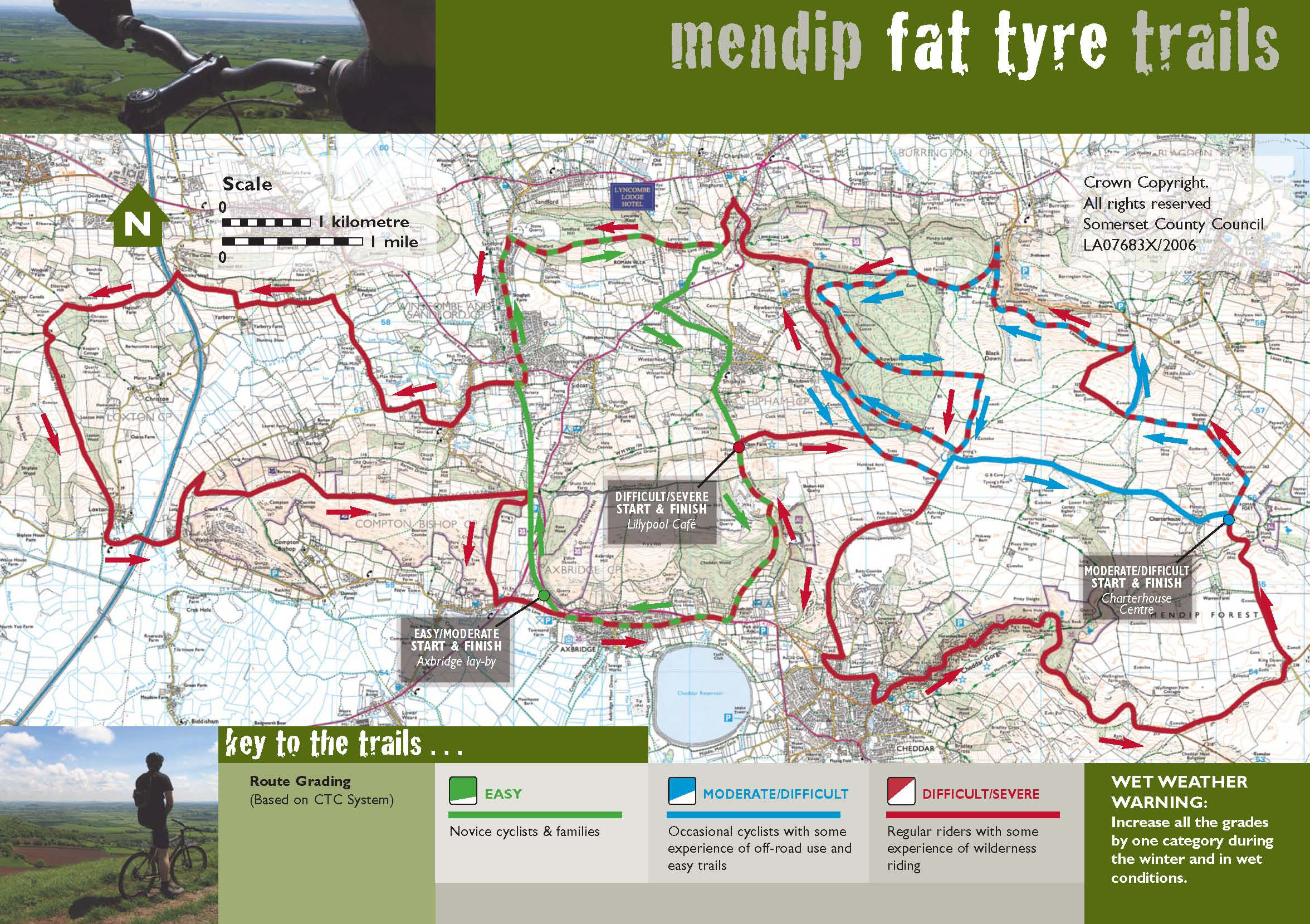
I want a version to print out, but it seems to have been removed from the offical site...
Thanks
You need to put an e-mail address in your profile!
Can you send me one, too? email in profile 🙂
aha I've added my email - lubaloo at gmail dot com
cheers!
now why can't i subscribe to a thread on here by email?
Ah yes, comissioned by the AONB, then withdrawn when they found that MTB traffic increased on those routes and they didn't like it. You can't get it anymore from the official source.
Ooh I would like one too if poss.
Email in profile
I would love one of these as well please??
Anybody know the distance of the long ride (roughly)?
Could someone possibly email me this map too...heading there this weekend!
Cheers
Me too pretty please?
Wouldn't mind one too please, email in profile.
Has it got Slotcars on it? 😀 Lovely trail!
Me too if possible please!
A reworked version of this is now available from bad ass bikes.
Why the hell would you go [i]up[/i] Cheddar Gorge on a MTB!?
The alternative is climbing Cheddar Man which is not fun really and a spin up the gorge is both fast and scenic.
I have a gpx file of the route I can email if you want it
Cheddar Man isn't that bad Buzz. Theres a lovely technical section mid-way up to test those skills!
One would most certainly climb up the Gorge in order to come down the Gorge path on the caves side, or the lesser known stuff lurking on the *shhh* [i]National trust side[/i].
However, generally its best (IMO) to approach the top of the gorge by more circuitous means.
That map also shows the route to the trig point by bike where there is no bridleway .It happens to be the highest point of the Mendips though so we all go there 😆
