
I am toying with a weekend down in exmoor & dartmoor but I do not know the area too well.
Here are two routes I have knocked up. just wondered what the local experts thought of these or know of some better options?
My brother lives in [url= http://www.streetmap.co.uk/map.srf?X=271500&Y=125500&A=Y&Z=120 ]South Molton[/url] so ideally the two route starts want to be fairly accessible from there.
The two routes are:
[url= http://www.bikehike.co.uk/mapview.php?id=24810 ]exmoor[/url]
[url= http://www.bikehike.co.uk/mapview.php?id=24811 ]dartmoor[/url]
The Dartmoor loop looks ok, not ridden all of it but the bits I have are quite fun. I've a number of GPX files around Dartmoor all starting at Plymouth if your interested?
I ride on Exmoor a fair bit & you've got a lot of tarmac in that route!
I'd not consider some of the road sections very safe as they're narrow with frequent blind bends & the locals are mad drivers!
A fair few of the lower parts to the west will be very muddy this time of year, I tend to ride the north east side as the ground drains quicker.
When are you down this way?
yes please steve - email in profile.
no idea yet trailseeker - need to plan - probably not till spring time though as pass outs need to be sorted !
was down last weekend and did a nice ride with my boys from near simonsbath to lanacre via cow castle and back by back lanes.
By the north east do you mean Dunster area - that does look good but would mean a good drive from South Molton.
We normally start at this carpark here http://www.streetmap.co.uk/map.srf?x=290255&y=143925&z=120&sv=290255,143925&st=4&ar=y&mapp=map.srf&searchp=ids.srf&dn=544&ax=290255&ay=143925&lm=0 probably about 12 miles on from Simonsbath, a fair way South Molton side of Dunster - its just more rideable more of the time.
I havent done all those trails - dartmoor trail - but I know its really wet around hexworthy - await some of the moor'rs but I suspect its going to be pretty wet southwest of Belever this time of year - rode arounf belever when it was really dry and towards hexworthy some of it was unridable. People on here will no doubt send you some nice gps files 😉
I always recommend this one - fairly tough but good views - I do it fairly often from my house - BTW I used to live in South Molton - ghe's not a vet by any chance ? 😉
[url= http://www.embc.uk.net/riding_dartmoor.php ]http://www.embc.uk.net/riding_dartmoor.php[/url]
MadBillMcMad you got mail!
no vet - engineer.
The Dartmoor one looks a bit ambitious to me.
I don't really know the area from Peter Tavy across to Bellever but don't expect all those bridleways to exist on the ground! I'd imagine it'll be pretty wet up there too.
The stretch from Sherberton to Whiteworks will be very wet - i've done that in 'dry' conditions 😯 The Abbot Way SE from Nuns Cross does not exist on the ground, at least we've never been able to find it.
If you do get to Bellever, don't miss the famous rock garden [url= http://www.streetmap.co.uk/map.srf?x=264695&y=76450&z=120&sv=264695,76450&st=4&ar=y&mapp=map.srf&searchp=ids.srf&dn=544&ax=264695&ay=76450&lm=0 ]here[/url]
the northern part of the dartmoor loop will be mostly bog. especially with the rain forecast for saturday night.
Exmoor's not far from me & I went to school in South Molton.
As Trailseeker says the better stuff is Dunkery side & its easy to minimise the tarmac & the loons that drive on it!
There is some good riding to the west but it does get very muddy in places - Azarat on here is more knowledgable when it comes to Brendon & the Doone valley.
Your more than welcombe to join us for a ride - give me some notice & I'll knock up a 30 mile 6000ft of climbing ride if you like.
Cow castle from the ridge
[img] 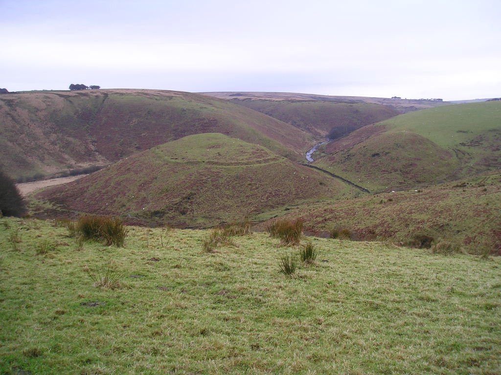 [/img]
Done the Killer loop a long while back but to be honest
if you like XC then thats all it has to offer.
I really wouldn't attempt that Dartmoor one. Lot's of stuff there that's at best tussocky nastiness. Huge stretches will have a ROW on the map but no followable trail on the ground. Get issue 49 of the mag and do something out of there instead.
Wow - you certainly live up to your Mad name Bill coz that Dartmoor loop is a stonkin epic mate 😕
The BW between Peter Tavy & Bellever via Cocks Hill 😉 is an absolute bog-fest and would probably be more of a hike-a-bike than a ride. I hope you have a camouflage colour bike too cos you do realise that the route goes through the Merrivale MOD firing range - in coming!!! - the last time I was up at Princetown they were in fact live firing on that range.
I agree that the Sherberton farm to Whiteworks is another bog-fest. The route is a series of posts marking the way if you can find them & the streams can be very 'interesting' to get across especially after some rain.
To be honest I have ridden fairly regularly on Dartmoor & I wouldn't want to undertake your route - Sorry - I would stick to something a bit more rideable rather than trying to go over the open Moor which is a nightmare.
+1 for TM's suggestion. get the best of the moor done on known routes that work.
Did a very modest route this week,after long absence from Dartmoor. Had forgot how difficult it is to navigate even on simple bridleways, as TM says, the OS map and reality on moor are totally different. If only you could find some of them life would be a lot easier, but less of a challenge!
I'd look at the previously mentioned routes in the mag and give them a go, it'll get your eye in to what's actually 'on the ground'. You can alsways use them as a base idea and tweak it to suit.
Q
cheer guys. Thanks for the tips.
best go & look at issue 49 then.
not sure when we will be off down there.
Will see when We can muster the troops.
I'm no local but ridden a bit round Exmoor when camping there a few times and it's bloody marvellous round Minehead, Porlock, Wooton Courtenay, Webbers Post, Dunkery, Periton, Selworthy, Horner etc. Link all that stuff together and you'd hardly need to hit tarmac at all... More bridleways than you can shake a stick at, some nice technical stuff, rock gardens, eyeball bursting climbs and some fantastic downhills. Riding there with someone with local knowledge would be fantastic.
Only downside in the summer is the flies, of which there are many, and a large subset seem to want to be inside your mouth as you gasp for air on climbs. Presumably they go away in the winter at some point.
I'm like snowslave. I go to that area too because of the mass of trails that stay in reasonable nick - many good ones marked on the map and many more. As winter draws on, the tea-shop ramblers melt away and all the marvellous cheeky trails become available too. Bits I really like so far:
Good fast downhill off Dunkery in the direction of Stoke Pero - hop the water bars.
Granny's ride - kicking off steeply down from Stoke Pero, re-climbing a bit after you hit the stream and then lunatic fast descent into Horner. Some tough grannys in Somerset!
Crashtastic ugly techy trail off Dunkery toward Webbers - absolutely not for mincers - last time we all went over the bars at least once, mainly from front wheels falling into ruts or hooking up on water bars.
Numerous excellent technical options descending from Webber's Post to Horner
Various scenic cheeky descents off Selworthy Beacon, and Allerford Woods (uber cheeky)
Tea and cake in Periwinkle cafe in Selworthy
Various lethally fast descents off North Hill
Something about the area makes me want to hurt myself [nurses torn ligaments in shoulder]
dartmoor peter tavey to bellever, has anyone managed this?
As trailmonkey says there is often no bridleway on the ground as lucky walkers dont need them as they can go where they like.
I've done it, fekkin easy for us dartmoor philes
[url= http://www.v-outdoor.co.uk/products/mountain_biking/south_west_mountain_biking_-_quantocks_exmoor_and_dartmoor.php ]Nick Cotton's[/url] book gives very good basic info to the area and quite a few rides that avoid the mud and stick to trails that really exist.
I know it's all a matter of personal taste but imho, avoid Nick Cotton's book. Full of stodgy, turgid rides that do their best to avoid anything remotely interesting but exist simply because they form a nice tidy loop on the map and fit snugly into the guide book. Look at his Quantock route suggestions. The ridge ❓ 😯 🙄
Just ask on here for route advice when you're nearer to coming down. There are already suggestions on this thread that are much more fun than anything you'll find in the VG book.
Just for the record, I found the VG book for the Lakes very good.