With the hot, dry weather set to continue, fire crews are warning that moorland and woodland across the UK is primed to burn – and plenty of it is exactly where we ride. Fires on dry moor can move faster than you’d believe. Here’s what to do if you come across one mid-ride, courtesy of West Yorkshire Fire & Rescue Service.
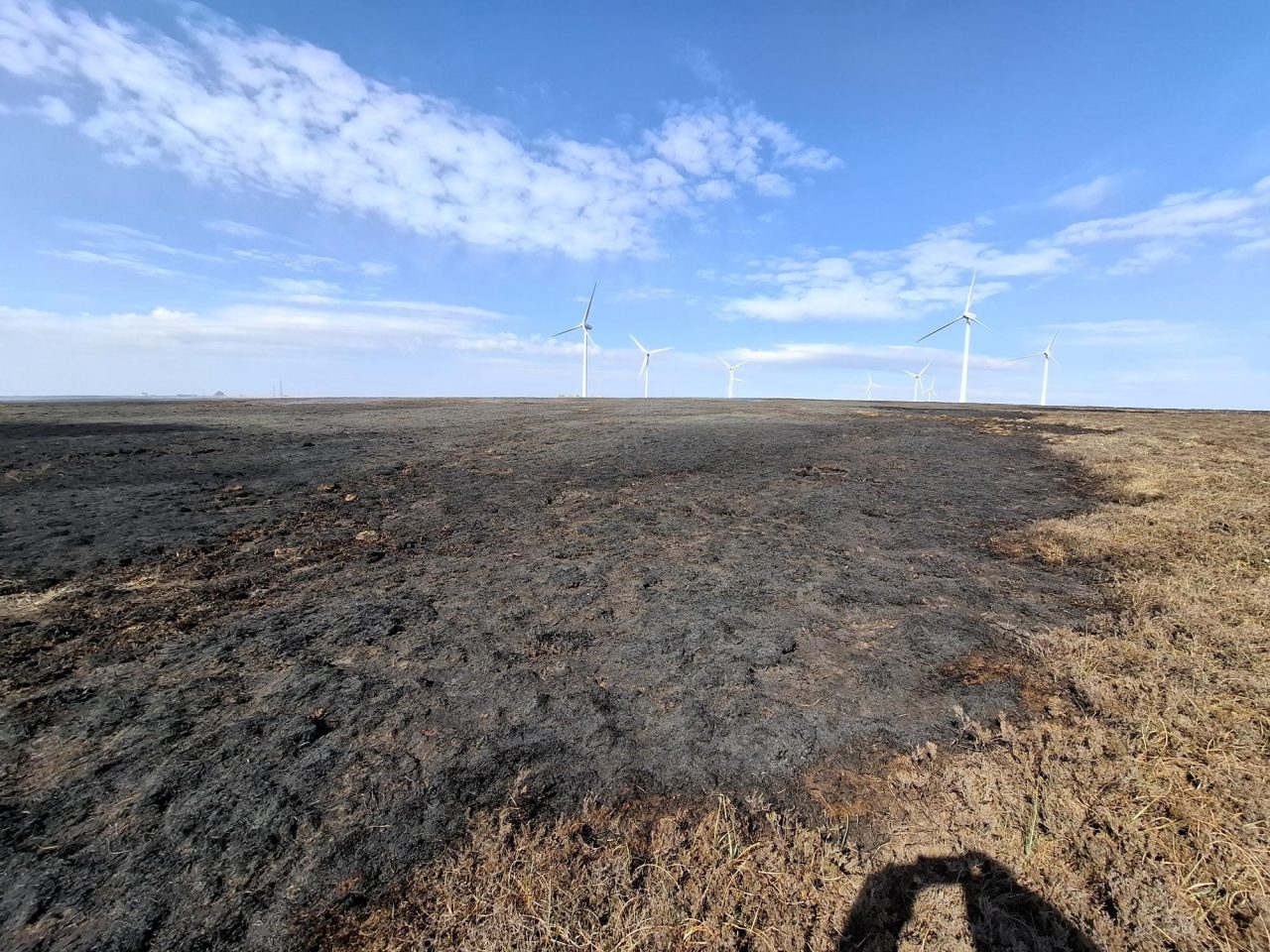
If you see smoke or flames
Move to a safe place and call 999 immediately – ask for FIRE. Give as much detail as you can: the size of the fire, the location and the terrain.
Don’t attempt to tackle the fire yourself, however small it looks. Moorland fires spread fast and can change direction with the wind.
If you haven’t already, get out of the area as soon as possible.
Tell them exactly where it is
This is where riders can be more useful than almost anyone else on the hill: you’re carrying GPS. Control room operators can work with any of these:
- A what3words address (the free app gives you one even offline)
- An OS grid reference – the free OS Locate app gives you one instantly, or pull it from your mapping app
- A lat/long from your bike computer or phone
- Failing that: the nearest named landmark, car park, trailhead or road
A precise location can save crews the better part of an hour searching moorland access tracks.
Don’t be the reason there’s a fire
- No BBQs, no campfires, no exceptions on the moors in this weather – and if you see someone using a BBQ on the moorland, call 999 and ask for FIRE. That’s the official advice, not curtain-twitching.
- Take glass bottles home. They can hurt people and animals, and they can magnify the sun’s rays and start a fire.
- Don’t park on dry grass at the trailhead – hot exhausts can easily start a fire.
Should you even ride?
The moors stay open during most wildfire warnings, but on extreme-risk days it’s worth checking your local fire service and National Park social feeds before heading up – crews sometimes ask people to stay off specific moors, and access tracks may be in use by appliances. If in doubt, there’s always a lower, greener loop to ride instead.
Fires don’t just close trails for a weekend – burned peat moorland can take decades to recover, and access disputes have a habit of following blazes.


The advice in Norway is pretty similar as they can blow up very fast, even when you think they’re extinguished. The ones I see are a mixture of farming burnoff running away and natural
Oh dear!
I saw this earlier but didn’t post as it was only an arrest on suspicion; she’s subsequently been charged.
https://www.bbc.co.uk/news/articles/c6212vj664no
GMP statement says they aren’t stopping with just her.
https://www.gmp.police.uk/news/greater-manchester/news/news/2026/july/woman-charged-with-aggravated-arson-following-dovestones-reservoir-fire/
It looks like the Cairngorms Nation Park is in trouble too!
https://www.bbc.co.uk/news/articles/c3v0kpderp9o
Good video here.
As an outsider it seems Scottish Government are just not prepared and planned for such events. Seems Scottish Fire and Rescue similarly under resourced for this as well.
Talking of the Abernethy fire, is there somewhere on the t’internet where I can view the extent of the fire and/or the area closure overlaid on an OS Landranger map? Or is there a way to download a shape file, or KMZ or GPX so I could do it myself?
This is very good … but not sure the UK is included. Bushfire.io | The Natural Disaster Map
The Abernethy, Ryvoan pass area is currently cordoned off. The wildfire was under control but still smouldering yesterday and we’ve had lots of rain overnight so it must be well dampened down now.
They have bulldozed through the Abernethy forest and the Glenmore forest to create huge firebreaks. As fas as cycling round there is concerned the outer Cairngorm loop through Abernethy to Dorback is a no go due to the cordon. The inner loop goes right through where the fire started near the junction between the Lairig an Laoigh pass and the Ryvoan loop. So that’s a total no go just now. If you want to cross the Cairngorms off road at the moment best to stick to the Feshie Linn o Dee route or the Glen Tilt route. You can make a nice loop out of these passes if you add in the Gaik pass.
There was a video on FB yesterday showing 4 or 5 relief engines arriving from London under police escort through Tintwistle and on up the closed A628 (Woodhead Pass).
Resources coming from around the country but it’ll be leaving some parts very thin.
Whilst doomscrolling through YouTube I zipped past a video that I think was a social media MTB influencer with a video shot of him riding through the fires in Cairngorms…I’m hoping I just imagined it as I can’t find it now.
Can’t find it now and can’t remember the person’s name, has only just started appearing in my doomscrolls, so isn’t a name I’m recognising.
If you can help safely, then do what you can but don’t be ignoring it or trying to be a hero…
On the map front, this isn’t going to give much in the way of resolution, but it does cover the UK so should give a general overview of what’s going on. I assume it gives heat sources. Anyway, it’s quite fun to play around with if a little over my heard.
No fire service in the UK is properly resourced for huge wildfires. In my near 28 years in the service it just doesn’t happen often enough to warrant the cost although the last couple of years could change that and wildfire has moved right up the priority list in my service.
Probably need a national resource funded from Government, much like the High Volume Pumps and Mass Decontamination units that are scattered around but as mentioned earlier, these cost loads and are hardly ever used.
That’s the thing about emergency preparedness for anything though, it’s a cost/risk balance.
We spend thousands on a confined space rescue team, (which as it happens are all retired fire and rescue staff) each big outage at work. 95% of their time is spent sitting in a site cabin near the action and they’ve never been used in anger. Feels like a right waste of money when I’m paying the bills, until you’ve got someone passed out or injured where they’re hard to get to.
The thing I would do is get well away from it. If there’s a choice of direction I would go upwind (with the wind in your face) as the fire is most likely do spread downwind, and might be faster than you.
Re: fire overlays on maps.
I have both Trailforks and Gaia mapping apps on my phone and both have options to overlay current wildfire boundaries and smoke/air quality forecasts on which I’ve used when road-tripping in BC and the US.
For anyone road-tripping in the BC or the US, I suggest you check this before you commit to a specific area. All this data is public domain, so it’s available in numerous North American orientated mapping apps….
I was hoping the UK had something similar.
Found the video and then lost it again! I did manage to watch a bit of it before I closed it down in error. They were out on a bike ride and didn’t intentionally go looking to ride through the fires…fire spread and they got asked to evacuated as soon as they could.
Suspect my last post suggested they were doing it for show but no, they got caught amongst it all and had to get out asap.
Ended up ringing the fire brigade last evening after coming across this delightful sight in Chopwell.
400 mL of water wasn’t going to put it out, and didn’t want to risk spreading it as it looked like it was started at the top