Route guides! Remember them? Once the mainstay of every mountain bike magazine on the newsstand, nowadays… well, nowadays there aren’t many mountain bike magazines full stop.
Words: Benji. Photos: Benji & Heather.
Regardless, the art of route guides appears to have been lost. There are many reasons for this. And yes, trail centres and bike parks are certainly one of the causes. Mountain biking appears to have lost its ‘navigating around a rights-of-way network’ roots. A lot of folk think that mountain biking is a ‘resort-based’ pastime; go to somewhere with some sort of visitor centre and follow the coloured arrows around identikit McTrails. Mountain biking has become even more like golf than it used to be in the noughties.
What else caused the death of the route guide? My main suspicion is that around a decade ago, anyone ‘old skool’ enough to want to follow a highlighted map had basically done them all. Completed it, mate. Especially as far as routes in England and Wales were concerned. There are only so many times you can publish variations of the same basic route. So the demand from the old skoolers dropped off. And the ‘nu skool’ weren’t into navigating shared paths. They were riding resorts. So, no more route guides.
From a ‘changing media landscape’ point of view, route guides just became too expensive to produce. Or, more accurately, route guides cannot really be done any cheaper. Photographers, accommodation, travel expenses, food and drink for any and every rider, paying Ordnance Survey for publishing rights. Route guides quickly came under lots of scrutiny from the budgetary bean counters. The fact was (is!) that an editor/publisher can fund two or three other features for the price it can cost to produce a route guide.
Perhaps foolishly, we’re bringing route guides back.
Well, perhaps foolishly, we’re bringing route guides back.
There are three theories we have for doing so.
Firstly, navigating has never been easier. My Mum can download a .gpx file into her smartphone and follow the hi-def breadcrumbs. Probably.
Secondly, the aforementioned ‘nu skoolers’ are now ‘old skoolers’ and thus feeling the itch to break out of the Forestry Commission’s aggregate mazes and into the wild yonder.
And thirdly, ebikes. Yep, ebikes. Having some assistance makes people massively more open to exploration and New Things. And this is relevant for every and any ebiker, no matter what skool they are in. Speaking from personal experience, I’ve been revisiting several ye olde classicke route guide routes but doing them on an ebike this time. And it’s been absolutely fantastic. Routes that I would never willingly wish to do ever again on an acoustic bike turn out to be really excellent on an ebike.
As much as we may like to bemoan New Fangled Technology, there’s not really any hiding from the fact that smartphones and ebikes make riding route guides roughly 14,000 times more enjoyable than it used to be.
That said, doing this route guide – sorry, Destination Guide – to Calderdale reminded me why we don’t do these anymore!
Pick Two: Models, Weather, Local Knowledge
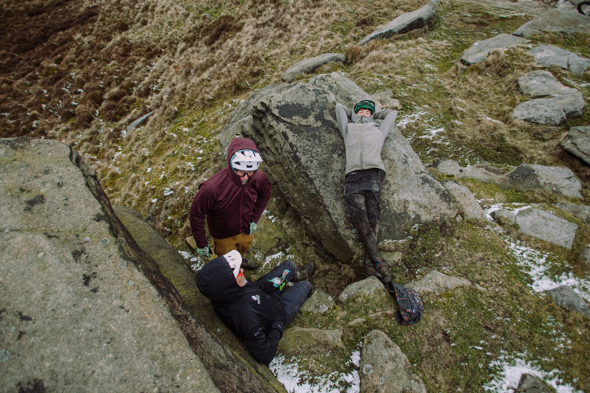
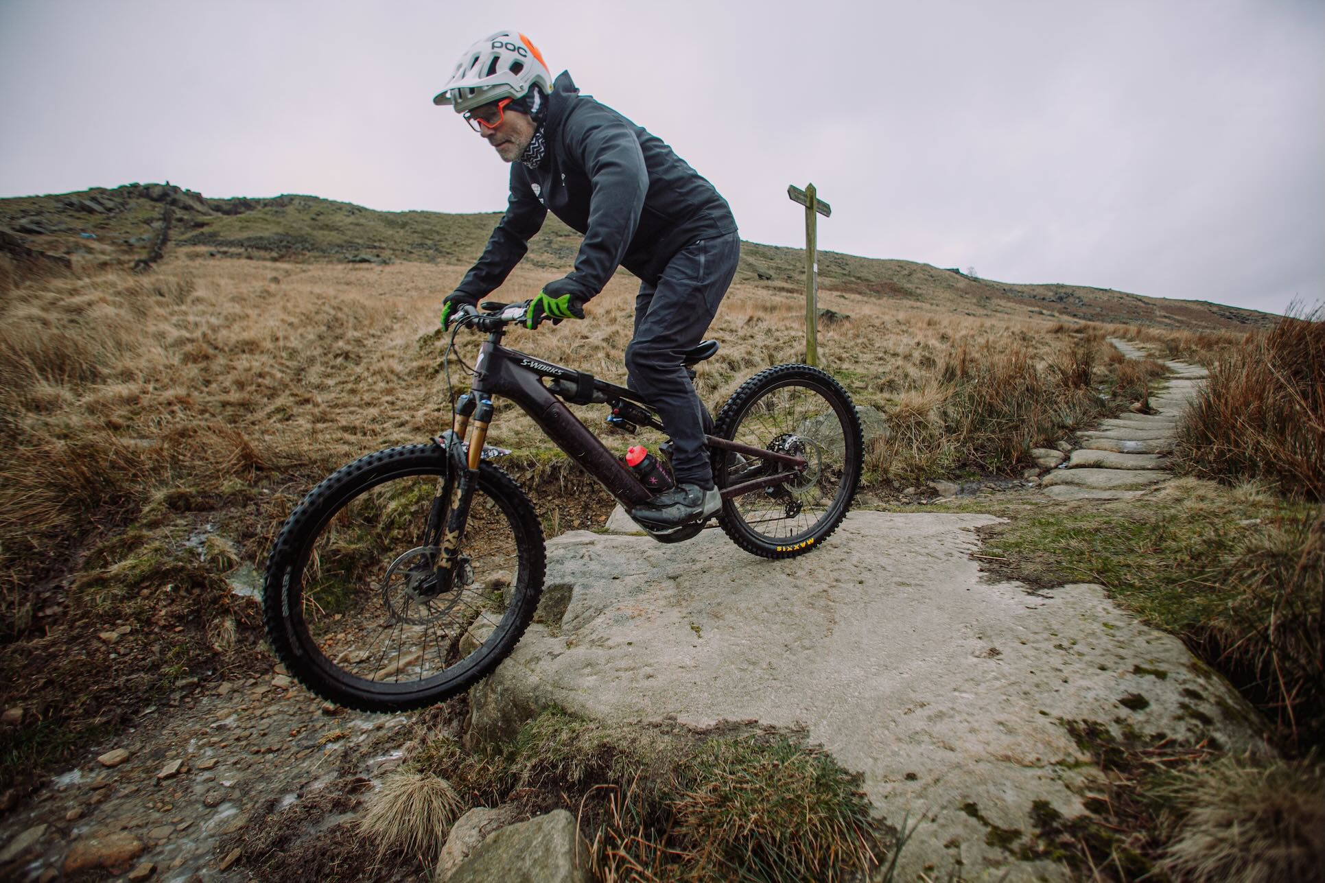
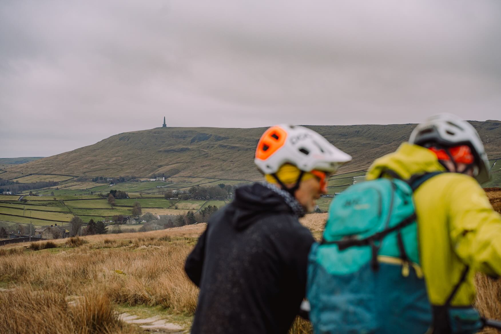
As the nominal author of the feature, there’s just so much out of my control. To paraphrase Señor Bontrager: willing-and-able riding models, decent weather, someone who knows the area extremely well – pick two. And the two that we got for this? Well, it wasn’t the ‘decent weather’ one. But it is what it is. Which is the South Pennines in February.
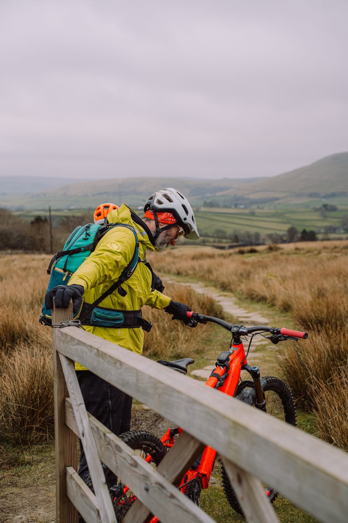
In terms of the riding models, the assembled cast for this photoshoot/ride was something of a who’s who of Singletrack route guides past (and present). There were Seb and Matt, who were frequent riding models back when I used to do route guides for magazines the first time around, along with current Singletrack employee Heather and current Singletrack contributor Aran. As for the ‘someone who knows the area extremely well’. Er, that’s me. I’ve ridden around Calderdale for – checks watch – over thirty freaking years now. I work in the area. I even lived in Calderdale for a few years. I’m fairly certain there isn’t an OS map square that I haven’t had a nosey at.

So, What’s the Riding Like?
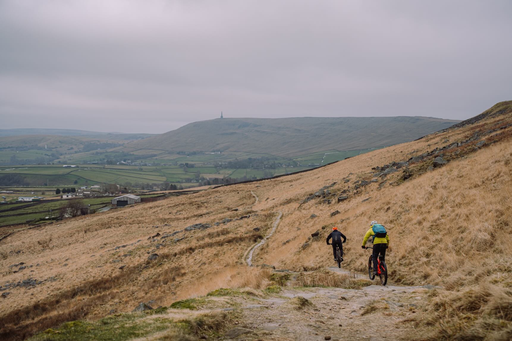
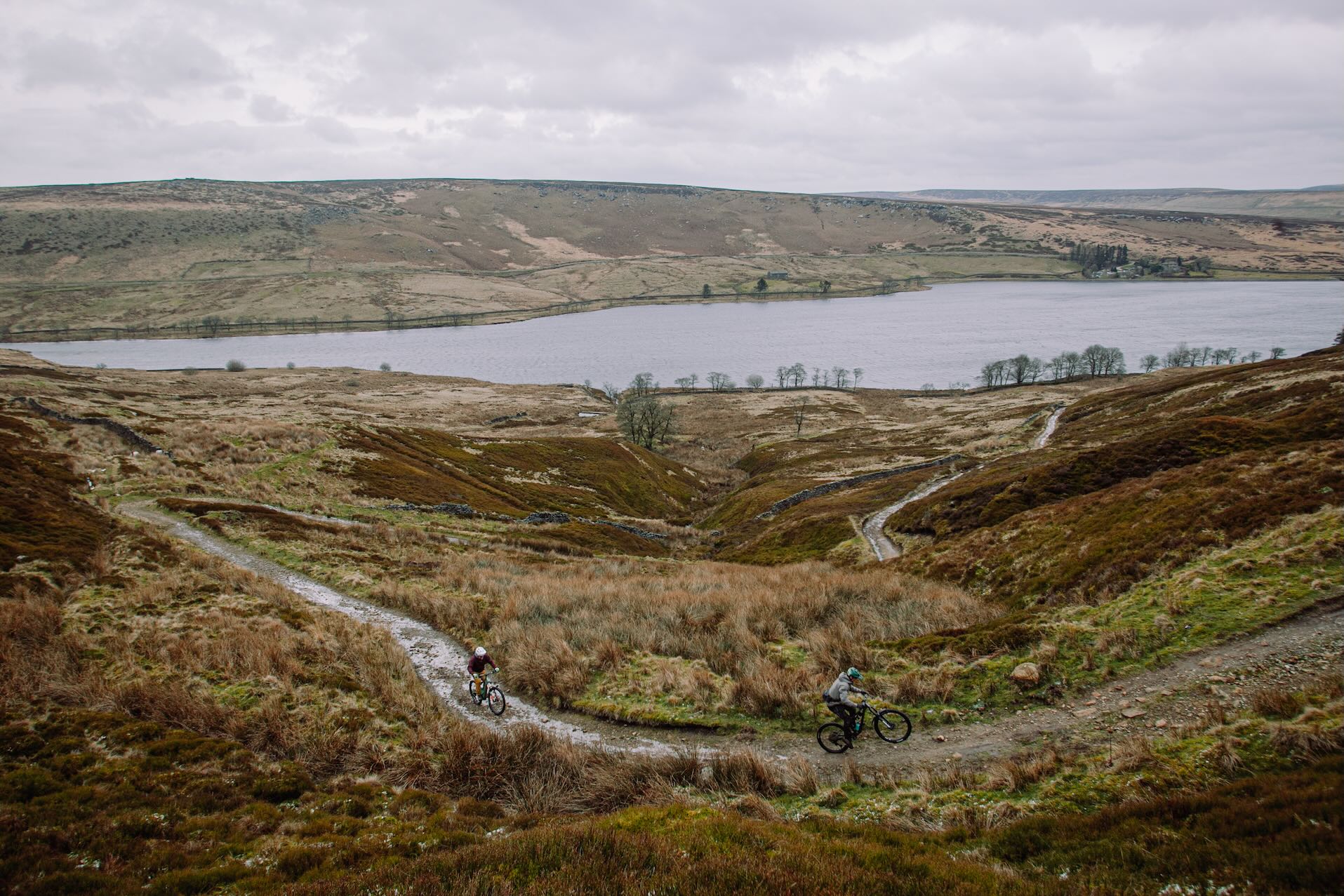
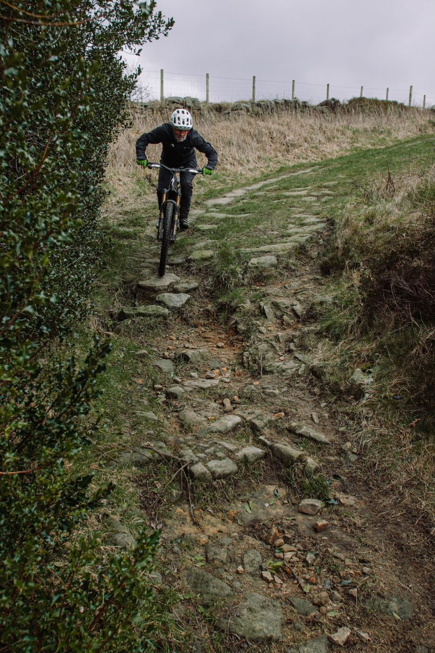
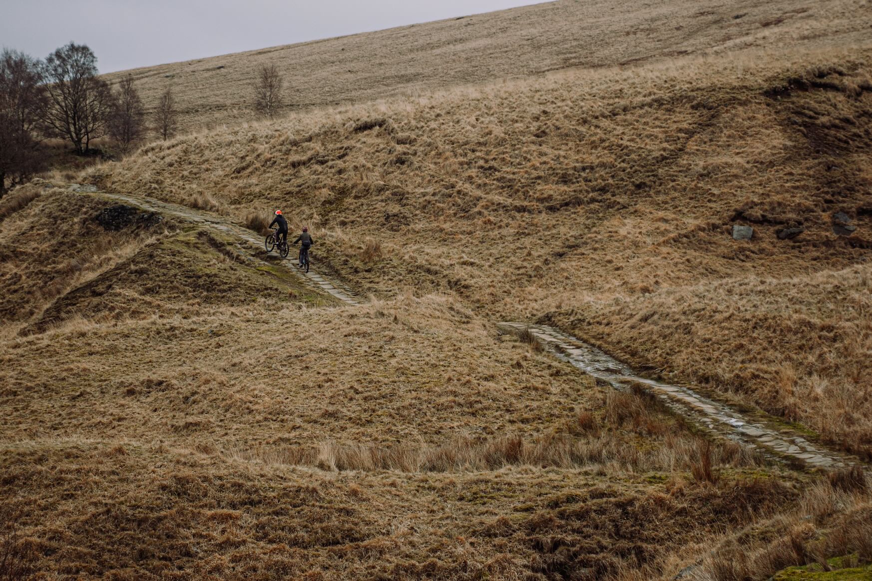
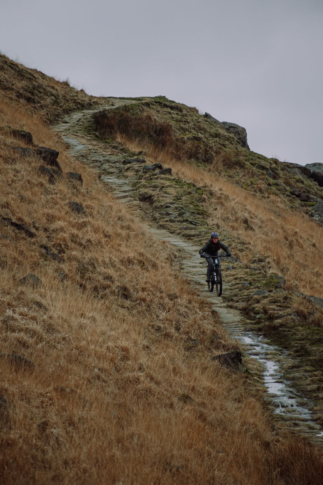
In a word: gullwing. In two words: gritty and gullwing. By ‘gullwing’ I refer to the profile of the valleys. The valley sides begin very, very steeply at the base of the valley, then about two-thirds of the way up, they shallow and ultimately plateau. The summits aren’t mega high. There’s nothing over 500m if I remember correctly. But they often start similarly low slung (circa 100m above sea level). And while there are some long slogs that go from 100m-ish to 450m-ish, most Calderdale riders find themselves doing sawtooth reps of 200m ascents.
Feeling the itch to break out of the Forestry Commission’s aggregate mazes.
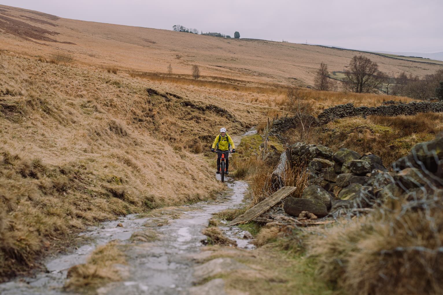
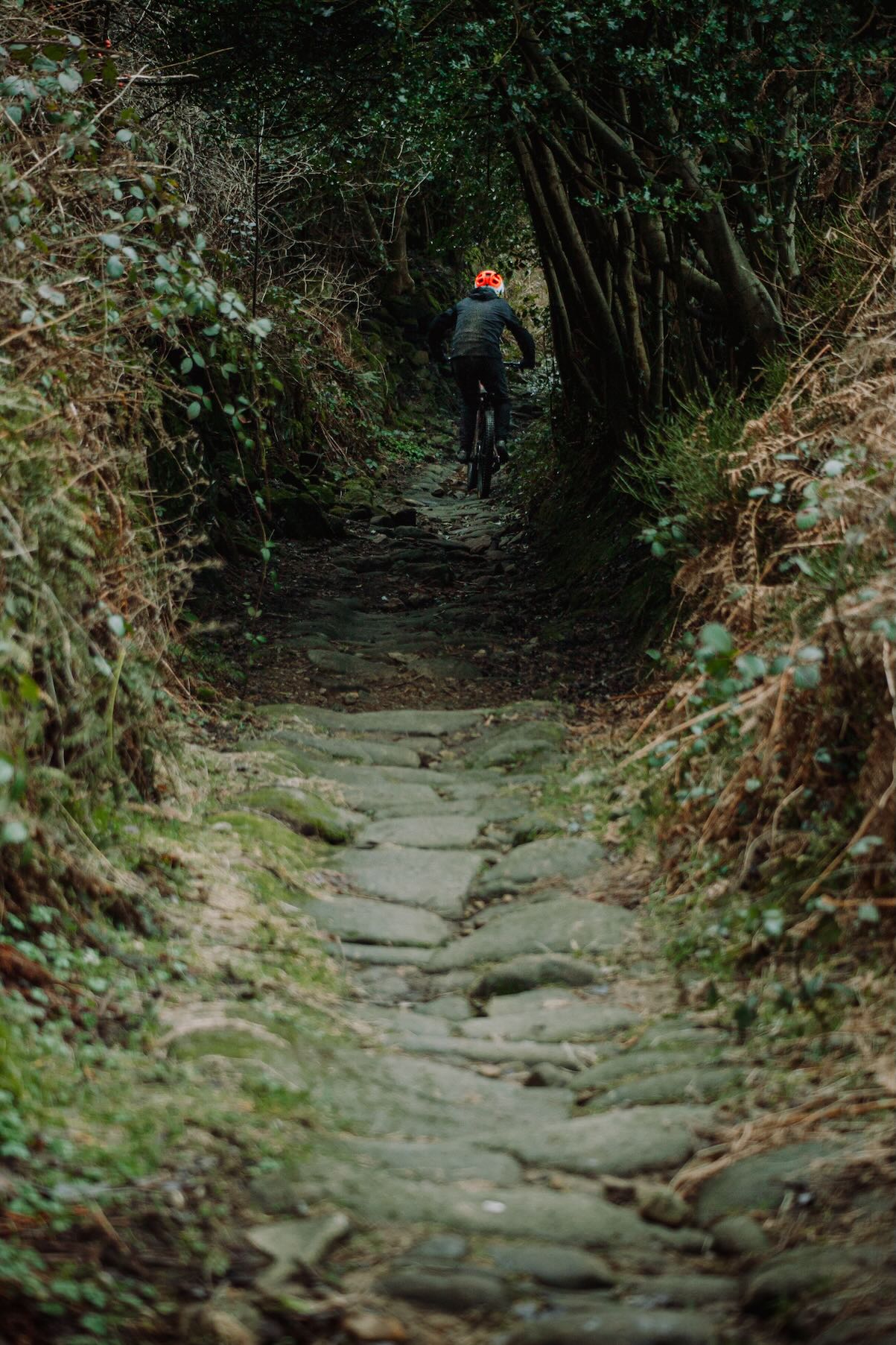
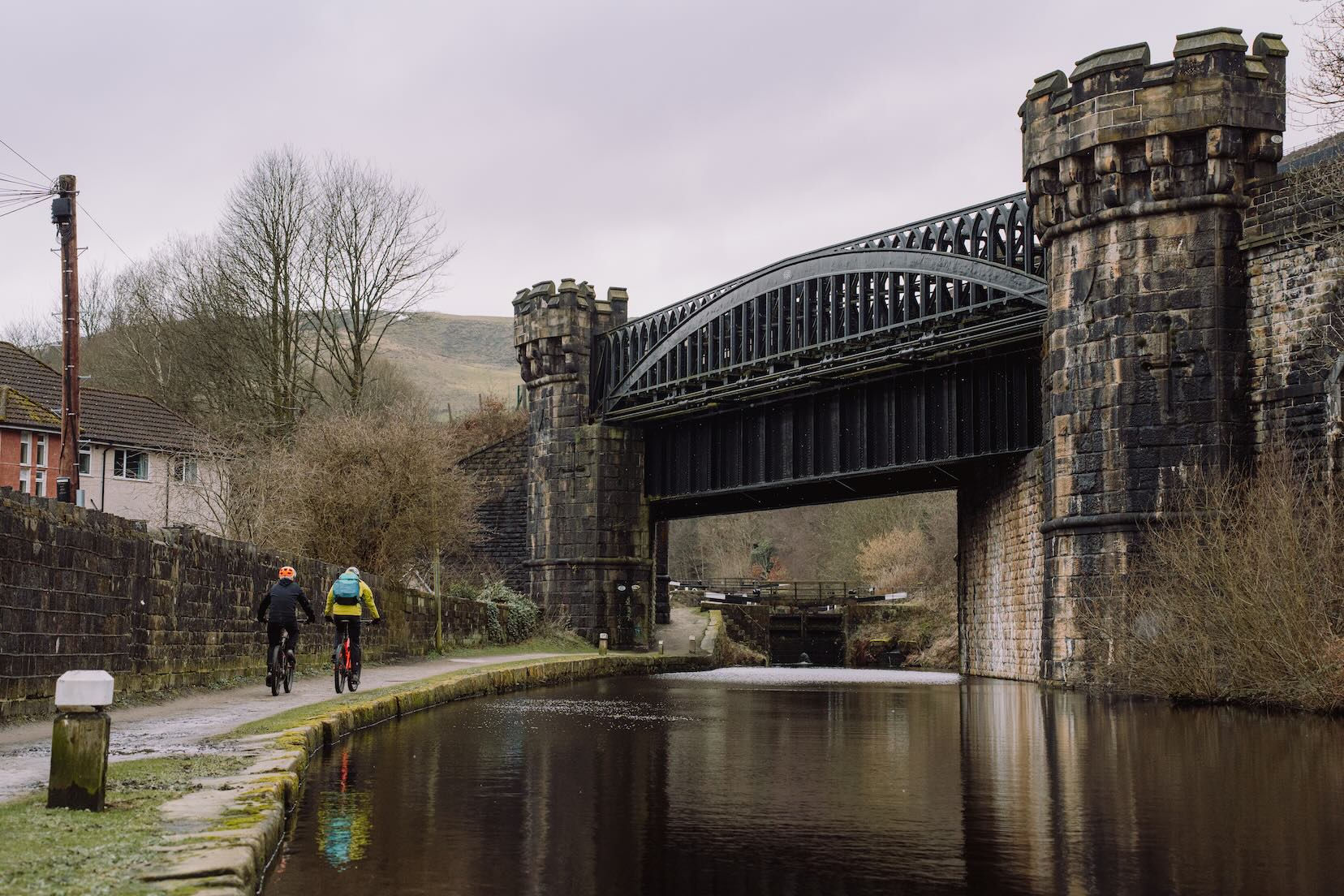
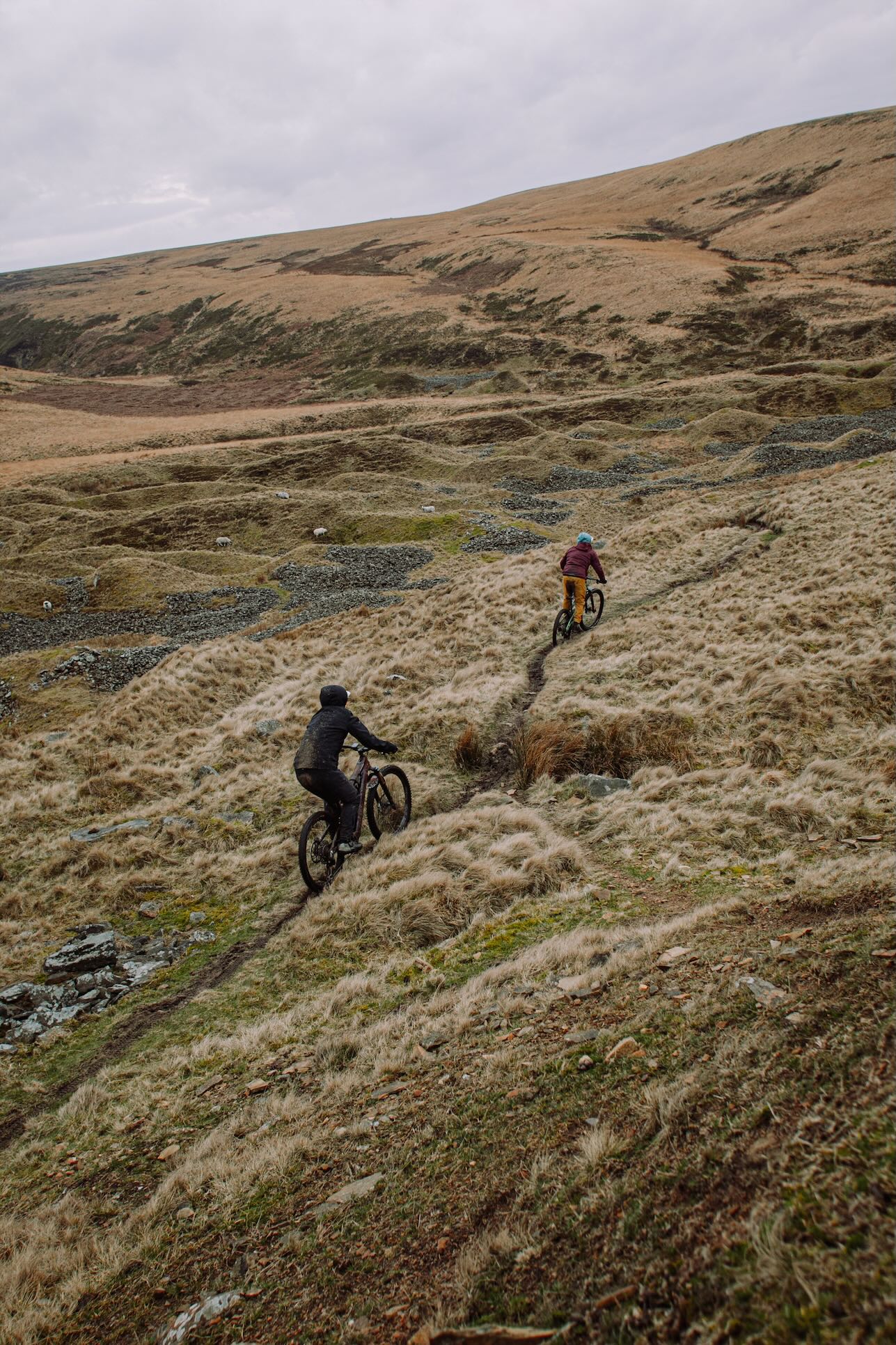
What you won’t find on many bridleways in Calderdale are trees. I’ve done my utmost to concoct the routes in this guide to involve as many trees as is feasible/legal. In the main, any decent length fully-legit route is going to mean moorland. Thankfully, there’s a decent amount of single-bike-width moorland trails in Calderdale, so it isn’t just a case of glorified green laning.
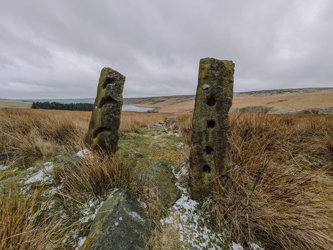
In terms of trail surface, despite Calderdale being in the South Pennines, I think that it does pretty well at not getting bogged down and slutchy. In wetter times it’s more a case of gritty puddles and thin, slice-through black mud than anything overly energy-sapping sticky (like clay) or unrideable, collarbone-breaking slippery (like chalk). Back to the day of the photoshoot/ride when the bulk of the photos in this feature were taken. The Weather Gods did not play ball. As well as the somewhat typically flat, grey brightness of February, there was a flipping f-f-f-freezing strong wind. You can’t see wind in photographs, but I’m still pretty sure you can sense it in the images on these pages. You may also be able to make out a few patches of ice in a few pics. Needless to say, these were not ideal conditions for conjuring up seductive imagery. But at least we’re not going to be accused of false advertising. I can pretty much guarantee, should you opt to follow the routes in this guide, that you will have more favourable conditions than we did.
The Routes
What tyres for Calderdale? I’m going to suggest a classic pair of Maxxis Minion DHR II front and rear. What maps? OS Explorer Leisure OL21 South Pennines.
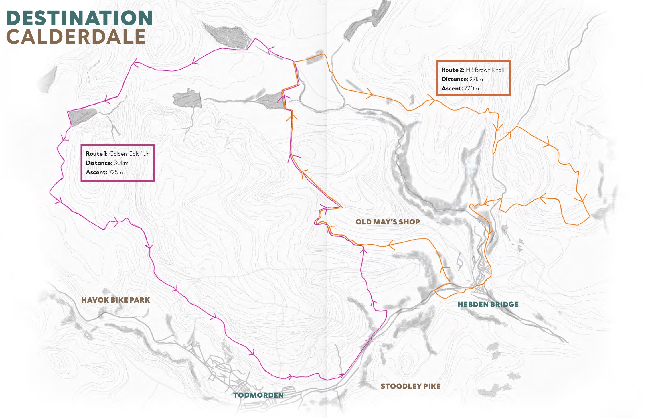
Route 1: Colden Cold ’Un – 30km, 725m ascent
A ride of two halves, Brian. Starting from the Todmorden end of things, the opening half is rather trad. Which is a polite way of saying that there is pretty much zero singletrack encountered. It’s all views, cruises and social side-by-side climbing. The return half, basically from Widdop Reservoir back to Todmorden, is where the more interesting trail riding is found. There’s some multiline gritstone moortrack, permissive bridleway sheeptrack plunging, plenty of rollercoaster packhorse pummelling, and all topped (bottomed?) off with some highly entertaining zigzag flinging down Rodwell End.
Route 2: Hi! Brown Knoll – 27km, 720m ascent
This route is best avoided after soggy weather. Basically, the best sections of it don’t have a great deal of gradient, so if things are a bit squidgy, the route loses its USP. Its USP being zippy slot-car moorland singletrack. It shares the same opening few miles as Route 1, so the same advice goes here: take your time, have a chat, bide your time waiting for the good stuff on the return leg. Either side of the route’s main dish (High Brown Knoll) are the twin delights of a lovely appetiser drop to Lumb Falls and a spicy dessert final descent from Pecket Well.
Route 3: Northern Mary T – 48km, 1,200m ascent
AKA the Best Half of the Mary Towneley Loop (That Misses Out The Southern Land Of A Thousand Annoying Gates). This route is not marked up on the map in this feature. Mainly because it takes up too much space, but also because it’s mostly a waymarked/signposted National route so a highlighted map is kinda redundant. Anyway, as with the other routes here, you’ll be able to download the route online so you can follow it via your phone or Garmin, etc.
Havok Bike Park
Situated just t’other side of Cornholme, west of Todmorden, lies Havok Bike Park. With a current tally of six descending runs of various levels of flow/gnar, plus arguably the most picturesque jump line in England (well, if the weather plays ball), there’s more to go at in this pocket playpark than you might think. You can pay on the day. You can push-up or uplift, or a combo of each. Open weekends 10am until 5pm. Check their socials @havokbikepark for up-to-date trail conditions and Special Stuff. Visit the official website at havokmtb.co.uk.
Top 5 Descents (with grid refs)
- Pecket Well – SD996293
- Rodwell End – SD958249
- Gauxholme – SD925234
- Rams Clough Permissive – SD909321
- Stake Lane – SE017245
Top 5 Disgusting Climbs
- Orchan Rocks – SD923256
- Old Chamber – SD995267
- Gorple Road – SD932326
- The Penny Steps – SD957233
- Great Rock – SD964256
Food and Drink
Heather, Chipps and the Singletrack team give you the low-down on where to eat and drink and get your bike fixed in the town the magazine has always called home.
Todmorden
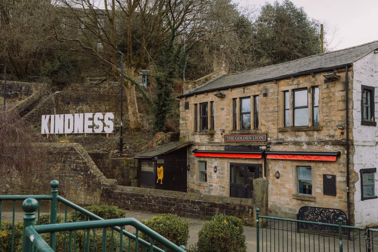
The Golden Lion – A Todmorden institution and a real community pub. There is an excellent range of beers and a delicious Thai kitchen, and at night it becomes a legendary music venue. Cosy real fires in winter, and a beer garden and canal-side tables in summer.
The Shepherd’s Rest Inn – A moor-top pub right on the Pennine Bridleway, within sight of Stoodley Pike. Accustomed to muddy riders, walkers and dogs. Serves a good pint and hearty food, with wood fires in the winter and a beer garden in the summer. A portion of chips has saved many a bonking rider here.
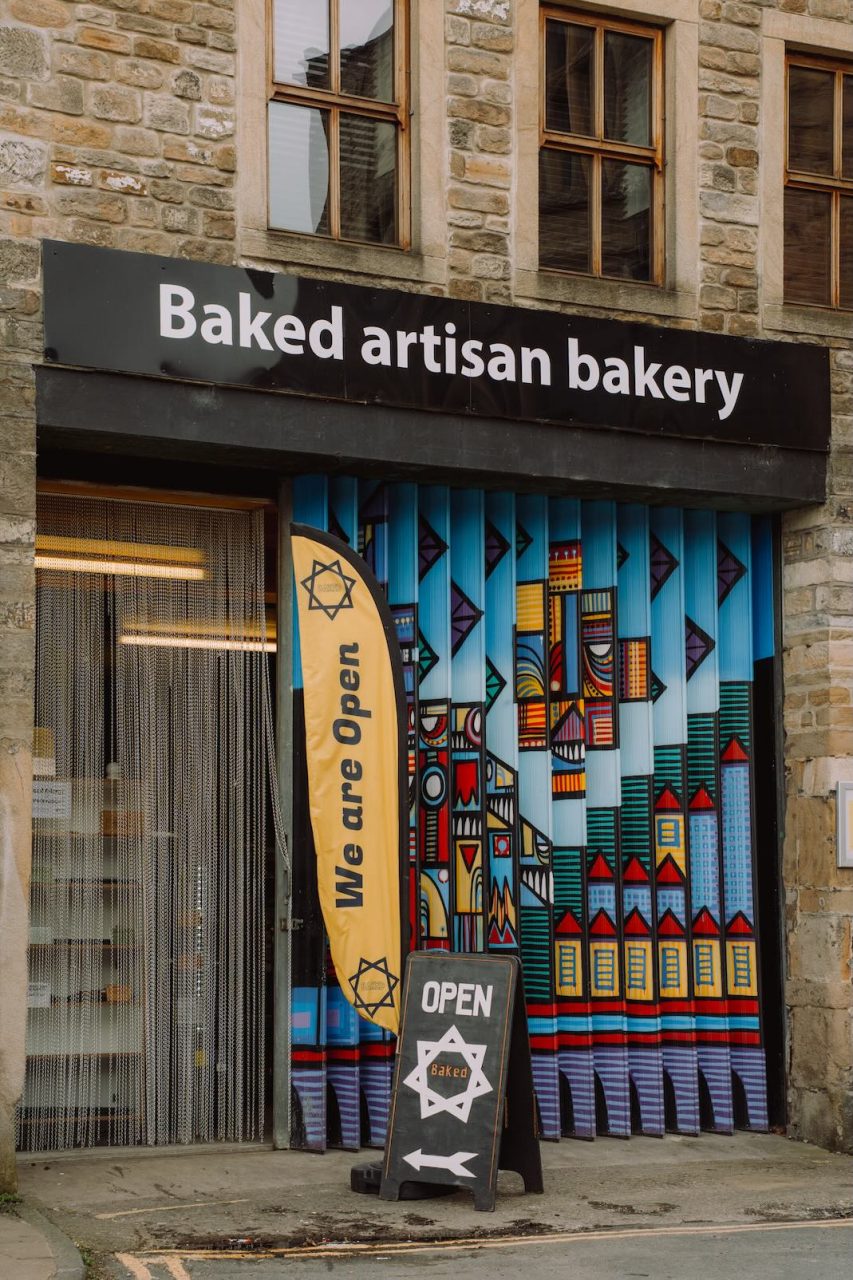
Baked – An artisan bakery in the heart of Todmorden. Great for stocking up before a ride. The Pompeii Badboy is highly recommended when available!
Tod Almighty – A vegetarian health food shop might be an unusual addition to this list, but their hot pasty selection deserves a mention. Stop in for a spicy bean or chickpea curry pasty to warm you on a wintry day. It also has a decent kombucha fridge if you’re after an AF (alcohol-free) choice.
The Beer Necessities – A relatively new addition to the Todmorden bar scene, serving a choice selection of craft beers. No true beer garden, but there are usually benches out on the classically cobbled Water Street.
Cadence Cycle Works – Singletrack’s newest neighbour! After a few years up the valley in Cornholme, it’s now located in the centre of town, offering spares, repairs, accessories and second-hand bikes.
Hebden Bridge

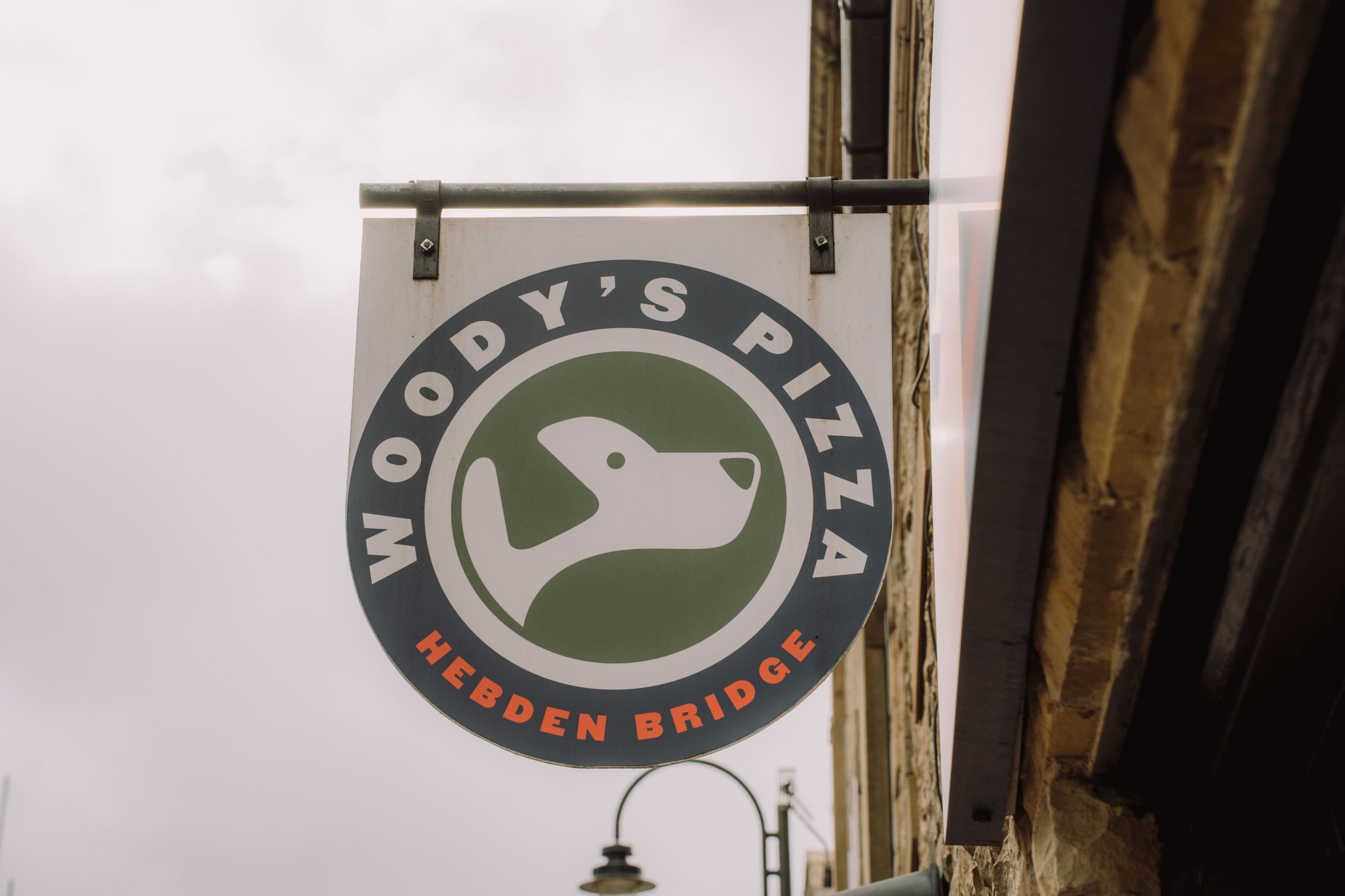
Woody’s Pizza – Branches in both Todmorden and Hebden Bridge. New York-style pizza with freshly made dough and some unexpected topping combinations. Often sells out, so get your orders in early.
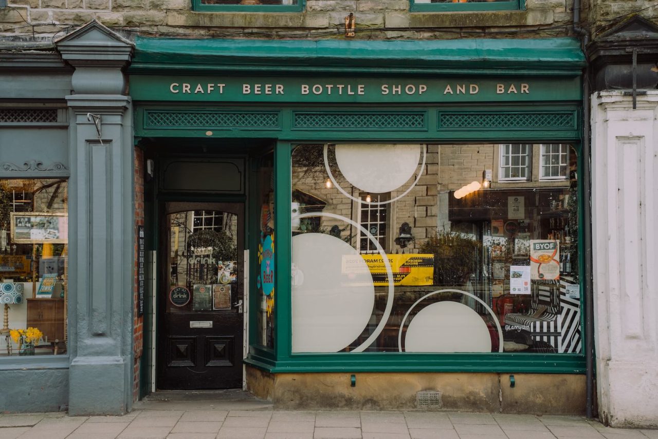
Drink – Probably the best independent bottle shop and bar in the world. It has a well-curated range of beers, ciders, wines, AF, mead and spirits. You’re certain to find something you’ve never tried before. No real space for bikes, but worth stopping in to pick up one for the road.
Vocation – The original taphouse from the Hebden Bridge brewers. You’ll find all of Vocation’s offerings, plus specials from selected suppliers. Well-frequented for a post-ride burger, they’re no strangers to muddy riders.
Mother – Be prepared to queue, but it will be worth it. Serving delightfully flaky pastries as big as your head. Get there early or miss out. Only open on weekends.
Saltas Sandwich Shop & Deli – A recent opening in Hebden Bridge, founded by the team behind COIN. Serving New York-style subs, coffee and soft-serve ice cream.
IOU Hostel – You may resent the climb up to the IOU Hostel at the end of your ride, but at least you know you’ll spend the night in comfort. Yorkshire’s only independent hostel, with both private rooms and dorms. Bike storage and cleaning facilities are also available.
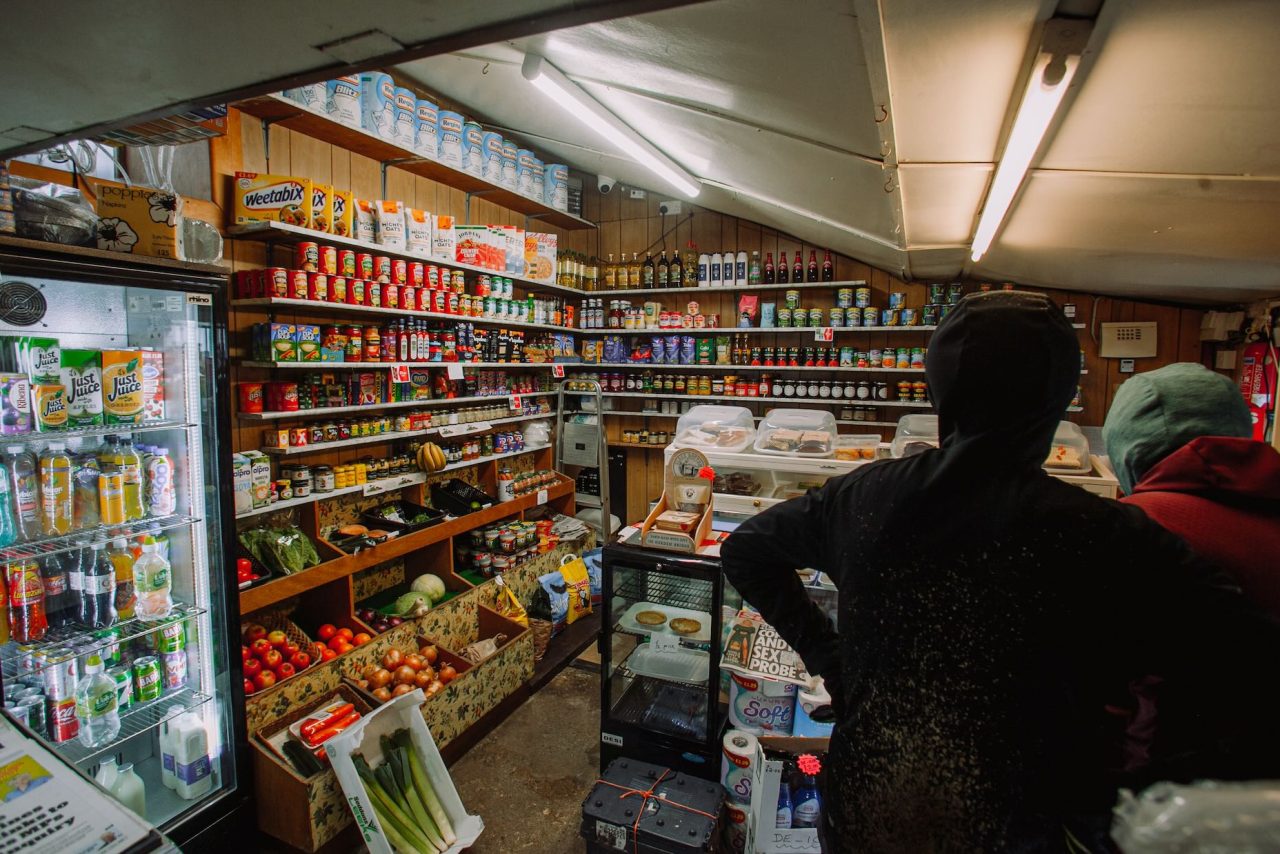
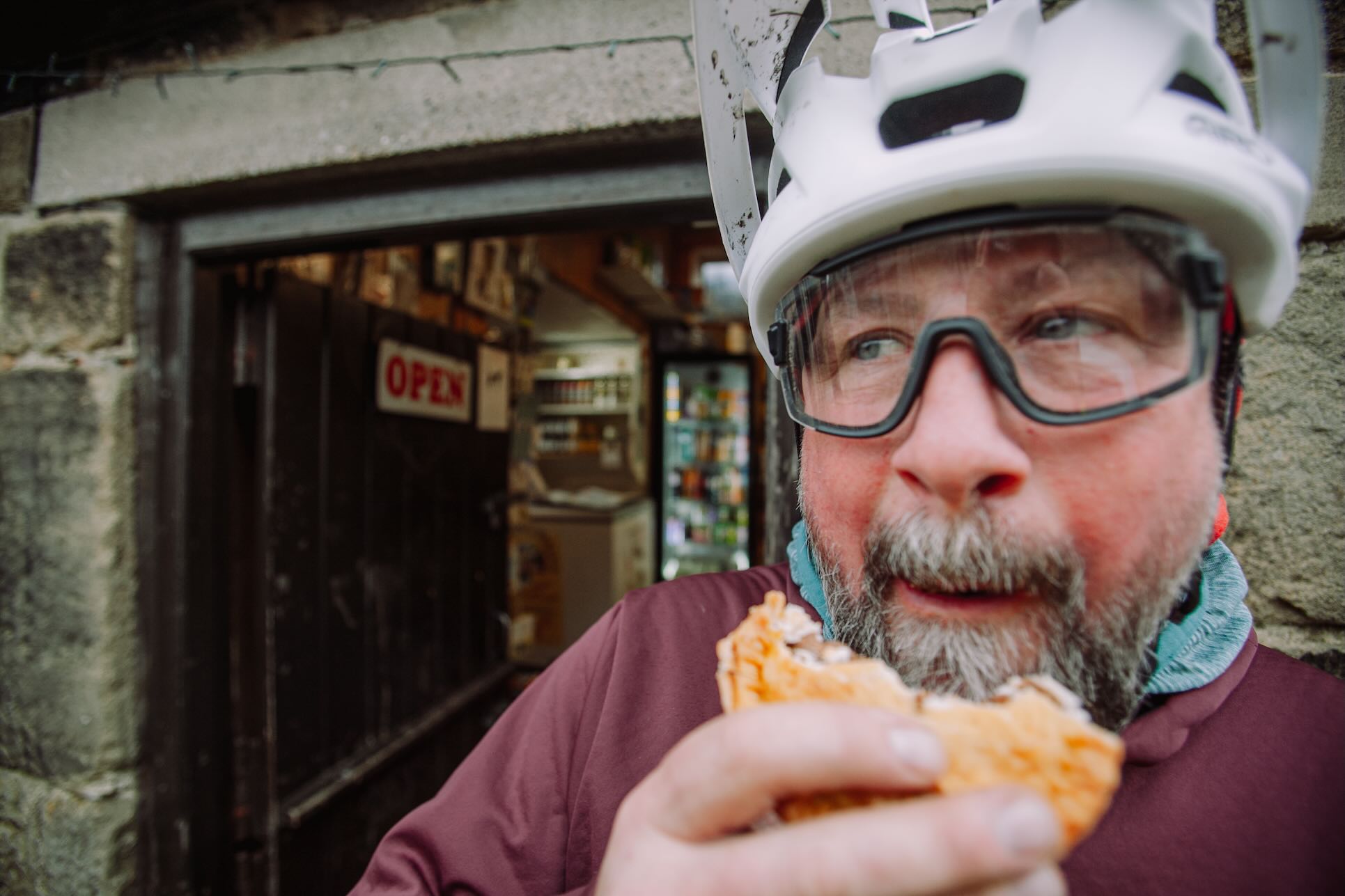
May’s Aladdin’s Cave – Every mountain biker in the valley has at some point been saved by May’s. Located seemingly in the middle of nowhere, it is a well-supplied convenience store that also offers pies, sandwiches and restorative cups of tea, just off the Pennine Bridleway. Often a welcome refuge from wild weather on the hills above Hebden Bridge.
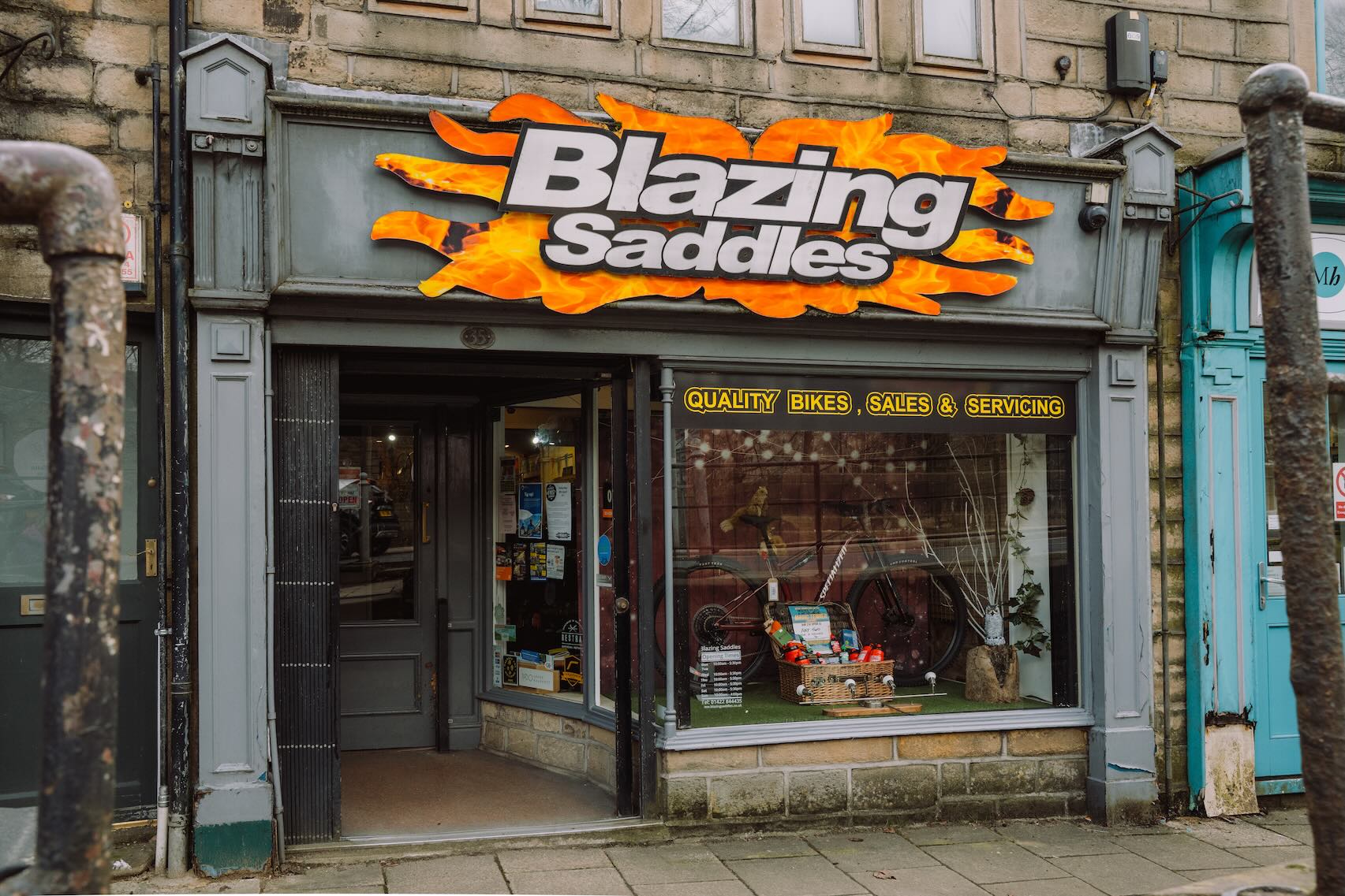
Blazing Saddles Bike Shop – Serving the Calder Valley for over 30 years with its workshop and bike shop. You can pick up any spares you might need, or maybe even find yourself a new bike.
Mytholmroyd
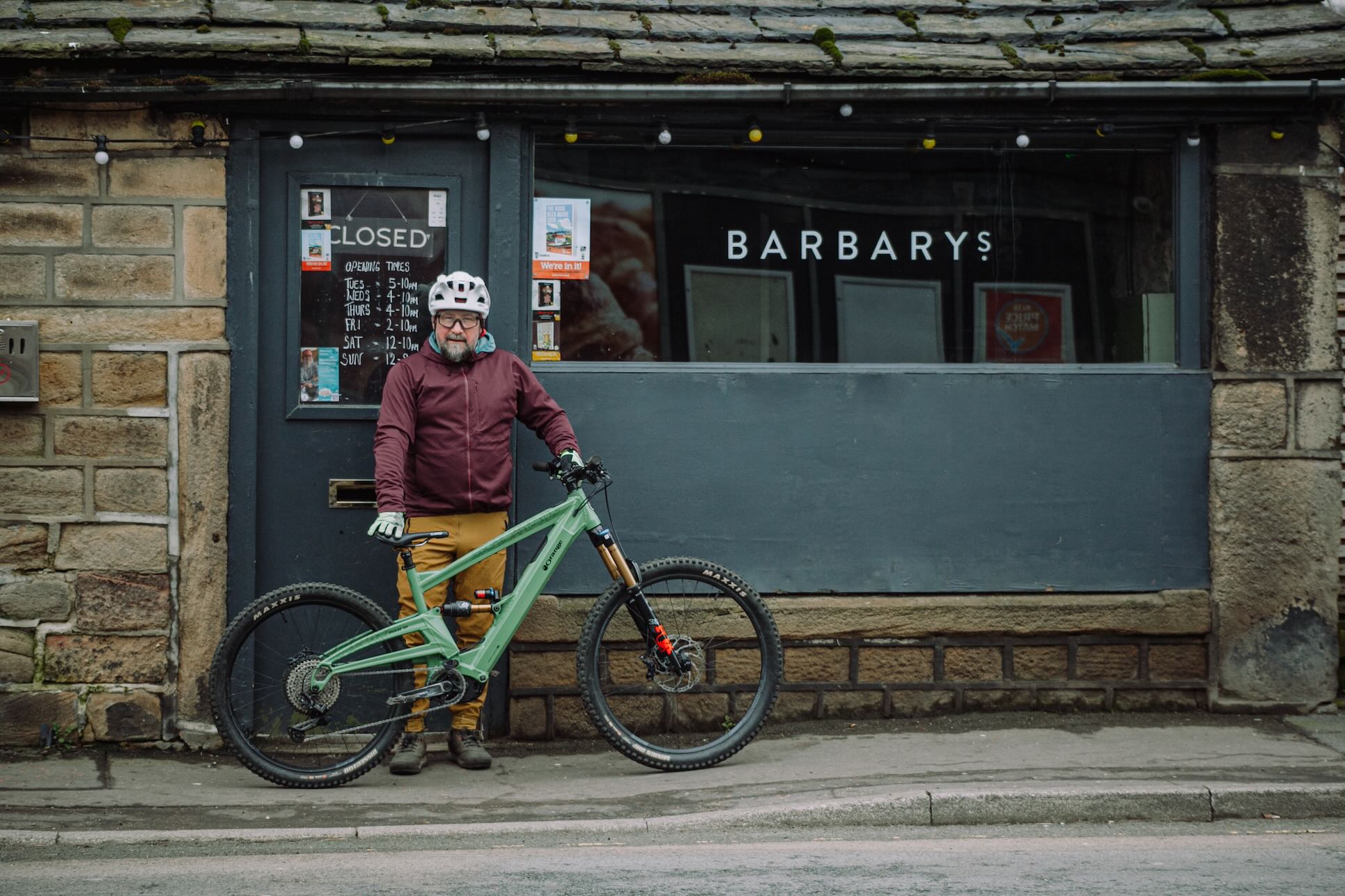
Barbary’s – Singletrack alumnus Matt Letch has just taken ownership of locals’ favourite Barbary’s, so you know you’re in for a warm welcome. The bar has a solid choice of beers, ample space for locking bikes and a covered beer garden by the river. But the real highlight is the locally made pork pies, the promise of which will carry you through any ride.
County Bridge Cafe – A place to get a good bacon butty or a full English. Sometimes that’s all you need.
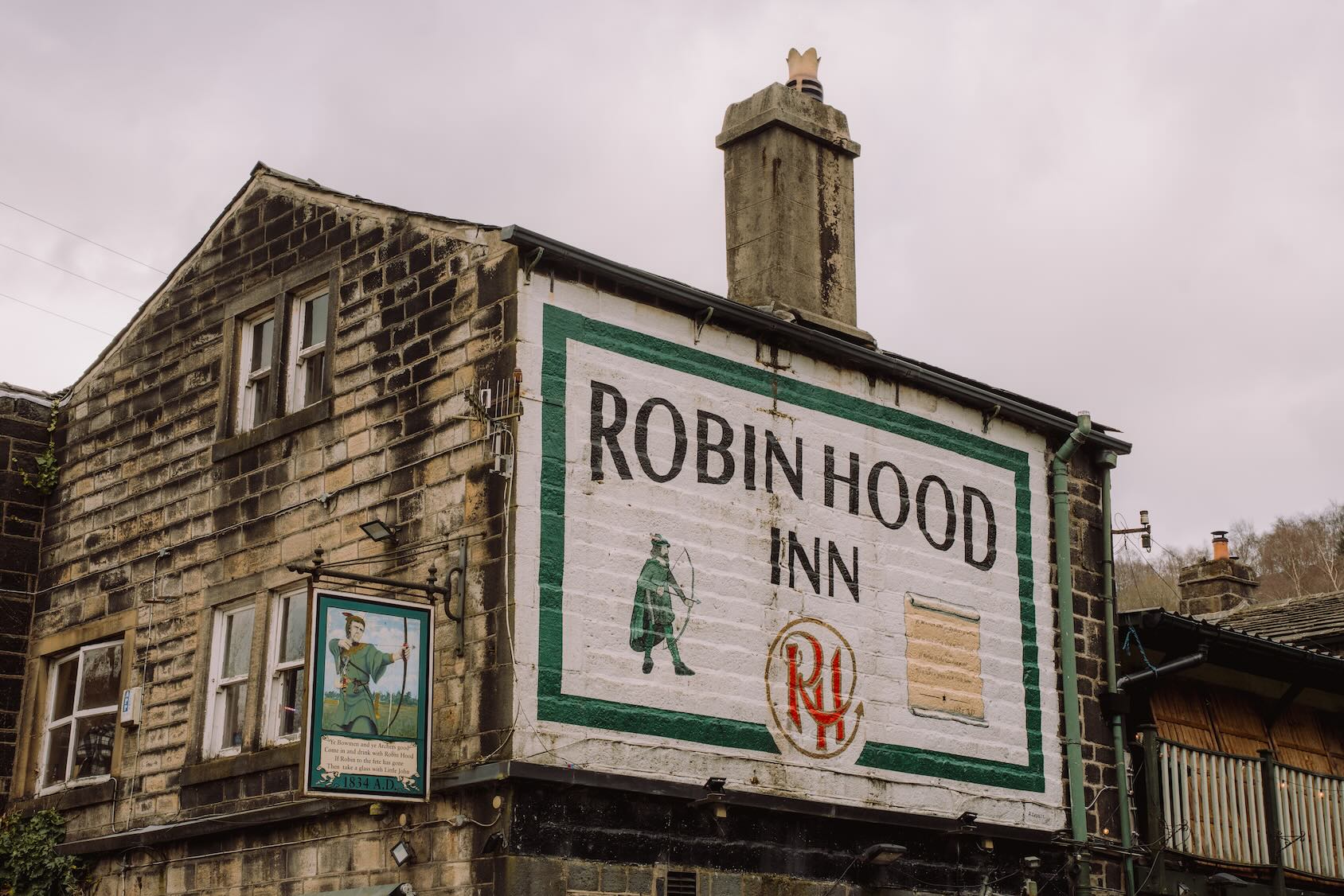
Robin Hood Inn – Yes, you will have to ride halfway back up Cragg Vale to get there, but you’re rewarded with a cosy pub serving home-made food. Hearty portions of all your favourite pub dinners.
Free newsletter
Singletrack
Weekly Word
News, reviews and riding from the Singletrack team — no spam, unsubscribe any time.


I’d divert onto the canal to avoid 2km road riding along the A646 on Route 1. On my Android phone you have to rename the gpx files, deleting the html tag so you can open them in e.g. OS app. Typo in the second climb grid ref.
I actually incorporated some of these routes into yesterday’s local ride, pleasant despite so-so weather.
More of this sort of thing please; I miss the old trail guides, and gpx can be the best way to drop routes over maps instead of trying to copy a description.
Love the new route guide feature, been buying mountain bike magazines for over 30 yrs now, always collected the route and kept them for future adventures. So glad you have bought them back
@montgomery, would you mind posting a GPX of that route, I’m in SB and it looks like some new bits I’ve not used before. Cheers
Ditto candog69 – great to get new route ideas for places so pleased to see this back, although I am still revisiting a couple of favorites from previous years here in the Lakes!