Try this for edge of your seat thrills in a transport industry that has had way more crashes than planes.
https://www.digimap.gg/marine/ais/
Make sure you have satellite map enabled in the layers palette on the upper left.
I normally go straight to Marinetraffic.com but I liked that the vessel names layer was visible automatically.
Interesting that Tor Bay and that area has a high density of cruise ships. I think they are all out of service and it's cheaper to keep driving in circles than pay for a dock, but I don't know why they don't anchor.
The 6 or 7 moored in Weymouth Bay have to pay a healthy fee for the privilege.
Was expecting to see Flightradar 48. Disappointed.
Flightradar48? You couldn’t handle Flightradar48!
I use Flightradar27.5, it makes the contrails come alive!
Most of those huge cruise ships were in the Caribbean before the hurricane season started. Given how active this year's North Atlantic Hurricane activity has been they definitely made the right decision moving them to the Channel
The ones in Weymouth Bay arrived in July so they got over just in time.
Some have moved away from the anchorage though.
Dover Straits at 2 am in a Minehunter as OOW, at least the watch went quickly as my brain melted over the course of four hours.
Some have moved away from the anchorage though
I've been looking into that; cruise ships have a lot of windage and can drag their anchor in the weather we've had recently, so staying on the move as a temporary alternative. Answers my question earlier.
They are pretty darn huge. I got caught out a few times kitesurfing downwind of
them off Nassau. Kite slams down and then turbulent air for quite a while.
This was the Weymouth lot in early July.
https://flic.kr/p/2jNNyNh
They also have very expensive anti-fouling coatings that don’t work if they are stationary too long.
I use Flightradar27.5, it makes the contrails come alive!
Thought that was worth a chapeau.
There's a collection of NATO warships West of Tiree at the moment, presumably for Ex JOINT WARRIOR.
The 6 or 7 moored in Weymouth Bay have to pay a healthy fee for the privilege.
No they don't. That's why they are there.
Really? The council used to charge the Russian trawlers for the privilege of using the anchorage. Times have moved on.
I use Flightradar27.5, it makes the contrails come alive!
Thought that was worth a chapeau.
Agreed!
Interesting that Tor Bay and that area has a high density of cruise ships. I think they are all out of service and it’s cheaper to keep driving in circles than pay for a dock, but I don’t know why they don’t anchor.
They probably are at anchor, but swing around on each turn of the tide.
Even though this is busman's holiday territoty I spent untold hours just looking at how is where and how many of us there are out here.
>>> I'm currently in the middle of this bit >>>
https://www.marinetraffic.com/en/ais/home/centerx:-56.9/centery:8.9/zoom:9
They probably are at anchor, but swing around on each turn of the tide.
No, at that time they were out of the bay and doing loops round the traffic separation zone. Mostly anchored inshore now.
Really? The council used to charge the Russian trawlers for the privilege of using the anchorage. Times have moved on.
The Council???
What has it got to do with them?
https://www.thetraveltrunk.net/cruise-ships-covid19-free-parking-option/
Love the thought of some poor minimum wage parking official having to row out to them ships and slapping a fine on the windscreen. Ladder and all in the row boat.
They probably are at anchor, but swing around on each turn of the tide.
No, at that time they were out of the bay and doing loops round the traffic separation zone. Mostly anchored inshore now.
Two things probably:
Water makers don't like inshore water, so they have headed further offshore to top-up the freshwater tanks
Dumping poop - not a friendly thing to do in an enclosed bay.
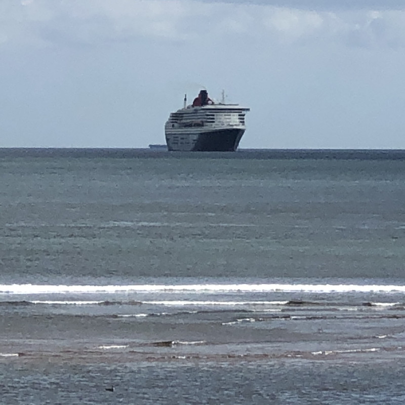
Queen Mary off Teignmouth
Dumping poop – not a friendly thing to do in an enclosed bay.
not friendly, and illegal...
http://www.imo.org/en/OurWork/Environment/PollutionPrevention/Sewage/Pages/Default.aspx
Thanks for the link OP, I just spent my whole lunchtime looking at that. Fascinating data and info about the vessels, will definitely bookmark it!
The Council???
What has it got to do with them?
It appears I may have been talking out of my arse.
Thanks for the link OP, I just spent my whole lunchtime looking at that.
Just doing my bit to destroy UK business productivity.
Anyone know why there are a load of oil tankers at anchor off the coast of Southwold?
Not a lot of oil being used at the moment?
On the east coast by Suffolk and Norfolk there are channels "Roads" of deeper water inshore "Yarmouth Road", "Lowestoft North Roads" etc, great for coastal freight traffic and a decent place to loiter a tanker or ten, waiting for an upturn in the oil market. Edit: OS maps show some of them.
Probably a stupid question, but......if I select a boat to have a look at it in more detail, I then can't de-select it to look at something else.
Any idea how to de-select to look at something else?
The pop up window with the boat info has a little X in the top right corner. Tap on that. (On an iPad. Not Drac’s).