Forum menu
I went out on a run last night, and the first mile took about 14 mins (should have been the easiest mile). I could be wrong, but on the route it certainly looks that mile 1 is longer than mile 2, and mile 2 is shorter than mile 1 or 3 ?!? Is there any way you can truely check?
I've tried laying a piece of string over the route and it certainly appears wrong doing it that way, but its not particularly scientific.
[img] 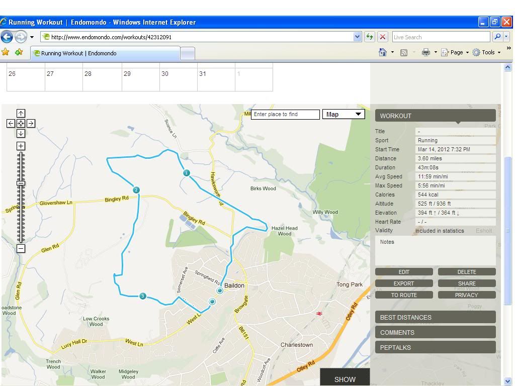 [/img]
bump...
Export the gpx info into a new file, then read that into another online mapping program like biketoaster or better yet, a PC based mapping program like tracklogs. Endomondo is often out by quite a bit, especially with height.
What device were you using to map? Are you Pro? The battery saving option reduces accuracy a great deal IME.
There's a glitch / missing segment in the GPS data - straight line from shortly after Hazel Head Wood until after you crossed Hawksworth Road...
I'm actually BETA testing a new version of Endo, as currently its pretty rubbish on a Nokia Lumia.
Before I emailed them the details (of yet another issue) I thought I better check...
just wondered if it was me going mad..
One thing I've always wondered about GPS tracking: (and I suspect this is an obvious question) does it take height loss/gain into account?
For example, if you go 5 miles straight down a 3 in 4 slope, does it tell you you've gone 5 miles, or 4?
Does it need to be clever to do that, or is all GPS data 3 dimensional? Would say, the GPS speedo on my phone give me the speed based using the 5 miles or 4?
Cheers!