Gents, We are planning a trip around the westcoast in a couple of weeks and I'm trying to get organised and find some routes. Does anyone here know of a good place online to look for them? Already tried the http://cycling.visitscotland.com/mountain_biking/ to no avail. Help much appreciated. Cheers.
Don't really know of any routes but it is well worth the trip round to Baddachro for teh inn and the whole area is absolutely stunning. I managed an hour or 2 when I was up there a couple of years ago but it was mostly following farm tracks round to Redpoint beach.
Did this a couple of weeks ago. I can send you some GPXs for putting into google maps etc. Go to harris, there is some epic riding there...
Drop me a mail at ewan at ewanpanter dot co dot uk
Thanks mailed you.
Anybody else got some routes or know where I can find them?
As always, I recommend the Kenny Wilson book - but it's currently out of stock. Have a look here too: http://www.offroadadventures-online.com/
That's the very one. One caution; you need to be a decent map reader, Kenny doesn't spoon-feed you 🙂
Ahh, my homeland.. I'm up to Opinan (just south of Gairloch) on the 25th June if you're around by then - going to do a couple of stalkers tracks, including route 41 (?) in the Kenny Wilson book.
Have found quite a few routes just by dashed black lines on the map - one previous thread:
http://www.singletrackworld.com/forum/topic/can-you-help-routes-in-the-highlands
I'll see if I can find grid ref's for starting points & post later. Be prepared for flying vampires though.
Thanks druidh, I've ordered one of those this morning and hopefully my map reading skills shouldn't be to challenged with my new active 10.
Rob, we are heading there the 29th, 2/3 nights in Gairloch, a night in the Applecross Inn, 3 nights on Skye. I live in Aberdeen so its not a too far a travel. Ahh, the old midges, 100% DEET and a head net, the only things!
fwb - if you opt for KWs Loch na h-Oidhche route do [b]not[/b] attempt the optional return detour to see the "waterfall".
I [i]would[/i] however recommend the path from Poolewe to Carnmore bothy. I walked this a couple of years back and it's high on my MTB "to do" list.
Hi Colin,
Why not the waterfall bit, somewhat rough is it? I've walked the track a few times (including to the top of Baosbheinn on xmas day '95!) but 1st try on the Pitch next Friday..
Tried the Tollie - Loch Maree track last November (part of KW route 43) uphill from the Loch after 2 weeks rain - Total Nightmare on the hardtail.
fwb - a decent one, if it's been dry, is the track inland starting at Sheildaig, a mile over the bridge just south of Gairloch. Park opposite the hotel then take the right a little way back up the hill. Takes a little bit to get going but once you clear the lower parts there's fun to be had. Think the OS ref is approx NG 180883, 872050.
Rob - the waterfall bit actually crosses a massive section of bog, then you need to ford a river, and then you have to negotiate a loose, tree-lined gorge while pushing/carrying the bike. I'm all for a bit of off-road adventure, but I actually felt really guilty about the damage I was causing to the soft ground. Kenny did the test run in winter when the ground was solid and before the bridge had been washed away. He has now published a correction on his web site - along with a few others.
http://www.mountainbikescotland.com/guidebookupdates.html
To save you the trouble, here's a photo of the falls 🙂
[url= http://farm4.static.flickr.com/3413/3638951283_3b6b21172c_b.jp g" target="_blank">
I should say that the rest of the route is great though. Just make sure to take it all the way to the bothy at the end of the loch
[url= http://farm4.static.flickr.com/3318/3638952351_1fd880baa0_b.jp g" target="_blank">
Cheers for the heads-up - my folks say it's been tropical up there for a couple of weeks so hoping for a bit of dry ground (unlike an early dash into the Pentlands tomorrow...)
Thanks for the heads up guys, not sure if I'll be able to convince the misses that 'it'll be alright' but we'll see. Just hope that Tredz get me a copy of the book ontime to head off. Are there any bike shops around Gairloch and Skye where you can get suggested routes and maps etc?
I'm looking forward to the harris trek, looks awesome.
TBH - given the information on this thread and an OS map, you already have some great routes. The one I've highlighted starts at NG856720, and there's just one main track all the way to the bothy at Poca Buidhe.
Ok, well thanks very much for your suggestions and routes gents. I look forward to having a few epic rides out ther next weekend.
Rob, If you see a 6' 5" skinhead on a black XL 575 thats me, say hello, I don't bite!!
walked many of the routes round Gairloch/Poolewe nearly 30 years ago - going back in July this time with the bike to do them again.
You could try this link http://www.sportwide.co.uk/cycling/gairloch.htm#ride1
also Baosbheinn is a corbett so you can get a map and gpx at this link:
http://www.walkhighlands.co.uk/torridon/baosbheinn.shtml
Thanks Coylumbridge, those look ideal, they give a good idea of the route, climbs etc.. Presume most of them will be rideable if walkable. Thanks again.
Did the na-h'oidhche route today + a little of the #42. Jesus it's rough, looks like some temporary road was put in a couple of years back + has eroded away. Scree on top of 2 inches sandy gravel on most climbs + fist sized round rocks everywhere punching your wheels left n right. Glad I didn't take the hardtail. Couple of high gates too. Just glad the place was pretty much bone dry, slick rocks would've added a good hour to the ride I reckon. Couple of photos to follow...
MM, sounds fun. Heading there (Applecross then Skye) tomorrow morning. Got loads of routes planned from the walkinghighlands www. Can't wait.
Colin - a recent photo of the same spot, slightly better weather though..

Interested to hear if fwb2006 did it - am I under-rating it's pounding power?
Rob - nice photo! Looks like a new roof on there too.
I guess the track [i]is[/i] pretty rough once you reach the boathouse, but I thought it was just such a great laugh trying to find a decent way past the roughest bits. I struggled to lift my bike over one of the high gates on the way back as my arms were so tired, and worked out it was easier just to lift the gate off its hinges 🙂
A great spot though, with the "back door" view of the Torridon mountains.
Hmmm, thought the boathouse-on section was some light relief after the preceeding few miles! That water splash was seriously welcome in the heat though. A couple more pics here -
http://www.singletrackworld.com/forum/topic/your-best-start-off-pic-ever
(forgive my inability to save under a cool name..)
Looking forward to a nice smooth go up the Pents this weekend!
p.s. nice thinking with lifting the gate off - must try applying that kind of logic one day
Had a great time around ther eguys, ended up only staying on the mainland for 2 days then went to Skye. The routes/www off coylumbridge were fantastic and really lucked out with the weather. It was/had been so hot even the midges were nowhere to be seen. Did the Quraing and the Sligachan routes but my favourite was the Macleods Maidens courtesy of Coylum, the route was this (with about 4.5 k of mega sweet singletrack)
http://www.walkhighlands.co.uk/skye/macleodsmaidens.shtml
[IMG] 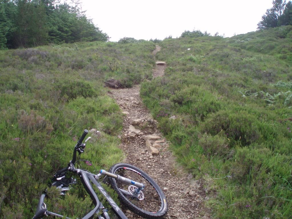 [/IMG]
[IMG] 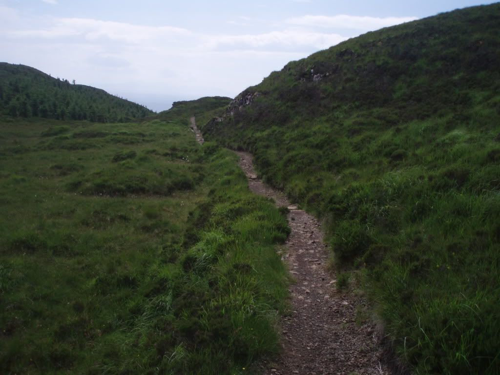 [/IMG]
[IMG] 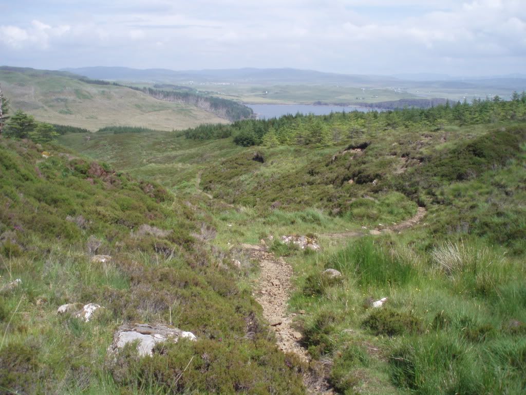 [/IMG]
That does look sweeeet... Think we were in Dunvegan just before you, and Damn, was it hot, but nice & clear too. Sligachan definitely on the cards for later this year.
Yeah go for it, Sligachan was a bit of a handful but awesome. We stayed at the Kinloch campsite in Dunvegan which was really nice. Here's photo from the campsite. To be fair there were loads of routes around there just needed to head off in the car for something more epic.
[IMG] 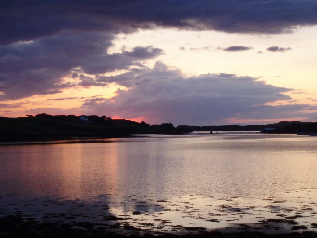 [/IMG]