From a few years back - [url= http://singletrackworld.com/forum/topic/whats-the-longest-downhill-you-can-find-the-lake-districtcumbria/page/2 ]Fizzer clocked this at 3.76 miles[/url]
For the record:I clocked it at 3.76 miles LITTLE Sca Fell summit to gate at Longlands onto road. You have to pedal up from Great Sca Fell onto Little Sca Fell to begin descent so that bit doesn't count.
Height Loss:418m
Time descending: 8 mins (includes photo stop at signpost near bottom) & I am sure aomeone will be along shortly to say they have done it in a quarter of the time blindfolded on a fully rigid unicycle
Grin factor: 100%
Effort to get there: 99.9%
Gav, I have to add I made about half a dozen pedal strokes in total near the bottomto keep speed up but could prob just have got down without
Summit of Little Sca Fell looking down to Longlands
Postscript: I would say that at least 5km of Bowderdale is pedalling Not descending
Looks good fun that run does Chickenman
Descents to Annat and Achnashellach won't be far away...
Anyone mentioned the bridleway from Tees Head (Cross Fell) to Blencarn in the N. Pennines..?
Cheers
Paul
Don't we need some sort of objective measurement? "According to strava", UCI has a benchmark for climb categories - average gradient in % x length of climb. If the answer is > 80,000, thats a HC climb, cat 1 is > 64,000 etc. Minimum gradient to be called a climb is 3%.
https://support.strava.com/hc/en-us/articles/216917057-How-are-Strava-climbs-categorized-For-Rides-
Shouldn't this conversation have a similarly objective measure?
The top of Bheinn a'Bhuird to the Quoich Water is about 4 miles and from memory is all downhill with a lot of singletrack. About 11% average gradient.
[img] 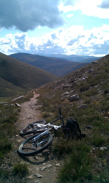 [/img]
Look at most of those mentioned on a map and they aren't *that* long. The Lochnagar descent is 4Km, the Torridon descents are 5Km or so, maybe 6Km for the Coire Lair descent, the Great Scafell descent is just 3Km. Of course these are flat distances but even with a bit of Pythagoras and allowing for small bends in the track you'll only add a couple of hundred metres to those distances. The Tees Head - Blencarn BW mentioned above is about 7Km.
Then of course it's how you define "downhill". Is it a track where you don't have to pedal *any* of it or are some short sections of pedalling permitted. Much as I like both Bowderdale and The Doethie Valley, I'd be hard pushed to call them "downhill", yes the start is higher than the end but they are cross country tracks really.
I thought of Ben Macdui down to Glen Derry but that comes out at about 6Km before you hit the flats of the upper glen. It's likely to be one of the old roads like the Coireyairak Pass which aimed for a steady gradient to allow movement of goods.
The complete brinmore tramroad from Trefil Quarries to Talybont is 10km
The old road past the reservoir through the middle of the blacks is 6.3 km
Yeah neither are particular gems of trails though are they?
What tyres for the longest descent in the UK?
Anyone mentioned the bridleway from Tees Head (Cross Fell) to Blencarn in the N. Pennines..?
I've seen claims that Wildboar Scar is the longest uninterrupted (no gates or stiles) Bridleway descent in England. Or maybe its the highest? Its bloody good though 🙂
https://www.strava.com/segments/5623430
Pretty sure the Doethie valley isn't continuous downhill, nice though it is. Pretty sure there are some v small uphill bits. If you're going to disregard enjoyment, then rail trail descents will probably be the longest.
Great / Little Scafell as above clocked at 3.76 miles and you can get from the top to the bottom without a single crank rotation. Would have to be after a dry spell though.
Top of Y Das down to Mynydd Ddu in the Black Mountains must be around 7km, but hardly a classic DH ride.
Doethie Valley needs plenty of pedalling!
It doesnt count, but there's a trail the drops to Aosta from high above Pila that is around 15km and proper DH for most of the way. Blown to pieces now though.
I would like to suggest Golspie at 7km of unbroken single track in a descent is surely in contention.
If you're going to disregard enjoyment, then rail trail descents will probably be the longest.
Taff Trail descent is almost 9km. Biggest waste of altitude possible on a bike though. You have to pedal to go over walking pace, it's that shallow. Also straight, wide and completely smooth.
😐
I guess you can argue it's a 8km descent, but a good 4km of it actually feels like dh before it levels off.
Calf to Bowerdale.
https://www.strava.com/segments/6915293
Descents to Annat and Achnashellach won't be far away...
I think both have some uphill
Which trail selection is that?shortcut - MemberI would like to suggest Golspie at 7km of unbroken single track in a descent is surely in contention.
I only did the black from the top and it works out at 4.5km:
https://www.strava.com/segments/1261290
The question should be the longest man made trail with a continuous marked trail going down. Otherwise you can throw yourself off any old mountain and 'ride' down.
Glenlivet must be up there as a contender.
