[url= http://www.streetmap.co.uk/idld.srf?x=342050&y=514160&z=120&sv=342050,514160&st=4&ar=y&mapp=idld.srf&searchp=ids.srf&dn=557&ax=342050&ay=514160&lm=0 ]Thinking of using this to connect Boredale Hause and the Knott.[/url]
Walked it many years ago, but cant remember what it was like. Has anyone er, 'got lost' and rode it ?
lowey, thanks for the offer, cant make it sunday...brownie point building.
Yes, I've not done it, but I'm told there's a good dose of vertigo at the top of a cliff near Angle Tarn :o)
[url= http://www.geograph.org.uk/browse.php?p=462953 ]looks like it might be alright[/url]
[img] 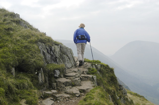 [/img]
[url= http://www.geograph.org.uk/browse.php?p=462052 ]Also from geograph, this looks promising[/url]
[img] 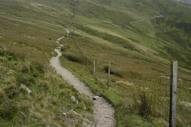 [/img]
Yeah I remember the cliff section from years ago. Its not that bad.
The second pic looks like the clincher James.
I think we may have a "navigational malfunction" when we are in that particular area.
lowey, thanks for the offer, cant make it sunday...brownie point building.
No worries mate.
Simon: I have a vague memory of a ride report going that way - AndyB I think.
Digging a bit further on geogrpah, there is also:
[img] 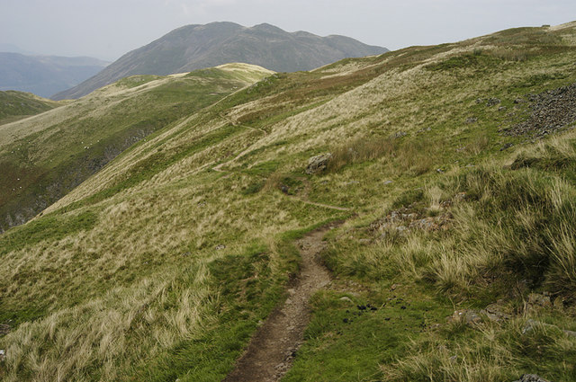 [/img]
[img] 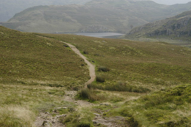 [/img]
cherweeeTTTTT!
that looks great. I'd be careful about being too careful with the navigation if i were you...
Yep I did it this year "when I was lost" ahem,Its best done from the Knott to Angle tarn,Depending on your choice of decent,Just after the Tarn keep on the higher path that heads around towards Place fell,when you get to roughly the number "5" at 567 on your map,Turn right off the track and follow the level path here, theres some exellent singletrack that heads around towards Bedafell and the long muddy/grassy decent to Dale Head.
This is probably a summer option as it gets very soft and wet up there!
the lower path to Boredale Hause is also great singletrack with a couple of interesting rocky outcrops. Enjoy 😉
Anyone know what the BW that runs to Bedafell to Dale head is like?
see my above thread Haddock 🙄
yep ta 😳
[IMG]  [/IMG]
[IMG]  [/IMG]
[IMG]  [/IMG]
Lost again in 2008 🙄
GaVgAs - MemberYep I did it this year "when I was lost" ahem,Its best done from the Knott to Angle tarn,Depending on your choice of decent,Just after the Tarn keep on the higher path that heads around towards Place fell,when you get to roughly the number "5" at 567 on your map,Turn right off the track and follow the level path here, theres some exellent singletrack that heads around towards Bedafell and the long muddy/grassy decent to Dale Head.
This is probably a summer option as it gets very soft and wet up there!
the lower path to Boredale Hause is also great singletrack with a couple of interesting rocky outcrops. Enjoy
That's good, because in a [b]genuine[/b] navigational error a couple of years back, we once overshot the bridleway from Boredale Haus down to Rooking and ended up riding down the footpath. Best trail I've ever ridden, and links in nicely if you take the above trails in the direction Gavgas recommends 😀
Unfortunately, we would be getting lost on it going up. It looks a damn sight better than shouldering up the Knott though. I agree it looks an awesome track to get lost on coming down.
That looks marvellous....I'm sure I will be getting lost there soon too.................I also manged to get lost in the snow on Fairfield Horseshoe last December. There is some wonderful descending to be had there too..... 😆
TON - shame
Can't actually condone using FP to ride on here as you usually get slagged off BUT on a "navigation error day" it was found to be an excellent track - better from the Knott end as it's generally downhill all the way.
We did it semi-legally. During Foot and Mouth only certain parts of the Lakes were open and then only accessing via approved points (where they had a warden, disinfectant etc). It was accepted that bikes were riding in these areas and using the approved accesses. We rode from the top of Garburn, over Yoke, High St, then down that to come out at the road (then back over the road to (freinds)Home (Windermere).
It was brill
C
anyhow, i dont care cos it is gonna be sooooo windy on sunday, and you might get blown off the precipitous cliff............. 😉
