Not quite sure what they're called, but those timber fence constructions that corral and slow bikers down on trails at junctions with forest roads, bridleways etc. I need a picture of one for a proposal I'm doing. It's an obvious point where people stop for a chat and take pics, so I'm banking on someone having a good example.
Alternatively, does anyone know the accepted name/terminology for them
ta
"A coral"
You can always email me y'know 😉
these things??? (not my piccy):
[img] 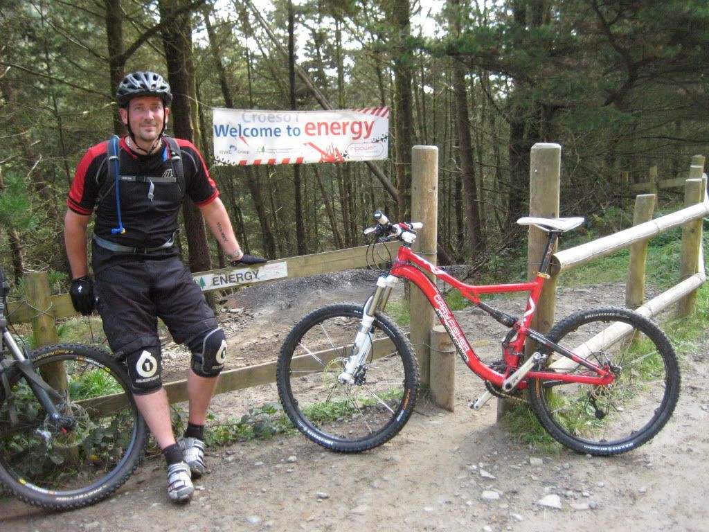 [/img]
We call them pinch gates or pinch stiles.
They're not to slow MTBers down, its to keep MXers out IIRC. Not that it always works.
I know the things you mean, they turn you through a couple of tight corners to feed you onto the forestry track slowly. CAn't find a pic in any of my pics though!
Thanks for looking zippy/bigjim, but not quite what I mean. I've tried googles of combos of corral, pinch, stile, gate etc to no avail. It's what bigjim is talking about.
Cheeky Monkey YGM shortly with the draft, J still has a section to add, but bulk of it is done. Going on your spelling^^^ I won't ask you to copy proof read it for spelling errors 😉
Googling anti-motorcycle gates/barriers throws up several metal ones like this . . .
[img]  [/img]
Canal ride up to Cwmcarn is riddled with the things - bars wider than 26" are a complete no no if you don't wanna dab 👿
Found this pic over on pinkbike.com of one of the gates on the Cwmcarn trail . . .
[img] 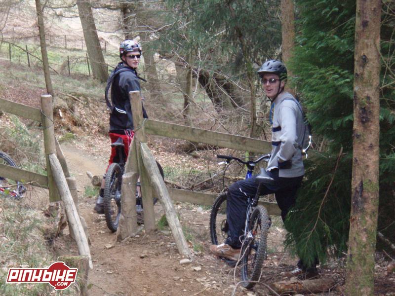 [/img]
[IMG]  [/IMG]
[img] http://upload.wikimedia.org/wikipedia/commons/2/26/Cycle_trail_crossing_road%2C_Haldon_-_geograph.org.uk_-_238832.jp g" target="_blank"> http://upload.wikimedia.org/wikipedia/commons/2/26/Cycle_trail_crossing_road%2C_Haldon_-_geograph.org.uk_-_238832.jp g"/> [/img]
Googlemaps streetview thingy goes up the main climb at glentress and there is one where electric blue hits the forestry road - hopefully the link will show it.
yep Jeremy thats the thing I was thinking of. Good old scary google streetview.
There's loads of these things on my commute. Luckily I ride a cross bike to work and back so taking them at full tilt is mandatory.
Yep, what TJ links to is the sort of construction, three sided fencing with exit gap right or left, so you have to do it slow. I need a jpg or similar pic format tho. Thanks to everyone for their time tho, sorry to be a bit vague in the first place.
screengrab from the streetview?
I'm off to GT on Saturday. I can get you a few shots if you have no luck in the meantime.
Yes Please Flying Fox, you will get a credit on the proposal, it's for a new mtb trail, so you'll be doing your bit 😉
