[IMG] 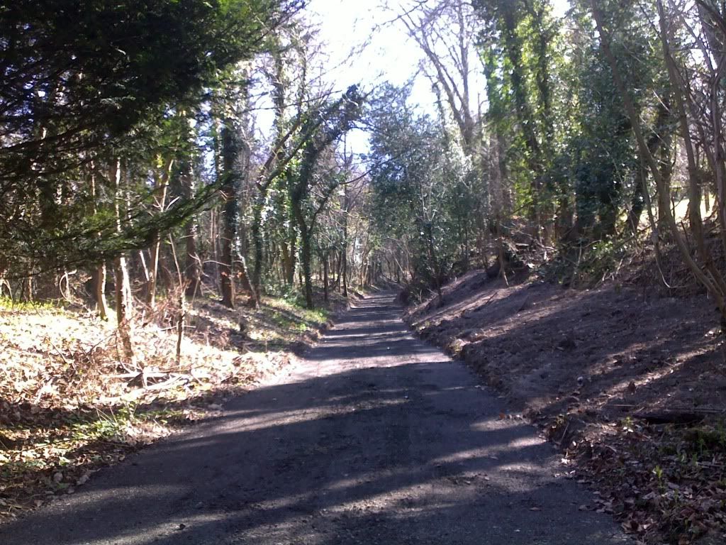 [/IMG]
The one from Hogtrough Lane to Kingsash...
What you can't see from here is that is was about 15ft deep originally.
Yes it was heavily overgrown and a deep gulley, but that's because it doesn't really go anywhere (that a bridleway user would use) and has separate footpaths' either side. Talking to the contractors its seems that Bucks CC spent £15k on it. And all it really needed was a couple of trees that had fallen, removing.
<div id="mapviewer"> http://www.bing.com/maps/embed/?v=2&cp=51.74896173342606~-0.7208658456802341&lvl=15&dir=0&sty=s&eo=0&form=LMLTEW&emid=956027f3-2029-faea-72b6-d7c7ec6994c0 <div id="LME_maplinks" style="line-height:20px;">View Larger MapDriving Directions</div></div>
Trying to picture exactly where this is, I think I know; when you've gone up Hogtrough Lane past the farm and houses on the left there is a fork: the left route takes you up to an already murdered trail to (eventually) the top of a nasty road climb at the end of Hale Lane, the route you've taken a picture of is the right side of that initial fork?
Is it for easier farm access or something? I haven't followed the gulley all the way around before as I usually cut-off at some point to head for the cafe in Wendover Woods.
Yes it is, and no, there is no access to anything.
Almost identical to what happened to a couple around Tring.
Oh goody, well I'm glad they've done that then. I could never work out why they paved the other, left hand route other than to stop people's shoes from getting muddy. It was never the most technical of trails but now it's just a motorway.
I came across that on Sunday, bit of a surprise but I'm in 2 minds as to whether it's a bad thing - that bit was mostly unusable anyway as the gulley was too deep to pedal in and it had several fallen trees. I'm treating it as a more convenient route back up; if you want something interesting coming down that way most people used one of the parallel footpaths anyway.
Is it for easier farm access or something?
Strangest thing about it is that it's only been "improved" about half way up, so no. Probably more to do with horsey access.
I guess the horses don't want to get mud on their hooves.
It's not actually paved - it'll be a mud-fest next time it rains, just like the Tring ones.
Same here Ashridge/gaddesden area.... Horsey folk carry a lot of weight - figuratively and literally...Almost identical to what happened to a couple around Tring.
most likely to do with spending money asap before april and new budget, council funding works on the grounds that if you don't spend it, you don't need it!
What material is it exactly? It looks tarmac-y from the picture.
I think it's a mixture of clay and road scrapings. Not entirely sure though. Yesterday it had some substantial hoof prints in it, so I'm guessing it won't stay looking like that for long.
[i]What material is it exactly? It looks tarmac-y from the picture. [/i]
Hardcore base and then tarmac scrapings; so pretty crap to actually ride on (either up or down). And my wife's 'horsey', and its not something they want either.
Good job the footpath on the left is still there 🙂
What a complete waste of money never mind the fact it spoils it for us and will be knackered after a few horses.
Oh well, we will just have to find a cheeky alternative.