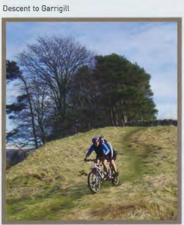
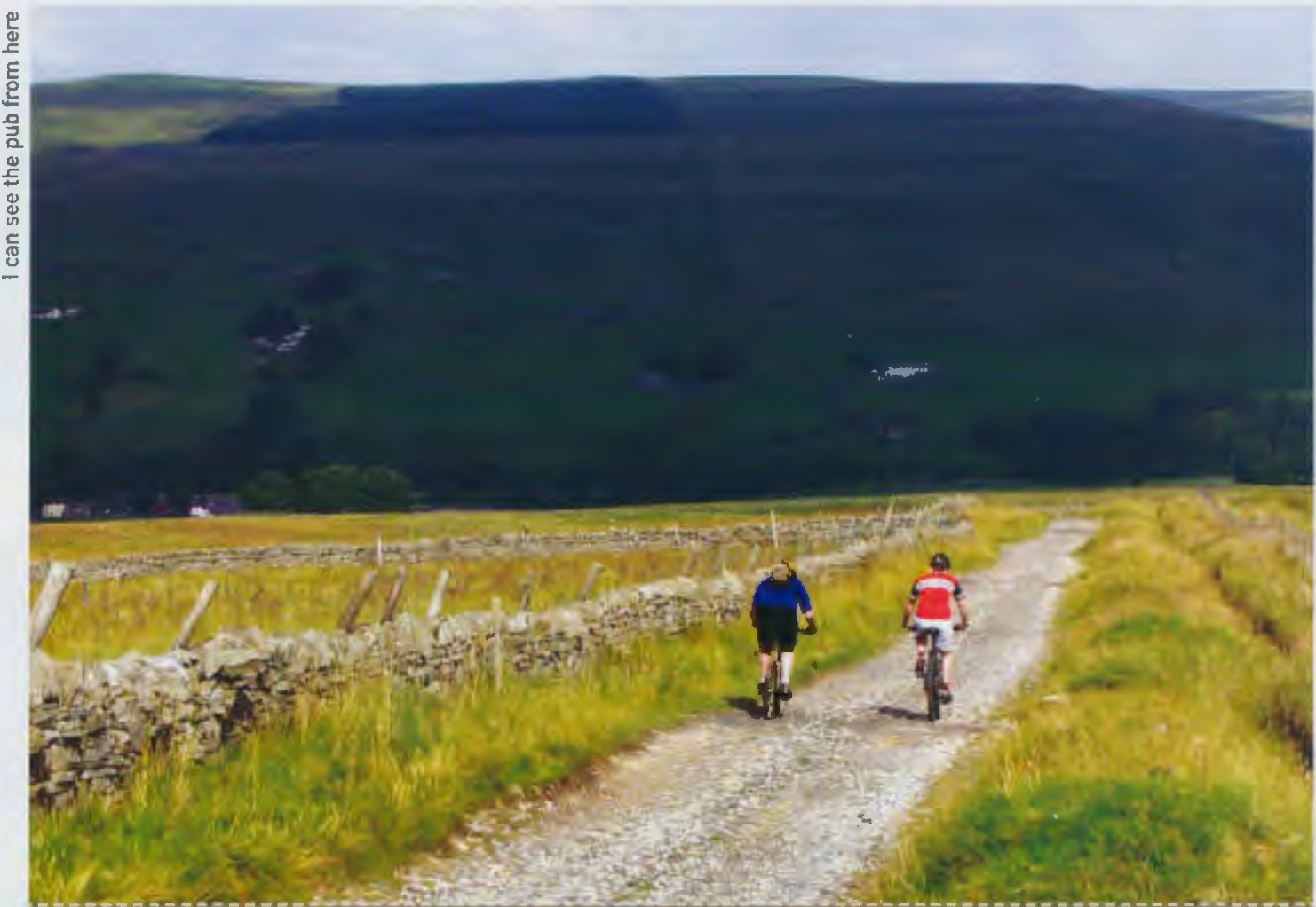
Arguably the most remote route guide we ever published. Garrigill is a tiny village set in one of the last bastions of true English wilderness – the North Pennines.
NB: route updated 09/06/26 to avoid now-closed access track
Northern Exposure
From Issue 17
We didn’t go and ride these all in one go. The riding is just a little too ‘big’ for us to go doing all it in one weekend, although we have no doubt that there are readers out there spluttering words like ‘Lightweights!’ about now.
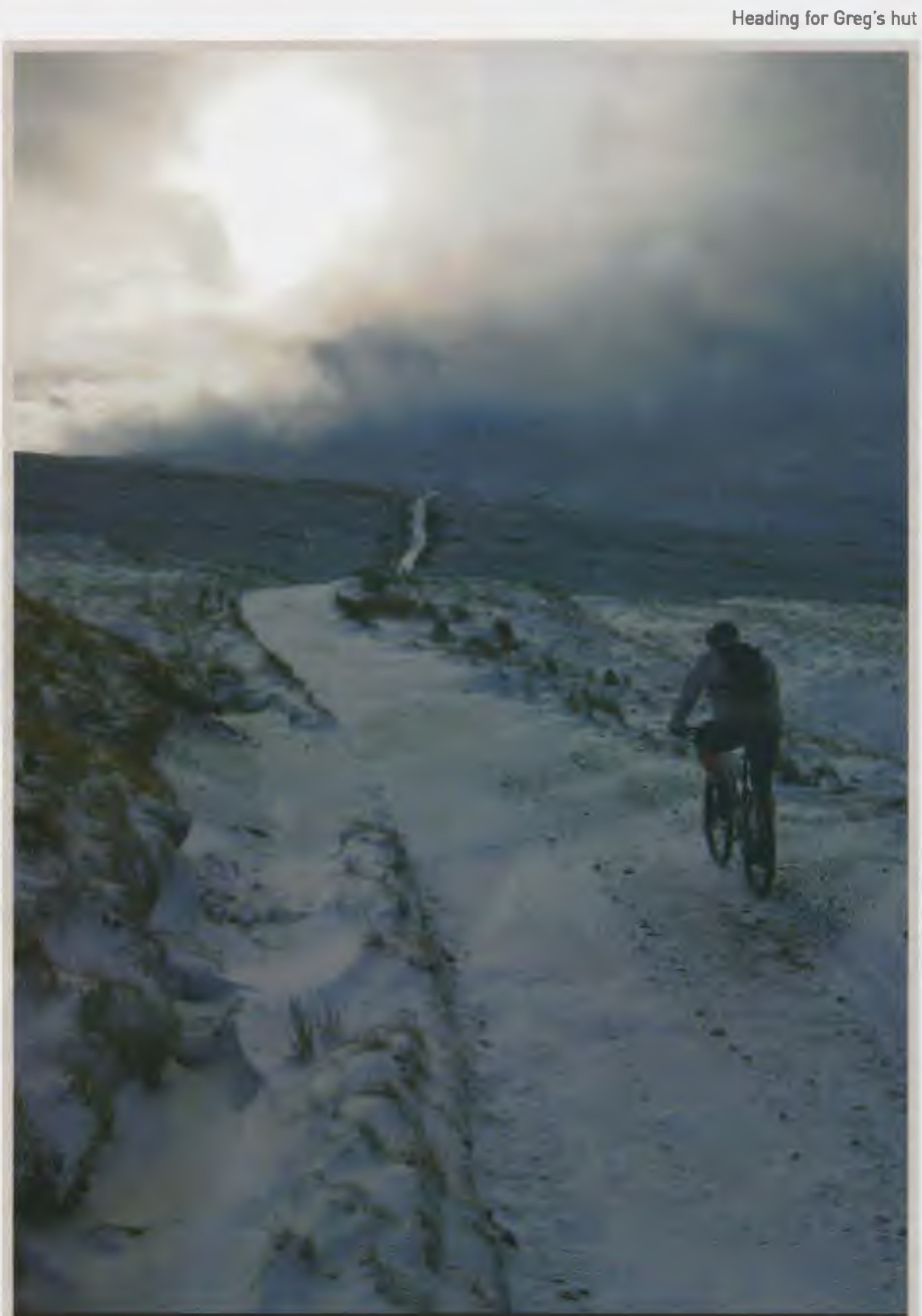
This is truly one of the most remote areas of the English countryside. From the natural resting point at Greg’s Hut [the bothy on the Eastern side of Cross Fell) the views take you 50 or more miles out in almost every direction and yet not a road, village or even a farmhouse is visible anywhere. There’s just rolling countryside. Being natives of this rather compressed and urbanised country it’s rare to experience such a feeling of isolation. Usually on big rides there is always some kind of sign of civilisation somewhere to give you that subconscious feeling of security as you fix that puncture. “It’s alright because if this doesn’t work and the weather turns bad, I’ll just head over to that road/village/farmhouse I can see over there.” It’s surprising just what a rush you can get and also what a chill it can send down your spine when you look around and see no such reassurance.
This is not the place to come riding alone – as you would expect mobiles don’t serve much purpose on these hills. And if you have ever wondered when you should really pack that ‘survival’ mars bar, bivvy bag and first aid kit, then this ride will be that time. Maybe stick in an extra inner tube and probably that puncture repair kit too … oh and best be safe and pack some more dry clothes … That fluffy pack of Lucosade energy tablets won’t take up much room. Is that a SAS survival guide I see on the shelf?
Big route
- 35km
- 1,130m ascent
- 4-5 hours approx
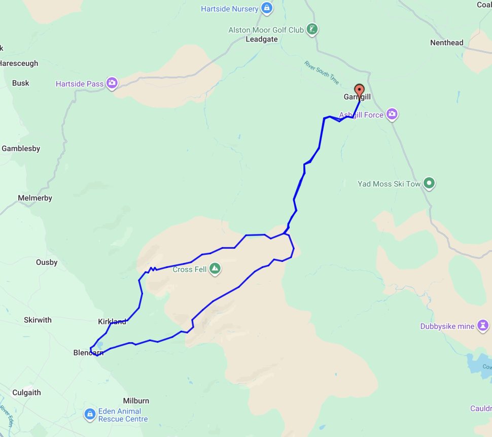
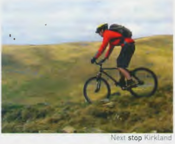
We would easily qualify this as our longest route in any other issue. Do not underestimate the ‘Big’ tag. The descent down to Kirkland off the top of Cross fell, and even the climb back up for the return leg are spectacular. But this route does take you over the serious part of Cross fell.. twice!
Medium Route
- 17km
- 50m ascent
- 2-3 hours approx
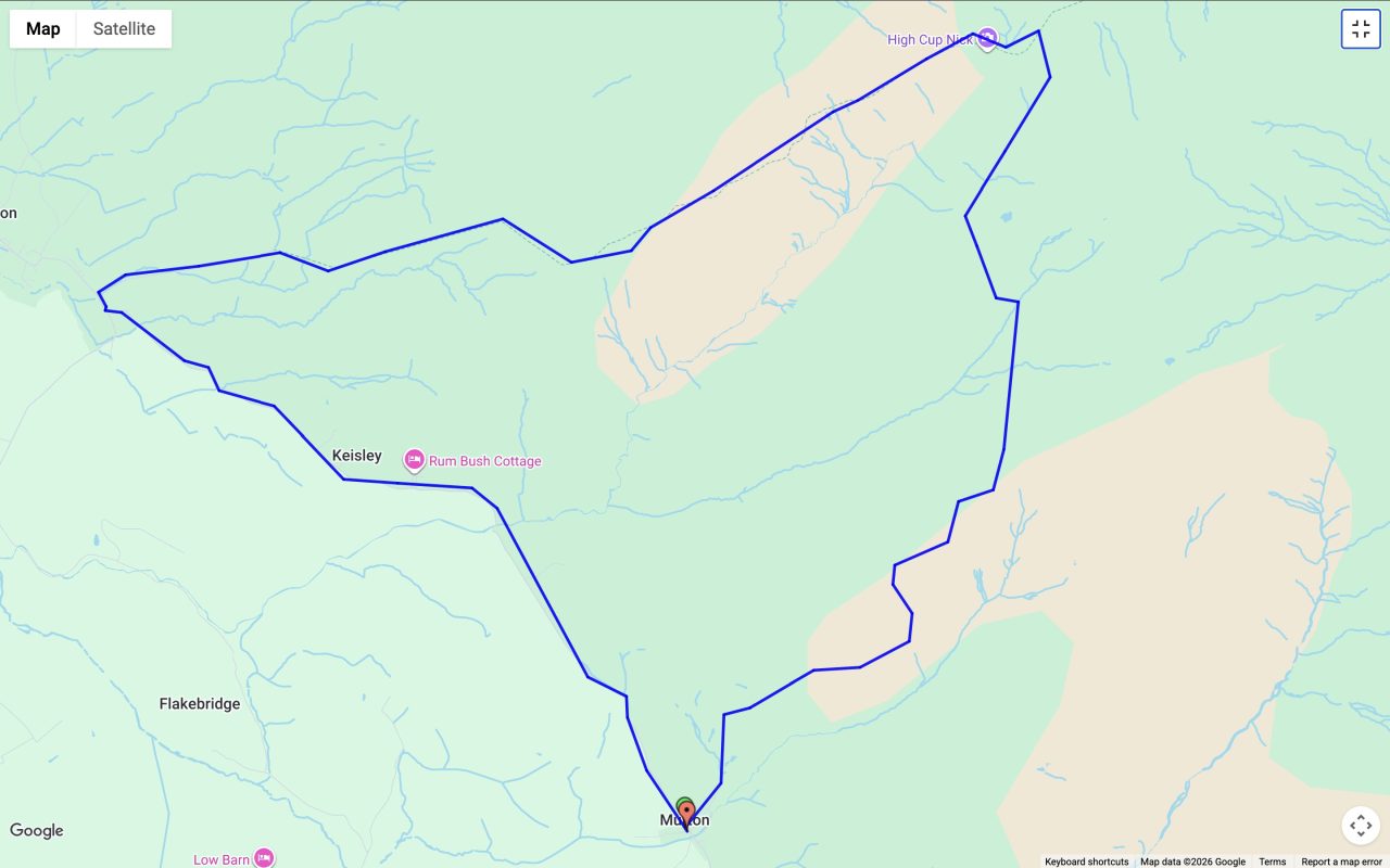
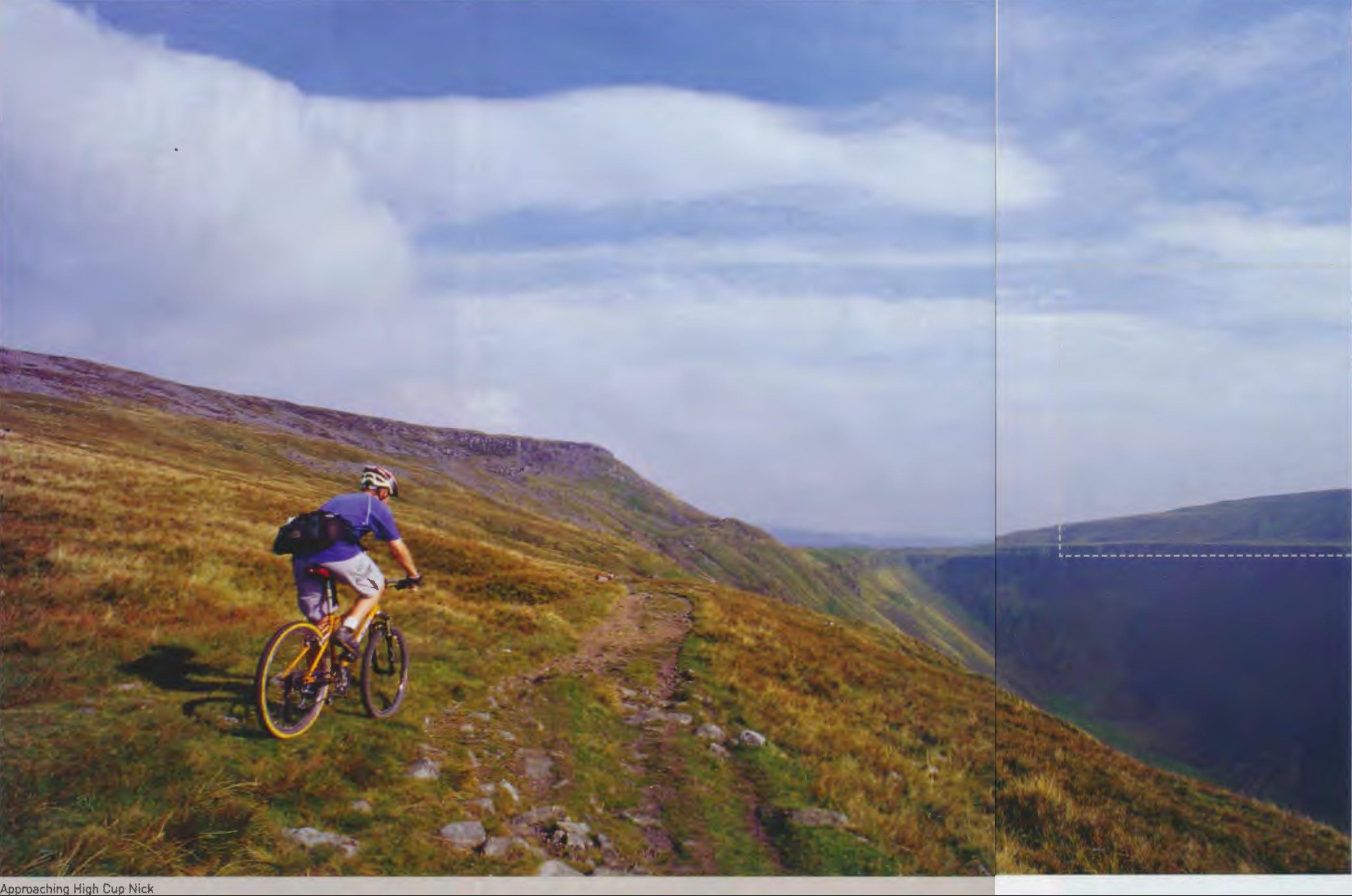
Our original Epic Route being currently out-of-action (due to closure of the unsafe access track alongside Cow Green Reservoir) we’re sticking in a replacement shorter route that takes in the iconic High Cup Nick ‘ice cream scooped valley’ seen in the top photo.
Epic route
60km1,290m ascent6-7 hours approx
The climb up to the summit of Cross fell from Garrigill is steady and on a wide rocky track. The descent to Kirkland is fast and the views across to the Lakeland mountains are incredible on a clear day. That’s the easy part over with. The Nick itself is the highlight of the loop. Not only does the track at last reduce down to singletrack but the spectacle of the waterfall at the head of the valley, visible for a good 45 minutes before you reach it, is truly inspiring. There is a bridleway that actually crosses the falls, literally a few feet away from the precipitous edge, and looking on the map this way does look tempting, but we would not recommend it. If you look closely on the map you will see ‘Dang..r Area’ to the south of the river. The bridleway takes you right through this zone. This is where the MOD like to come and practice dropping bombs and generally blowing things up. The bridleway is practically invisible on the ground and before you know it you will be pushing your bike through bogs and between the odd bomb crater. How do we know this? Bitter experience. We do this so you don’t have to.
The Helm wind
Occasionally our predominantly westerly climate blows eastwards. In the Autumn and Spring periods this can lead to one of the most intriguing natural climatic phenomena in the UK. As much as we Brits go on stereotypically about the weather, what we usually get is pretty benign when compared with the extremes experienced elsewhere around the globe and can best be summed up as a bit wet and breezy. However, there are times and places in the UK when things do get a bit more extreme. Cross Fell is one such place. When the wind turns round and blows from the east, things can get a little hairy up on the fells in the North Pennines. The colder easterly air meets with the warmer westerly air above Cross Fell and results in a localised and often dangerous micro-climate known as the Helm Wind. When all around is calm, clear and even cloud free, given these conditions, a small cloud will appear above the summit. Within minutes anyone on the westerly facing side of the fell will experience a cold and potentially gale-force wind blowing down the hillside. Stories and accounts going back centuries tell of walkers being blown off their feet and even horse and carts being toppled. Maybe the tales have been exaggerated over the years but regardless, the phenomenon is well documented and observed. The message is clear: this is no place to go riding unprepared.
The North Pennines
Referred to as the backbone of England, the Pennine hills begin at Hadrian’s Wall and end a good 300 miles due south in the Peak district. The highest point of the chain is Cross Fell, which was clearly taller than its 2800feet currently before the last ice age ground the top down to the characteristic plateau that we see today. The Big Route starts in the tiny village of Garrigill – a central refuge for Coast to Coast walkers and riders for many years. The Sustrans official C2C route passes through here as does the more unofficial off-road route that takes in the best (worst?) of the Lakeland mountains before heading straight over the highest part of the Pennines and gradually drops down the relatively gentle slopes of the Eastern Pennine moors to Sunderland.
Free newsletter
Singletrack
Weekly Word
News, reviews and riding from the Singletrack team — no spam, unsubscribe any time.


Hmm. The links seem to be broken. This is the kind of thing I get when I click …
#metoo :o(
He did say it was tough…
Ah. Lemme see what’s (not) occurring…
For the time being, I think ‘right click > save as’ on desktop, or ‘long press > download link’ on mobile should work.
Nope. Not working for me. Go into my downloads and it just displays the same gobbledegook …
Links work fine on Android/Chrome. Variations on those routes are my standard Solstice/Equinox trips; I’ll be up there in the next couple of weeks.
With mobile, once downloaded you’ll need to fire up your gpx viewer app of choice (I use GPX Viewer on Android), locate the downloaded file and open it.
Link seems fixed now to me.
“…doing all three in one weekend,…"
Am I the only one who only sees two routes though?
The “gobbledegook" is what a GPX file looks like if you open it with a text editor. I’ve tried downloading it and then uploading it to bikehike.co.uk to display on a map and it works fine.
@branes – Oops. Corrected now. The original article had a third route but it was very short and flat so not really worth including here.
Thanks all!
It’s worth noting that the last time I did the larger route (2024) the section of unclassified road that descends down to Tynehead (Meadowhead Culvert) was closed due to an “unsafe structure" (and looking at the entry point on Google maps that hadn’t changed in Jun 2025). It also might not be to everyone’s taste because the end of the ride isn’t as good, but occasionally I’ve started and ended this in Dufton because it has loos, a shop/post office and a pub (the pub in Garrigill closed in covid and didn’t reopen, though I think there’s a plan to reopen it in 2027). If the weather is good I usually push up to the top of Cross Fell – it seems a shame to be so close to the summit and not grab the views, as they are spectacular on a clear day. The descent to Blencarn is also my favourite route down.
The Tynehead link to the road is pretty thankless, not one I’d tend to ride. I’d always take the track from the county border to the Cow Green car park (or vice versa) rather than road options; never had problems with farmers I’ve met despite the ‘no bikes’ sign at the lower end. A few pics.
curiosity led me to this
https://maps.app.goo.gl/AGujBWNhCd9V2rLd6