Below the picture, the drop is a further 300m
[img]  [/img]
I heard some guy on a rigid ss did it! 😆
where is it?
with the morose mood i'm currently in i'd give it a go.
I could descend it easy. Whether I would be attached to my bike or not is a different matter all together.
its a road 😉
Doesn't look too bad, just steep?
it looks like a road to me
it looks like a road to me
Glad i'm not the only one who can only see a road. Smooth tarmac, therefore, easy!
EDIT: Where is it, Norfolk?
Below the picture, the drop is a further 300m
If it's below the picture how're we supposed to tell you?
I would huck the lot, 900 metre road gap?
I heard some guy on a rigid ss did it!
You rang?
This is like magic eye
If you were to divide the picture into four sections, the trail would traverse diagonally across the top right section, from bottom right to top left. It's clearest where you can see squiggly singletrack, above the fir tree to the right of the road (the fir tree is pointing at it). That road is not a "road", by the way, but the top of a truly enormous dam.
The trail descends from the ridge at the top (i.e. the horizon), to just out of shot to the right, on the road. The penalty for failure is the big drop to the rider's right (into a gorge, the Barberine gorge). It reminds me rather of the bridge-crossing scene in Holy Grail ("what is your name, what is your quest, what is your favourite colour etc.").
no apparently it was a 29er! 😀
I see it. Impossible to say. Certainly the shallower bits look ride-able but you can't say how steep the steep ones are.
Bits have got to be via ferrata
This is my answer to this thread by the way http://www.singletrackworld.com/forum/topic/which-singletrack-has-the-biggest-view-in-europe
I had to enlarge the window to 207% to make out the trail & on so on tha basis......"I'm Out".
via ferrata ................ with a bike
Not for me
OK, this thread is now a challenge. The trail descends from Loriaz to the Emosson dam, and is readily accessible to anyone in Chamonix. Photo evidence required on this thread by the end of October, or we're all mincers. Doing it in SPDs gets extra points.
Easy...I'd do that on a unicycle.
Is there no better pics / footage of the trail?
on the way
Depends how steep the camber is. If it's flat it may not be too bad. If it's steeply cambered down the slope it'd be hard IMO
I did it on my fixed CX bike, stayed on the drops all the way
Easily.
(Signed Billy Gruff)
I unicycled up it. 🙄
No pictures really. It's a bit of a black spot on google maps, and generally. I have no idea of what's over the ridge, in particular, but I think it's a bit flatter, wider and less exposed (but still rocky). The only way to know this trail will be to get out there and try it.
The only picture I can offer is this one which shows the context a bit (the trail is just off to the right)
[img]  [/img]
The bit in the first picture above is definitely the steepest part. Also, I think I was wrong to say it's 300m exposure. It's more like a 1200m fall if things really go pear-shaped...
Can't be that bad, otherwise it wouldn't be there.
If snowboarders/skiers are doing [url=  ?w=500&h=777]this[/url] we need to be doing stuff like the above to maintain the respect nay the dignity of the sport!
It's all in the head. The trail is prolly quite do-able, it's just the steep drop on your right that you need to look away from!
It's a bit of a black spot on google maps
There is a good view of it on geoportail.fr and you could use their version of googleearth for a 3d view overlayed with terrain if your keen. It doesn't look so bad from the satellite image but its impossible to tell really. Looks like hard work to get up there in the first place!
I'd give it a bash (in spds as that is all I have!) - I'd ride the bits I could ride and I'd walk the bits I can't ride (then curse myself for not riding them!)...surely everyone does that, no?
Easy...I'd do that on a unicycle.
Ponce
I'll do it on a unicorn
In truth I don't think any of it is rideable after it gets all squiggly and the big rocks kick in.
Jesus, I can see it now. Just one moment of hesitation to catch your breath, trackstand. But your momentum goes away, you can't get the necessary turning force, your centre of gravity goes forward, the bike jackknifes, you fall over the bars and down to the right, not a big fall if it weren't for the drop, but there is a drop. You stop after 10 feet or so with a broken collarbone, but your bike? It keeps going to the valley floor...
Trail looks doable.
It's the high-consequenceness of it all that is a little perturbing.
jhw, PMA matey, else you'll never amount to anything.
Yeah it's pretty much a straight line after all. Just slightly off-camber. I've seen worse in the Lakes.
Easy...I'd do that on a unicycle.
Ponce I'll do it on a unicorn
Pah, I'll do it in a unitard
with a good pair of sturdy walking boots, aye nae bother.
Easy...I'd do that on a unicycle.
Ponce I'll do it on a unicorn
Pah, I'll do it in a unitard
Saps, I'll down a bottle of Unicum then go for it...
Easy...I'd do that on a unicycle.
Ponce I'll do it on a unicorn
Pah, I'll do it in a unitard
Saps, I'll down a bottle of Unicum then go for it...
All w*nk.
Ill do it naked, on fire, backwards, blindfolded, on my arse!
I could ride it on one of these,
[img] 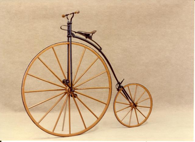 [/img]
blindfolded, whilst fellating a monkey with dubious personal hygiene and listening to his satisfied little lip smackings
Amateurs. Unimog FTW.
i manualled down it last week on my Raleigh Grifter
holds up hand.....................me me me
High consequence riding is where its at don't you know...
[img]  [/img]
