Viewing 8 posts - 1 through 8 (of 8 total)
  • Chamonix Walking Advice?
  • Blackflag
    Free Member

    Anyone got any good tips for walking in Chamonix? Suggested routes or guide books?

    Also, we are going at the end of may / june so i expect the lifts will not be open, but will have a hire car so will have to gain initial height with a bit of a drive. Will this be an issue?

    slugwash
    Free Member

    There’s a good route through the steep forest in Argentiere up to Lac Blanc above the tree line. You have to climb a couple of metal ladders attached to the rock face in places. After reaching Lac Blanc you can choose several routes back down towards Chamonix or somewhere else along the Chamonix valley. A lot of the routes are sign posted. You might want to get the local IGN maps for the area to pre plan you route/s. Expect some snow on the higher ground at that time of year.

    Sorry I can’t go into further detail but I’ve got to go and drink some beer now. Plenty of marked out trails to be had around the valley and surrounding mountains though.

    Blackflag
    Free Member

    Cheers. I doubt very much the missus would be impressed if we had to climb any metal ladders though. shes not so good with heights.

    cdaimers
    Full Member

    I found a number of books but the best one was this one ,Cicerone Guide. It has some very good walks but would also agree that getting the local IGN map would be a good one.

    Some excellent walks from the mid stop on the midi cable car, even back down to Chamonix even for my wife who struggles on most lakes routes.

    cxi
    Free Member

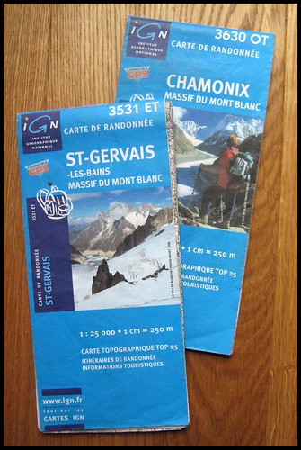
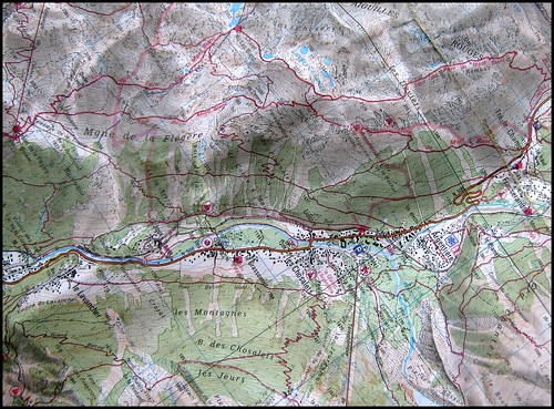
    I spent a week walking and biking based in Les Houches at the end of the summer season in 2008.

    One day we got the cable car from Les Praz up to Flegere, then the chairlift to L’Index. Was a lovely day but damn cold up at 2385m! From L’Index, it’s about 4km over to Lac Blanc, which also has a refuge if you want a drink. We looped back and down to Flegere but there’s loads of options if you want to walk all the way down into the valley. Google turns up a couple of route guides eg this.

    Another day we grabbed the Bellevue cable car out of Les Houches, then followed the Tramway du Mont-Blanc up to station at Mont Lachat. You can find a nice spot for lunch round here, with views straight up the valleya and it’s a popular launch spot for paragliders. We found a path which was waymarked and took us all the way back down to Les Houches.

    You can find the summer lift opening times online eg Flegere / Brevent. One thing to note is that Compagnie du Mont Blanc operate a number of the lifts but not all. The Bellevue cable car out of Les Houches is run by a different company.

    slugwash
    Free Member

    These are you maps you want….

    Many of the hiking trails are marked in red on them though you might want to cross reference them with a guidebook or you might find yourself biting off more than you can chew! Also, don’t forget that your paid accomodation (hotel, camping or otherwise) should give you a free travel pass for the valley which is handy for getting to or back from the trails. Though not the pub as there seems to be very few trains or buses in the evening.

    IGN 3531 ET

    IGN 3630 OT

    Guides

    glenh
    Free Member

    The lifts will be open.

    Shandy
    Free Member

    http://www.blurb.com/bookstore/detail/1275923

    Some lovely routes in here. I would try and take in Lac Blanc, Brevent, Les Houches, Midi midstation – Montenvers, all very different views and perspectives.

    If you’re looking for a leisurely stroll from the valley floor or en route back down from Brevent Flegere then Floria is hard to beat.

Viewing 8 posts - 1 through 8 (of 8 total)

The topic ‘Chamonix Walking Advice?’ is closed to new replies.