Will be heading up to meet some mates for a ride on Friday, one lives by Scotch Corner, other in Skipton. I'm heading up for a week in the Lakes, so can do anywhere in between the two.
We'd like to meet some where handy for us all that will be a good 3hr ish ride, not too gnar, that we can pootle round and have a catch up while we ride.
Any suggestions? Much around Hawes? Head for Dales Bike Centre and ride from there?
Thankyou!
Loads around Hawes - think Bainbridge, Cam Road, Stake Allotments etc, or loads in Swlaedale - Reeth, Fremington, Pinseat, Gunnerside, or uptowards Langthwaite is all good. Stu at the DBC will see you right as well. Be warned though, there arent many 'easy' routes around here, you'll be knackered wherever you head...
Thanks SM.
Looks like we're going for Hawes area.
Can anyone suggest specific routes?
Thanks.
The [url= http://technagen.com/Downloads/BoltonCastleRoute.pdf ]Castle Bolton[/url] one is nearby, you could extend it easy enough Harkerside moor direction.
We did this, the weather was poor so we carried on down the Cam road, rather than the track down from Wether Fell to Burterset
[url= http://farm7.static.flickr.com/6197/6096369390_367d891c3b_o.jp g" target="_blank">
[url= http://www.flickr.com/photos/66452821@N00/6096369390/ ]Dodd Fell & Burtersett Route[/url] by [url= http://www.flickr.com/people/66452821@N00/ ]ritcheyp20[/url], on Flickr
I really enjoyed the Orton loop from tebay services on the M6 I have a map of it if you want
Settle loop, quite short though
[url= http://farm7.static.flickr.com/6066/6095825075_cc0c671c72_o.jp g" target="_blank">
[url= http://www.flickr.com/photos/66452821@N00/6095825075/ ]Settle Loop Route[/url] by [url= http://www.flickr.com/people/66452821@N00/ ]ritcheyp20[/url], on Flickr
Hawes, ascend Pennine Way then Roman Road south to Grove Head & Kidhow Gate. Locate start of Ribble Way and follow to meet Ingleton/Hawes road (or carry on and descent to Cam Head, Gearstones & Black Rake). Take road for Dent to BW 200m on right. Head up to Wold Fell and cross to top of Arten Gill. Go right & descent via rocky track into Widdale. Follow long track to Widdale farm & main road. Follow road back to Hawes.
Pennine Way
[img] 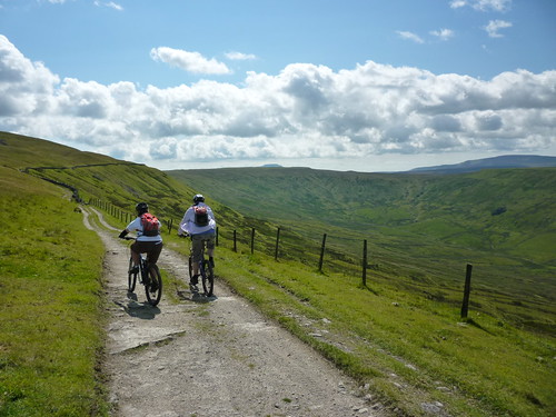 [/img]
Wold Fell
[img] 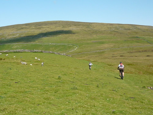 [/img]
Widdale - big rocks or chicken run (either way is fun)
[img] 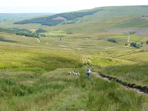 [/img]
Great stuff, thanks for all the suggestions. Fingers crossed for blue skies like those in pennine's photos!
Aye up, would you folk mind if tagged along for the day .... if I can obtain a day pass?
P20's route from Hawes is good but the Pennine Way out of Gayle was incredibly wet 4 weeks ago - better to take the Cam Road off the B6255 which is a good stony track turning into a boulder track for a shortish push but at least you won't be knee deep in water. The descent into Burtersett is good.
I ride regularly in the Southern Dales, the majority are physically tough, but not gnarr technical. Next on our list further north is Reeth The Edge [url= http://www.yorkshiredales.org.uk/mtb-the_edge.pdf ]http://www.yorkshiredales.org.uk/mtb-the_edge.pdf[/url] supposed to be a classic.
B.A.Nana - brilliant route that one - navigation is easy until about point 6 towards the 'steep descent' if you wizz down the obvious double track it becomes a single track footpath and joins the BW further down making that whole section under Winterings a descent - which is ace, but if you want the gnarly bit turn off the double track at the 180deg left hand bend and drop into Bunton Hush.
This is what you should find 😀
[url= http://farm3.static.flickr.com/2737/4502738897_5a857af2fe_z.jp g" target="_blank">
[url= http://www.flickr.com/photos/23772898@N07/4502738897/ ]Reeth 8-4-2010[/url] by [url= http://www.flickr.com/people/23772898@N07/ ]Dee P Jay[/url], on Flickr
