It’s difficult to say where the rumours started that the way off Beinn Fhada is the longest singletrack descent in the UK. Luke Bradley investigates.
Words & pics: Luke Bradley
There are mentions of Beinn Fhada’s status as the longest singletrack descent in the UK on internet fora going back over a decade, but even there, the posters claim ‘Well, I’ve always said it’s the longest.’ The metrics are fuzzy – is it longest in terms of distance (around 10km by my measurements on an OS map, others say further), or height loss (1,016m, if that’s even a way to measure ‘longest’?). There are mutterings of agreement, but also voices of dissent… ‘It’s the Golspie Wildcat black route.’ ‘There’s one that’s 12km in South Wales.’ YouTube videos claim six miles of uninterrupted downhill trail, and one even goes so far as to call it “life-changing”.
With that sort of reputation, irrespective of whether it’s actually the longest or most likely to alter my entire existence, it sounded worth exploring. Tucked up to the north of Glen Shiel, the magnetic pull of Skye means the majority of people passing by Beinn Fhada just fly by without ever noticing its majestic, craggy form on their way back from the Fairy Pools. It sticks out from its neighbours with its serrated top and imposing, dark southern flank – at first glance from the west, it doesn’t show promise as a place to take a bike.
Trust in Pete
I was in the fortunate position of trusting my pal Peter’s judgement. He said it was fine and to follow him, and if he told me to jump off a cliff, I’d probably do it. On a hot summer day, we parked up next to the charming River Croe, a pine marten scampered away, and things looked rosy. Armed with as many snacks as the tiny shop in Shiel Bridge could provide (fistfuls of Fox’s Rocky bars and a fruit cake), we set out on the surprisingly gentle spin into the glen.
I drag my bike up a lot of Munros, those 282 Scottish peaks over 3,000ft – only separated from one next door by about 300ft – and I’m not sure I can remember such a pleasant start. Singletrack winding its way gently uphill alongside a babbling burn, curving around the flanks of the hill. Compared to the common alternatives (pitching straight up with the bike on your back from the off or trundling along a few kilometres of Land Rover track), this was a joy.
You really sneak up on the summit – once you’re in the glen, you can’t see it at all, and you spiral around the mountainside for almost 9km before the final pull up to the top. On the way, the sides of the valley steepen and close in around us, further obscuring the peak from view. The glen teems with life – there are insects and brightly coloured flowers everywhere. It’s unexpectedly hot, and we use one of the bigger fords to top up our CamelBaks and dunk our sweaty heads.
Shouldering the burden
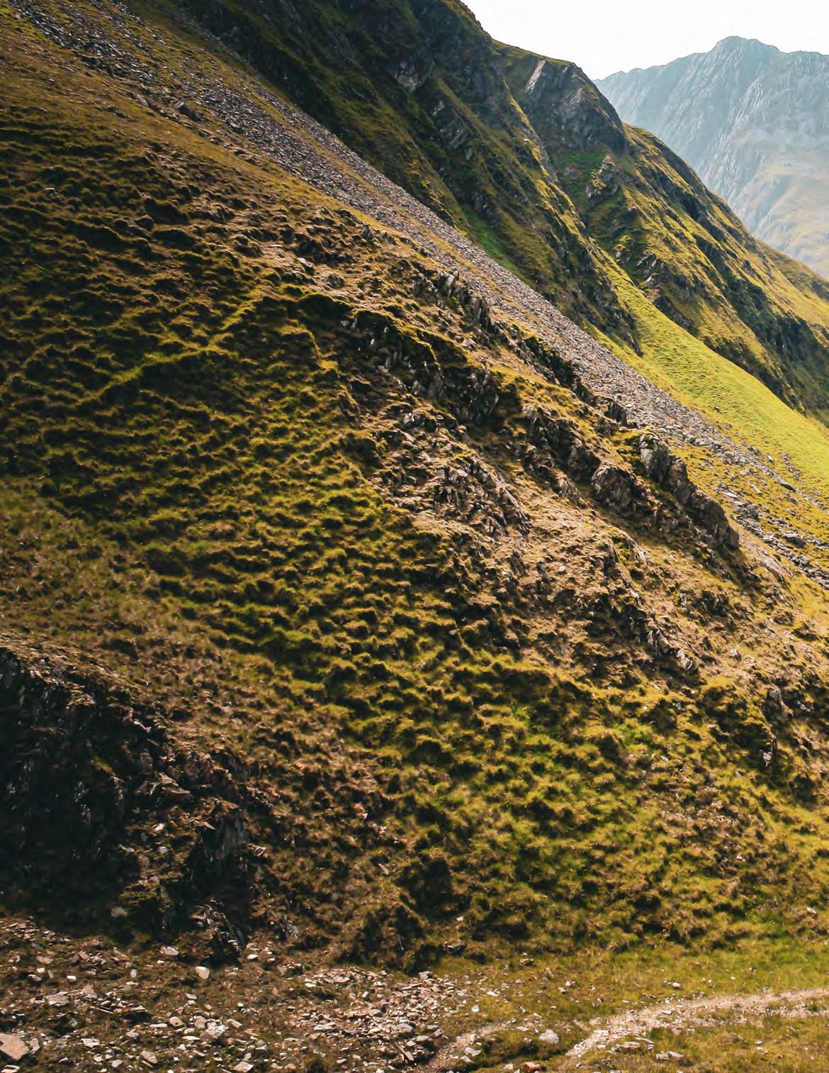
Suddenly, the track turns right and steepens. We’ve arrived in the spectacular northern corrie, and it’s finally hikeabike time. The green slopes have given way to towering cliffs of metamorphosed sandstone and marble, rich in semi-precious garnets. As a geologist, metamorphic rock generally means a lack of grip, but not here. Where we can ride, we do; pulling the bikes off our backs and finding our tyres bite the whole way until we reach a set of switchbacks that would require a Herculean effort to conquer.
At the top, we’re greeted by an unusual sight – an expansive plateau, the likes of which you hardly ever see in this neck of the woods, being a much more distinctive feature of the Cairngorms. This is the Plaide Mhor, the largest extent of land untouched by glaciers in the Western Highlands. Nearly 12,000 years ago, Beinn Fhada resolutely poked its enormous head out of the ice for a millennium, dodging the erosion that left its neighbours so spiky. Truly a mountain of superlatives – as well as this and the alleged longest singletrack descent, on the far side of the hill to us is the largest rockslide in the country.
What this means in the current century is a gentle pedal to the trig point. Apparently not gentle enough for my chain, which bursts apart halfway across and, as I pop it back together, I’m extremely grateful that the day is warm and still. Fixing a bike on this featureless expanse would be unpleasant whenever the wind is up. There’s a stone wind shelter at the summit, and we settle down in it to refuel.
Replete with chocolate and stodgy cake, Peter tops up his tyre pressures, and we set out to explore the plateau. It’s big enough that there’s no view to the west, so we pedal over to the secondary summit where Loch Duich nestles, peeping at us through a gap in the hills. To the south are the imposing Five Sisters of Kintail, a ridge of pointed peaks doing its best to look like a Toblerone. Now we’ve filled our eyes as well as our bellies, it’s time to point our handlebars downwards.
Er… now where?
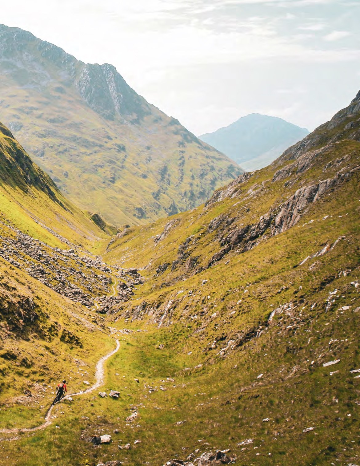
Up here, there’s no trail at all, let alone singletrack. We have almost free rein to go where we please, so we hug the edge of the corrie, clouds now being pushed up and over its back wall from below and into our path where they instantly disappear in the sun’s warmth. Eventually, a track appears and there’s no warm-up – it’s immediately into an exposed spine of rock. It heads straight towards a huge precipice, and there’s a similar drop to the left. Just before we’re plunged into oblivion, we twist to our right and drop steeply down to the start of the fabled ribbon of dirt that will take us back down to sea level.
The switchbacks we tramped up earlier are the first obstacle. Given they have to drop us down 100m of vertical and they only have a distance of 150m to do it in, they’re tight, supporting a shallow rut that clings to the gradient by its fingernails. Peter’s far better at hopping round them than I am, but once we’re on the corrie floor, the trail gets less sinuous, and I chase him at full tilt along a path that is barely wider than our tyres.
The going is good – the ground is rocky and drains well, and with only a few big rocks and water bars, this first stretch is properly fast. The consequences for clipping the edge of the trench we’re in are still fairly high – we’re riding on a ledge, and there’s a steep slope falling away to our left. A tyre grabbing at the side and sending me over the bars would fire me down far enough that it’d hurt an awful lot.
There’s a short stretch at the lip of the corrie that’s almost flat but crucially is still angled, so gravity is in our favour. The payback is a last set of switchbacks to bring us back to the glen. They’re not as tight as the ones we’ve already navigated, but there are stone steps positioned almost precisely to muck up either the entry or the exit from each bend. Once again, Peter outdoes me, and I hook up a front wheel and end up staggering forward with the bike between my legs to stop myself from tumbling.
Big bike terrain
Wiggling dispensed with, we arrive at a junction. The trail to our right forms the start of the descent on the Beinn Fhada circular route, a 30km ride which goes along the Affric-Kintail Way through Gleann Lichd at the foot of the southern side of the mountain before turning west to reach a bealach 1km to our right. Those with the legs and stamina could easily add on a trip to the summit to really get the most out of their day. This would also be a better option for those with a less gravity-oriented taste in mountain biking – to this point, the riding has required a big bike and quite a bit of bravery, but the descent from the top of the pass is trail bike territory.
Not requiring masses of suspension doesn’t mean the ride from here is any less enjoyable than the first half, though. While the gradient has reduced significantly, the trail snakes its way along the hillside in a way that makes it a pure pleasure to ride. The internet may have forewarned me that this is (probably) the longest singletrack descent in the UK, but what it forgot to mention is that it’s probably the best. Yep, I said it. This, for my money, is as good as mountain biking gets in this country.
What follows is just under half an hour of top-class stuff. We only have to dismount once to get through the stream we’d refreshed ourselves at on the way up. Weaving in and out of nooks and crannies in the side of the valley and occasionally splashing through streams, the clinometer remains in our favour. The rocks start to vanish, and things get more flowy. We barely turn a pedal until we reach a small birch wood where a slope eventually looms upwards ahead of us. It’s only a few metres long, but after all this time it feels like a bit of an affront.
Mercifully, it takes all of a few seconds and a handful of crank revolutions to deal with this and then we’re freewheeling again. We get our first whiff of civilisation as cultivated fields emerge to our right, then a barn, then a house and all of a sudden, over an hour since we left the summit, we’re unceremoniously dumped out onto a gravel road. We almost don’t know what to do with all this space – I weave about while Peter does a couple of cutties.
Longer = better? Longest = bestest?
It’s a real disappointment to get back to the car. The sun blazes down and we take the opportunity to cool our sweaty bodies in the river. Shaded with trees, fish nibble at my shins, picking away at the minerals that have been thrown at my legs by my front tyre. I’m no wild swimmer, but today the water’s mild enough that I spend twenty minutes splashing about before clambering out and drying off. Tired and happy we head off to the pub for sticky toffee pudding before returning to our camping spot for a cosy fire and a big sleep.
Longest? Who knows. Best? That’s my opinion. The only things probably biggest and brightest about Beinn Fhada are the things determined by science, but you can at least go and test the theory of whether or not this is the lengthiest singletrack descent in the country for yourself. You will definitely enjoy it.