- This topic has 166 replies, 49 voices, and was last updated 11 years ago by gee.
-
Swinley Investment and Mountain Bike Network
-
thisisnotaspoonFree MemberPosted 11 years ago
jump track on the whole 9 yds, think again – the last section of that was also fenced off for forestry work. The other end by the manhole cover wasn’t fenced so I guess it may only by shut to the fire road with the double drop on.
You’ve lost me?
Jump track on 9 yards? you mean ride 9 yards from the lookout to the manhole above the gulley, then turn left rather than crossing the fire road, almost the way you came back to the double drops?
That’s an interesting way to be going AFAIK that doesn’t really go anywhere other than back to the lookout, and I like that bit of trail so it’ll be nice if it’s weather resitant (as long as they dont remove the drops). But slightly worried that if they’re including that bit of trail then they might not even be heading towards the labrynth!
somewhatslightlydazedFree MemberPosted 11 years agoI really hope they don’t restrict us to the three new trails, although I suppose they probably will.
I take a group of kids and newbies to Swinley about once a month. At the moment there are enough trails to enable us to vary the route to suit the kids’ abilities. They can get plenty of practice at all the fun stuff – roots, drop-offs, berms, mud, climbs.
As most of Swinley is empty, even on Sundays, we can avoid any areas that are a bit crowded and also ride a different route every month.
If we are all forced into using three short routes I worry that some weekend warriors could get pretty shitty because there is a ten year old on a rigid Islabike in front of them on “their” red route.
I would also be pretty difficult to stop and do a bit of training over obstacles if all the routes are now armoured motorways.
I suppose we all will all still be able to ride in Crowthorne and the bit behind the top of Deerstalker?
rj2djFree MemberPosted 11 years agoPicture posted on the Swinley FB group looks like the actual trail itself will be quite nice to ride.. but I don’t think that was ever in doubt with Rowan Sorrell involved.
thepuristFull MemberPosted 11 years agoTinas – I meant if you’re on the 9yds heading for the gully, then the last section of 9 yards before the manhole has got the forestry work. There’s a fireroad/wide track that crosses that 2/3 of the way down the bermy bit.
theotherjonvFull MemberPosted 11 years agoI don’t think anyone is in doubt that the quality will be good, it’s the fact it’ll be restricted to one way, and all the non-waymarked stuff will allegedly be at best ‘off limits’ (ie officially not to be ridden) and at worst, actively blocked off / dug up.
boltonjonFull MemberPosted 11 years agoTo be fair, some of the new trails cut in over the last week look quite exciting
atlazFree MemberPosted 11 years agoThe plans are up on facebook but you need to join the Swinley Action Group group in order to see them
philconsequenceFree MemberPosted 11 years agointeresting. as long as they dont stop me riding in from crowthorne woods underneath the bridge and just joining the red route there.
thisisnotaspoonFree MemberPosted 11 years agoCan anyone see what’s happening at the Labrynth? Looks like possibly going in at the end of deerstalker and doing a portion of the labrynth? But then it looks like it goes in and turns right (whereas the labrynth is on the left).
interesting. as long as they dont stop me riding in from crowthorne woods underneath the bridge and just joining the red route there.
Can’t see how they could without putting up a big fence, Crowthorne is FC up untill the gate at the end of the Seagull?
philconsequenceFree MemberPosted 11 years agothey’d need to block off the fireroad going in to stop me…. wonder how much crossing over fireroads the routes will do as walkers and dog walkers will still use them and i fully plan on teaching my dog to ride along side the bike on some of the fireroads in there…
thepuristFull MemberPosted 11 years agoIs it just me that can’t open anjs’ first link – the pdf*? I’m guessing the jpg is a rough outline of blue & red routes???
Unless they build bridges or tunnels there will be plenty of fire road crossings, so opprtunities to join wherever you like (& ride whichever way you like!)
* – EDIT – chrome opened it fine, FFox didn’t want to
philconsequenceFree MemberPosted 11 years agotis what i was thinking with the fireroad crossings…
hope it doesn’t suck the fun out of swinley by having lots of grumpy strava people getting pissy at people being slower than them.
EDIT: to explain a little better…. it was nice chillin behind new riders on bits like the labyrinth, holding back a good distance and giving bits of encouragement, i hope the new trails dont end up with unnofficial trail guardians getting angry at people being too slow in their opinions. people can’t progress to the next level without trying the next level!
muppetmanFree MemberPosted 11 years ago@ packer – those are of the red trail- saw them sunday, gonna be sweet, not extreme, but faster than most at swinley
thepuristFull MemberPosted 11 years agonot extreme, but faster than
mosteither of the other two trails at swinleyif you believe what’s being said about the rest of the trails there 😥
scu98rkrFree MemberPosted 11 years agoGood to see a few more positive views on this page. Page 2 in particular was full of extreme negativity.
Looks like on the blue trail there will be a fair bit of new singletrack.
Looks like there a few sections of fireroad still on the red which is a shame.
thisisnotaspoonFree MemberPosted 11 years agoGood to see a few more positive views on this page. Page 2 in particular was full of extreme negativity.
Mine, and I suspect others negativity is due to CE’s attitude coming accross as “they’re our toys and we’ll take them home whenever we like”. the first most people on here heard about it was either this thread or coming accross the trail closed signs.
It wouldn’t have hurt them to to put some signs up explaing what was/is/will go(ing) on or have a more public consultation, the majority of people probably aren’t on BOB or the facebook group.
molgripsFree MemberPosted 11 years agoI would be very sad if you really aren’t allowed off the prescribed trails. Tragedy.
Sparky77Free MemberPosted 11 years agothe first most people on here heard about it was either this thread or coming accross the trail closed signs.
I’ll second that. Between the guys at work and myself we ride Swinley at least once a week, if not more and to not hear anything of this until it was announced on here was a bit dissapointing to be honest.
I’m going to be interested to hear how they are going to police riding in the ‘banned areas’. There is still quite a few of well used trails that don’t look as though they are going to be encompassed within the new routes.
nickcFull MemberPosted 11 years agoLong gone are the days of few bikers using swinley, it attracts riders from all over the south, and in all weather. If the choice is ride built trails* or closing it, then I know what Id go for know matter how much I might dislike it. But some of the trails are trashed now, both through weather and traffic. Mind you, I cant see that we do any more damage than say: a dirty great big water pipe project….
* lots of people ( rightly or wrongly) want to go mountain biking solely on these types of trail. Each to their own
starfanglednutterFree MemberPosted 11 years agoCan anyone see what’s happening at the Labrynth? Looks like possibly going in at the end of deerstalker and doing a portion of the labrynth? But then it looks like it goes in and turns right (whereas the labrynth is on the left).
Think that’s right.
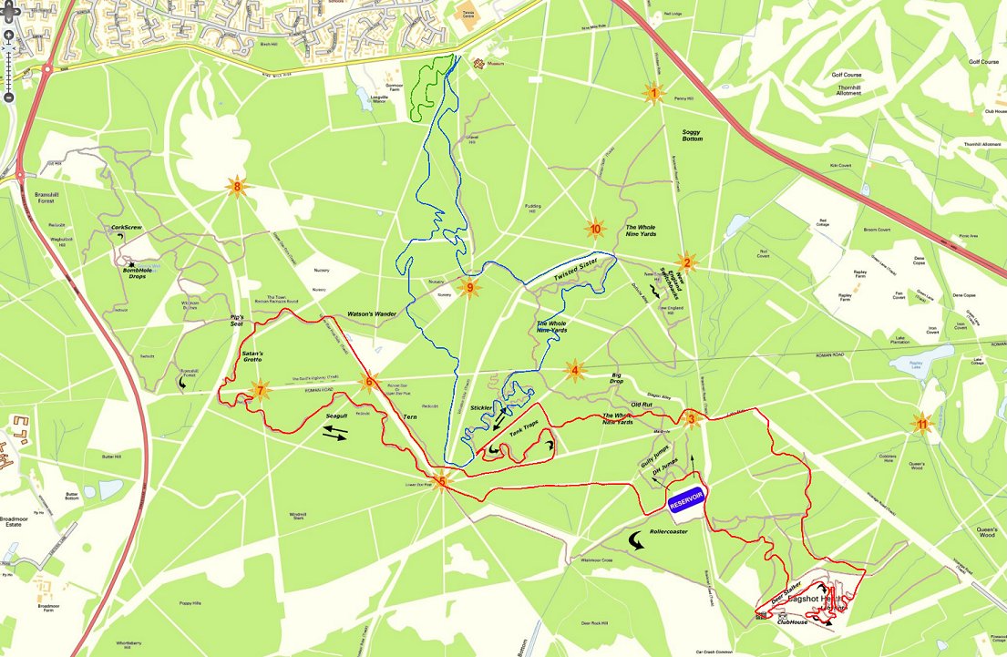
Here’s the (incomplete)[list]old map[/list]
Here’s the [list]new map[/list]Looks like Babymaker and that rather fun downhill run next to it are to be bulldozed, which is a shame.
molgripsFree MemberPosted 11 years agoI don’t know if any of the trails there are really bad. Nothing out of the ordinary for a forest trail. I mean there’s mud and all, but that’s not a big deal. It’s not like say the main routes up the Brecon Beacons or something.
starfanglednutterFree MemberPosted 11 years ago…unless I’m reading this wrong and the ‘DH zone’ will actually contain those runs separately… *fingers crossed*
thisisnotaspoonFree MemberPosted 11 years agoWhat he said +1 about babymaker seemingly avoiding the cull, shame mini-alps seems to be missed out though, that could do with a propper surface! 🙁
Odd that they’ve designated DH and freeride areas, but the current ‘advanced mountainbiking area’ isn’t shown. Does that mean the other jumps/drops are being removed. And does it mean babaymaker etc are being made official like the red/blue trails or willthey just be a free for all for the diggers to continue building what they like?
somewhatslightlydazedFree MemberPosted 11 years agoI suppose a lot of the negativity stems from realising how lucky we have been with Swinley until now.
For the past 10-15 years we’ve been able to go there and just ride where we like without any bother from anyone. The network of trails was always evolving I found it still possible to come across new bits or re-discover areas I hadn’t ridden for years. Every ride can be different and despite the crowds and trashed trails it can still feel like you are just exploring some woods on a bike.
And sometimes you meet the nicest people at the bottom of a bog, or tangled up in some bushes, or hopelessly lost.
I suppose something was bound to happen, it is just too popular to stay as it is (a big kids playground). For me the writing was on the wall when BOB started building Sticklers rather than just repairing the trails that were suffering from overuse. I’m sure the whole “trail centre experience” will be fun, for at least a while, but I’ll miss the mud, the roots, the odd little out of the way bits, and not being able to ride seagull in both directions.
geeFree MemberPosted 11 years agoThe trails I’ll miss are New England switchbacks and the one parallel to 9yards by the drain cover end. That was a nice one and has already gone under felled trees. Hopefully the new blue trails will be worth the loss. It will be nice to have all-weather trails, although the motorway surfacing oils definitely do with a shedload of rocks to add some interest. It will be a shame too that ‘big drop’ has gone as that was about the only techy bit. Plus the first ever trail I rode there, a nice twisty one opposite the reservoir, has gone as have the steep ones at the top of the wall. Shame.
molgripsFree MemberPosted 11 years agoSomeone should show this thread to the authorities, so they can see what they are destroying forever.
thepuristFull MemberPosted 11 years agoWas thinking something similar molgrips. I’d have thought that Gorrick, BOB & the Facebook group probably share a lot of the concerns expressed on here. AFAIK they’ve all had some sort of contact with the CE & SorrelCorp about this work, but either haven’t asked/had answers about these things or else are sitting on the info as part of some sort of secret conspiracy pact (where’s that tin foil hat?).
thisisnotaspoonFree MemberPosted 11 years agoSomeone should show this thread to the authorities, so they can see what they are destroying forever.
What? That they’ve upset the “middle class whiney (coloquial term for penis)bags” as the urbandictionary.com defines STW?
YOU CAN TAKE OUR 8FT WIDE BOGS THAT USED TO BE SINGLETRACK

BUT YOU CAN NEVER TAKE OUR FREEDOM!!!!!!!!ti_pin_manFree MemberPosted 11 years agoas usual this thread shows humans really love change… not. ;o)
Looking at this logically, man made trails get used most of the time by most of the people. We all use them now to link the tourist hotspots – Stickler, Seagull etc. Then we ride (AKA get lost) around linking these with nice more natural trails.
So whats going to change? Nowt.
We’ll still mostly use the man made trails, only now there will be more. We’ll still be going to the tourist hotspots and now linking more up with the new man made trails. And we will still be going off these new routes around the forest BUT most people, most of the time will use the armoured trails, thus probably reducing wear and tear on the more natural stuff.
Trail centres arent bad things, they help to introduce more people to the sport we love. I like the fact theres a green route, ace for total newbies and families. The new trails arent gong to stop people determined to use the more natural stuff. Stop moaning. ;o)
molgripsFree MemberPosted 11 years agoSo whats going to change? Nowt.
Hopefully. Is it only the yellow brick road stuff that’s to be preserved? If so, will it be made into one single loop?
Every time I
get lostride there about 50% of it is the yellow brick road, the rest is nice peaty singletrack and random trails of various kinds. I don’t want to be made to stop doing that.Trail centres are great things, I love them and ride at them a lot. However at every one I know, the trail centre is not at the expense of ‘natural’ trails. You can still do that if you choose. I’m just worried that this would take a big area of forest out of commission.
thisisnotaspoonFree MemberPosted 11 years agoSo whats going to change? Nowt.
Depends how they enforce the ban on mountainbiking.
On the one hand they may do nothing (I presume they’re not stopping families riding round on the fire roads) and everything will continue as normal, abeit with a one way system, which lets face it, we’ll probably ignore at off peak times.
On the other hand they had got more visible checking permits in the last few years so could have a jobsworth in a landrover chastising people for riding the corkscrew (which isn’t on those maps unless I’m imagining it in the wrong place?). Or even worse, completely demolishing anything unofficial or some tactical clear felling.
And what molgrips said about most trail centers not being att he expense of natural trails +1. No one is unhappy about new trails. We’re less happy about the loss of exisitng ones (or at least the permission to ride on them).
ti_pin_manFree MemberPosted 11 years agoI dont think anybody will stop you, how can they? the point is to reduce usage off the mtb trail, which will happen naturally as more people will stick to the man made stuff. they cant sign post every footpath or police every junction, the forest is too big and rambling, what they can dol is make statements to discourage people straying and hand in hand with dryer, and more man made stuff, it will. It will put ‘day trippers off’, is all, not regulars who know the forest well.
weeksyFull MemberPosted 11 years agoI’m looking forward to seeing some fat blokey trying to chase us MTBers off a trail puffing and panting running down the single track after us.
From what i hear the consultation with BOB’s and Gorrick etc has gone like thus
“We don’t like what you’re planning… maybe you should…”
reply “We don’t care what you like or don’t like, this is how it’s going to be…..”
“Yes but…what about..”
“Yeah, we don’t care ….”
Ad Infiniitum.
theotherjonvFull MemberPosted 11 years agoso could have a jobsworth in a landrover chastising people for riding the corkscrew (which isn’t on those maps unless I’m imagining it in the wrong place?). Or even worse, completely demolishing anything unofficial or some tactical clear felling.
This is my concern – my understanding is that there’s going to be three colour coded, defined routes, and the rest (all the off-official map stuff) is going to be off limits. And what does that mean – illegal* to ride but still actually there, or actively blocked off or bulldozed / ripped up.
* remember, it’s private land, the landowner can in theory ban bikes if they want to. Then you get into the usual discussion about who can enforce that, trespass, etc., but different from the usual theft of a cheeky footpath where unless it goes right through a farm you’re unlikely to actually encounter the landowner or their agent, they will have wardens in landrovers so the chances of being caught in the act will be far higher.
Technical point to TINAS – corkscrew is not on the Crown Estate, it’s on FC land in Crowthorne wood. So not part of this process, but who knows what the future holds for that side of the fence too.


![[list]old map[/list]](http://oranj.files.wordpress.com/2010/10/swinleysingletrack2.jpg)
The topic ‘Swinley Investment and Mountain Bike Network’ is closed to new replies.