I was thinking this might make a nice gentle weekender.
Then I looked it up...212 miles and hits 2000ft 80 times WTF? Anyone ridden it?
Not the whole thing but nice sections both directions starting at Inners that are well worth trying for starters.
I was thinking of this too, but probably 4 days riding. Even getting to the start is a PITA as it's a train to Glasgow, then to Stranraer and ride to Portpatrick. From there, the first bit is along a beach with scrambly rocky bits so I'd be avoiding that. Most of the other bits I've seen all looked navigable by bike but I reckon all the uppy-downy stuff would make for long days. It's been said that, unlike the WHW which goes with the grain of the land, the SUW cuts across it.
its a slog, some bits of rough riding- read broken up ground etc. You'll feel the reward in reaching the end- whether you will reflect on it with joy is another story!
Good coffee and cake in Lauder at the Flat Cat Druidh, look good on your blog. I've ridden a little bit from Lauder heading east, some nice bits near Thirlestane then mostly grassy. Ridden in the other direction as far as Inners, some good bits next to the Tweed. And some quite nice stuff near Abbey St Bathans but that's going back a few years. Might be worth spending one of your nights at Inners and doing a bit of extra riding round there just for the hell of it.
We did Portpatrick to St Johns Town Dalry a few weeks back - I did a write up in the bike and bivvy thread. I'll copy it here as it will make more sense if anyone uses the search function to look for info on this route.
The bits either side of Sanquhar are ok, with a wee bit of hike a bike.
Coming down of Green Lowther is 'entertaining' in a 'HOW STEEP!!! vertical grass kinda fashion.
I'd recommend at least a week of dry weather before the attempt.
Good luck
just north of Duns to St Marys' Loch is decent, high (exposed) and good views - no real single track though.
We're planning a couple of days round Moffat next month, possibly doing bits of the SUW.
We've also done a few other bits over the years, around Wanlockhead and Traquair and they've been pretty decent. Helps a lot if it's dry.
Im planning on doing it all mid winter over 5 days on one of my winter weeks hols,
A few friends fancy it as a bivvy trip next summer too,
Im planning using the Bothies on route and a (blagged cheap) hotel room at Lauder on the last night 🙂
Be deserted mostly and be a nice solo "me time" few days away...
Hope to get a clear frosty weather period as be great,
Done nearly all of it over the years, some of it we rode down in Dumfries years back on (cough) motorcycles 😳 but it was to raise money for a friend with cancer,(coast to coast in a single day offroad inc riding down there)
Plan is a through train ticket to Stranraer then pedal home,
At least its not far to ride home from its end 😀
Also on the cards is the Roman Way, Newcastle to Melrose via Hadrians Wall and Dere Street roman road, again train down, ride home... 🙂
Coming down of Green Lowther is 'entertaining' in a 'HOW STEEP!!! vertical grass kinda fashion.
yeah, my pal was the only to ride that. he was on a clunky old giant that was too small for him with narrow handlebars and half a foot of spacers. in addition, he was carrying his super heavy bivvy bag, his sleeping bag, a two man tent for me, and my heavy sleeping bag! what a guy.
that trip we rode from innerleithen to cockburnspath over two and a bit days. there were a few boggy/steep bits that we avoided. but it was pretty exhausting, so not really cheating!
EDIT: i think it was a different hill, very short but insanely steep down to a river; grassy field with lots of hoofs marks. god knows how he didn't go a-over-t!
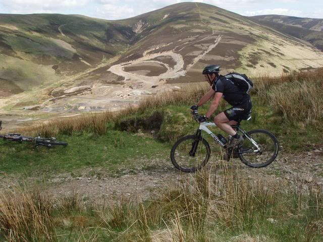
Above Moffat;
[IMG] 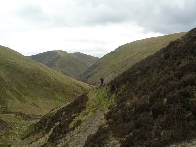 [/IMG]
Above Wanlockhead;
[IMG] 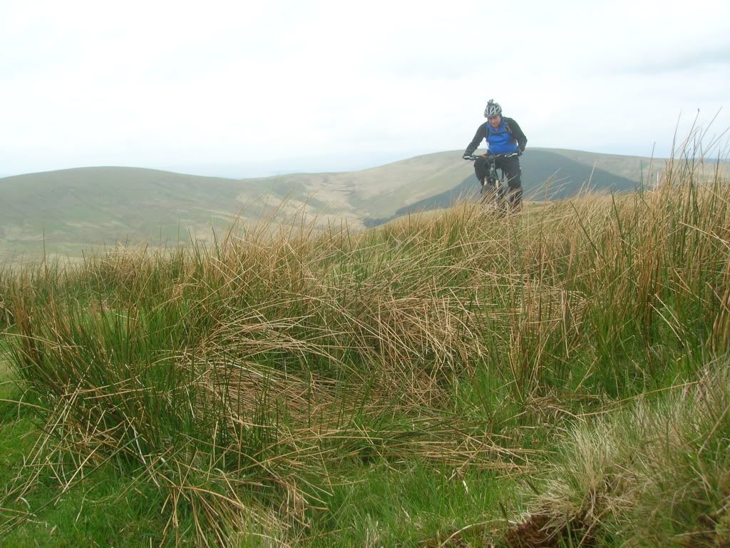 [/IMG]
Enterkin Burn rather than the SupW, much better, easier;
[IMG] 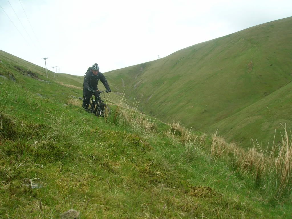 [/IMG]
Above Beattock;
[IMG] 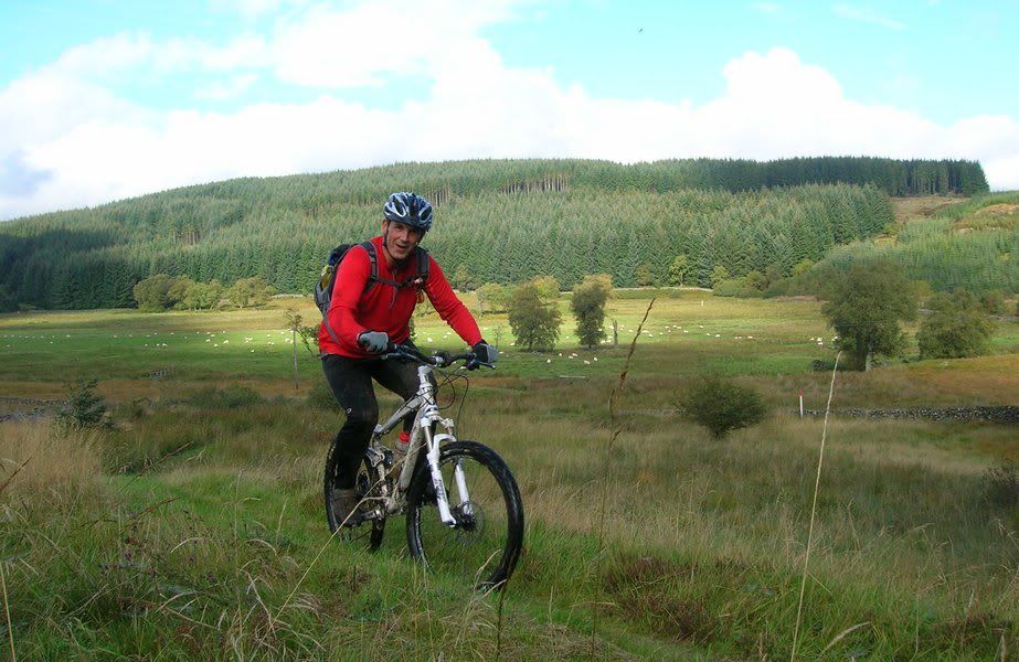 [/IMG]
Another few from above Sanquhar on the way to Wanlockhead;
[IMG] 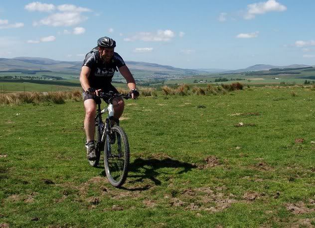 [/IMG]
[IMG] 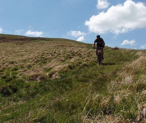 [/IMG]
[IMG] 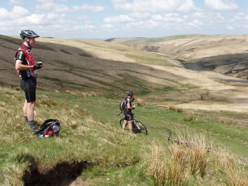 [/IMG]
Cheers guys, looks interesting.
Big hike out of Sanquhar
Big struggle up to the radar station from Wanlockhead
Big hike up from the Daer and quite boggy in bits to Brattleburn bothy
Hikes out of Moffat to Pawhope bothy
Those photos look very tasty.
Sounds ideal fat bike?
What im doing it on Al 😉
kennyp - Member
Those photos look very tasty
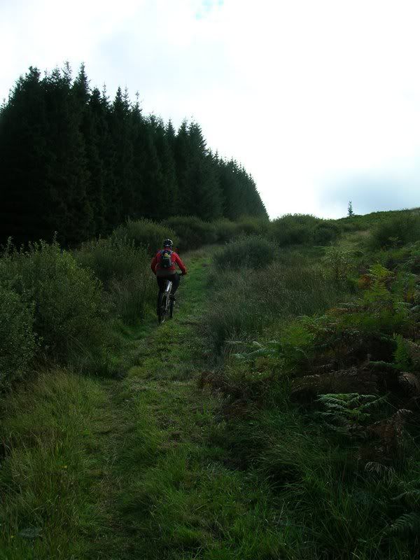
Couple more
This bit is a struggle due to being covered in grass and recent felling has it running with water when wet 🙄
[IMG]
 [/IMG]
Nice descent into Wanlockhead 😆 Has to be earned tho 🙄
[IMG]
 [/IMG]
You on Nates yet Bruce....?
No, sticking with Larrys for the coast, i have the super wide rimmed 29er for mud plugging 🙂
here's some info from the western sections that I posted in another thread:
Portpatrick to Stranraer
Theres some steps up from portpatrick to the cliff top - they aren't too steep so you could push the bike up with out too much trouble. After that the route follows the cliffs and drops down in to a couple of bays where you'll need to carry you're bike - its a lovely stretch of the route in terms of scenery but hard going where you need to carry the bike. If you've got a lot of gear and can't shoulder your bike, you should miss this bit out and go the road way out of Portpatrick, taking a left just outside the village and you'll pick up the SUW at the turning for Killantringan lighthouse. After that its all rideable (mostly farm road) to Stranraer with a nice but fairly short section of singletrack roughly halfway.
Stranraer to New Luce
Practically all rideable - Just outside Castle Kennedy village and Gardens, you pick up the road to New Luce here, as you start the climb, there's a short section of SUW which goes off to the right, its very steep and not much fun as it takes you through a very muddy cattle field so I'd advise you miss it out (if traveling with gear) as it joins back to the road a little bit further up. At the top of the hill, the route heads off toward Glenwhan moor where there's a nice section of singletrack nearly all the way to the luce valley, then a fairly steep drop down to the railway line and river - after that, you need to push for a bit until you clear the trees and can cycle over the river and push for another little bit up a very short but steep hill back to the road. You can take a short detour into the Village of New Luce here, theres a (very) small shop and a pub with a beer garden next to the river which made a nice stop for us.
New Luce to Bargrennan
Theres a fairly steep climb out of New Luce on farm track, the route takes you past some ancient caves/burial Cairns and then links on to road for a short bit before going totally off road through fields/bogs just north of Balmurrie farm. This section was a PITA - theres no trail at this point, but there are wooden waymarkers (sometimes hard to spot) every few hundred meters to keep you on course. You'll need to push your bike as its almost totaly unrideable for just over a mile and goes through a peatbog which you'll get wet feet from without appropriate footwear. After you come through the fields the trail is visible again and cuts through a wooded section for a few miles - its hard going again here as the trail is boggy and muddy but soon improves to half decent singletrack as you get closer to Laganngarn where the Beehive bothy is situated. Its a nice wooded bothy but no fireplace. The single track continues on passed some interesting standing stones and picks up forest fire road soon after. Your not on the fire road for long before the SUW goes off up a fairly steep hill before dropping you back down on to fire road. From here on its plain sailing all the way to Bargrennan mosty farm/back roads - theres a couple of short sections which take you off the road as you get closer to Bargrennan but they aren't great for riding and easy to skip. Theres a pub at Bargrennan which does decent food, and a campsite with shop. Theres loads of good spots in the woods here though if you prefer wild camping - we found a cracking spot on the shore of Loch Trool, not far from the old Caldons campsite which is now abandoned.
Bargrennan to Dalry
They changed the trail out of Bargrennan to Loch Trool a few years back which you might need to bear in mind if your using an old map. We missed this bit out as we'd been in the pub for a couple and were camping at Loch Trool so just headed up the fire road - it looked like half decent forest single track from what we saw though. The forest road way takes you passed the 7 Stanes trail centre cafe which serves sandwiches and has an outside tap for refilling water (if you camp round here like we did, you could also do a quick blast of the blue route).Once you get to Loch Trool, if you have a lot of gear, I'd advise sticking to the forest road north of the loch which leads to the car park at the base of Bruces monument . We didn't do this and followed the SUW round the south side of the Loch and it was really tough going for the lads laden with gear. Lots of really steep sections, steps etc but mostly rideable and good fun without the gear - some good gnarly/technical descents. You also pass the battleground where Robet the Bruce defeated an English force ten times his size. The spot is marked with an information board which was quite interesting to read about. Once you clear Loch Trool, theres a steep climb on forest road with some great views of the Galloway hills at the top. The forest road continues on for a good while passed Loch Dee and the Whitelaggan bothy (stone building with fireplace) and on to Clatteringshaws Loch. Just north of the Loch, the SUW leaves the fire road and goes over a few hills, we missed this section as we were running short on time and just stuck to the forest road and then back road over a hill and down to the Ken valley and St Johns Town of Dalry where we had a couple more pints and pub tea before being collected.
All in all, it was a cracking run but some of the boggy sections could be really bad now with all the rain we've had of late.
Dear oh dear Bruce...think of all that erosion!
Sums it up really -- as much hiking as biking depending on fitness/loads carried. Quite a lot remains boggy all year round 🙄
Sounds a perfect description 😀
most of the hard stuff to memory is indeed in the 1st 3rd of the way, Moffat back home to Co path is all mostly rideable, a bit hiking also keeps the feet warm in winter 🙂
Plan to post the ride on a new blog of Scottish Long Distance routes, having done a few other routes already, be good to get them documented for other folk interested in having a go
How rideable is the Wanlockhead to Moffat section?
kennyp - Member
How rideable is the Wanlockhead to Moffat section?
Depends on fitness but once the ride up to the radar station is done it is relatively "easy". That is the bit I struggle on due to a dodgy back. The slow grind aggravates it. Having done the section from the radar station to the Dalveen Pass road once I now do the Enterkin Burn descent instead. Just too much hiking and too many boggy bits to be bothered with when there is a cracking descent which takes you to the same road. Does mean a bit more tarmac riding back up the road to get back onto the next section. The next section across the road takes you to the Daer Res. This is pretty straight forward. Starts of by biking across a field which is a bit boggy in places, cross a burn by bridge and then over a fence onto a made up bit of singletrack. It is then onto a forest road for a bit and a newer section created when the forest was being felled. Then onto a forest/farm track before joining the tarmac road to the Daer. Ride alongside the Daer for a bit and then there is an almighty hike/carry up Sweetshaw Brae to Hods Hill. Once this flattens out at the boundary fence it is mostly ridable but watch out for the wheel grabbing black peat pots!!
Where you come to the edge of the forest(Hods Hill on map)there is a good, short descent followed by a short hike(again)
Possibly not much left of the forests around that area, they were busy felling when the pics above were taking tail end of last year so the condition of the track down to Mosshope and Brattleburn which are usually wet but fun is unknown. The section from Rivox is a double track descent which can be fun but was running a river last time!! Cross a burn at the bottom, ride across a feild. Climb over a dyke ride/walk up a slippy section of singletrack for a bit and then it is mostly flat to the gate onto the road at Easter Earshaig.
Onto a tarmac road which climbs for a bit but then becomes an absolute scream down the "Squiggly road" as it is known. Beware blind bends, cows, sheep, tractors and dopy postmen and waterboard van drivers.
As a local ride we do some of that as a ride out of Moffat via Greenhillstairs and Harthope onto Mid Hill.
Another option is to take the train from Dumfries to Sanquhar and ride back. Not done this year so far due to a dodgy knee
To answer your question it is very ridable. If I can do it most people can 😆
Cheers Trekster, I'll check that out on a map. As you seem to know that area very well, there's another track (not the SUW) I'm curious about.
If you take the minor road north out of Moffat to Ericstane there's a track heads roughly NNE from there towards Fruid Reservoir. The first bit is obviously a push, but it's the bit after Spout Craig I'm wondering about. The rough plan is (maybe) to take that track, then head down towards Tweedsmuir, along the A701 a bit, and go off-road again over the hill, dropping down to close to the Tibbie Sheils Inn. Well either that or in reverse. Does it sound a viable option?
kenny...never even considered it, way too step to hike and is probably more of a sheep track than anything. Will have a word with my mate who rides it on his 224 DH bike. Not sure of his route up, possibly from the top of the Beef Tub. He has been exploring those hills this year whilst I have been struggling with my dodgy knee. Walking on that type of terrain has been out of the question.
The TransScotland event descended that hill I recall
Have only ridden SupW in and around there + Bodesbeck descent from Pawhope bothy usually starting at Moffat or Wamphrey.
Cheers Trekster. We have a boys' mountain bike weekend every year where we try and find somewhere different to ride (with mixed success over the years), as well as plenty beer on the Saturday night. This year we hope to do something around Moffat, probably starting and finishing at Tibbie Sheils.
Answer from my mate, the guy in the Moffat hills pic^^^^^^^ ;
John
NO
Ian
Seriously with my limited knowledge of the Moffat Hill its a no no, your plan is to push up the steepest bit of the Devils Beef Tub - when you could start at the lay by at the top of the Tub and cycle along Chalk Rig Edge which is the Regional Boundary to Spout Craig which is a popular walk most go onto Whitehope Knowe and return by the same route.
He was/is ex police search & rescue!!
If I can find a map I can have look at what can/could be done.
Got dates set yet?
You could use the SupW to go over to Eskdalemuir and have a coffee with the Monks @ http://www.samyeling.org/
[IMG] 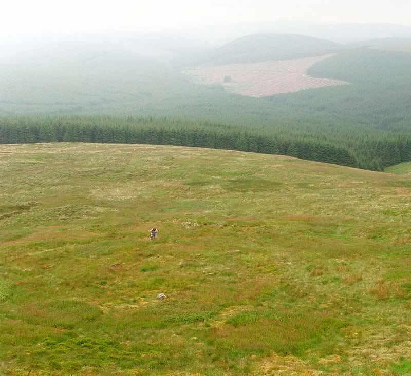 [/IMG]
Hike up and over Ettrick Pen
Or.....just ride to Moffat and back via the descent down Bodesbeck at Potburn, onto Selkirk road, down to Moffat and then back via SupW(top pic^^^)
You could also head over to Peebles via the Gysy Glen descent and return via Inners and the SupW
Cheers Trekster, that's given me a bit to think about. Back to the maps I reckon.
Oh, and just to say I hugely appreciate all the feedback you've given. Cheers.
We spent a couple of days doing some of the SUW at the weekend there and had a great time. Started at Leadhills, detoured off before the radar station down the Enterkin Burn (as suggested by Trekster above), detoured more to see the Roman fort at Durisdeer, back on the SUW and finished with a brilliant descent in the dark (luckily we'd taken lights) through the forest on a very wet and slippy track.
Saturday night was spent in Moffat. Two recommendations here. The Buchan Guest House is one of the friendliest I've ever been to. Not bothered in the least by seven very muddy bikers turning up. And the Moffat Indian restaurant does a superb curry.
Sunday was following the SUW up to St Mary's Loch, although we missed the very last section and did the descent down to the Loch of the Lowes instead as it's more fun.
All in all a top weekend.
