
The first trip…
I’ve been into mountain biking for as long as I can remember, and over the last couple of years have also taken a fancy to longer road/gravel rides. I love the speed at which one observes the world by bike, how in touch you can be with your surroundings, and how easy it is to meet people as you pass through their parts of the world. Also, when it’s appropriate, shredding down lairy hills and doing jumps is super fun.
So naturally, since I heard about bikepacking, I’ve been itching for a proper wilderness adventure combining both disciplines. Now, free from the constrains of full-time education, I’ve been able to have one.
The GR247 looked like a pretty sweet option for a first big-ish trip abroad. Having drooled over all the routes and tales on bikepacking.com, it stood out as a sensible but not too sensible option. Some fairly tough-looking riding on dirt roads that are gnarly enough to mean a mountain bike is necessary, but not so gnarly that they’ll gnar my arms off. Some big old climbs, but still 90% ridable. Pretty middle-of-nowhere, but the odd town means I won’t actually die if I run out of food.
There’s also tons of information on the trail from both the brilliant bikepacking.com, and sierrasdecazorlaseguraylasvillas.es, a website specific to the 247 itself. Oh, and the whole place looks gorgeous. Sold!
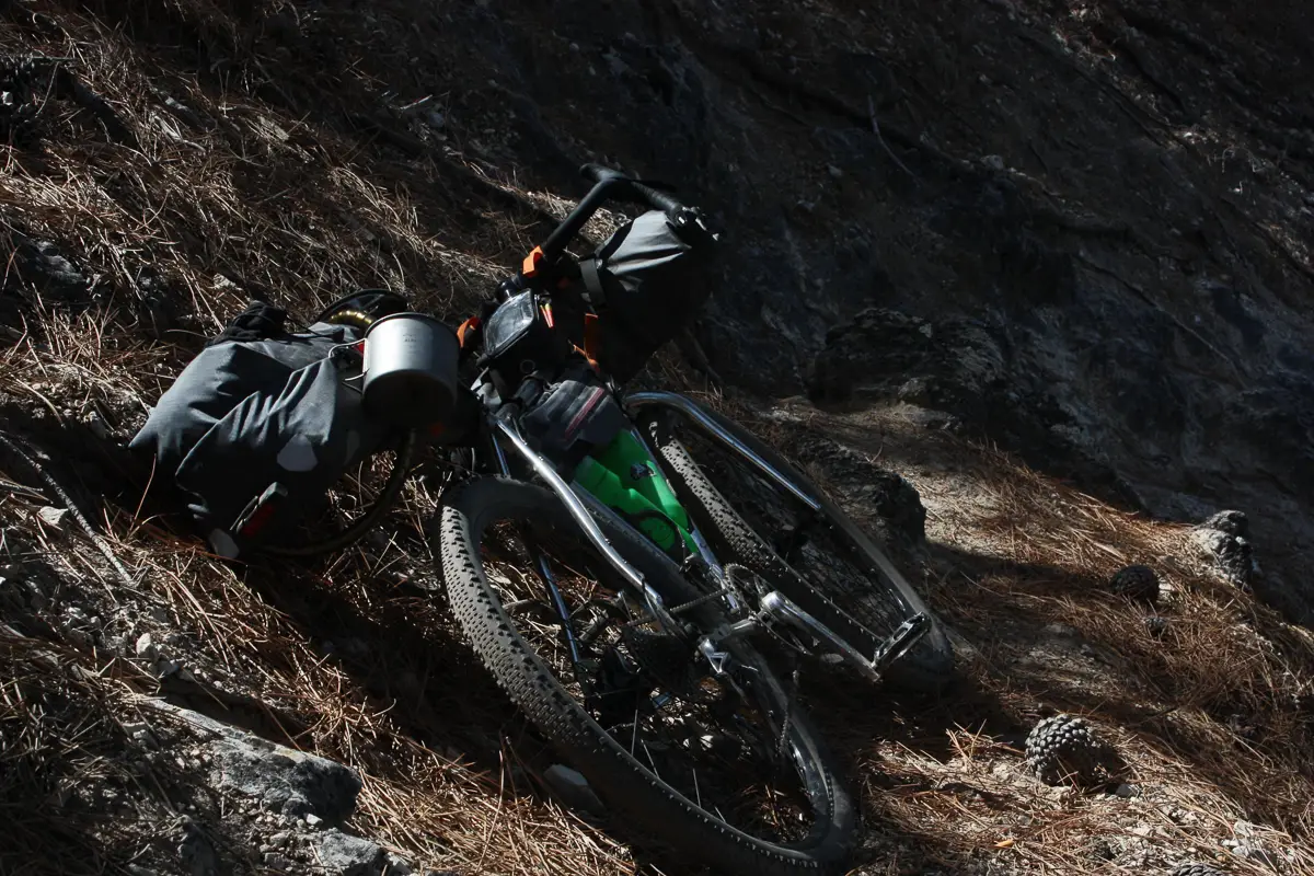
I chose to ride my Sven Cycles Pathfinder, as it’s designed for “riding your bike wherever you want.” I thought it should be the perfect machine for the job (and it was!).
And so with a vague plan of where I’d stay each night, a couple of maps I’d printed off the trail website, an excessive quantity of dry food, and a beautiful handmade bicycle, I set off on my first solo adventure.
Uno: The ride to the ride
Beas De Segura to Refugio Casa Forestal El Campillo.
48.2km.
Up 1494m, down 908m.
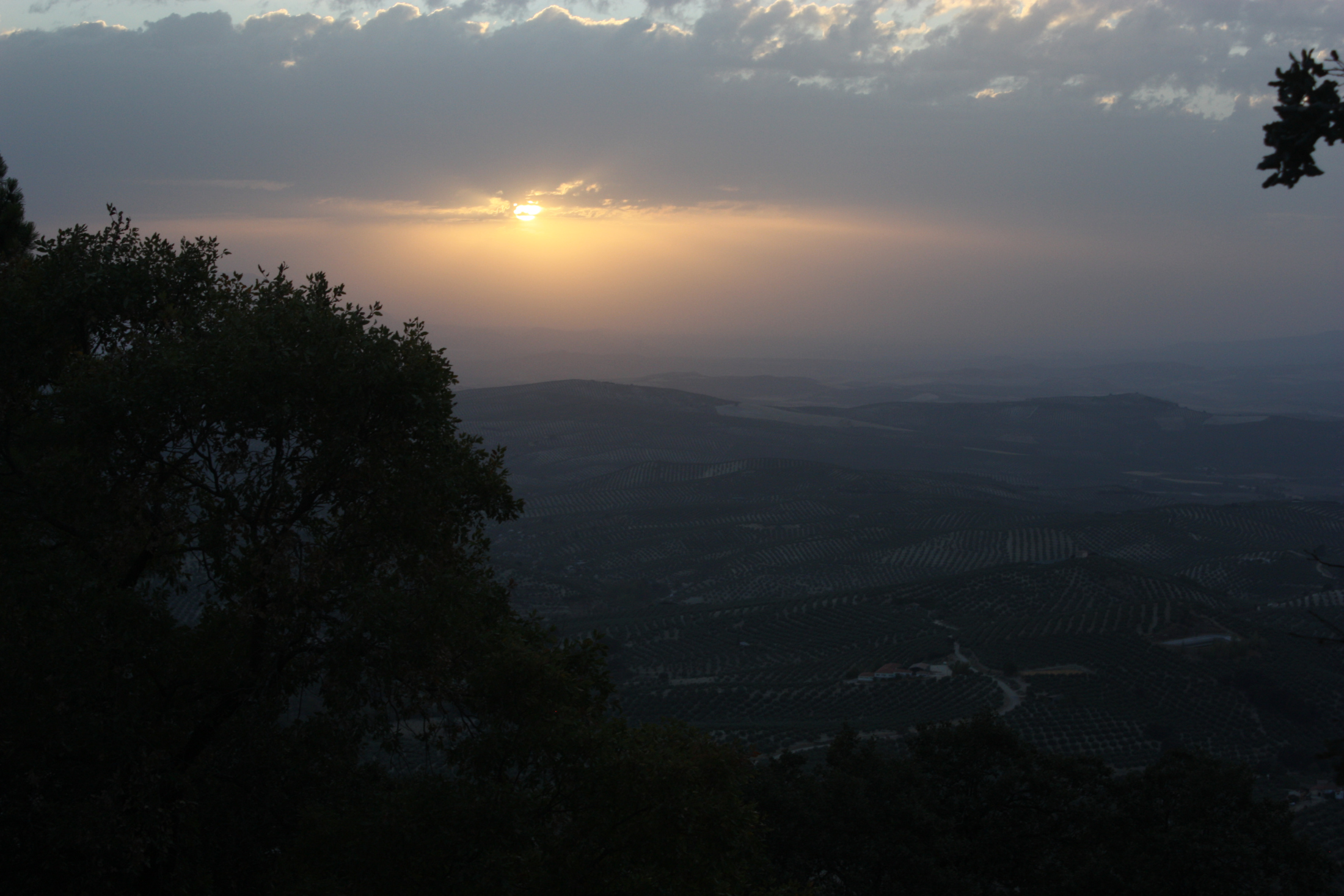
After a flight over the evening before, I awake in Madrid at 4:30am. Super delirious but buzzing with excitement, I write a quick thank-you note to my Airbnb hosts, then head out into a cold night. Onto my first train of the day, heading south with the feeling that the urban world is rapidly flying from the present, there’s no way I can sleep. I change to a bus in a town called Albacete, feeling like it could be my last outpost of proper civilisation before the backcountry- it’s open, barren, raw. Heading out on my final leg of transport, the surrounding landscape is purely plains of cracked sand. Hills rise from the horizon, hills become mountains, mountains intensify…
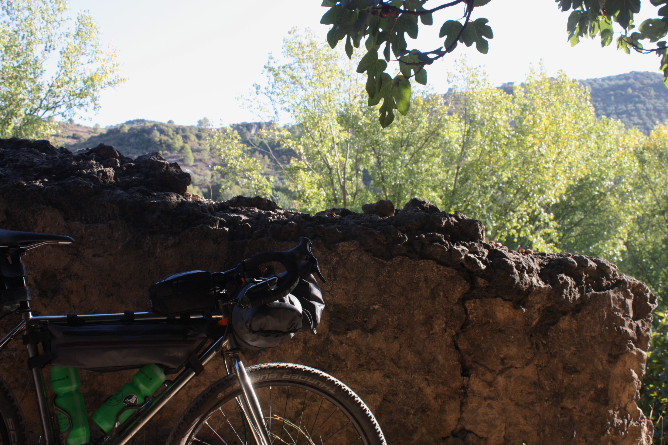
It’s 6pm by the time I leave Beas de Segura, a town on the outskirts of the Natural Park that houses the 247. Having assembled my bike and left my travel box at the very friendly and helpful Hotel Avenida, it seriously kicks in where I am and what I’m doing, and I love it.
Pedalling out, I get the feeling of being truly wilderness-bound. I was way too camera-happy with the bike here, the excitement had me…
This first ride to the trail would prove to be pretty long, but a perfect first impression of the scenery.

This is also my first impression of how the Pathfinder rides loaded—and luckily for my weary head after a day’s travelling on minimal sleep, it’s superb. On the initial long dirt climbs it’s my donkey; a comfortable, forgiving laden beast. A donkey with not the slightest sign of flex in the bottom bracket, either, even cranking under extreme load, and I’ve never experienced anything like it on such a comfortable ride.
When I reach peaks and begin to descend, it becomes a stainless steel knife, slashing precise lines down loose rocky paths, dodging boulders and giving me the confidence to ride way too close to precipices.
I eventually arrive at Refugio Casa Forestal El Campillo at midnight. A perk of the 247—numerous Refugios (hiker huts) are dotted along the route. A bothy equivalent, they’re dry and safe, all in good condition and have a fountain nearby or in them.
Dos: The actual first day
Refugio Casa Forestal El Campillo to Camping La Montillana.
25.04km.
Up 744m, down 1343m.
I sleep off last night’s surprisingly big ride, pack up my gear and set off.
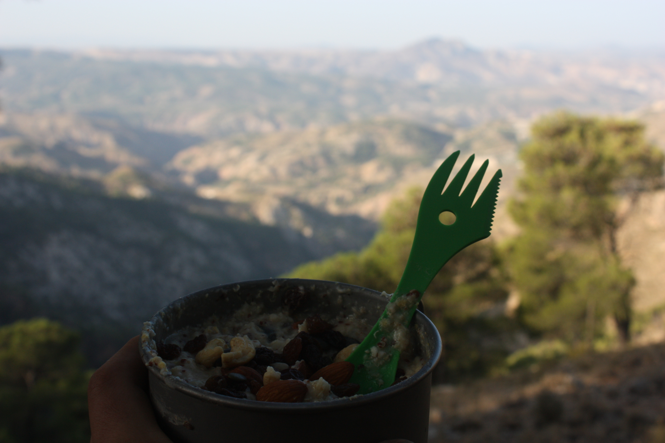
Now begins what will be a long running theme of my trip—no water. I know I’ve just praised the Refugios, and while they are one of the great things that enable penniless travellers like me to complete this route, soooooo many of the fountains don’t work. I’d gone to sleep thirsty and woken up into midday heat; the real mission wasn’t off to a great start.
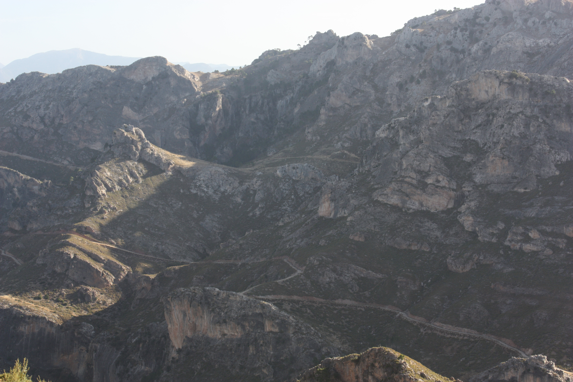
But after a bit of a gruelling pedal I got my agua, and got a taste of what was in store. Hills! Newsflash: it’s mad hilly in the mountains. It’s quickly made clear that my path doesn’t mess about with them either; it’ll rarely skirt around foothills, preferring to blast straight up, down and all around.
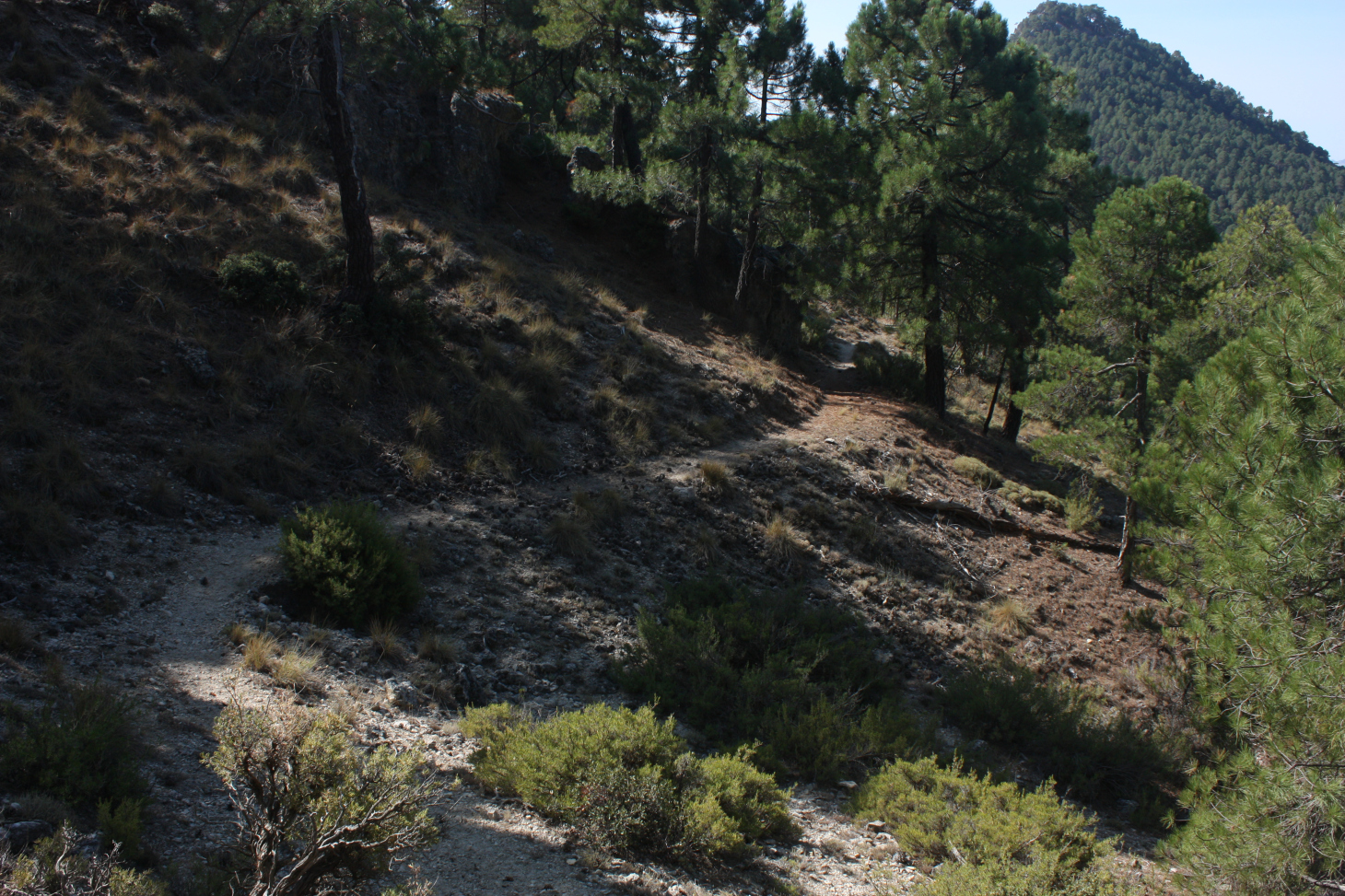
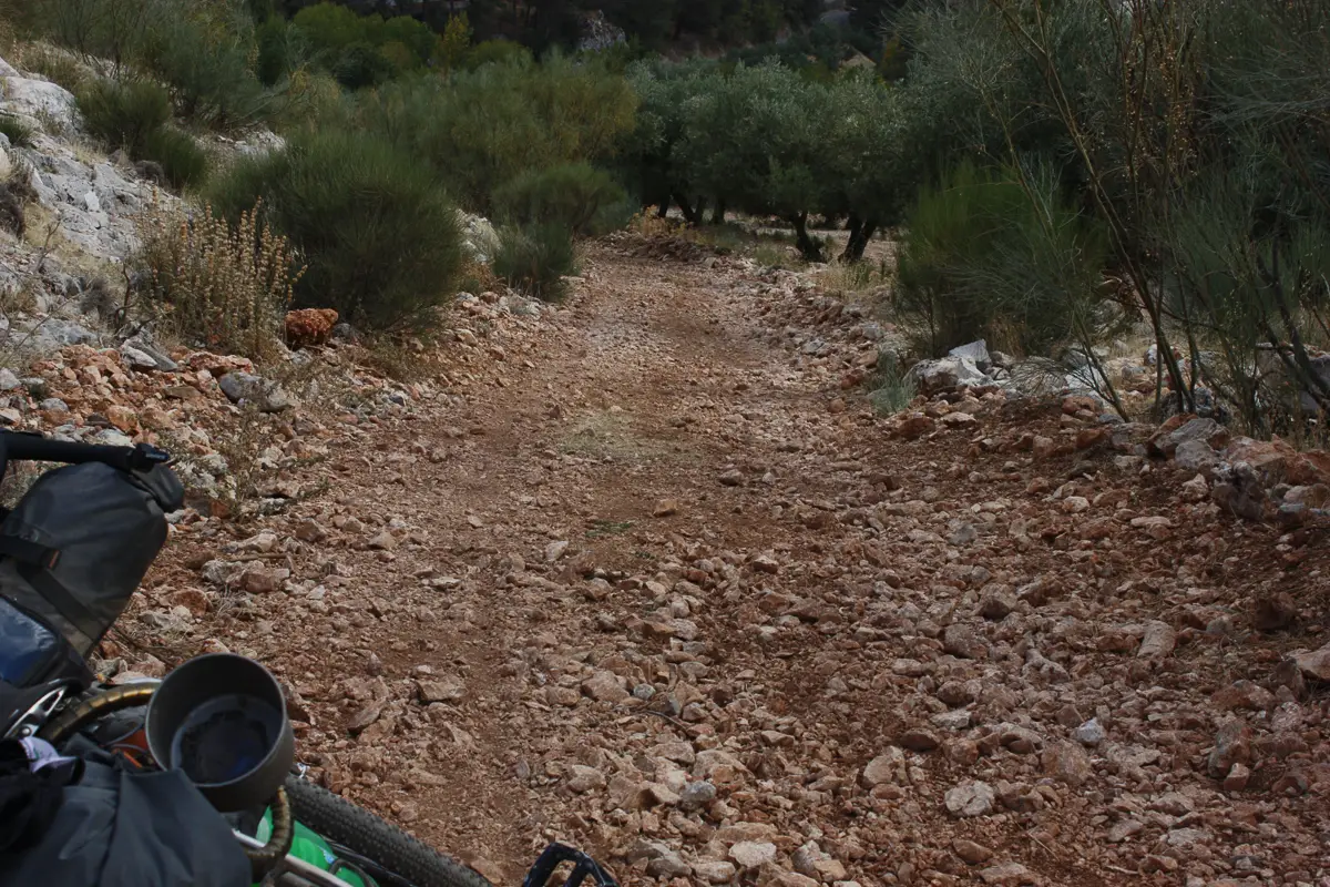
The riding is amazing though. It’s mostly dirt roads, but they’re playful—sometimes loose, occasionally littered with boulders, meaning only a narrow section is ridable, and consistently winding through incredible scenery. Where there are singletrack paths they’re tight and exciting; I found them to be just as memorable as the far longer dirt roads. The Pathfinder eats it all up, staying agile when it gets twisty despite the load.

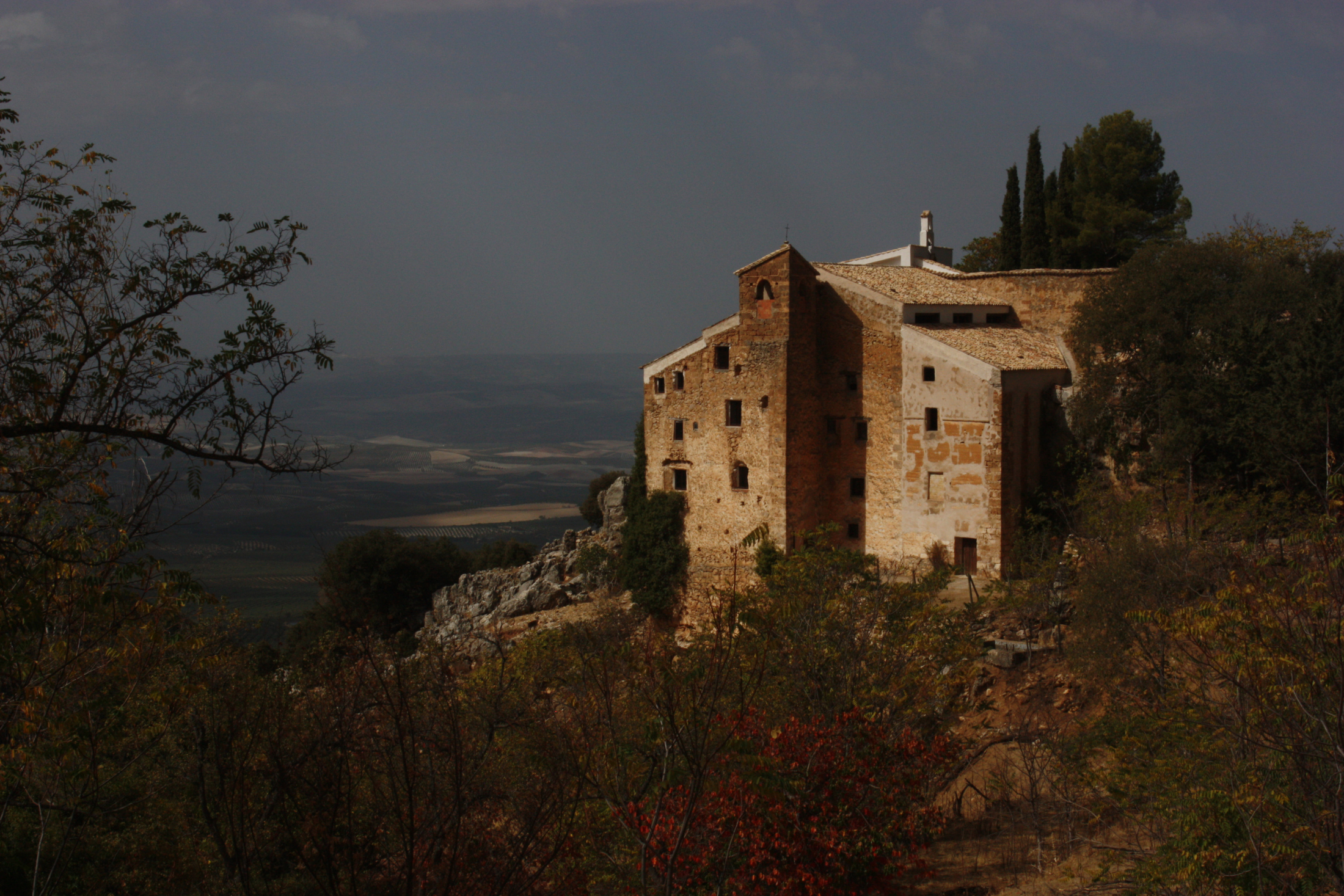
I had the privilege here of passing through the majestic hillside town of El Hornos.
My day winds to a close at a campground called ‘Camping la Montallia’ —well, sort of. I’d been aiming for it all day, but then when I got there found that it was closed, and so then I thought I’d see if I could camp in the grounds of a nearby ‘Casa Rural’ hostel, and then got a kind “no,” but then the owner did call the owner of the campsite who said I could go in anyway—for free— “You can pay me next year!” she said, but then when I went back I couldn’t get in, so I wild camped across the road. All part of the fun of it.
Tres:
Camping La Montillana to Fuente de los Cerezos Controlled Camping Area.
32.16km.
Up 1501m, down 1330m.
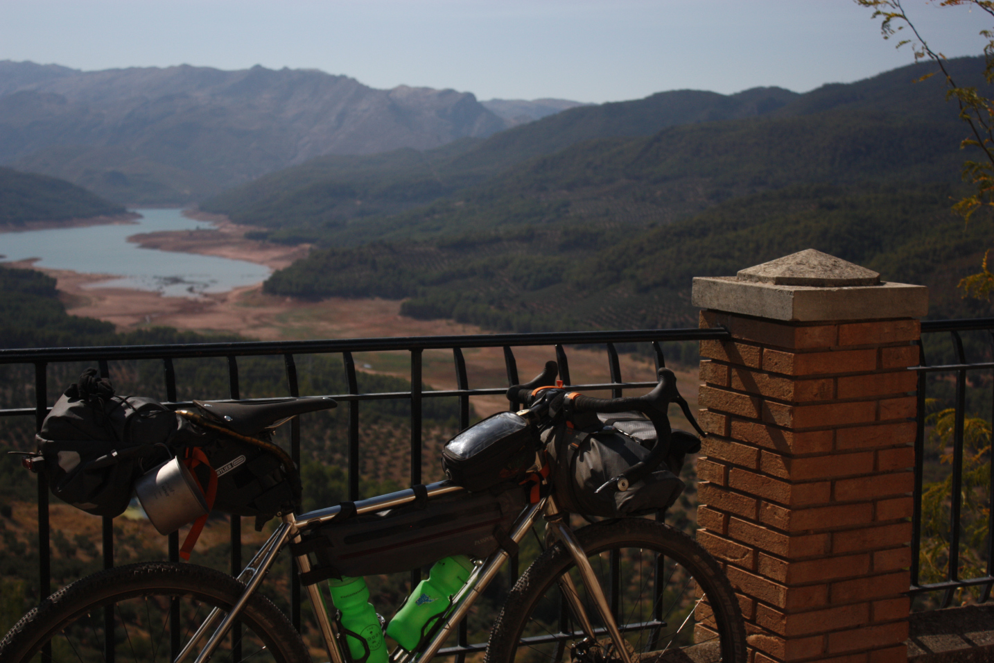
I awake to crisp morning sunlight glowing around my campground. I’m on the edge of a hilltop forest, overlooking the gorgeous El Tranco (The Stride) reservoir. Feeling refreshed, having finally caught up on sleep, I have a quick breakfast, soak up the views and begin the steep climb out of the valley.
This would turn out to be one of my hardest days—the initial climb is pretty brutal and covered in loose rock. Progress is slow and many of the water fountains marked on my map are bone dry. Only getting hotter, day two is already proving to be a test on body and spirit.
Approaching the summit, salvation comes in the form of four cheerful local riders blasting down the hill. They’re impressed (albeit a bit worried) that I’m doing the 247 solo with so much baggage, and tell me there’s a rocky 5km hike-a-bike round the corner, but also a fountain. Can’t complain, I suppose. They’ve done the trail many times and are now trying to complete it in just four days—four days! They only have a couple of little rucksacks between them, I could definitely learn a lesson from that…
I thank them and they continue whizzing down. Having a bit of human contact puts me in a much more sane state and I complete the rest of my climb. The hike-a-bike that follows is tricky; the path dissolves and then it’s clambering up and down an exposed rocky outcrop for what feels like hours. That said, I felt great having traversed this sketchy epic.
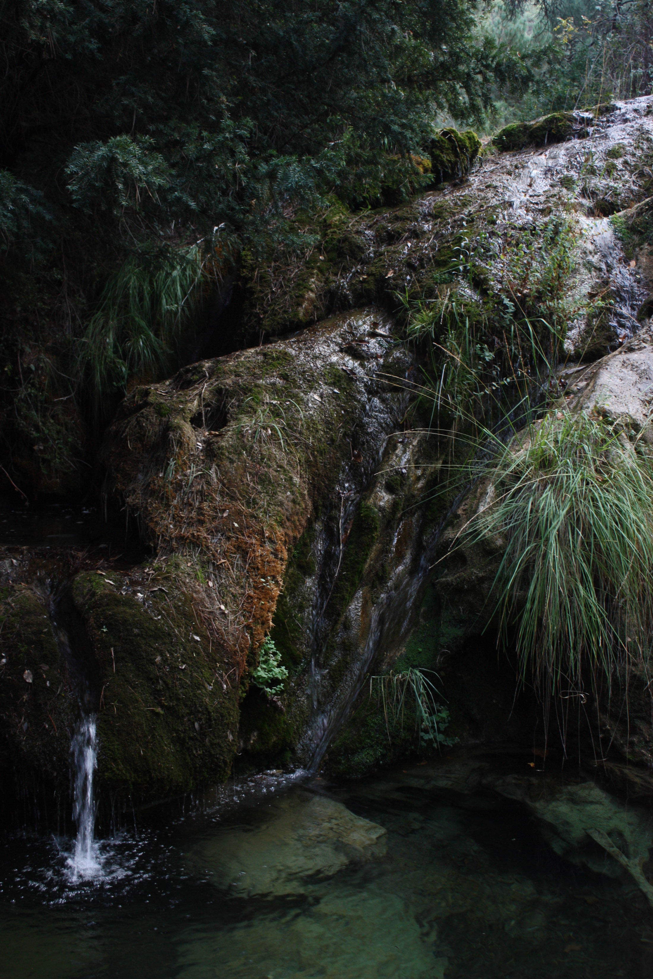
The path eventually reforms and takes me back into the valley, and here I get my first reward from the trail. What was marked on the map as simply a ‘recreational ground’ turns out to be this gem:


Well, what a day. I trundle into my stop for the night, a ‘controlled camping’ area, at golden hour. These controlled camping areas are basically legal enclosed spots to wild camp, and are all nicely finished. This one is tucked in a basin of three small peaks, in a dense pine forest. I sleep in a sheltered picnic area to save the faff of putting up my tent, it was a bit of a depressing scene but there was nobody about to mind…
Cuatro:
Fuente de los Cerezos Controlled Camping Area to Burunchel.
53.17km.
Up 1648m, down 1610m.
I get on my way early and ooooh man it’s steep. This steep:

Insane views greeted me at the top though, some of the best I’ve ever seen…
And the euphoric cruise along these ridges was followed by a lush downhill blast.
“That should’ve been much scarier” is something I kept coming back to on the descents. I’m riding some steep singletrack that’s all types of loose, on tyres with minimal tread, the bike’s seriously loaded up, my knackered limbs should be rattled off on a rigid bike on these savage rocks, and that’s a sheer drop just there: this shouldn’t be fun on such a road-capable bike. The Pathfinder’s handling, ride quality and stability when loaded are first-rate.
The fun ride down brought me from exposed crags to an amazing autumnal forest.
There was even opportunity for wild swimming… in hindsight this was such a nice day!
There were a couple more peaks to scale, but before I knew it the day was over. I didn’t have a solid plan for where to stay that night, and found myself overlooking the village of Burunchel at dusk, so decided to see about a hostel. I dropped off the trail, following hairpin bends in the wake of a crimson sunset down to an evening of tapas, cervezas and a little log cabin.
Cinco:
Burunchel to Belerda.
44.06km.
Up 1853m, down 1675m.
After a leisurely morning with copious amounts of pastries, I make the climb out of Burunchel to rejoin the trail. It meanders along a mountain backbone before descending into the town of Cazorla.
Cazorla is an island of loud, hectic, bustling brilliance in a sea of calm natural beauty. It springs from the ground out of nowhere and disappears as fast as it came—nothingness borders onto five- or six-storey buildings with a city atmosphere. It feels bizarre to be somewhere so lively after the last few days of wilderness; I’m an out-of-place feral creature.
After further pastry-based indulgence, I continue back to the trek. Some heavy climbing brings me to a stunning lookout, circled by eagles!
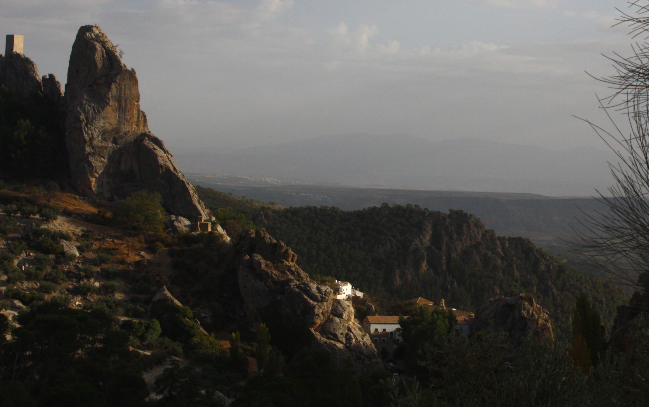
The rest of my day is mostly steady dirt roads. The landscape is constantly engaging, and that goes for the whole of the Sierras de Cazorla, Segura y Las Villas Natural Park. I’m in awe with how the structures of the valleys, peaks, bowls and various undulations entwine.
There were also some fun loose bits!
But alas, it wasn’t all smooth sailing. The whole day I’d been making for ‘Belerda‘ on my map, in the knowledge that there was a campsite nearby called ‘Camping La Bolera’. An easy mistake to make (if you’re an idiot) but no, Belerda and La Bolera aren’t the same place. Ah well. After a bit of searching in the dark, I find a decent wild camping spot.
Seis:
Belerda to Refugio Casa Forestal Fuente Acero.
41.67km.
Up 1954m, down 1118m.
Day six gets off to a flying start: breakfast oats in a luscious view. Mmm. Back on the trail, the going starts slow with dramatic and unforgiving landscapes making for harsh climbs coupled with unridable descents.
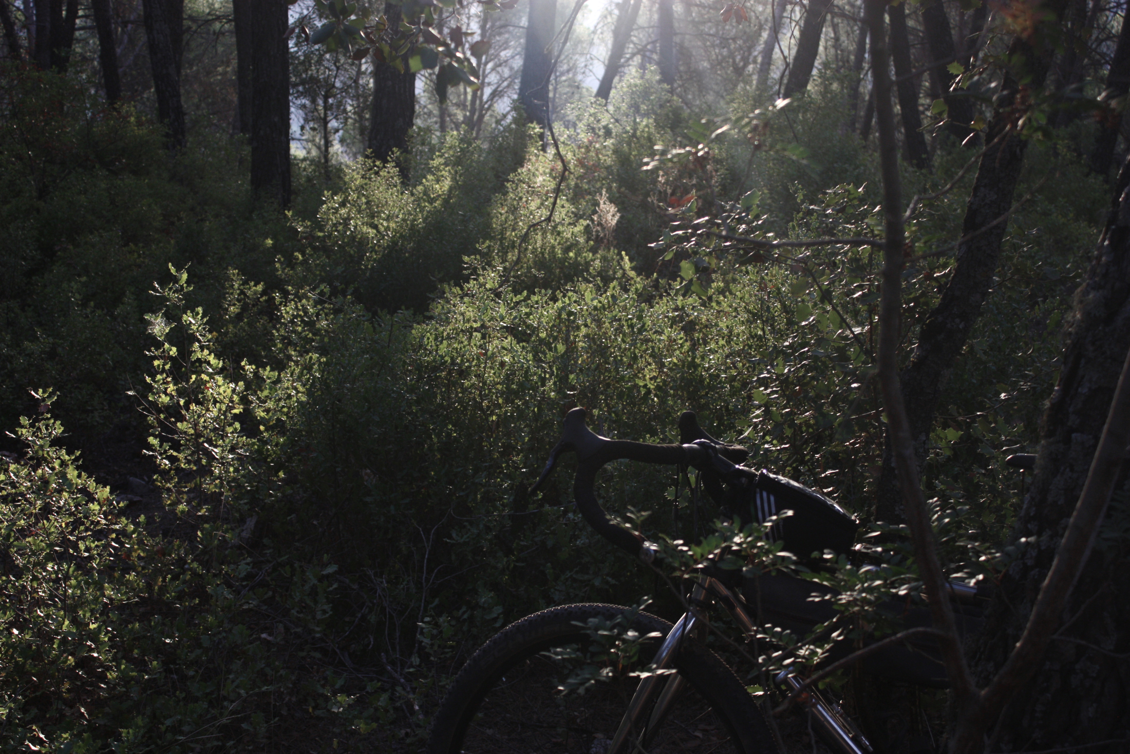
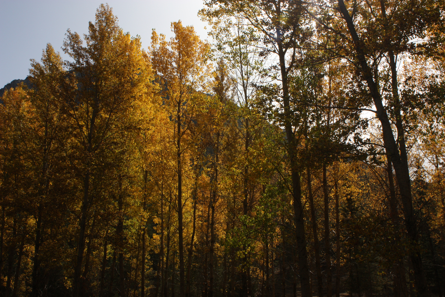
Quickly, though, I’m led into a rich autumnal forest along a riverside path. Kind gravel tracks flow gently to the sound of running water. Bliss.
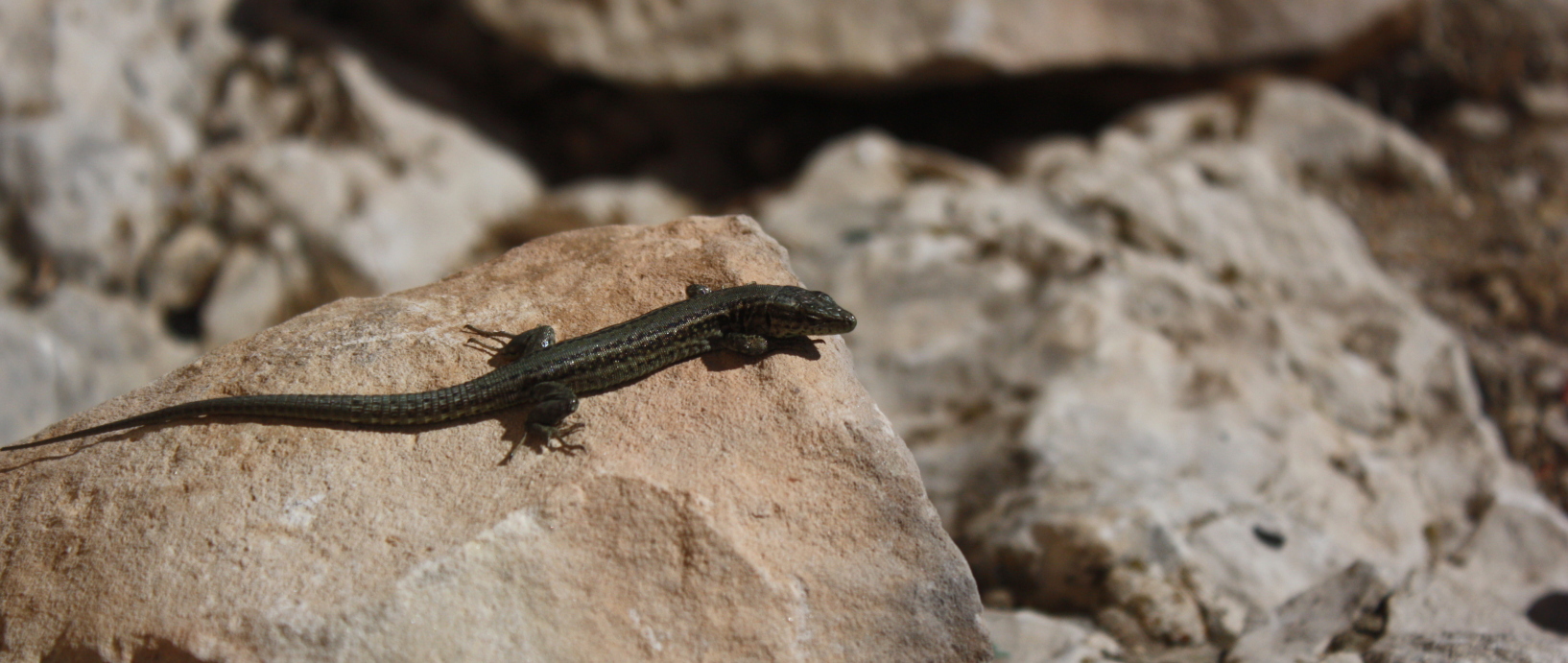
In the evening light the forest is radiant, glistening gold. Feeling contented, I follow the winding track deeper into the woods, headed for the Refugio Casa Forestal Fuente Acero. It’s a Grade A natural reserve here and this is evident—the canopy thrives with evening birdsong, many ibex cross my path, and then…
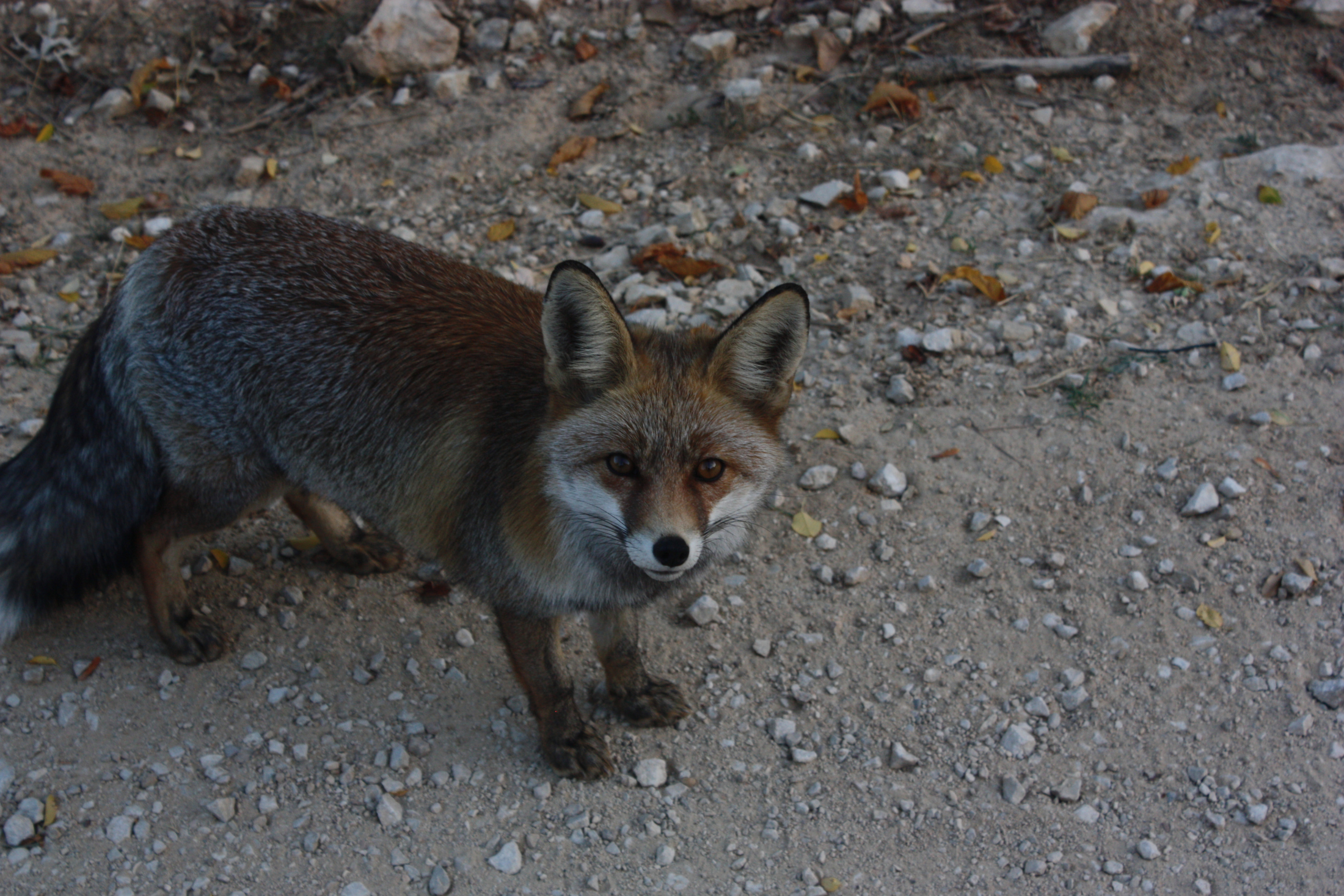
Yo! These foxes were so friendly and loved playing up to the camera.
I use the last of my day’s water on a candlelit meal for one (no fountain again), but sleep easy knowing I’ve got friends outside my beautiful refugio.

Siete:
Casa Forestal Fuente Acero to La Toba.
58.32km.
Up 1043m, down 1646m.
I get out early, and am a bit sad to leave my wildlife haven behind. It quickly becomes apparent that the scenery of today is far different—rolling hills upon vast, bleak plains are a huge change to the perpetually steep, verdant mountains that’ve made up the route until now.
Before too long I came across this fella:
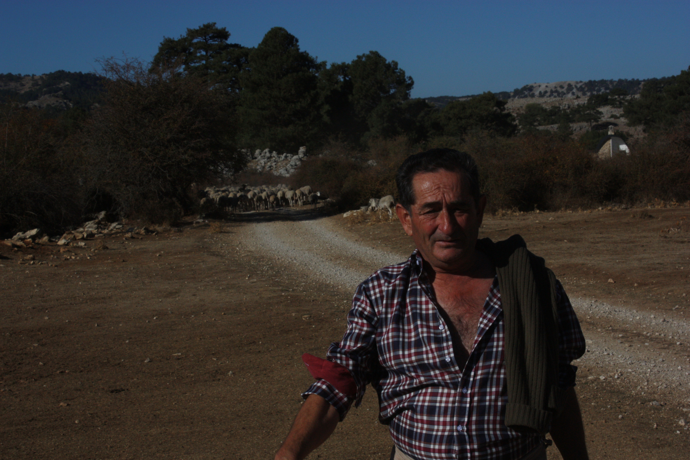
We had some laughs despite my broken Spanish, and kindly he pointed me towards the nearest fountain. After I took his photo he said “¿Esta bien? ¿Luzco bien? Ahhh, muy bien.”: “How is it? I look good? Ahhh, very good.” Sadly I didn’t get a name.
Met this guy, too!
I was fuelled by the desert-like scene here, exciting plumes of dust behind me as I quickly rampaged down the track. Bliss.
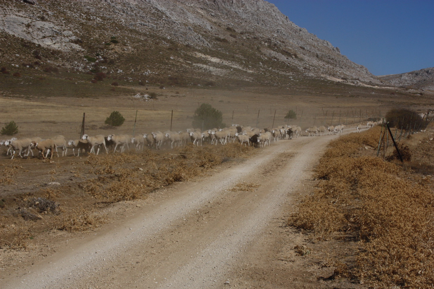
Sheep as far as the eye can see! They appeared from nowhere with rackets of collar bells regularly.
To give you an idea of how much bloody food I was lugging around, only today on day seven did I need to resupply. I reached Pontones late afternoon, found a nice cervecería, hung out with some tapas for a bit, and then did my shopping. The place was perfectly representative of the towns on the 247: beautiful, friendly, and with the whole place ghostly silent until you reach the local cervecería, a social hub housing what seems to be the entire community.

I camped just down the road at La Toba, in a lovely riverside controlled camping ground.
Ocho:
La Toba to Refugio Era del Fustal.
26.95km.
Up 1357m, down 991m.
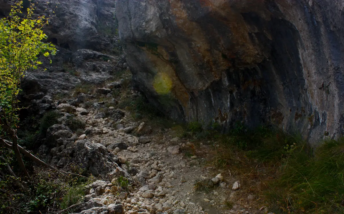
Although it was one of my smallest days, day eight definitely was the hardest. The terrain was mostly unridable:
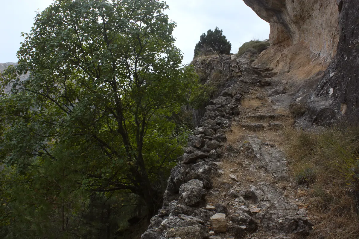
On sections like these, the trail gives a firm reminder that it was designed as a hiking route. But, while the intricate pathways were tricky to carry a bike up, they showed hidden depths of the mountains that one can’t see just by sticking to wider tracks.
It wasn’t all bad at all though—there were a couple of hard-packed dirt singletrack descents towards the end that could’ve been sessioned all day long!
But then the rain came in. I’d been so lucky with clear skies until now, but I had to finish up my second-to-last day in a downpour.
Nueve:
Refugio Era del Fustal to Camping el Robledo.
54.44km.
Up 1946m, down 2247m.
And still it poured. I procrastinated going out into the cold for the whole morning, but once I set off from the confines of my Refugio I was fuelled by a mad energy. The finish line was in sight.
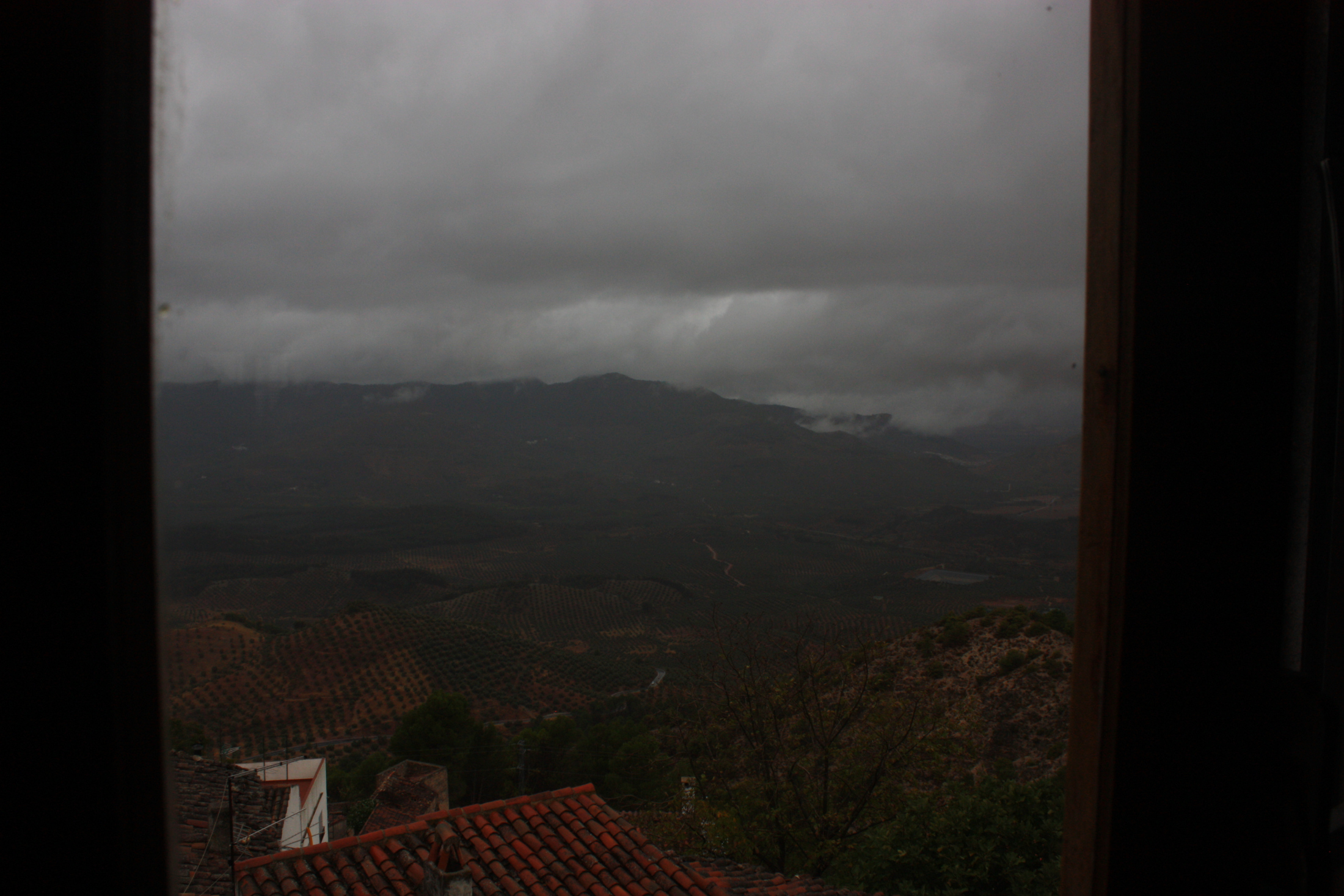
What had been a breezeless, tranquil landscape all week showed me a different side in the pouring rain. Ominous peaks hiding behind dark, thick cloud stared down at me for the duration of the final ride. Having acclimatised to the 30 degree heat every day, the rain was a bitter, biting cold.
Sadly, I don’t have too many photos from the last day, as I was scared to get the camera out in the wet, but got these from the window of a cafe in Segura de la Sierra. Seeing clouds littering the valley floor was a highlight of a grey ride.
A bit of a low note to end on, but a satisfying battle of a day; the route was complete in its entirety as I rolled past Refugio Casa Forestal El Campillo where I’d picked up the route a week ago. I said my goodbyes to the trail and followed a road down to a nearby campsite.
In summary:
The trip was everything I hoped it would be and more. There were a lot of firsts: first solo travel, first wild camp, first proper bikepack/off-road tour, so lots to think about, and plenty of challenges. It’s only left me wanting more. I loved the pure freedom of travelling alone, and although it wasn’t as fun as it could’ve been with a friend, the whole experience was a getaway from everything and has stuck with me.
The Andalucían people were consistently friendly, always making efforts to help me out despite the language barrier. Many thanks to the staff at: Camping La Montillana, Camping el Robledo, Cabañas de Madera El Cerrillo and Hotel Avenida Beas de Segura for all their patience with the bedraggled smelly boy who spoke very poor Spanish.
Some notes on the trail, if you’re thinking of doing it:
- Do it, it’s really really good.
- Don’t get hung up on stages/kilometres per day as they vary massively in difficulty! The trail website has information about which stages contain hike-a-bikes.
- You will have a hard time on a gravel bike. Although the Sven I’ve done it on may look like a gravel bike, it’s very much in the drop-bar mountain bike category. Crucial features for this trail were: the higher BB, slacker geometry, insanely comfortable ride and 2.2″ tyre clearance.
- Run at least 2″ tyres that’ll fare well on loose rock.
- Don’t use panniers—although most of the route is doubletrack, it’s frequently littered with boulders which would be hard to dodge.
- October was a great time to go for the weather, but there were barely any people on the trail and many campsites were shut. Be sure to check availability in advance.
- Contact me if you’d like any further info.
Special thanks to:
Mark Treviss-Bell,
All of my friends and colleagues at The Woods Cyclery and Forest Lesuire Cycling,
And of course, Darron Sven of Sven Cycles.