UPDATE: Reviews section refreshed, redesigned, searchable: Go take a look
[url= http://www.guardian.co.uk/technology/2009/nov/17/ordnance-survey-maps-online ]Ordnance survey maps to go online for free[/url]
and down to 1:10,000 as well. Cool
sounds good - substantially cheaper mapping for GPS users ?
I guess people like Memory Maps, Anquet etc etc dont see it as good news !!
1:10000 (OS Streetview) is already freely available online for non-commercial use , through OS Openspace e.g.
http://wtp2.appspot.com/wheresthepath.htm
10k is pretty useless for biking, no rights of way marked on at that scale.
Only potential improvement I can see from a like cycling and looking at maps point of view is that there might be 25k released in addition to the 50k available currently.
The government is to explore ways of making all Ordnance Survey maps freely available online from April.
This being the same government that was looking at ways of selling off Ordnance Survey last month?
10k is pretty useless for biking, no rights of way marked on at that scale.
if you care whether it's a right of way...
lots to print out on www.magic.gov.uk - has been for years as well.
By not showing rights of way, I mean that in a lot of rural areas, the streetview mapping doesn't even indicate that there is any sort of path/track nevermind whether you have a right of way along it (be that on foot/bike whatever)
It'll be interesting to see how this pans out. As someone with a day job that has considerable interest in this area, it certainly appears to be an about turn by OS. We have recently been trying to unpick what their new Pan Government Agreement for the use of OS data meant for derived data. Historically, this has included boundary datasets where an OS mapped field boundary, path or road formed part of the data. More recently, there has been murmerings that anything with a OS Grid reference could be considered derived data. This announcement should make life a little easier for some of our partners.
If the OS decide to open up OpenSpace for commercial users, it will be a bit of a fight back against Google.
1:10000 (OS Streetview) is already freely available online for non-commercial use , through OS Openspace e.g.
I see no maps below 1:50000 there 🙁
What scale are the maps used on sites like bikehike?
Simon - try zooming in on the OS side of this. You can make the whole window OS if you want too.
http://wtp2.appspot.com/wheresthepath.htm <
multimap has had os maps for ages too.
[img] 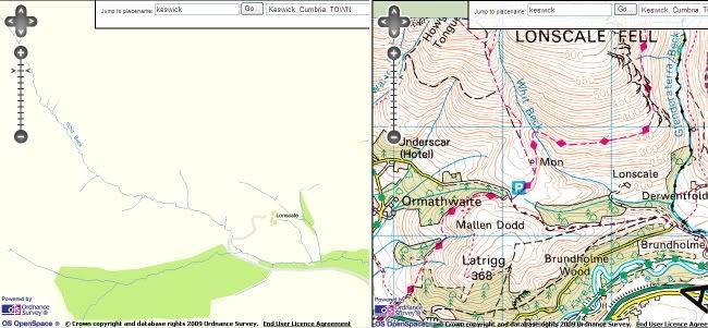 [/img]
Looking at Lonscale in Streetview (10k) and 50k, and hopefully you'll see what I mean about it not being much use for off road biking
having looked at most of the OS mapping sites, they use little squares and trying to rip them off is a pain, i believe some of this is down to the licences and designed to inhibit people "stealing" the data.
If the maps are free to use there is no reason to restrict what is seen and printing off any map you like should be a lot easier.
And I've paid all that money to Viewranger 🙁
mrmo - Memberhaving looked at most of the OS mapping sites, they use little squares and trying to rip them off is a pain, i believe some of this is down to the licences and designed to inhibit people "stealing" the data.
If the maps are free to use there is no reason to restrict what is seen and printing off any map you like should be a lot easier.
Yep - that was my angle on this as well. 1:25,000 maps where you can print off enough of an area to cover a single route/loop - rather than having to buy (and take with you) a whole OS map. I find 1:50,000 maps pretty difficult to navigate with. Never tried 1:10,000 so now know from above^ that they're no use for biking
Looking at Lonscale in Streetview (10k) and 50k, and hopefully you'll see what I mean about it not being much use for off road biking
but the real 10K maps have far more detail - what you have there is a very crude susbset of the data
they use little squares and trying to rip them off is a pain
using the little squares:
[url= http://www.bogtrotters.org/route/showrouteframe2.php?route=231 ]http://www.bogtrotters.org/route/showrouteframe2.php?route=231[/url]
But the 10k product they're talking about releasing is streetview. 10k raster is no use for outdoor stuff in my opinion, no contour lines
If the maps are free to use there is no reason to restrict what is seen and printing off any map you like should be a lot easier.
All the talk I've seen has been about [b]making all Ordnance Survey maps freely available ONLINE [/b]
So I see no reason why they'd change the setup that would let you download them more easily
It's about rights. They are effectively relaxing the restrictions of crown copyright. About bloody time since we, the taxpayer, paid for it.
"the online maps would be free to all, including commercial users"
So Anquet, Harvey etc and other commercial users (that means you) can exploit it.
1:2500 is the scale you want for riding 1:5000 at a push.
[i]1:2500 is the scale you want for riding 1:5000 at a push. [/i]
You'll be carry some serious amounts of paper on a ride.
[i]You'll be carry(ing) some serious amounts of paper on a ride. [/i]
Too right. I've just nipped into town (5 miles) and at 1:2500 I'd need a map about 3m long 😉
About bloody time since we, the taxpayer, paid for it.
Pay for it more than once as well, seeing as the OS then charges councils/police/fire etc for the data
ebygomm - exactly right.
It's not like I never bought OS maps - I own about 60 - but I always felt I was buying the printed product, not a licence to use the data it contained.
The OS was commercialised and our survey data given to them on a plate, with crown copyright to protect it. It was protectionist and anti-competitive at a time when there was an explosion in the demand and use of mapping. It's a credit to Harveys/Anquet that they embarked on their own excellent surveys is direct competition.
People have been illegally pinching and using OS data from multimap and streetmap for ages. I have viewed this as a "moral right" because of the way the surveys were funded.
It now means that we can make our own cycling maps and sell/publish them, based on OS survey data, without licensing and without fear of prosecution. Hooray!
as mentioned before www.magic.gov.uk is good, it also has tools for measuring etc... ok not got all os data on it, but handy for looking at and measuring routes it works well
and at any scale you want... here are are some screen dumps at std scales
1:2500 , 1:5000, 1:10000, 1:25000 - start of Cardingmill valley, stretton
[img] 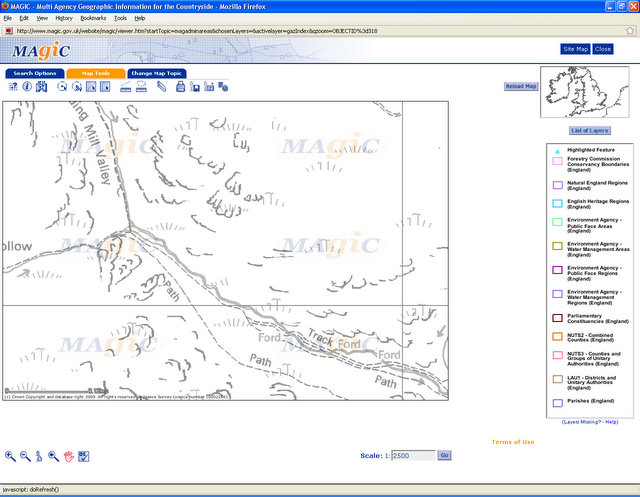 [/img]
[img] 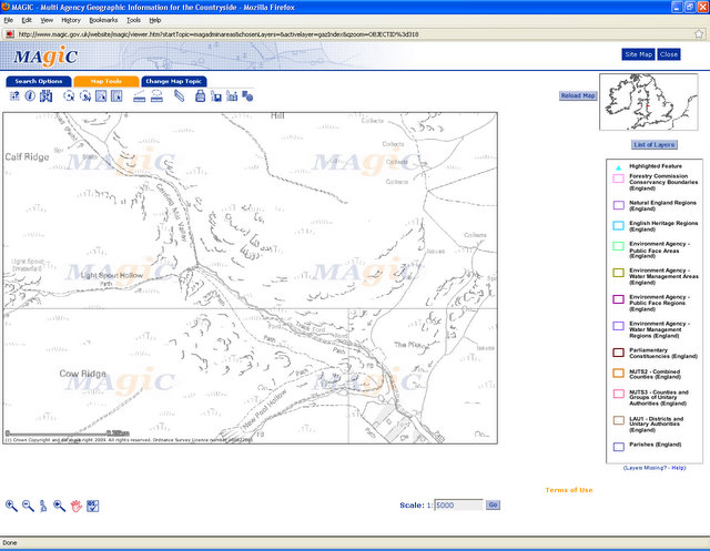 [/img]
[img] 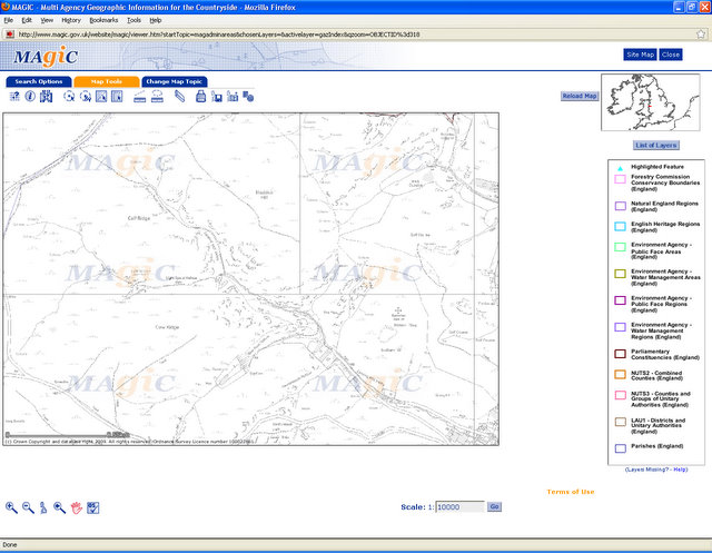 [/img]
[img] 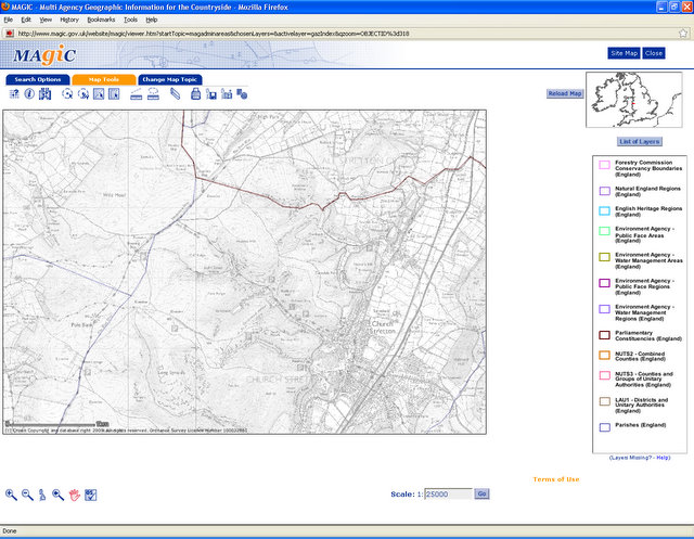 [/img]
Did we the tax payer pay for the making of OS maps
Or did we the map buying public pay for OS maps?
Taxpayers paid for the surveys - the data we see represented on maps.
It seems reasonable that the style of representation - symbols, datum etc - belong to OS since they designed it. When OS sell printed maps and electronic mapping products, that seems OK too because they made them.
But the survey data are ours and should be free to use and exploit. That's what this is about.
Did we the tax payer pay for the making of OS mapsOr did we the map buying public pay for OS maps?
Yes, no.
Basically paper maps for outdoors people are just a small part of their licensing of the data. Much of their money comes from charging companies (and other bits of government) masses of money to use their data. At a ridiculously high cost.
Joe
Hopefully, then, this could leave the way open for iPhone apps similar to ones used in the US, where you can buy a cheap app, then download whatever section of map you need for a particular need; a hiking holiday, offroad bike riding, so the map is installed in the phone for full offline use. That would be fantastic, the whole of the USGS is available free, so this has me getting quite excited. If this happens next April, it'll coincide nicely with my phone upgrade; my current 16Gb 3G is nearly full up...
Nobody's mentioned Bikehike? It's got free access to multi-scale OS maps that you can combine with Google maps and aerial shots, and can be used to plan routes (showing elevation profiles as well). Bit slow and clumsy to use though but otherwise pretty superb.
