[img] 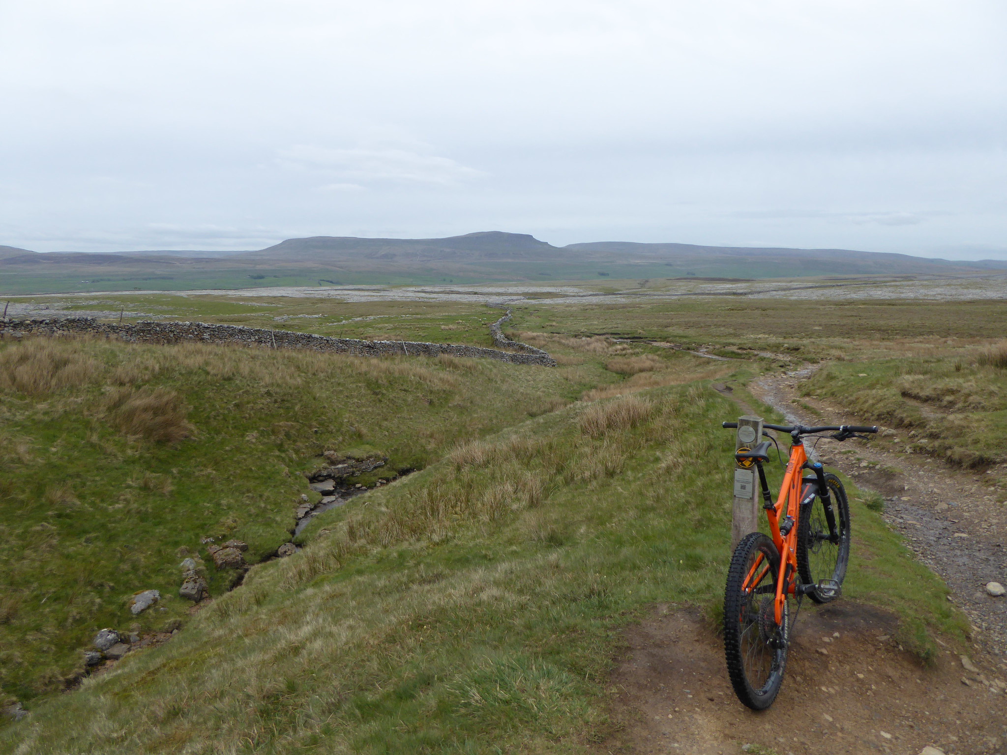 [/img]
Where is that?
Sulber ?
Looks ace. Love the Dales.
Has rained regularly over the last few days, but haven't seen even a nod of extra water down the river Aire, so must be very dry up there. somewhere near whernside I'd assume?
With all the trees now in leaf, I think a lot of the rain has been taken up by vegetation. We've not really had heavy rain, it's still dry under trees after showers for example.
The shot above is on the descent from Ingleborough down to Sulber Nick.
[img]  [/img]
Swaledale / Arkengarthdale was bone dry last Wednesday, arid even. Its rained quite a bit here in Skipton over the past couple of days but hoping to get out tomorrow so fingers crossed things are all good up on top.
That good news as i am hoping to ride round kilnsey/arncliffe cote tomorrow
That good news as i am hoping to ride round kilnsey/arncliffe cote tomorrow
Nice riding up there. Are you going up Mastilles Lane or down it? I actually enjoy the descent down Arncliffe Cote more than Mastilles so usually do that loop clockwise.
I wouldn't climb up from Arncliffe Cote even when it's dry!
I'm hoping to be out and about tomorrow as well.
Lowey: you have the right area but whitestone has got the path.
Good day for that particular trail, Pennine. 🙂
I've done the Arncliffe Cote climb a few times but it's better as a descent. It was very bumpy last weekend due to the cows having been in the fields and their hoof prints have hardened. Not fun on a rigid bike!
I wouldn't climb up from Arncliffe Cote even when it's dry!
I made that mistake last June the first time I did that ride. It wasn't dry, there was a huge bull surrounded by cows with calves in the middle of the bridleway, and I took a wrong turn and got shouted at by a farmer for riding past the bridleway bit on the Monk's Road. 😆
got shouted at by a farmer for riding past the bridleway bit on the Monk's Road.
Yes, he really doesn't like that. 😀
Is that the one at the Malham end or the Arncliffe end?
Doing the Arncliffe cote as a descent, we are approaching it from Conistone bridge. We usually do mastilles lane descending too but last time we did it the other way and its a brutal start to a ride getting up there.
Went to Hetton last week and up to weets top and it was bone dry, even the almost always boggy parts were dry.
its a brutal start to a ride getting up there
[img]
 [/img]
Is that the one at the Malham end or the Arncliffe end?
What, the farmer? - the one at the Littondale end of Monks Road is traditionally the unhappy one, where the track somehow turns from BW to FP in the middle of nowhere. You would have thought the name 'Monks Road' would have been a clue to its correct status.
Haven't been down that way for years though.
Yes, meant the farmer.
When you look at the map, the Monk's Road changes status at the parish boundary. It's not only bikers who moan about it, local horse riders aren't happy either. Another BW that stops in the middle of nowhere is the one over Sand Gate.
Yeh, Sandy Gate. Trail is pretty much non-existent even for foot traffic on the Nidderdale side these days, which I guess is what the landowner wanted. Did mean to go up there when it was dry to see if I could find it.
martinhutch - Member
I wouldn't climb up from Arncliffe Cote even when it's dry!
We do that climb at least once a summer, usually with me protesting.
Last summer We climbed from arncliffe and descended monks road (first time). tbh we won't be doing monks road again, didn't see a farmer thankfully.
We had a concentrated push to get Monk's road upgraded about 10yrs ago! I've spoke to area rangers of Nidderdale AONB about Sandy Gate but land owners are against upgrading to BW status. IIRC it was something to do with horses rather than cyclists.
Don't suppose any of you have links to strava or other routes for what you describe above? I spend 99% of my time road riding and my knowledge of the bridleway routes round here is poor!
[img]  [/img]
This is the Mastilles Lane - Arncliffe Cote ride. The Monks's Road is the red track that comes off the main route near to Malham Tarn.
If you want any .gpx files for decent Dales rides then feel free to message me on here. I've got quite a few.
Wonderful - thanks v much.
The shot above is on the descent from Ingleborough down to Sulber Nick.
Naughty, naughty.
What's the climb like then, lots of pushing or rideable? (I'm presuming from ingleton, prols done it in the distant past but can't remember)
@bainbrge - it's worth getting a map, either OS or Harveys as there's quite a network of BWs and tracks in the Dales. The area bounded by the roads linking Settle, Arncliffe, Kilnsey, Threshfield, Hetton, Airton, Settle (which includes the above route) has lots that can be ridden at most times of the year.
Most of the BWs can be ridden in either direction but obviously some are better as descents - the Arncliffe Cote descent for example. Sometimes you need to do a bit of road to connect things up.
B.A. Nana - Ha ha! If you can ride up the BW from Ingleton then your name is Danny McCaskill and I claim my £5. The top 100m or so is basically jumbled rocks that are hard enough to walk over, curious as to why it was designated a BW - the route that the Three Peaks Cyclocross race takes would have been better.
So other than the chance to piss off a farmer, is that Monks' Road worth riding? We usually do arncliffe cote on the way over to Littondale, back either up mastiles or further north at Litton up to Dawson Close (that's returning to Settle rather than Malham tarn).
I'm not sure it's worth the aggro, personally. Quite a lot of typical limestone grassland. The best things about it are the views over into the valley and Cowside Beck.
I've run along it, a long time ago, from memory it was a grassy track probably wide enough for a quad bike that contoured above quite a steep hillside.
[img]  [/img]
The final drop into Arncliffe was steep and would be interesting on a bike but not worth the rest of it or potential hassle.
[img]  [/img]
[img] 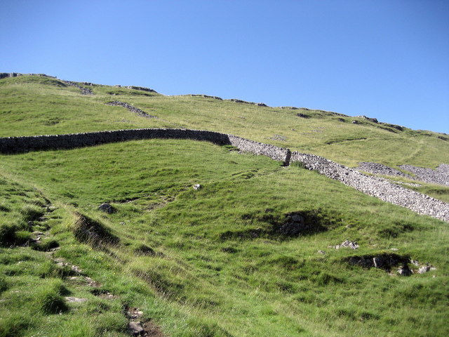 [/img]
That takes me back. I pushed up that Monks road on a Townsend mountain bike in 1986 with a water bottle gaffer taped to the frame. Got some funny looks passing the farm on the way to Malham tarn.
we did it last year and decided not to bother again. there's much better paths to ride in the dales.
Its not worth riding Monk's Road on the bike, unless you've ridden all the trails round there and are looking for something different. As mentioned above there are some really nice views so worth a walk on a nice day.
Just to confirm from this morning's ride, the trails are still nice and dry in most places but the boggy parts are a tiny bit boggy after the past few day's rain so still had to give the bike a quick wash after.
Just to confirm from this morning's ride, the trails are still nice and dry in most places but the boggy parts are a tiny bit boggy after the past few day's rain so still had to give the bike a quick wash after.
Ground is actually faster than last week with a little bit of moisture.
Any good technical bits in the Dales? I've always found the riding there very pleasant but not enough gnar for my enduro fun-sponge. 😉
[url= http://radventure.cc/the-road-not-taken/ ]The Dales makes more sense on a gravel bike imo[/url]
Any good technical bits in the Dales? I've always found the riding there very pleasant but not enough gnar for my enduro fun-sponge.
Probably Swaledale is your best bet, although most of the bridleways are more fast and flowy singletrack than tech.
What is the route up from Clapham called (past Thieves Moss)? I rode that on a rigid hardtail every day of a summer spent mapping the vegetation of Sulber. I would love to go back with a more comfortable bike
That's Long Lane up to Sulber Nick (which is actually further on than Thieves' Moss)
Loads of good riding round there, all right out of my door. Started Strava-ing only in autumn but many routes on there. Username Highbark.
When I say out of the door, I mean who wants to live in a house like this..... http://www.jacksoneditorial.co.uk/2928-2/
[img] 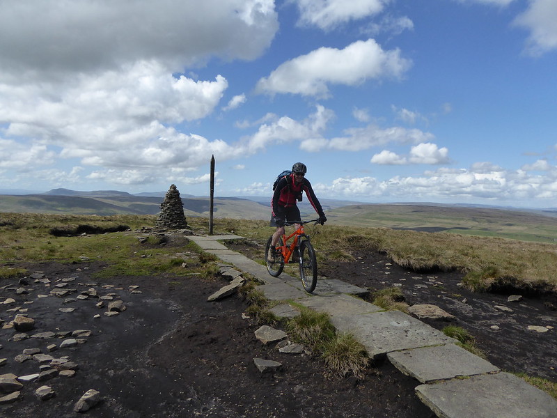 [/img]
Another ace day in the dales. High level route from Kettlewell to Buckden Pike. The usual bogs & peat hags are all rideable (but for how much longer?)
Any good technical bits in the Dales? I've always found the riding there very pleasant but not enough gnar for my enduro fun-sponge.
There are, but they tend to be either cheeky or hard to build into the kind of loop you see in places like the Lakes and Peak.
The descent off the back of buckden pike has been spoilt since they put in a load of water bars, many of which are too tightly spaced to bunny hop.
The Dales makes more sense on a gravel bike imo
Great article, thanks for posting.
