For those that have shown interest in the past, this is just a wee heads-up that the water level in Loch Loyne should soon be approaching the minimum and the flooded bridge should be exposed.
[img] 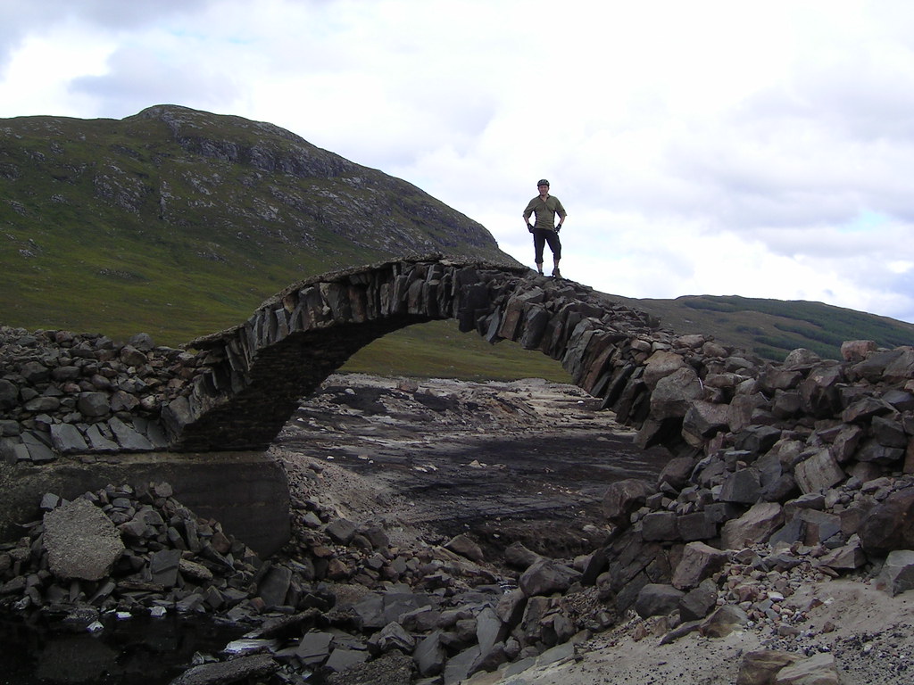 [/img]
If you want to do a Tomdoun-Cluanie route, best make plans....
http://www.flickr.com/photos/druidh2000/sets/72157607210625132/
I was only a nipper back in the early eighties, but I remember my old man taking me up to Lagan to show me how low the water was and onto another loch that Alcan used for the hydro up there.
Caused havoc that year at the smelter. Pretty sure that was the year of strikes as well.
druidh, looks like a nice route. Didn't even know it existed, in spite of the fact I've walked the first bit when doing the South Glen Shiel Ridge.
I'm out on tour most of next month, can't decide whether to take my road tourer or my mountain bike. Anyhow, question for you - could I get the road tourer along enough of that to make it worthwhile? It copes well with fire roads as long as the surface isn't too loose. I'm not afraid of say 1/3 pushing and carrying.
Road tourer would be perfect actually. Most of the tarmac is still in place. Other than the wee bit through the drowned section you'd be fine.
Thanks druidh - I owe you info in exchange!
Hi Druidh,
Do you know roughly what date the Hydro board start to lower the water and also what date they start to raise the level again ?
No specific dates I'm afraid. I chased and chased but no one in the Hydro could provide me with any information.
As I understand it, the water level should be constantly falling through the summer and they want it low so that it can capture lots of rain during the wetter months. So, it should be pretty low now, falling further and filling up in October some time.
The only ways I can think of confirming this are;
[*]Find a local who passes along the A87 and ask them to check it out with a pair of binoculars[/*]
[*]Contact the Tomdoun Hotel. They have a key for the gate across the access road and loan it to passers-by who want to look at the bridge. They should be able to provide you with a reasonably up-to-date assessment.[/*]
Hi Druidh,
Thanks for the information, three of us are trying to organise this for the weekend of the 17th Sept. I'll give the hotel a phone so fingers crossed.
Many thanks
