From the Singletrack archive: this Classic Ride first appeared in Singletrack Magazine Issue 111 (2017). Words & photography by Barney Marsh. Details in The Knowledge section were correct at the time of publication.
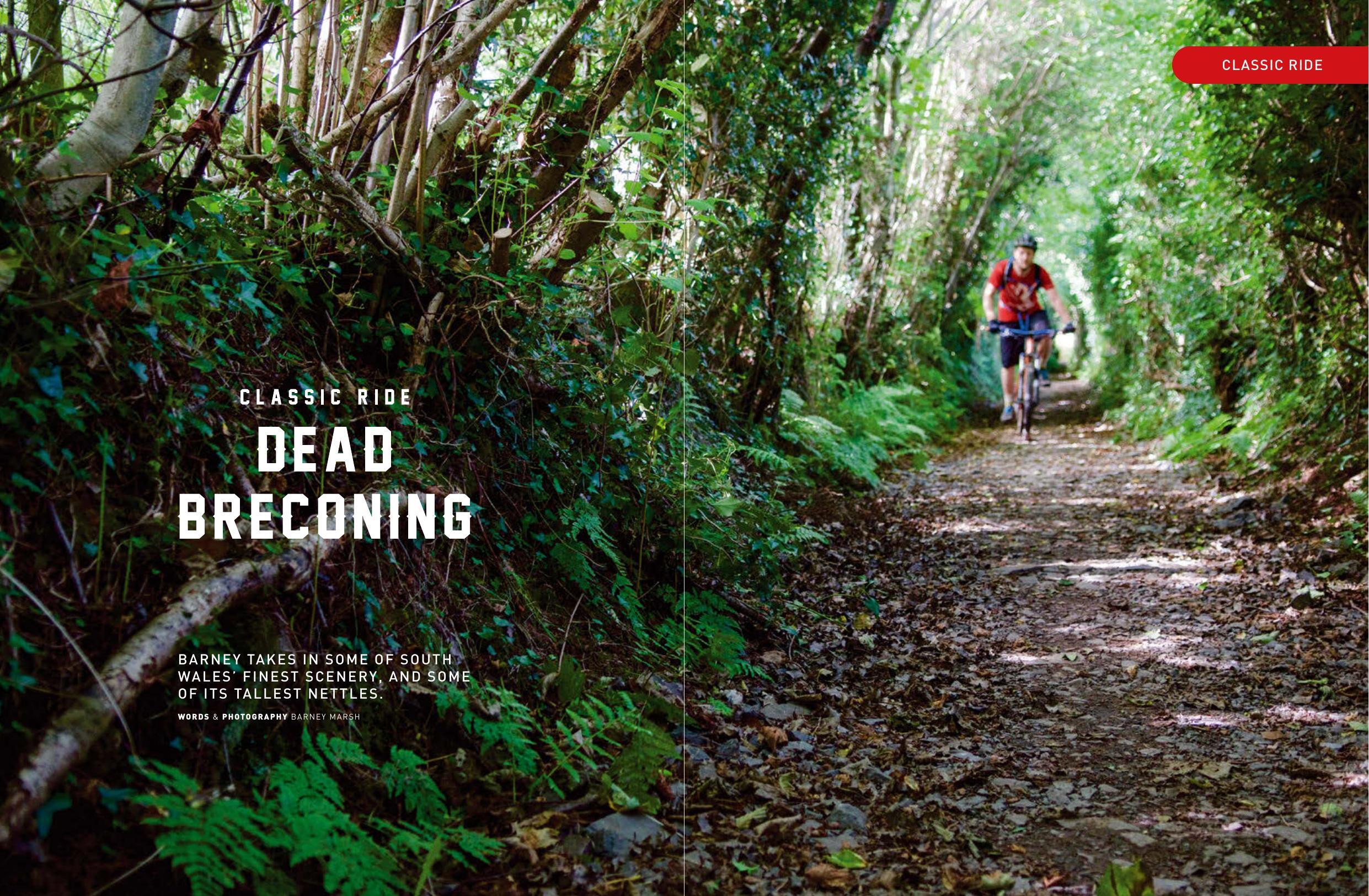
Barney takes in some of South Wales’ finest scenery, and some of its tallest nettles.
It’s a surprisingly long drive, all the way to our South Wales campsite from Yorkshire. It takes many hours of hideous motorway torpor, punctuated by dead-eyed service station coffee, and huge great tranches of 50mph roadwork drudgery. So it’s a welcome relief to kiss the churning motorway goodbye, and head out into the hills, which glow fire-red, amber and green in the setting sun. Much more exciting.
Thanks to those motorway ‘entertainments’, Antony and I arrive at our campsite a good couple of hours later than we planned. We’re forced to pitch our tents hurriedly by torchlight. The stars emerge, quietly magnificent, but powerless to cast any but the most feeble light on our frantic pole assembly and fabric draping. The hurry ensures we’ve enough time to scamper to the pub for food, and the inevitable beer means we don’t notice quite how poorly we’ve pitched our tents until the next morning.
Under false pre-tents
We are awoken by the plaintive calls of a herd of trainee soldiers, who are no doubt looking at the mess of fabric and metal we’re sleeping under with profound derision. So we blearily disassemble our sagging tents, and attempt to assert ourselves on the morning by making coffee (in bowls – I’d forgotten my mug), desperately pretending it’s not autumn.
We are rewarded, though, by a glorious day – eventually. Local rider Scott joins us, and a quick group huddle serves to bestow as much warmth as wisdom. We decide to start our pico-adventure in the nearby town of Talgarth – mostly because it is somewhere we could feasibly get breakfast before we start. There are only so many bowls of coffee I can drink before I need to soak it all up with something (preferably bacon flavoured), followed by a nice long sit down…
Suitably toasted up, we duly set off from Talgarth and spin our way leisurely southwards. The sun looks almost enthusiastic as we head down our first bridleway of the day towards Penyrwrlodd. It’s a close structured thing, this trail; hedges and trees loom ominously overhead as we pedal up the gentle incline, but the gradient coddles us with feelings that this will be a piece of cake. Isn’t Wales supposed to be lumpier than this?
Hills? What hills? Oh, there they are
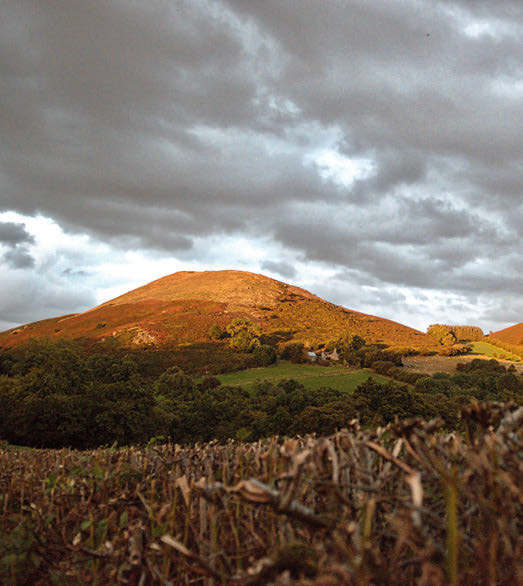
It’s only when we emerge from the trail onto a metalled road that the hills become more obvious. In the occasional tunnels of vegetation that crop up in these parts it’s easy to imagine that you’re somewhere with a very different geological profile – Dorset, perhaps. But regardless of the lies our brains tell us when they’re not directly confronted, the hills of the Brecons are very different to those in the north of Wales. Much less pointy, for one thing. More verdant. A bit, well, softer in aspect – although perhaps not so much when you’re grinding up them. And so we head towards the very steep looking grassy lump that is Mynydd Troed (or ‘Foot Mountain’).
Like headbutting a cuddly toy only to find it’s stuffed with billiard balls.
Happily, and appropriately, our route skirts the base; soft and green Foot Mountain may be, but climbing it yields plenty of pain… like headbutting a cuddly toy only to find it’s stuffed with billiard balls. So we merrily carve our way through the trail and the bracken, gently climbing at first, then more steeply, before taking in an all-too-brief top-drawer undulant descent.
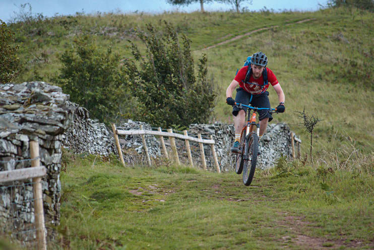
Inevitably, though, things soon get painful. Our next climb is a near-vertical slab of green, which two thirds of us (me and Ant) are resigned to pushing. But Scott is the sort of chap for whom the phrase ‘fifty miles before breakfast’ isn’t an utterly horrific concept, and of course, he cleans it. It’s all I can do to get the long lens on and shoot off a few photos before he disappears from view around a rocky outcrop, and even that puts me out of breath.
At the top, however, we’re rewarded with some spectacular views, and – joy of joys – the sun comes out. It’s not exactly the south of Spain up here temperature-wise, but the sunlight is enough to recharge our batteries and put a little pep in the pedals as we head on down to Blwch.
Hooting good
The descent here is a hoot. There’s very little in the way of technicality, but it makes up for that in speed, exhilaration and views. The trail is wide, occasionally rutted, and very, very fast.
At what feels like 40mph, we pass ancient cairns; stones thrusting upwards in an exclamation mark – the precise meaning of which has been lost, but we don’t care. Waymarker or remembrance stone? It’s part of the landscape’s overcoat; part of how the landscape looks, sure – but not part of how it feels. We can better assess that by letting our tyres run their frantic burr over the ground, and thrill at the brief seconds of silence as we jump the little imperfections that make up the true face of the hillside. And then, all too soon, we are threaded into a steep, narrowing, bracken channel, faster, step down, faster, before an abrupt decelerate through a gate, and we’ve arrived in Blwch.
This small village used to be a prominent stopping place in the Brecons, part of the turnpike road from London to Carmarthen and Fishguard (and thence to Ireland). Once, weary travellers would alight here for rest and recuperation, and perhaps to wonder as we did about its pronunciation, and stagecoaches would change their horses. There were nine inns, even more alehouses and a thriving community. But now its heyday is long gone, and we found a sleepy intersection, with one pub (closed during the day) and one tiny village shop.
Sadly, even this precarious status quo is about to fail. It seems there isn’t enough passing trade to keep the little store open, and so its chocolate, ice cream and sandwiches will all go the way of the dodo. So if you’re exploring this route, bring your own sandwiches – you’ll need them by this point.
Suitably fortified
A mild back-road spin takes us to the start of another climb. The bridleway starts surfaced and the trees either side crowd over us, curious. This is a Roman Road – one of those paths that stands as testament to ancient needs and ancient traffic. Wheels much more primitive than ours no doubt rolled along the same path, and it’s likely wheels vastly more advanced will roll along it in years to come. These paths are as inviolable as they are ancient, and this one creaks and churns its way up the hill with us. Presently, as we crest the summit of Allt yr Esgair, we find the reason for the road. A Roman fort once sat, proud and mighty, atop the ridge, although now the only evidence of its existence is a few sandstone rocks that have seamlessly integrated themselves into the surrounding environment, and a couple of helpful plaques which point out the history of the ridge and where the fort once stood, although the fort itself is hard to imagine. Two thousand years will do that.
It’s a gorgeous vista, of this there’s no doubt; the hills drop onto the valley floor as if it takes them by surprise; the River Usk below meanders so violently it’s likely that in a few years oxbow lakes will festoon the valley bottom like thrown rice as the river desperately struggles to make a straighter course. But we must find our way down the other side of the ridge, and so we do, along some hugely fun trails, wide open and fast at first, and becoming much more enclosed and thrutchy lower down. The Three Rivers Ride, the mysteriously map-named last portion of the trail before we hit the road once again at Pennorth (it crosses no rivers; nor are any in sight), is a lot of fun indeed, with a particularly nadgery move towards the end past a large tree down a sunken trail. It’s possible to see a line where, with enough speed and confidence, you could straight-line the whole thing, and exchange ten seconds of satisfying stepdown with half a second of applied ballistics, but where’s the fun in that?
And here, gentle reader, is where things go somewhat awry.
Day of the Triffids
Yes, yes, we make a wrong turn. A simple thing, really – we’re chatting a little too much perhaps, not paying enough attention, and before we know it, we’ve missed a turning, and the little snick of trail we’re supposed to be riding is a good couple of miles back. No matter, though – a swift map perusal suggests an eminently suitable-looking bridle path not far away, which will conveniently take us back onto our desired trail with a minimum of fuss. Apparently.
This is not how things transpire. As we roll towards a disconcertingly malevolent looking farm (on some weird level, I think all farms are malevolent. Although I should probably point out that this reflects more on my childhood experiences than any issue with farmers per se), we dart off to one side to find the trail, which appears to be along an ancient sunken road. Hedgerow and trees loom overhead; the trail is relatively clear, apart from sticks, branches, and a few years’ worth of debris, which suggests that this path isn’t one of the more lustily travelled in this part of Wales, but no matter, we spin on.
It’s when the thickets above our heads deign to loosen their grip on the sunlight that things become rather more tricky. Mostly because in giving up their hard-won battle for the light, the hedges give the brambles a massive foothold. And the nettles. Lots and lots and lots of nettles. And more brambles. These things are all around ten feet tall, and we’re in a sunken trail. Erk.
A lot of bouncing up and down to peer over the thicket gives enough information for us to think that this little stretch is a scant few metres long, before the tree-tunnel once again welcomes us, but, crikey, there is a lot of flailing to get there. And our thrashings with sticks, bikes and each other only affords a brief window; once we move forwards, the nettles and brambles mysteriously move back into place as if to prevent any search party from ascertaining our whereabouts. Uh-oh.
And yes, this new tunnel of trees is lovely and clear – and about forty metres long. When it opens up again, there is yet more brambly goodness, which apparently carries on for the next thousand or so miles. But lithe young things that we are (shut up!) we recommence flailing for, ooh, twenty metres. At this point my top hangs off me in rags, and Antony’s face resembles that of a man with a hundred hungry cats and a beard full of Whiskas. It’s time to beat a retreat.
So an abrupt about-face, a scramble through an extremely precarious rusty fence/rusty metal sheet/tetanus festival, and we arrive in a field full of extremely surprised sheep. Offering conciliatory ‘baas’, we eventually emerge next to the Farmhouse Of Death, and beat a very rapid retreat as we hear a chainsaw start up in the yard at our approach. It could’ve been a strimmer, of course, but my panicking mind will only accept chainsaw for an answer.
The rest of the tale then involves roads, pain, encroaching darkness, whimpering, hills, shooting daggers at the spot we should have emerged from, and eating our own body weight in food once we get back to the car. Mountain biking – always an adventure. But you can rest assured, we’ll be back for more.
Why bother?
The Brecon Beacons (more properly the Bannau Brycheiniog) are, depending on whom you ask, a range of sandstone peaks to the south of Brecon, or the Brecon Beacons National Park, which also includes ranges both east and west (the Black Mountains). Confusing, yes. But for ease, we’ll just refer to the whole lot as the Brecons. They’ve got similar geology, after all, and it’s actually hard to see why there is a distinction between them at all. There’s the odd forest, plenty of grassy moorland, more than a few mountain sheep and ponies, and plenty of tip-top riding. The military also uses it extensively for training – including the SAS, who regularly send ridiculously fit army-types on Sisyphean tasks in an effort to break them completely.
This bit of the Brecons is perhaps somewhat overlooked by some as a mountain biking destination, either in favour of the famous Gap to the west, the nearby trail centres, or in favour of the pointier and more pronounced rocks of Snowdonia. But to overlook it would be a mistake. As I’ve mentioned in the story, the peaks around here are more rolling, but they’re still extremely steep, and there’s plenty to challenge the most steely-eyed of wheelpersons, whether your predilections are upwards or downwards.
While the classic ride mentioned here isn’t the most technical (although there is technical riding in abundance in the Brecons, if you look), it makes up for it with staggering views, and old-skool riding as it used to be – not cross-country, not trail, not enduro, just riding. And it’s all the better for it.
Moreover, the Brecons are surprisingly straightforward to get to. They’re relatively accessible from the north, the south, the east – and there’s not an awful lot to the west of them, so if you’re in Swansea and you’ve not ridden there, then why not? And if you sample the Brecons and they’re not to your taste, there are always the world-class trail centres nearby. But we think this unlikely. It’s a wonderful place, and well worth a visit. Though not from my house.
The Knowledge
Distance: 37k
Elevation: 1,000m
Time: 4–5hrs
Maps: OL13 Brecon Beacons National Park (Eastern Area) (1:25,000)
Accommodation: We camped at the basic, but excellent Talybont Farm, as Talybont-on-Usk is a great central point for many rides in the Brecons, and it’s a short drive to Talgarth (talybontfarmcamping.co.uk). There are plenty of other options in the area – for B&B try hawthornstalybont.co.uk. Accommodation in Talgarth itself is plentiful – check out the Old Radnor Barn (oldradnorbarn.com).
Transport: You’re best off driving, if we’re honest. The nearest train stations are Abergavenny or Cilmeri in Builth Wells, but it’s a bit of a slog…
Food: As mentioned, the only sarnie shop in Blwch, about halfway round, is likely to be closed by the time you read this, so bring food with you. The pub (the New Inn), is also a backpackers hostel – check out their website for details of opening times and when food is served (beaconsbackpackers.co.uk). There are pubs in the small villages dotted about on the latter half of the ride.
Bike Shops: For bike hire, take a look at Adventure Cycling Wales in Talgarth (adventurecyclingwales.co.uk). There’s also bikes+hikes in Brecon (bikesandhikes.co.uk). Further afield, check out Drover Cycles in Hay-on-Wye (drovercycles.co.uk).