A cyclocross bike adventure in the Lake District
Words and pictures by Michael Burdon
First published in Grit.cx Issue 1: October 2014
It was only as I got my bike down from the roofrack and repacked my rucksack (again) that the magnitude of what I had planned dawned on me. The first phase of the ride was a route well-known to me. From the car park at Clappersgate, down and over Claife Heights to Near Sawrey, then around the bottom of Esthwaite Water and up the bridleway to Moor Top in Grizedale Forest. This was all done in glorious sunshine and with a modest tailwind. It was nearly all rideable, save for some rocky climbs that crop up occasionally and are too technical for me when riding a ‘cross bike.

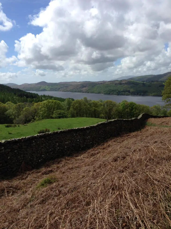
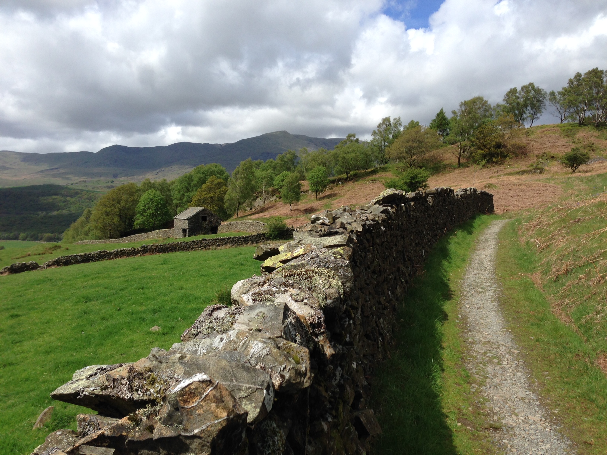
From Moor Top, I followed a series of fire roads to a cracking bridleway descent through tall conifers down to Lawson Park and past Brantwood to Coniston. The weather was beautiful and sunny. Given the time of year, and that the sun came after the inevitable Lakeland rain, the colours of the landscape looked as if they had been given the Instagram treatment, with vivid greens and browns glowing against the grey of the slate on the Old Man. Going through Coniston, it was gone 2 p.m.; I had munched on a few cereal bars and a banana but was still peckish, so I stopped for a sandwich and to top up my water bottle.
I was grateful for the food and rest as I set off towards Torver into a strong headwind. The steep road climb up Hummer Lane was hard work, especially when rolling on heavy Schwalbe Landcruisers, carrying a rucksack and riding into the increasing headwind. The summit coincides with the entry into the forest at Broughton. It is worth pausing at this point as it’s around now that the character of the ride (and the Lakes) changes from the carefully manicured, bustling, well-populated Lake District to the quiet, isolated, mountainous Lake District. I much prefer being on the latter side.
The Pub and Beyond.
The drop down to Seathwaite along a well-trodden mountain bike route is mostly rideable. I’ve done it before and know there is a choice of two bridleways after the drop to Stephenson Ground: either gradually up a rideable bridleway to the foot of Goat Crag and down a rocky path to the pub; or up to the Walna Scar bridleway via the disused Quarries before dropping down to the pub. Alarmed at the prospect of some unnecessary climbing (and a frightening descent), I decide to take the straighter of the two routes. There is one section of bridleway that is too rocky to be rideable on a ‘cross bike unless you’re Danny Macaskill, but it is an exhilarating drop to the pub.
Did I mention the pub? I had in mind that I would enjoy my first pint in the Wasdale Head Inn, so it was a struggle to settle for a Coke at the Newfield Inn. It was also after 3.30, and I still had two valleys left to traverse, so I pressed on.
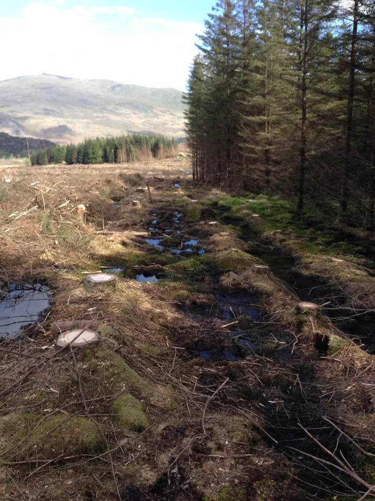
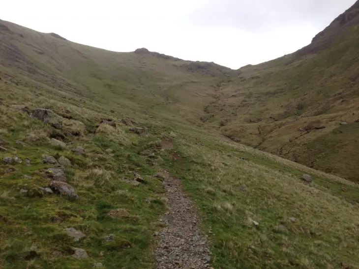
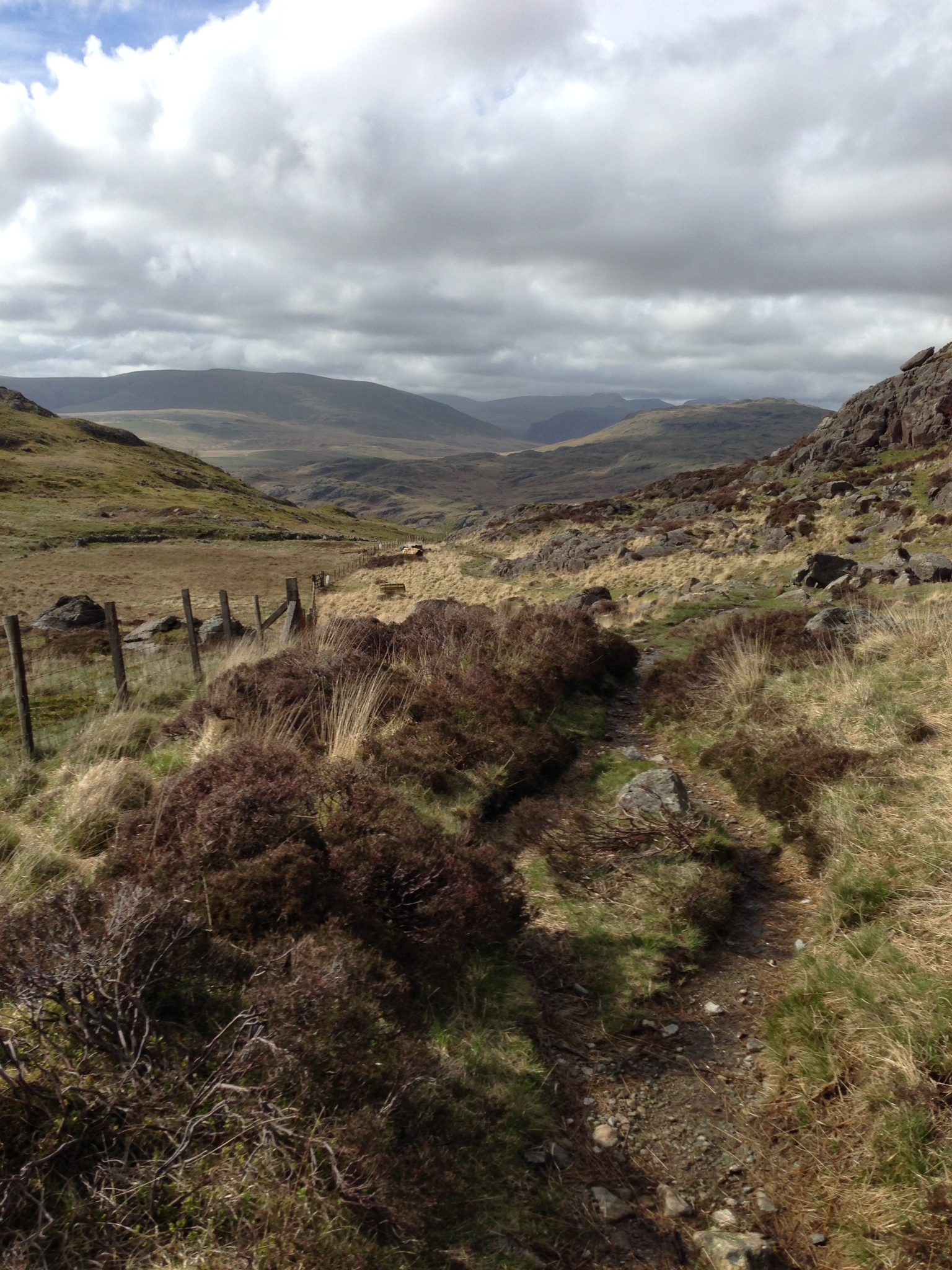
From here it was a journey into the unknown for me. I’d looked at the green dashed line that connects Seathwaite with Eskdale for a few years, but had no idea how rideable it would be. The answer is, not very. Once I’d located the bridleway and crossed the stepping stones over the fast-flowing River Duddon, the path went steeply up through crags set in a dense canopy of trees. It was a substantial carry with not much, if any, riding until the bridleway came out of the forest. It was here that the shape of the terrain bore little resemblance to what was facing me on the map. The Forestry Commission was in the process of redefining the size of the forest, largely by tearing most of it up. There was a sign for the bridleway, pointing to a smelly bog. I elected to follow the new ‘road’ created by the Forestry Commission machinery in the hope it would curve round and meet the bridleway higher up. To cut a long story short, it didn’t.
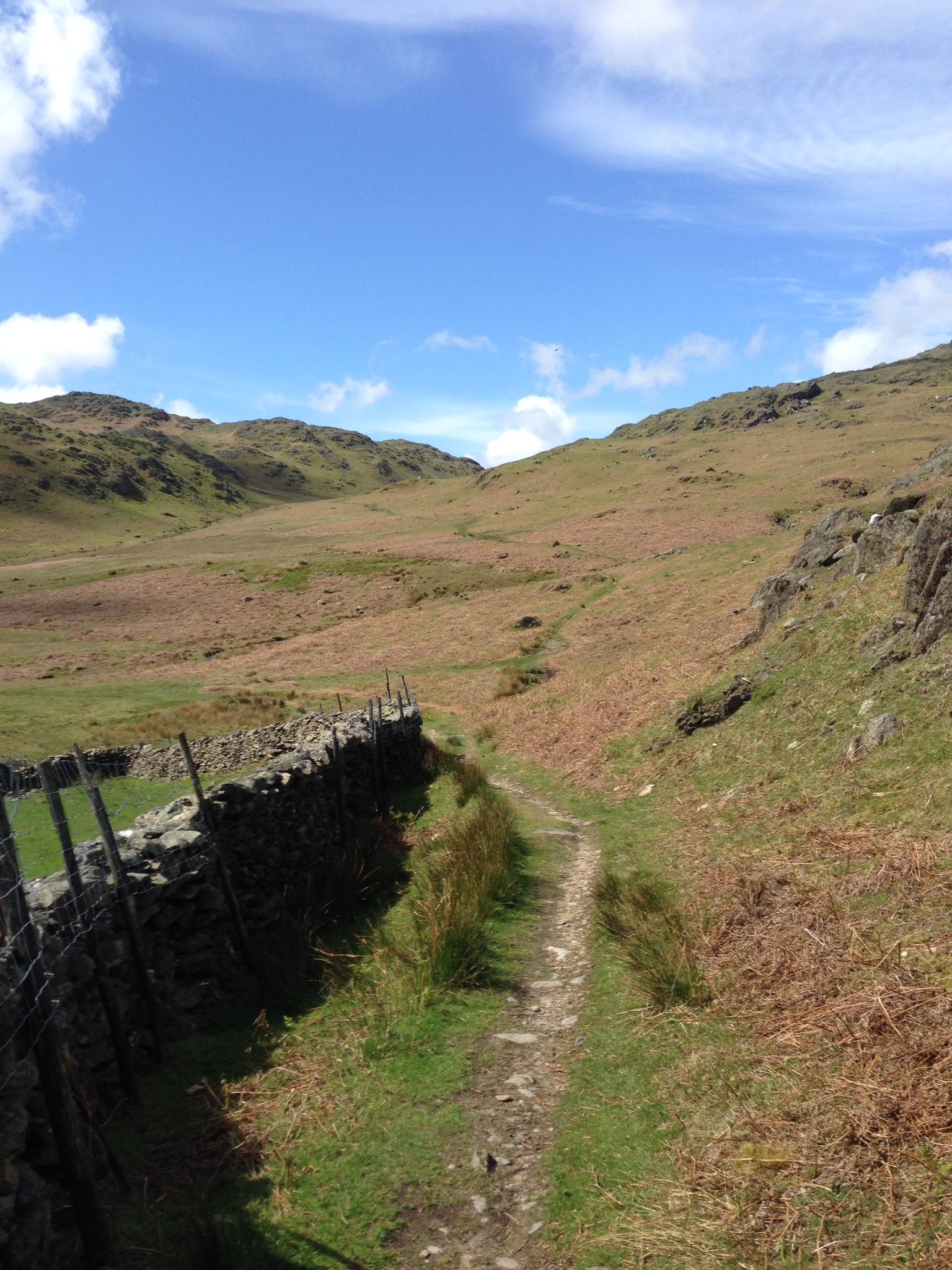
I ended up in the middle of a deforested forest, alternately falling into the boggy ditches that were forming between the newly-felled trees, and cutting my legs to ribbons on the stray tree branches. After way too long, I stumbled upon the bridleway by taking a bearing towards an easterly crag. My hope that a cracking descent would be a just reward for the hellish carry/climb were immediately dashed. A brief shallow descent followed, which was just about rideable in my advanced state of having-had-enoughness.
The next bit was probably manageable if you were wearing full body armour on one of those mountain bikes that looks like a trials bike without an engine. A chuffing carry down, on top of a chuffing carry up. Brilliant. Searching for positives to take from the previous two hours of uncomfortable hell, I found none. The bridleway came out at the 30% gradient sign at the bottom of the road up to Hardknott Pass. As I was riding the Fred Whitton on the following Sunday (it was Monday), this really was the last thing I wanted to see in my demoralised state.
Actually the climb over into Eskdale proved to be the low point of the day. I needed to do it to see if it could be done. It can be done if you view your bike as an accessory to be carried around like a shoulder bag. If I do this ride again, I would probably just carry on up the Seathwaite road to Cockley Beck and cycle over Hardknott Pass into Eskdale. If you know that road, you will know that it’s not an easy option and therefore will have some idea how hard the alternative is.
Then and Now.
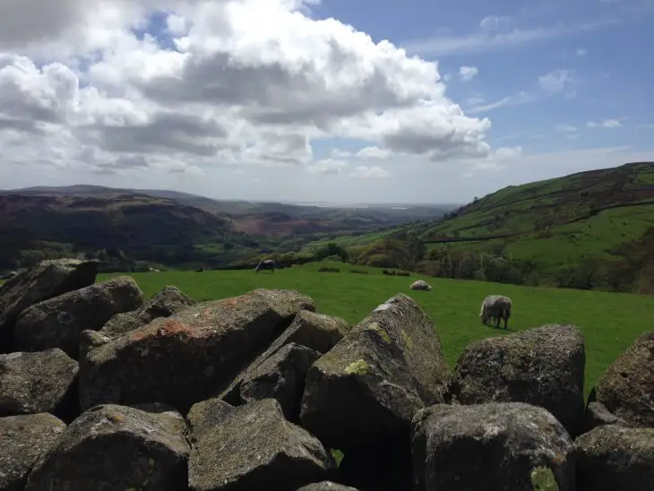
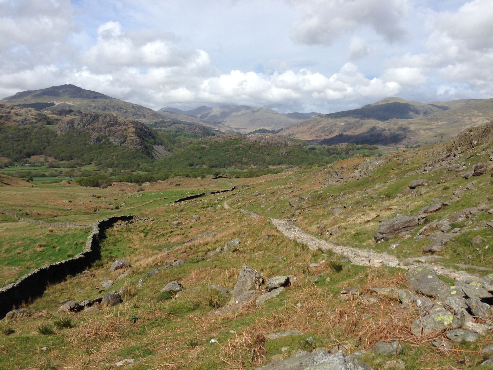
I love the Esk valley. I came here as a teenager on a school camp and spent a week climbing Scafell, Great Gable and most of the other peaks around the area. Not much has changed in the valley over the last 30 years. Cycling down the valley road, with the sun getting lower in front of me, I felt pretty good. I hadn’t made the swift progress I had hoped for, but on the plus side I knew from experience that the route over to Wasdale was fairly rideable, and it was my last climb of the day. Turning right at Boot and past civilization up to the wall that marks the boundary between pasture and fell, I stopped to pause for breath and to eat some food. It was gone 6 p.m. and I was keen to press on—I could see the head forming on the first pint of beer in the Wasdale Head Inn.
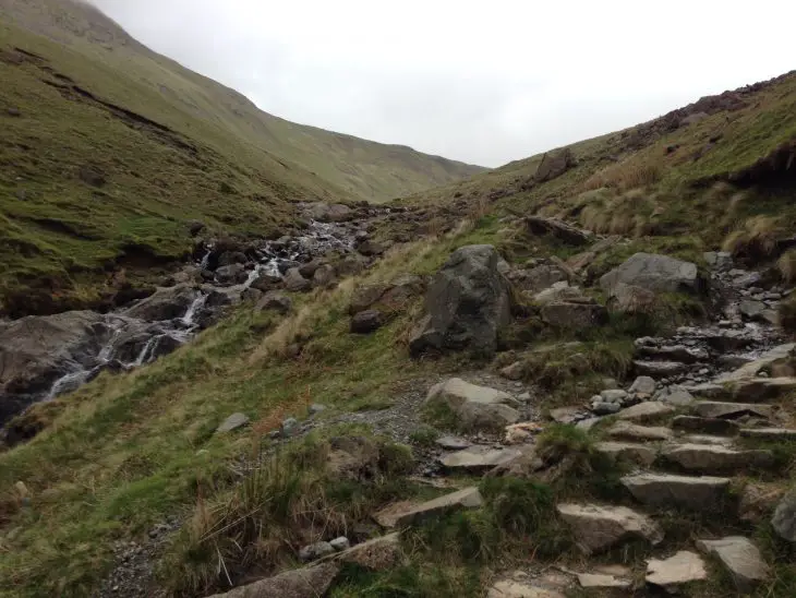
The climb up to Burnmoor Tarn was largely doable. It’s open fell and has a tendency to hold water, so I was lucky not to be bogged down. It’s an eerie journey between the two valleys, and the path is known locally as the Old Corpse Road. Legend holds that the dead were taken by cart along this road from Wasdale to the church in Eskdale for a Christian burial. A derelict house stands by the tarn, which completes the gothic horror nature of the land. I’d not done the descent by ‘cross bike before, and found it to be steepish and technical, but surprisingly doable all the way down the to the National Trust campsite. Good to end the day on a high.
I raced along the road to the National Trust bed & breakfast at Burnthwaite Farm. It was nearly 8 p.m. by this point, so I showered and rushed back to the Wasdale Head Inn to get some dinner and enjoy a few pints. I’ve never had a problem with being on my own, and as I sat reading in the pub nursing a second pint, I couldn’t think of a place I would rather be at that moment in time. Unfortunately these days, a long day’s riding coupled with a few pints meant that the moment was interrupted by the sound of my snoring. Gathering up what dignity I had left, I rode back to the B&B and crashed out on the bed with the window open and the faraway sound of Lingmell Beck providing the soundtrack to my unremembered dreams.
A New Day.

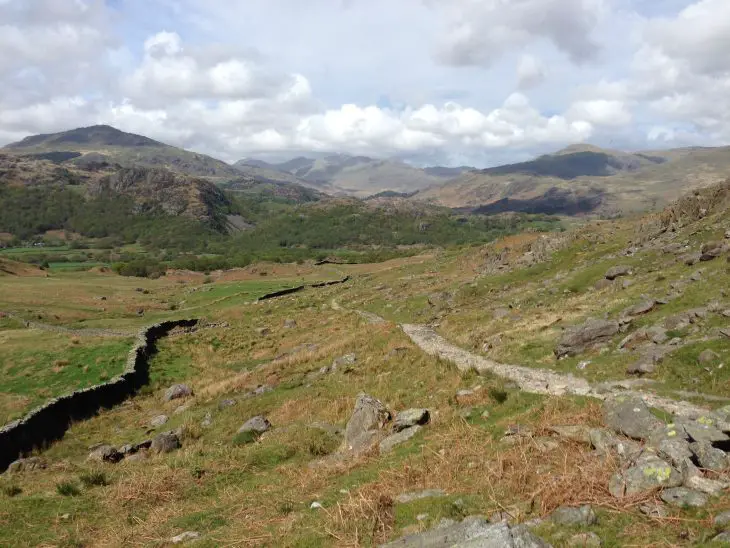
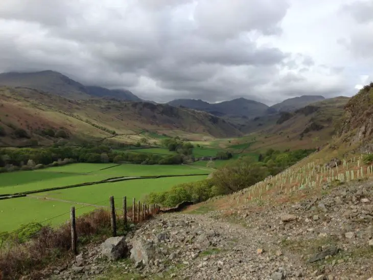
I woke early and looked out of my window to see dark clouds lying over Sty Head, a different picture from yesterday. After a great breakfast spent poring over the maps, I set off up towards Black Sail Pass. Cycling the bottom section was possible until the bridleway pitched up towards Gatherstone Head. Then it’s a carry to the top. If I’m searching for positives, whilst the rain became increasingly persistent, the views were incredible in every direction. Also, it’s a good, steep carry up the steps, so it’s great training for the 3 Peaks ‘cross race.
I was disappointed that the descent off Black Sail of memory was much less rideable than the reality. Even the grassy drop to the Youth Hostel was slick with water and too slippery to get in much saddle time. Over the Scarth Gap Pass and onto Buttermere was a carry-up, cycle-along, carry-down. There were tyre marks over the saddle which looked like they were made by big chunky downhill tyres, and I’ve since seen that the descent has a few Strava segments, so it’s obviously rideable on a suitable mountain bike, but it’s an on/off affair on a ‘cross bike. Even with disc brakes, the technical nature of the ride would mean slow progress. I was on cantis in the wet, so I’m afraid I didn’t have much confidence until the bridleway levelled off a bit towards the bottom.
Feeling the Groove.
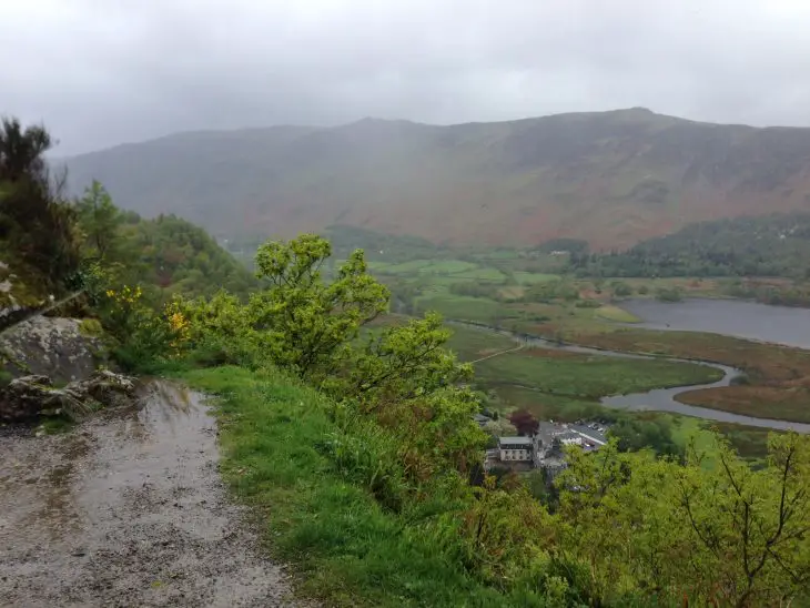
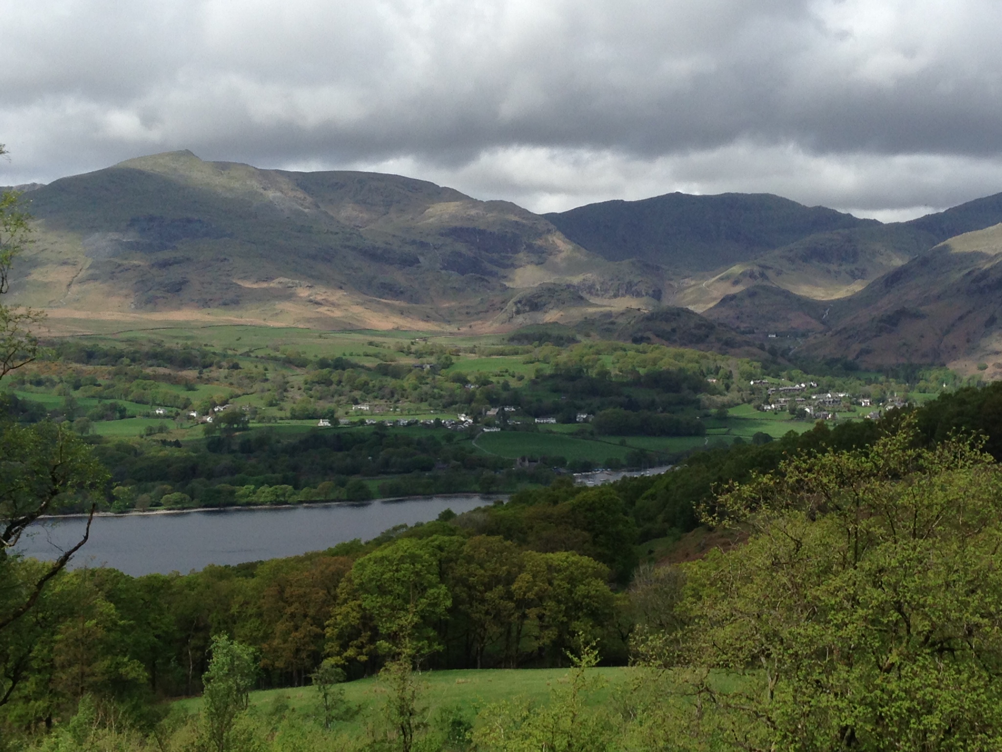
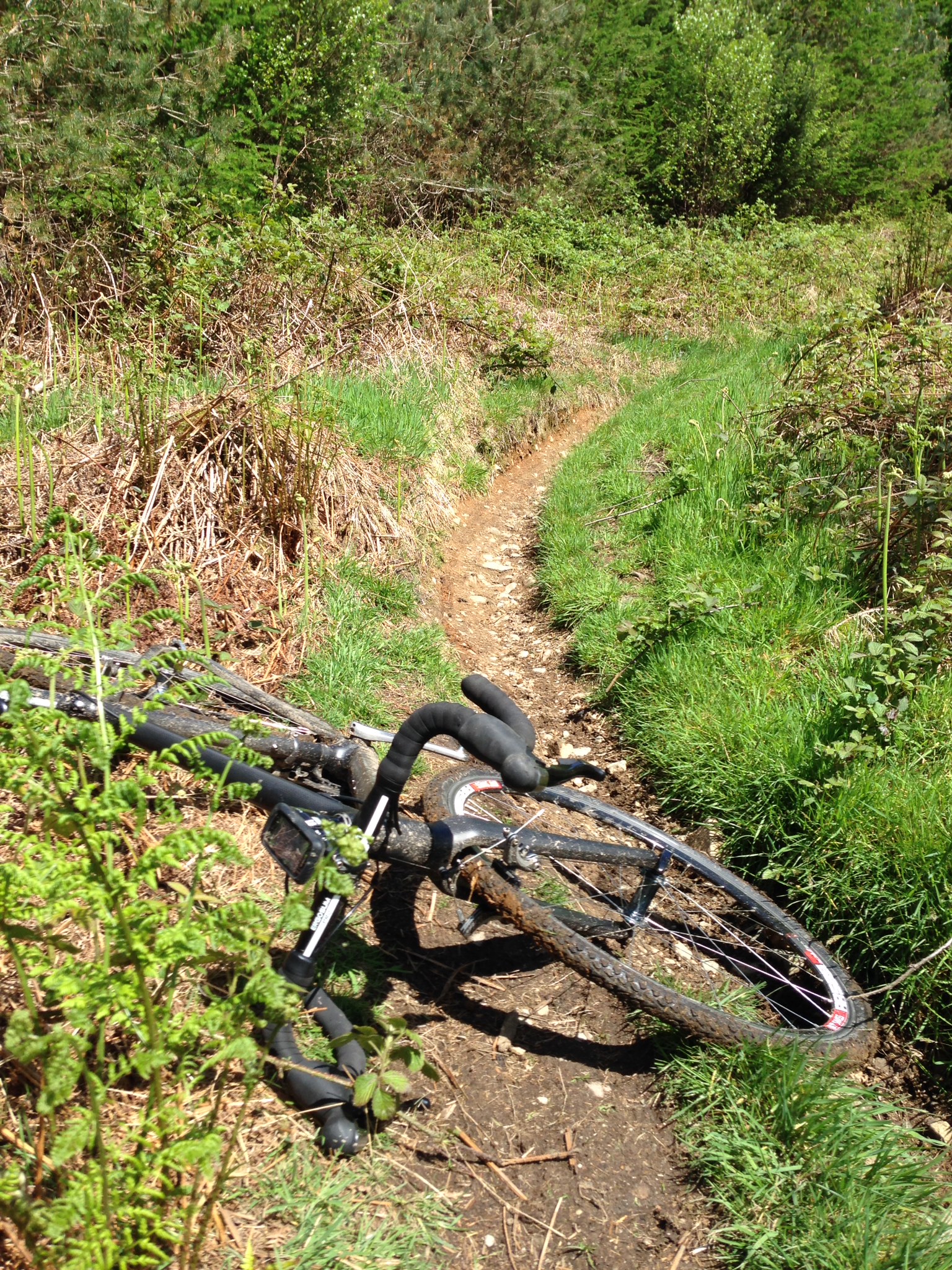
A short section of flat bridleway led to the road at the bottom of Honister Pass. The ascent from the west is the easier of the two roads to the café at the top, but the last steep section had me rasping for breath. By this time the rain was so heavy that the road ran milky-grey with the water coming off the slate mine workings. I stopped for a coffee and a flapjack in the café – and to dry out as I was soaked through. After an indecently long time waiting for the rain to stop (fat chance), I forced myself outside and onto the road down towards Seatoller. The bridleway was joined just above the cattle grid, beginning the part of the ride that mountain bikers know as one of the best bits of the Borrowdale Bash. Mostly a lovely flowing bit of singletrack down to Grange, there are two bits that were too boulder-garden’y to be rideable, but by now the groove on my right shoulder was used to the feeling of top tube.
I confess to being a bit demoralised by this stage. There was no end in sight to the rain, which by now had been joined by some not-insubstantial wind. This is not a combination a cyclist looks forward to at the best of times. I hid in a café in Grange, lingering too long over my chips, where I came to the blindingly obvious conclusion that a) it was not going to stop raining; and b) the quickest way back to the car was over the bridleway I had chosen as part of the route.
Along the main road to Keswick, and then left up the road climb to Watendlath, the road is initially steep and levels off before it becomes lumpy up to the village. There is a right turn onto a very technical bridleway back down to Borrowdale. I had hoped that after a carry-up the initial steep climb, the path would be rideable. With hindsight, I can reflect now that if the conditions were dry, the bridleway over the fell past Blea Tarn could be more enjoyable. As it was, it proved to be a nightmare. Cloud cover was low, but visibility was OK. The rain was inexorable and horizontal. The bridleway was very difficult to see (obviously not well trodden) and the ground was sodden. Riding was impossible, and carrying was difficult given the wind. Although I have great respect for the area, I don’t often think of the Lake District as one of nature’s dangerous places, but it was on this section that I sensed ‘peril’ was not too far away. I felt very alone and exposed. After what seemed like hours, but was probably less than 45 minutes, I was looking down on the small forest above Wythburn.
Before reaching the wood, I came down a wet grassy bank. It was too slippery to run and too steep to ride, so I slid down the bank on my heels with the bike beside me, using the brakes to slow me down. Great fun. The steep path through the trees opened out and the gradient became less severe, leading to a pleasant blast down through a deserted forest. The wind had abated by this stage, and the rain also seemed to have eased off a little too, although this was probably because I had almost dropped to sea level. Arriving at a clearing, most of Thirlmere lay below me. I heard the muted sound of rotor blades, which had me looking round for a yellow rescue helicopter. I didn’t see one, but instead saw the black outline of an Army Apache attack helicopter below me, traveling low to the water, down the lake in the direction of Grasmere.
I came down the last of the path to the road near Wythburn. It was gone 5 p.m., and it didn’t take long to weigh up my options. There was a whole other section that I had mapped out – over into Patterdale Common below Dollywaggon Pike, down to Glen Rhydding and then up to High Street and down to Troutbeck before taking the bridleway down to the back of Ambleside. It was clear that wasn’t going to happen today. I had to get home in any event, but I’m not sure I had the heart for more climbing and carrying. With some relief, I followed the main road over Dunmail Raise and past Grasmere, turning right onto the minor road below Loughrigg Fell, bypassing Ambleside. I arrived at the car, quickly changed into dry clothes and ate the last of my food. I whacked the car’s heat up to maximum and headed for home.
After Two Days in the Lakes.

So what did I make of it? I deliberately waited a few weeks to write this, as I wanted some time to reflect. I’ll not pretend that there was more carrying than I had originally thought. The amount of descent that could be ridden was inevitably less on a ‘cross bike with cantis than with discs, and a lot less than it would have been on a mountain bike with suspension. Having said that, it would have been a massive pain to cart any kind of mountain bike over those climbs. I suppose the best way to define this ride is to call it a ‘cross adventure’, and in that sense it was worth doing.
I wasn’t moving especially quickly as I stopped frequently to eat, take photos and just to look at the view. I think if you were prepared to make early starts each morning and upped the pace a touch, you could do the whole thing, including the extra 35-mile/5,000ft Patterdale/ High Street extension in two days with one overnight stop. There will also be some people reading this wondering how fast an uninterrupted circumnavigation of the full 110-mile/15,000ft ride would take – a sort of ‘cross Bob Graham Round, but I’ll leave that for others to investigate.
Now that I’ve done the route on my own, I’ll arrange a trip with my friends. On the upside, I won’t make any navigational mistakes. On the downside, I know that I’ll be getting plenty of grief along the way and especially on the climbs. It’s probably worth organizing the trip as a 3 Peaks Cyclocross training ride, as it’s difficult to replicate the sheer amount of carrying up inexorably steep gradients that the race entails. But if you’re going to carry a ‘cross bike up steep hills, I can’t think of a more beautiful place to do it than the Lake District.
Route Statistics:
Day 1: 39 miles, 5,732ft climbing
strava.com/activities/138610793
Day 2. 31.7 miles. 5,030 ft climbing.
strava.com/activities/138610669
Equipment:
Bike – I used my no-name, open-mould carbon ‘cross bike with cantilever brakes (TRP CR950s) with Swiss Stop pads.
Wheels – Hope Pro2 32-spoke hubs laced to DT Swiss R585 rims with Schwalbe Landcruiser 30c tyres.
Transmission – Shimano 5700 105 shifters, Ultegra 6700 compact chainset, long cage rear mech, 32-12T rear cassette, Shimano XT SPDs.
Finishing kit – 3t Doric Ltd. carbon seatpost, 3t Arx Ltd carbon stem, 3t Ergonova Pro aluminium handlebars, Prologo Nago pas saddle.
In an OMM Classic Marathon 25-litre rucksack (including whistle), I carried:
- Full-sized orange emergency bivvy bag
- First aid kit
- Multitool with chain splitter
- Spare chain
- Three spare inner tubes (none needed)
- Spare cable
- Four Ordnance Survey maps: Outdoor Leisure 4, 5, 6 and 7
- Silva compass
- Spare clothes, waterproof jacket and overtrousers
- Minimal toiletries
- Food
- Water bottle (I hate bladders).