- This topic has 113 replies, 53 voices, and was last updated 3 years ago by hugo.
-
Who hikes without paper maps?
-
dufresneoramaFree MemberPosted 3 years ago
Just thinking about what bits and pieces I need to take into the hills with me.
I don’t bring a paper map, sometimes an OS printout, but never a full OS map. I actually don’t own any.Everything I read tells me I should.
I can read a map and use a map and compass. I’m pretty comfortable with mapping and tend to study an area before I go. I even find myself just looking at maps sometimes.
I navigate using viewranger and have 1:25k topo maps on my backup GPS.
nickjbFree MemberPosted 3 years agoI like to have one as it’s nice to look at in the pub after but I don’t think it is a very useful tool when out and about. I’d rather have a back up digital device for actual navigation.
andytherocketeerFull MemberPosted 3 years agoDepends on which hills and how remote.
Maps are ace though, and can’t get enough of studying them offline.
SpinFree MemberPosted 3 years agoI hardly ever carry a full OS sheet, no need for most activities. I do usually take the appropriate section in a polypocket. I find it simpler to use the map for a quick check of something than using a device.
I have on occasion gone to the hills with no paper map and just an electronic device. In some circumstances I think that’s fine but there are plenty of people out there who would absolutely rip you apart for that. Feelings run surprisingly strongly on the issue!
ebennettFull MemberPosted 3 years agoI use the OS maps app for navigation and have taken paper maps as a backup when I’m not familiar with the area, but I don’t think I’ve ever opened them outside of the house!
jonbaFree MemberPosted 3 years agoNot done for years.
I plan walks/rides on bike bike which gives me full UK 1:50k. Occasionally I’ll use other sites if I want 1:25k or side by side satellite views. Better than paper as you get more information.
On the hill I use my Garmin 1000 primarily. Phones as a backup.
scuttlerFull MemberPosted 3 years agoA4 printout (so poor res) as backup if I’m on unfamiliar terrain or gonna be out all day but only in addition to OS maps app synced up and checked as offline for that trip (as the downloaded maps often aren’t…).
militantmandyFree MemberPosted 3 years agoDepends where I’m walking. If it’s a Munro or two on a well know route, probably not. I’ve done a couple of multi day hikes across Scotland and Romania and I brought a map and detailed notes with me for those and was very glad to have them!
nedrapierFull MemberPosted 3 years agoHave done plenty of times. Specially on Euro road trips where you’re planning on the hoof and it’s not really feasible to buy decent hiking maps for everywhere you might go, or to find one when you decide you’re going to head there and hike/ride *that* the next day. But downloading open source amps for the areas you’re heading to and whack them on a decent mapping GPS – very easy.
Also depends on what kind of route you’re doing and how likely it is be that you’re going to have to make big changes to your route.
I started a big ride in a group a little while ago and we had to make the 100 mile circular route into a 50 miler after about 25 miles. To decide on a decent off road route from point to point means having all the detail on one “sheet” you can see all at once. And a map’s a lot easier to carry than a laptop with a big screen.
footflapsFull MemberPosted 3 years agoIn the pre-GPS days I used to navigate using laminated photocopies of map sections. In winter, where the winds can be really fierce, the smallest possible map in your hand is a big advantage as anything large will just vanish the next time a 100mph gust hits you. You also tend to only use 1:50k in winter as most of the extra features on 1:25k are buried by snow and you mainly navigate by contours.
These days I just use OS Maps App on my phone with an unopened map in my rucksack as a last resort (which I’ve never had to resort to).
SpinFree MemberPosted 3 years agoas anything large will just vanish the next time a 100mph gust hits you.
If that’s what’s happening the size of the map wasn’t your first or worst mistake of the day!
ayjaydoubleyouFull MemberPosted 3 years agoA4 OS printout of the map with route highlighted on for hiking.
Only own 1 paper map, OS of my local area we were all given in school geography. I have no idea where it is.
I love maps and can study them for hours planning mtb and walking routes. Carrying and folding a table sized bit of paper around a windy and raining hill side does not appeal though.
footflapsFull MemberPosted 3 years agoIf that’s what’s happening the size of the map wasn’t your first or worst mistake of the day!
We used to go out regardless of the weather – storms were used for navigation practice on the Cairngorm plateau – got quite used to wandering round blind (white out) being knocked to our knees with each gust. I’d shit myself if I went out in those conditions now.
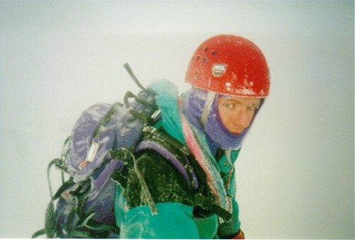
Somewhere in the Cairngorms in the 90s, on a ‘clear’ day 😉
 [url=https://flic.kr/p/dT7wpN]BEN IN BLIZZARD[/url] by Ben Freeman, on FlickrSpinFree MemberPosted 3 years ago
I’d shit myself if I went out in those conditions now.
And rightly so because it’s a stupid and dangerous thing to do. The kind of thing one does when young and dumb. Fortunately most of us survive that phase but it’s important to recognise the role of luck in that and not chalk it all up to skill or ability.
pedladFull MemberPosted 3 years agoOS app on phone and a printout of the local area – laminated if weather to be iffy. So I do take a “map” but not the OS printed map.
B.A.NanaFree MemberPosted 3 years agoDepends
Scotland – OS app + paper map / compass back up
Yorkshire Dales – just an OS appSometimes just use a map and compass so I don’t lose the skill. Must admit I sometimes miss that air of uncertainty, decision making whether to continue or turn back, arguing over a map as to where we think we are, finding bothy, summit and features in a white out etc etc.
tjagainFull MemberPosted 3 years agoI always have in the past but on longer treks where a few sheets are needed it becomes a pain. for the 350 mile trek we are planning carrying OS sheets will really not be possible. I think so long as you have a back up device and one that will function “dumb” ie not need a data connection its probably acceptable
Relying on one electronic device is foolhardy
for day trips I will always take a paper map
You can do things with paper maps that are very difficult with electronic devices like take a bearing on a distant mountaintop
TomBFull MemberPosted 3 years agoI would always recommend a power bank/ spare device if navigating by phone- GPS use and cold weather sucks battery and it’s often late in the day when things start to unravel. This is important both for continued navigation and if you need to communicate in an emergency. Across lakes MR it’s not unusual to receive the first call from lost/injured parties with battery life <20% before we start to talk them down/help them self rescue where possible.
footflapsFull MemberPosted 3 years agoAnd rightly so because it’s a stupid and dangerous thing to do. The kind of thing one does when young and dumb. Fortunately most of us survive that phase but it’s important to recognise the role of luck in that and not chalk it all up to skill or ability.
Not really, I used to do a lot of climbing and teaching winter mountaineering so you need a lot of practice in those conditions to be very comfortable in them and also to be able to take students up on the plateau in zero vis and make them navigate blind from cairn to cairn etc.
If you sit Winter ML assesment with Glenmore Lodge there’s pretty much no weather conditions they won’t have you out in navigating (or certainly was in the 90s).
In really bad visibility, where you wouldn’t see a cornice until you fell through it, you’d rope up in three ideally, short roping with maybe 10m between each person. You can then use the line of people as a reverse bearing to check you’re really travelling in the right direction.
Most of the practice part is just mentally tuning out the panic and operating calmly in very challenging conditions, you just navigate very slowly being very methodical. It just takes a lot of practice to ignore the wind etc and remain rational when it’s really howling around you.
EwanFree MemberPosted 3 years agoI generally don’t carry the paper version anymore, i’ll normally have it on my phone and make sure it’s on my wifes phone as a back up.
nedrapierFull MemberPosted 3 years agoYou can do things with paper maps that are very difficult with electronic devices like take a bearing on a distant mountaintop
But you’re only likely to be doing that to establish/confirm your position, aren’t you? And if you’ve got a little electronic map in your hand that says “you are here” why would you need to?
big_n_daftFree MemberPosted 3 years agoIf you don’t take a map your are likely not to have a compass on you and even less likely to use it. That means you aren’t practicing walking on a bearing and pacing. Which means some of the fundamentals of navigation aren’t being practiced and you are reliant on the battery life of your device and the quality of the built-in compass. You aren’t trying to read the land and visualise what the map is telling you, instead you are looking for the little arrow and how it’s changed since you last checked.
As a luddite I use the map and compass as primary and the GPS mapping on my phone as back up and a cross check when not sure/lazy. I’m teaching the kids using map and compass. I am aware I look quaint by using one.
Maps don’t blow like tablecloths in the wind if you fold them properly.
footflapsFull MemberPosted 3 years agoIf you don’t take a map your are likely not to have a compass on you and even less likely to use it. That means you aren’t practicing walking on a bearing and pacing. Which means some of the fundamentals of navigation aren’t being practiced and you are reliant on the battery life of your device and the quality of the built-in compass
Yes and no.
Yes I’m not getting the practice but I reckon I could manage well enough if I had to….
As for bearings, all a lot simpler now as you don’t have to add / subtract 5 degrees. IIRC the declination in the UK is now around zero degrees.
tjagainFull MemberPosted 3 years agoBut you’re only likely to be doing that to establish/confirm your position, aren’t you? And if you’ve got a little electronic map in your hand that says “you are here” why would you need to?
if your electronic device fails? GPs goes down? or if you need to walk on a bearing? its easier to walk towards something on the horizon than it is to follw a little arrow on a small screen Or simply if yo want to know what it is you are seeing
the beauty of a paper map is nothing can go wrong with it.
SpinFree MemberPosted 3 years agoNot really, I used to do a lot of climbing and teaching winter mountaineering so you need a lot of practice in those conditions
Perhaps we’re talking at cross purposes. There’s a big difference between going out in poor conditions and being able to deal with them safely and going out in dangerous conditions where it’s a delusion to think you can deal with them safely. 100mph winds on the plateau in winter is definitely the latter. You might get away with it on numerous occasions which is part of the problem because many people will take that as confirmation that they made the right decisions.
Maybe Lodge groups did go onto the plateau in those kind of conditions in the 90s, I don’t know. From what I see from pals who work there now that’s not likely. There’s a lot of emphasis on not being overconfident in one’s ability to cope with difficult conditions and recognising the limits of one’s skills and abilities. That’s something that can get harder to do as experience and confidence grows.
CougarFull MemberPosted 3 years agoI don’t bring a paper map, sometimes an OS printout,
You don’t take a paper map, you take a map that’s on paper?
big_n_daftFree MemberPosted 3 years agothe beauty of a paper map is nothing can go wrong with it.
In my case there is still plenty of room for operator error
AidyFree MemberPosted 3 years agoI bring a map unless I know the area really well (enough to be able to do escape routes in my head from anywhere I might end up).
AidyFree MemberPosted 3 years agothe beauty of a paper map is nothing can go wrong with it.
It can get blown away.
It can get too wet to be useful.
It can be out of date.nedrapierFull MemberPosted 3 years agoif your electronic device fails? GPs goes down?
You’ve said you didn’t need a paper map on 350mile hike, but that it’s nice on shorter hikes. You’ve answered the reliability question already. Unless it’s for practice? For really big outings when you don’t have a map?
or if you need to walk on a bearing? its easier to walk towards something on the horizon than it is to follow a little arrow on a small screen
If you can see it and you’re looking at it, you don’t need a bearing? You need the bearing if you’re in blank terrain in a whiteout or up and down in valleys. In both cases you’ll be checking against a little compass or a little screen? And non-bike specific units will have a navigate to bearing function anyway.
Or simply if you want to know what it is you are seeing
That’s fair enough!
tjagainFull MemberPosted 3 years agoits not that I do not need a paper map for that 350miler – its that its impractical to carry them I think We are still discussing what to do, We may take a 4 prints of tricky navigation bits.
If you can see it and you’re looking at it, you don’t need a bearing?
I was thinking of the situation where yo uknow yo need to walk so far on such and such a bearing – you then look for a landmark on the horizon on that bearing Its just easier on a paper map
dovebikerFull MemberPosted 3 years agoOS app on phone, GPS with replacement batteries. I have maps and a compass, but rarely see the need to take one with me – most stuff I’m doing is local / routes I’ve done before. If I get into conditions nearing white-out I’ll be re-tracing my steps back to the car – my days of going out in ‘filthy’ conditions are long gone. These days, weather forecast apps on phones are pretty good, so you have a good idea of what conditions to expect.
andrewhFree MemberPosted 3 years agoAs a luddite I use the map and compass as primary and the GPS mapping on my phone as back up and a cross check when not sure/lazy.
I do that. Always have a map, usually an electronic plan B. Maps are so much better for making up routes on the hoof, much better idea of what is around in all directions.
.
I have the full set of 1:50k OS maps, most well-used 😀big_n_daftFree MemberPosted 3 years agoIt can be out of date.
Less of an issue on the hill, contours don’t tend to change much
gobuchulFree MemberPosted 3 years agoUse A3 printouts of OS maps.
Phone with app and a Garmin as well.
You can see a lot more on a map, rather than a phone or 2 inch GPS screen.
Don’t do anything crazy and don’t go out if I have to pack more than a waterproof shell as a “precaution”.
tjagainFull MemberPosted 3 years agoiirc scottish mountain rescue recommend a paper map even if just as backup.
reluctantjumperFull MemberPosted 3 years agoIn areas I know well I’ll take my phone and my GPS (Edge 800 with 1:50k OS installed) as an easy way to get a set of coordinates in an emergency. For new areas I’ll also take a laminated printout of the OS map for the areas Ivan print out from Memory Map on my computer, if I lose it it’s no big deal. I also have the full OS maps for loads of areas which I tend to draw on, had them for decades.
Mainly though as I’ve got older I tend to not venture out on the hills in poor weather, prefer to stick to local hills or trail centres for safety. I also tend to hike in groups and that always ends up in good weather as people always pull out if it rains!
slowoldmanFull MemberPosted 3 years agoGPS on road bike and MTB, paper map when walking. I agree that when on a bike it’s nice not not have to faff with a map at every junction, but when it comes to walking, navigation is part of the game.

The topic ‘Who hikes without paper maps?’ is closed to new replies.