Home › Forums › Chat Forum › Stormy near Keswick…..
- This topic has 324 replies, 100 voices, and was last updated 8 years ago by chakaping.
-
Stormy near Keswick…..
-
bigjimFull MemberPosted 8 years ago
The 2009 event was described as a once in 100years – except it’s happened again.
It doesn’t mean a flood of this scale will only happen once every 100 years in a clockwork cycle, or will only happen once in every 100 year period. Think of it in terms of describing the severity of the event rather than anything to do with at what point they will happen in time.
edit ^ see above
ianfitzFree MemberPosted 8 years agoFrom a hydrologist via Twitter
@JakeZackAndy: 300mm rain
= 300,000,000 litres per km2
= 15 billion litres of water for a 50km2 catchmentHe also points out that no fixed flood defences which are environmentally and financially feasible could possibly cope with that amount of water that quickly.
I’m sure that won’t stop the media blaming the EA and other government agencies
gwaelodFree MemberPosted 8 years agoaye 1mm of rain is a litre per square metre. So if the weatherman says 10mm of rain imagine 10 bottles of mineral water being poured over a small kitchen table (approx 1 square metre) – thats actually a lot of water to deal with. scaling it all up to the size of a river catchment gives you a **** of h2o to deal with
DaveVanderspekFree MemberPosted 8 years agoLooks like here in Carlisle we’re in for it again, already some flooding now but defences are due to be breached at 1am tonight. Major evacuations underway, good luck to all. 🙁
boxelderFull MemberPosted 8 years agoWell, it looks like while the new defences in Keswick and Cockermouth have been over-topped, it would have been much worse without them. I’m told that this time there was no release of water from Thirlmere, which added a lot of water in 2009. Fingers crossed that the Main St of both towns will be up and running again much sooner than 2009.
What a day for the new Cyclewise shop to open in Cockermouth….. At least it’s well above flood level.grumFree MemberPosted 8 years agoGood to hear you’re ok and relatively promising news boxelder. Saw a pic on FB a bit of the road between Grasmere and Keswick has totally collapsed – will be shut for a long while I think.
jambalayaFree MemberPosted 8 years ago@zokes, thanks I have done, I agree in that it could make a difference. My gut feel is that modifcation of river flows and flood planes due to development is far more relevant than farming practices and high level tree removal/planting. That plus climate change leading to more intense rainfall thus changing what is “normal”
@box, yes indeed very tough for local business with Christmas shopping season in full swing
JunkyardFree MemberPosted 8 years agowater flooded the cellar to about 6 foot but stayed just below the first floor so no real damage done
Lifeboats outside the door so the river kent burst its banks by about 200 metres!!!
teamhurtmoreFree MemberPosted 8 years agoGood luck to everyone in the Lakes. Drove down Dunmail a few weeks ago 😯
Amazing Kinder video.
Nature is both beautiful and awful at th same time!
MosesFull MemberPosted 8 years agoJambo, which particular
modifcation of river flows and flood planes due to development
are you thinking of that could have made a difference here? We’re talking about a sparsely populated area, not the sodding Thames Valley. Have you travelled north of the M4 ?
JunkyardFree MemberPosted 8 years ago@moses I think three have tried to point out to him that the Lakes National park is not swamped by developments and river diversions 😯
He has go to be just posting for laughs as no one can actually think that, Either way it pointless though as he needs no facts to form nor maintain his view as he is demonstrating on this thread
postierichFree MemberPosted 8 years agoThrekeld to Keswick Cycle bridge gone probably for ever!
🙁
https://www.facebook.com/taravallentewriter/?pnref=story
 Untitled by Richard Munro[/url], on FlickrmonkeyfudgerFree MemberPosted 8 years ago
Some “amazing” pictures in Carlisle, I don’t think anyone truly expected the latest flood defences to be breached! It’s not 2005 but it’s horrible. One work colleague has been caught out, gutted, she’d just moved in and had just bought a load of furniture, imagine there’s a huge number of people in the same circumstances 🙁
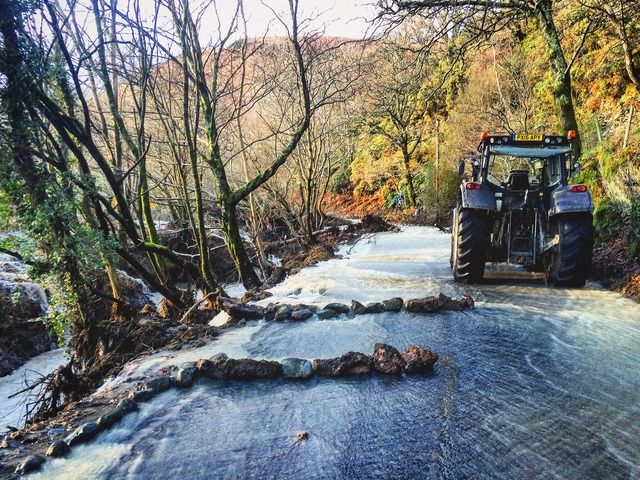
crazy-legsFull MemberPosted 8 years agoA591 at south end of Thirlmere (just by Wythburn) has collapsed so there’ll be no road from Keswick to Grasmere for a long time.
I saw the picture of the bridge this morning. 🙁
Phoned my former boss in Lancaster, he’s had no power since 10pm last night although his more pressing concern seemed to be dealing with his 14-year-old son who was struggling to adapt to a life without wifi!
doom_mountainFull MemberPosted 8 years agoManaged to get into Ambleside to work today, shop is flooded but everyone ok.
Road in from windermere is passable but still flooded in places.Absolutely gutted to see the Portinscale bridge gone, that was part of my commute for a few years… 🙁
Be careful out there.
crazy-legsFull MemberPosted 8 years agoManaged to get into Ambleside to work today, shop is flooded but everyone ok.
What’s the Clappersgate / Skelwith Bridge road like? And the little lane (Under Loughrigg) up the back of the River Rothay?
Hope you get the shop sorted soon, good luck with it.
breadcrumbFull MemberPosted 8 years agoFoot bridge over the Cocker.
View this post on Instagram#stormdesmond #cockermouth #flood #bridge #igerscumbria #cumbria
A post shared by Mark Gorman (@tinbasher79) on
crazy-legsFull MemberPosted 8 years agoGoing to be a huge amount of traffic disruption and diversions for months. Pooley Bridge at north end of Ullswater has collapsed. A591 at both Thirlmere and Bassenthwaite has collapsed. The road down the side of Ullswater at Glenridding is very severely buckled.
projectFree MemberPosted 8 years agothe current government will spend lots of money to remedy the situation and do something to help the peoples and tradesmen who are going to fix everything, just like they bailed out the bankers and are sending planes to bomb syria.Money no object.
senorjFull MemberPosted 8 years agoGutted about Portinscale bridge. I doubt it’ll be replaced.
Like the bridge over the quay in Workington:-(
My brother stayed dry,but several of his in laws are flooded. Buggery.crazy-legsFull MemberPosted 8 years agoGutted about Portinscale bridge. I doubt it’ll be replaced.
Hang on, has that gone too? Portinscale Bridge is the one at the north end of Derwent Water, the little cycle/foot bridge here
This one:

The bridge a few pictures back is this one:

which is on the Keswick – Threlkeld old railway path east of Keswick. Crosses the Glenderamackin River.
jp-t853Full MemberPosted 8 years agovery tired but very fortunate, most of our neighbours are flooded in the middle of the penrith, appleby, shap triangle. It was much worse than 2005. thankfully our village is high so the water moves on. i owe a big debt to the man across the road who was able to get sandbags over to us on his tractor . daughter had great fun.
photo’s aren’t working 🙁
matt_outandaboutFull MemberPosted 8 years agoJust seen a pic of the Pooley Bridge missing the start of the bridge. 😯
crazy-legsFull MemberPosted 8 years agophoto’s aren’t working
You’ve linked to a direct page on a private Flickr account that’s why.
Make the photos public then select the “share photo” option to get the actual picture info rather than the page url.muddy@rseguyFull MemberPosted 8 years agoBlimey! I know everyone from Cumbria is hard as nails but that looks dreadful, stay safe guys.
jambalayaFree MemberPosted 8 years agoJust asking questions about developments inc chanelling/ducting of rivers through towns both locally and further downstream ? There is far more to this imo than current very heavy rainfall and farming subsidies. It wouldn’t seem approporate chaps to post jolly pictures of my last trip up in Sep 2012, not been back since as my knee wasn’t strong enough for the sustained climbs on foot and/or by bike so spent the holiday tokens on a 3 week trip to Chamonix and Verbier where the lifts can do the climbing and even then couodn’t manage that much.
Best of luck to all those affected, flooding is a nightmare
davidtaylforthFree MemberPosted 8 years ago
That one is still standing! (it took em long enough to rebuild it last time, so I guess they did a good job)
Almost everything else is underwater. White Water hotel and the Swan; an massive torrent just raging through there earlier. Lakeside hotel had a what looked like a Windermere Lakes cruiser in the middle of the car park 😯
Madness; seems much worse than the 2009 floods
honeybadgerxFull MemberPosted 8 years agoDrove west over the A66 before heading north up the M6, it’s just mind blowing the levels of water at the moment. We actually got stuck in borrowdale a couple of weeks ago and afterwards thought, yeah, that’s the usual flooding problems done for a while now… Crazy to see the old railway bridge go. Thoughts with everyone affected.
NorthCountryBoyFree MemberPosted 8 years agoI took a ride out today from Cockermouth to Keswick to see how bad things are.
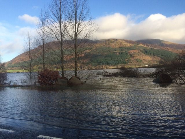
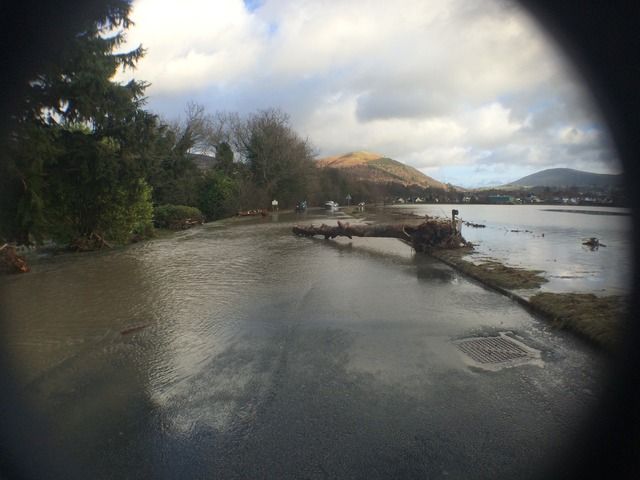
The A66 is closed due to Bassenthwait lake flooding onto the road, but Keswick is is very bad. Also Braithwait at the bottom of Whinlatter pass has had the road washed out.
Anyone thinking of driving up from that side to Whinlatter forget it!A66 cockermouth to Keswick
The road into Keswick High Hill side
monkeyfudgerFree MemberPosted 8 years ago
One of the main bridges into Carlisle centre, always amazes me it’s not damaged when there’s flooding. Water pressure must be off the scale.
The topic ‘Stormy near Keswick…..’ is closed to new replies.


