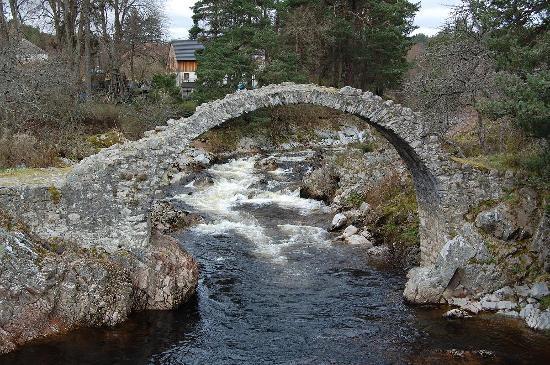
You might like to know that the bridge over the Derry Burn near to Derry Lodge has been washed away in the recent flooding. That effectively means that the Derry Lodge approach to the Lairig Ghru is now impassable – certainly until water levels drop significantly.
flatfish » The wifes having a wobble about coming up at the weekend.
Water does tend to drain pretty quickly in places that have steeper hills and valleys.
It’s the poor neighbours down south who tend to have floods as puddles rather than run-off….
Thanks (not sure that’s the best word) for the news, that’s useful to know even if there are some alternatives when water levels are nearer normal. After seeing the forecast yesterday I was surprised by lack of “news” earlier (on the main news channels or on here).
If anyone happens to hear of or find any other stuff that’s been taken out bridge/ bothy/ track wise then it could be useful to update this for reference.
Just saw this. I was planning on riding Lairig Ghru as an out and back on Thursday. I don’t know all the areas and trail names but was planning on coming in near Colyum Bridge and the Lairig Ghru cottage. Is this where the bridge is out? As an alternate I was thinking of starting near Glen More visitors center and going up and coming down through Creag a’ Chalamain. Is that reachable? Or advisable?
Hiring a bike in Pitlochry, and was wanting to ride some technical and fun natural trails. Lairig Ghru seems to fit the bill. Anything else to consider given the weather?
I was surprised at how much the water has already receded from highs – couldn’t quote figures but even on Monday, roads that were many inches deep in water in the morning were clear, and today water levels generally back down near a foot from peak.
Makes me think it’s soaked into the ground very quickly, has been simply overspill of water that can’t drain fast enough rather than a high water table and sodden ground.
We were advised not to go Via Elgin/Inverness to Fort William yesterday morning. We went down via Aviemore (we waved Colin) couldn’t believe the difference to the Spey in 24 hours!
We were worried about the folks camping next to the Spey near Dulnain, luckily the river hadn’t got that high there.
Kingussie was starting to get a bit of a mess,there were some amazing waterfalls further along the road.
I was glad I went for a spin round Moray on Sunday morning; it all went downhill after that, got home and 5 mins later pi$$ing down, repeat until yesterday evening really.
Collapsed ceiling wallpaper and some cracks in two front rooms – we were lucky 🙂
mattnmtns – Member
Just saw this. I was planning on riding Lairig Ghru as an out and back on Thursday.
This bridge is at the southern end so no impact on what you are planning. However, the Lairig Ghru isn’t worthwhile as a bike route much past Rothiemurchus Lodge so I fear you are barking up the wrong tree anyway. My response on your previous thread contains all you need to know
There is a bridge a bit further up the burn but they have yet to confirm if its still there. I also understand that the higher bridge over the Quoich is also no more.
I drove from Kintail through Lochcarron, Inversneckie back to Edinburgh yesterday. It was quite interesting. Lochcarron was epic waterfallsville. Roads were OK but lots of standing water and a big HELLO to the guy in the A4 Avant Allroad who overtook me beause I AM IN A VAN despite it being torrential rain, a downhill offcamber bend and a big waterfall across the road, yes I bet you did have to empty your pants after you lifted off when you got a bit too fast and went sideways and tankslapped it across the road. Lucky nothing coming the other way. You epic ****, learn to drive or be patient its not like i was dawdling along. Maybe next week you can come back and collect all the bits that came off your car but you were to embarassed to stop.
When driving through the poor conditions I remembered something I noticed when I was up there earlier in the year (again in poor conditions) Scottish drivers don’t use their lights! Rain/spray/visibility was dreadful
It’s not going to do much good for the coliform levels in the Glenmore campsite drinking water 😕
Due to unforseen circumstances the water at Glenmore is not drinkable.
Please can you boil all water and take care not to swallow water while showering or bathing. For more information please call the campsite directly on 01479 861271.