- This topic has 28 replies, 22 voices, and was last updated 11 years ago by RepackRider.
-
A week in California – Riding and other stuff
-
keppochFull MemberPosted 11 years ago
Afternoon.
I am going for a holiday in California shortly 🙂
The first week is a guided trip with Sacred Rides along the ‘Lost Coast’
Then we have three nights in San Francisco.This leaves us with a week to play with, a van to get there but an interest in not driving too far to maximise time to actually do stuff.
So far the thinking is to visit the following for a mix of cycling and other fun:
Yosemite National Park – Two days accomodation booked.
Mammouth Mountain – Bike park?
Lake Tahoe – Flume Trail
Downieville – Riding, any one know which trails are good?Any other ideas, suggestions of where we should go/stay particuarly for ‘do not miss’ riding or sights?
d45ythFree MemberPosted 11 years agoNice trip you’ve got planned! Have you seen this trip report on MTBR? It includes some of the places you mention.
zigzag69Free MemberPosted 11 years agoFlume Trail’s great for stunning views, not particularly technical though. If you’re up North Lake Tahoe way, I recommend the Hole in the Ground Trail.
phil56Full MemberPosted 11 years agothe trails around Lake Tahoe are great, the Rim Trail as well as the Flume Trail
Flume Trail
Rim TrailAndy_BFull MemberPosted 11 years agoI think Mammoth is slightly out of the way. You can combine it with a drive across the Tioga pass coming out of Yosemite but I would probably not bother if i was in the area again.
messiahFree MemberPosted 11 years agoGreg “Willie” Williams at Yuba Expeditions was an awesome help when I was in Downieville many years ago…
philconsequenceFree MemberPosted 11 years agomind if i ask where you’re staying in yosemite and lake tahoe?
going to drive through them on our honeymoon in october and haven’t planned anything other than staying longer in places we enjoy and driving away from places that bore us!
keppochFull MemberPosted 11 years agoThat MTBR trip report is great, looks like I should be able to get at the routes too but don’t have a Garmin, does any one know how I could downloads as gpx.
I was beginning to think Mammouth was a bit of a weak link so that is interesting. Downieville and Tahoe seem to attract a thumbs up so will keep them in the itinerary.
We are staying at ‘Curry Village’ in Yosemite. In a tent cabin. It looks a great location but not as cheap as a tent cabin sounds it should be! There are hotels at the same price that may better suit a honeymoon. I recommend booking well in advance, I think we have been very lucky to get a spot.
Nothing booked in Tahoe yet.
Any further recommendations welcome.
d45ythFree MemberPosted 11 years agoIf you want the GPX files, download as a course instead and convert that that to GPX. Either load the course into GPSies.com or such like, then convert. You could also download GPXtoCRS instead…it works both ways.
mcmoonterFree MemberPosted 11 years agoCheck out the Repack To Rwanda exhibit at the airport.
The riding around Loch Tahoe is good.
Check out the Armstrong Trail, Mr Toads Wild Ride and Christmas Trails.
I remember seeing a bike hire place at the start of the Flume trail. Basically ask at any bike shop and they’ll sell you a trail map.
Flume trail

phinbobFull MemberPosted 11 years agoDon’t underestimate the driving time between things, it’s a big place.
Yosemite from SF is 3-4hrs. You’re never going to see it all, so I’d suggest maximizing your riding time by not doing too much travel. If you’re not used to the scale you can find yourself spending far oo long in the car….
choronFree MemberPosted 11 years agoDon’t have any experience of the riding there, but have been to SF quite a few times. I wouldn’t bother with vesuvio myself (bit touristy – sorry CFH), but would definitely recommend hitting the valencia street area, awesome restaurants/coffee shops/ bike shops and not a chain in sight.
Best food I had in SF: frances (frances-sf.com). They reserve a few seats for walk-ins so no need to book if you dont mind waiting and dont have too big a group.
ibnchrisFull MemberPosted 11 years agoYou’ve got to go and do Repack hill. Just because…
It’s essentially just over the other side of the bridge from San Fran. I was lucky enough to ride down it with Repackrider. Top guy.
el-Gato-NegroFree MemberPosted 11 years agoOff to SF? have a look here… great city!
worth a look…
https://www.missionbicycle.com/def try and eat here, cos there both great…
http://www.foreigncinema.com/home.html
http://www.gitanerestaurant.com/tandem across the bridge, ferry back to SF was a good laugh
CaptainFlashheartFree MemberPosted 11 years agoChoron, a valid point, I suppose, but I think it depends when you go. I went midweek, early in the evening to watch the baseball (Couldn’t get tickets). It was a superb bar, full of really interesting people. Locals or not? Well, not too sure, but many of the folks I spoke to that night were locals. Went back the next night and had another lovely evening of chat and banter, the sort of thing that’s always great to have when travelling alone.
kayak23Full MemberPosted 11 years agoDownieville is great, I stayed there on a kayaking trip.
The leek and potato soup has bacon in it though.RepackRiderFree MemberPosted 11 years agoYou’ve got to go and do Repack hill. Just because…
It’s essentially just over the other side of the bridge from San Fran. I was lucky enough to ride down it with Repackrider. Top guy.
I had some health issues that kept me off the bike for the last two months. Back on this week, but SLOOOOW. I didn’t spend much time on bike sites when I couldn’t think about riding.
steveoathFree MemberPosted 11 years agoWe went on honeymoon last year. Didn’t make much of SF. Yosemitie is spectacular though, we spent a week hiking/rafting about and could have spent a month or more.
In SF for a night out see http://www.beachblanketbabylon.com/ I was sceptical but MrsOath wanted to go, and it was excellent. Great restaurants nearby too.
If you want to go to alcatraz book tickets in advance (online).
Ah, curry village is just along from where we stayed. Not far into yosemitie valley from there. get up early though, so you beat the traffic.
swingbingFree MemberPosted 11 years agoI asked similar questions when I was going around easter time. See the thread here.
Yosemite is great. Muir woods is also close to SF if you want to see some giant Redwoods.
For getting about I’d use the BART, their underground. Cheap and quick.
Do not miss the mission district in San Fransisco. If you are looking for somewhere for an amazing lunch in the mission, I can’t recommend boogaloo’s enough. Very reasonably priced too.
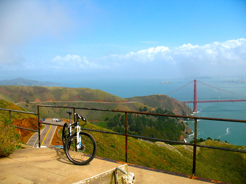
I loved my all day ride over the bridge and marin headlands. Think more flowing fast dusty trail than full on single track though. Awesome to ride all the trail named after Marin’s various bikes.
Here’s a little pic to wet your appetite…
IMG_0821 by davejoe054, on FlickrswingbingFree MemberPosted 11 years agoOh, and a +1 for vesuvio’s. I had a great pastrami sandwich there. Everywhere in SF you’re likely to find is “a bit touristy” anyway.
neilc1881Free MemberPosted 11 years agoIf you do any climbing and fancy a fun day out I’d recommend doing Snake Dyke on Half Dome, great day out. Did it as a rest day on a big wall trip and had a blast. If you need/want a guide I’ve a mate out there. Otherwise an evening on the top is a fantastic experience.
gribbleFree MemberPosted 11 years agoI had two weeks relaxing in Tahoe last Sept/October. Sunny and very warm 1st week, snow in the second.
Definitely go to a bike shop – I spoke to the guys in Olympic bike shop, Tahoe City. He spent 30 mins highlighting all the best local trails on a map, whilst my wife got sunburn outside. I felt so guilty for taking up his time I bought a water bottle – although the Trek EX8 in stock looked like a good deal…
Map is called: ‘Lake Tahoe Basin Trail Map’ – there are literally hundreds of trails.
Tahoe Rim Trail, Mr Toads, Armstrong Connector, Flume Trail all on the map.
Best ride for me was from Tahoe Meadows (located NE on the lake, on the road pas past Incline Lake), south on the ridge, down the Flume Trail and back around Marlette Lake (located half way down on the east shore of Tahoe). Really amazing scenery. There is also a ‘Tryolean Downhill’ trail which people were shuttling. Looked fun, but have a small todger and a hard tail, so too much of a big boys ride for me.
Also Armstrong Connector up to Armstrong Pass, back down connector and Cedar/Corral a real blast (on the descent). Climb is up to 8,500 ft though. (SE lake).
We stayed NW of the lake – south lake is busier, more night life and a bit more touristy.
Yuba expeditions were really helpful on email advice, but I never made it up to Downievile – trails looked very good.
Last bit of advice would be pack a spare set of lungs – the climbs were tough, but the views were awesome and after 7 days of riding trails/road (mixed up to keep the wife happy), I was a lot fitter on return to the UK. Would go back (but would try and buy a full susser by then).
gribbleFree MemberPosted 11 years agoSee MTBR forum link above – lots of helpful replies from some locals.
crotchrocketFree MemberPosted 11 years agoButtercup lives nr-ish SF – pretty sure he has an opinion as to whats good. lumashofAThotmailDOTcom
There is a bike park he was raving about when i last saw him can’t think for the ife of me what it’s called tho :/earsFree MemberPosted 11 years agoJust back from San Francisco and Mammoth Lakes.
We rode xc at Mammoth with gondola uplift. On Cheap Tuesday, Santa Cruz Hecklers for $29/day if you get to Footloose bike shop early. Gondola pass was roughly $50/day, including all transport up from the village to the Adventure area.
Plenty of xc trails and downhill, if that’s your thing. More teenagers with full-blown downhill bikes that you could imagine.
Rented a Mustang from Avis in SF for £50/day, if you have the time.
And keep 30 minutes free at SFO, as there is an excellent mountain biking exhibition between check-in and Passport Control.
RepackRiderFree MemberPosted 11 years ago
2retro4u
Marin County, CaliAnd keep 30 minutes free at SFO, as there is an excellent mountain biking exhibition between check-in and Passport Control.
Here’s a link to the San Francisco Airport Museum page about the exhibit.


The topic ‘A week in California – Riding and other stuff’ is closed to new replies.