- This topic has 20 replies, 6 voices, and was last updated 6 years ago by stumpy01.
-
3D Printer Adventures
-
mikeydFree MemberPosted 6 years ago
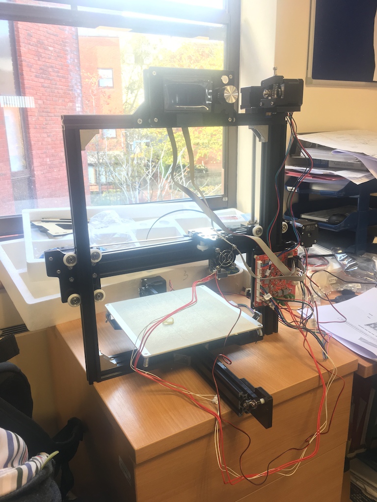
Thought I’d share some of the landfill I’ve been churning out. I’ve been interested in these for a while but had been put them off as being a bit of a gimmick with no real value in terms of producing functional items – mainly down to the material strength. The filaments that are available now have changed my mind, especially some of the modified PLA and PETG filaments.
This thread inspired me to go for it: http://singletrackworld.com/forum/topic/cheap-3d-printer-kits-experiences
I went for an Anet A2 in kit form from eBay (£140) and am using fairly expensive filaments from rigidink.com – their PLA+ is very tough and as long as you don’t treat the material as isotropic you can print some very strong parts.
I’ve used AutoCAD for the past 15yrs or so, but I’m finding TinkerCAD great for 95% of the stuff I want to print, powerful yet simple and has been developed with 3D printing in mind (unlike Sketchup), it’s also web based so all you need is an internet connection and a web browser.

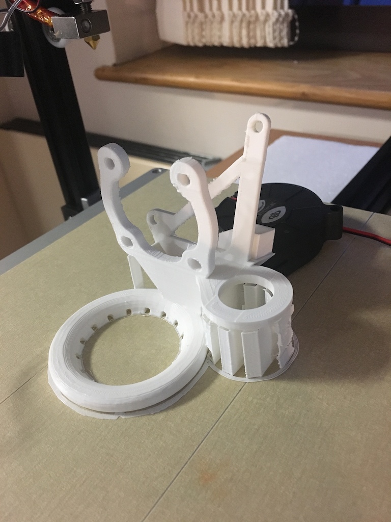
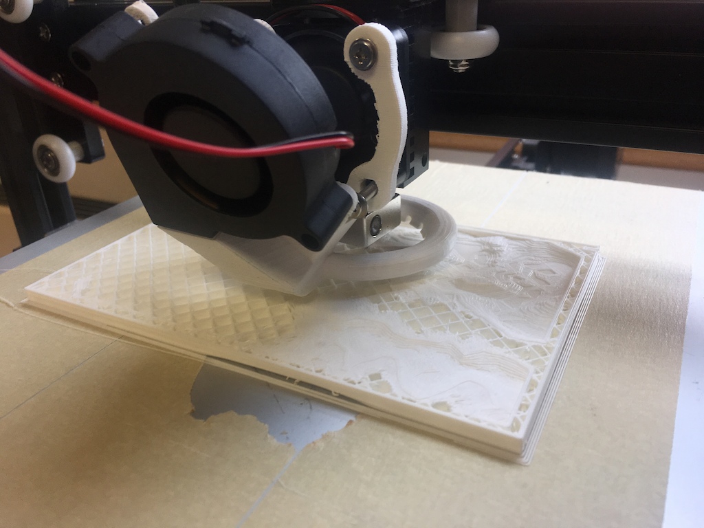
First thing to print was a cooling duct/fan arrangement for the hot end, important for printing in PLA
3D relief map to show a client what was what
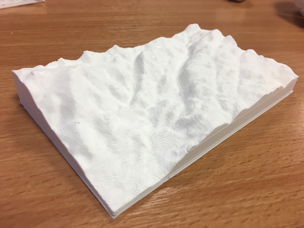
3D relief map of Dartmoor – Lustleigh Cleave (Haytor bottom left, Bovey bottom right) – 3hr print time
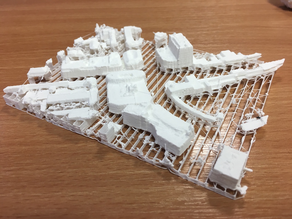
Exeter city centre – Lidar data with no post processing, literally just downloaded and printed
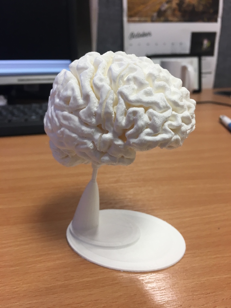
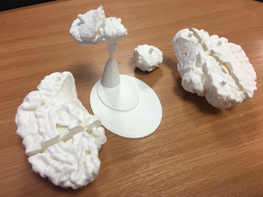
½ scale Human brain from MRI for a friend who’s doing a doctorate in clinical psychology – total 9hrs
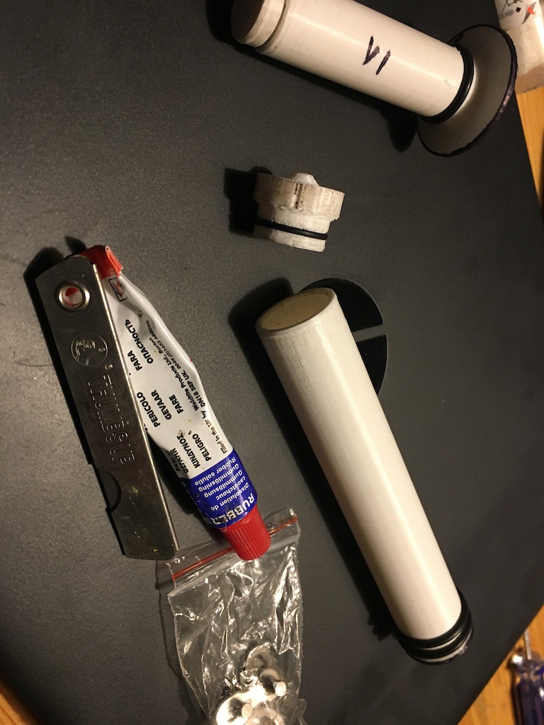
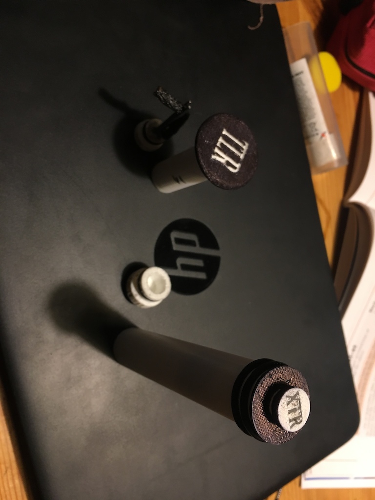
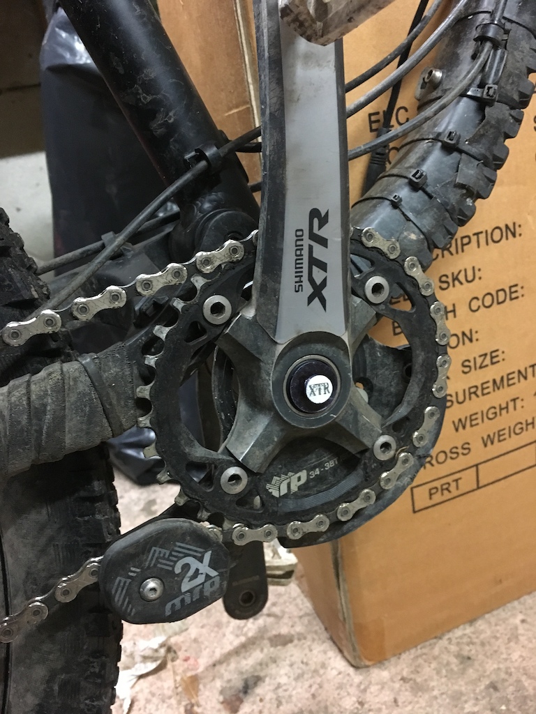
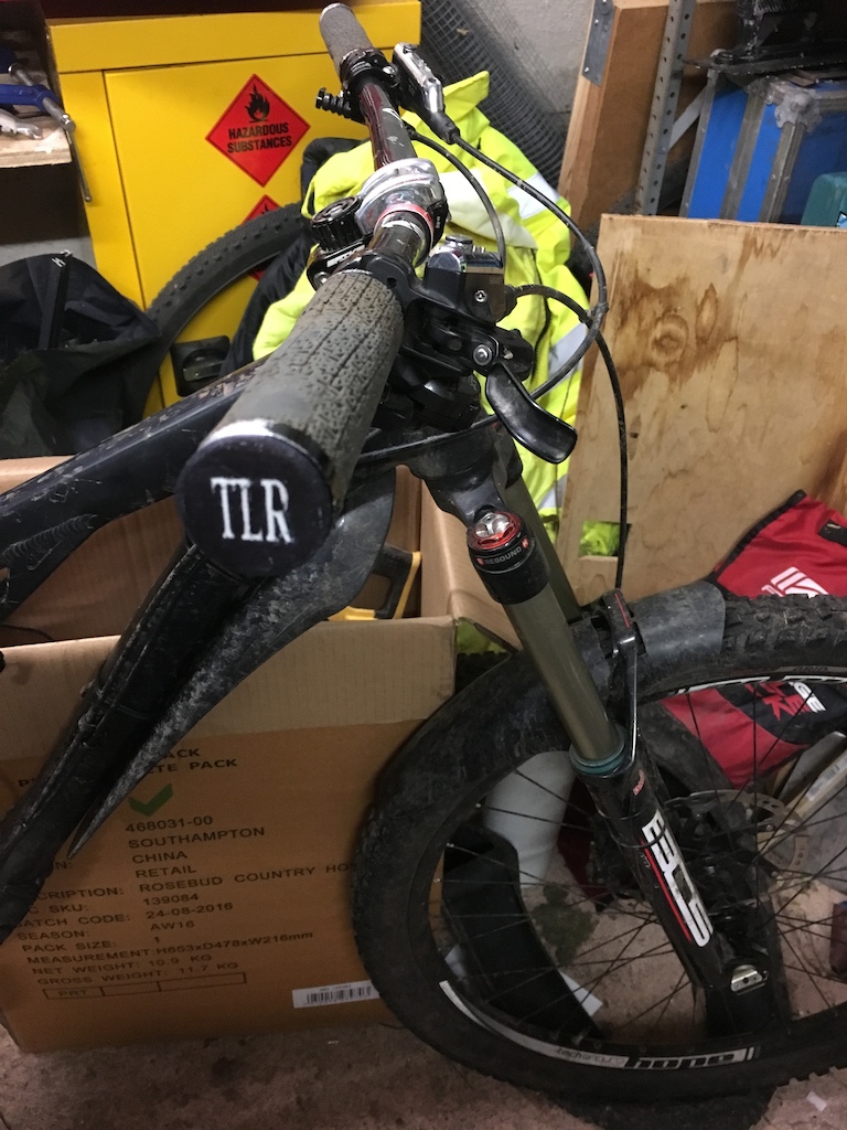
Storage tubes for BB and bar end holes – Bar end plug is tubeless repair tool&worm
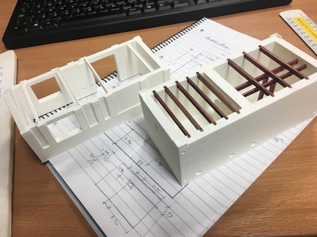
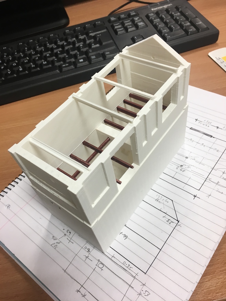
Pumping station which we’re refurbing – 6hrs
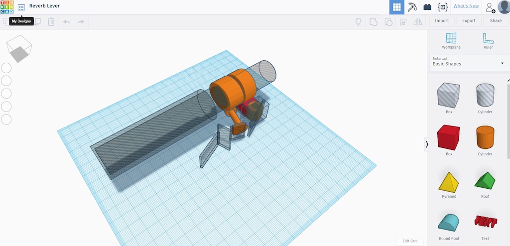
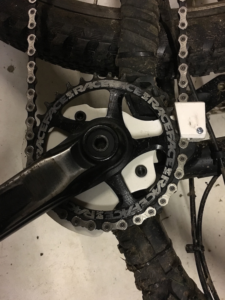
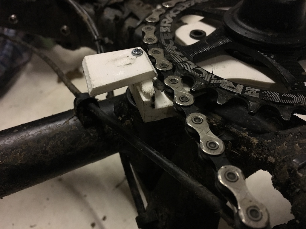
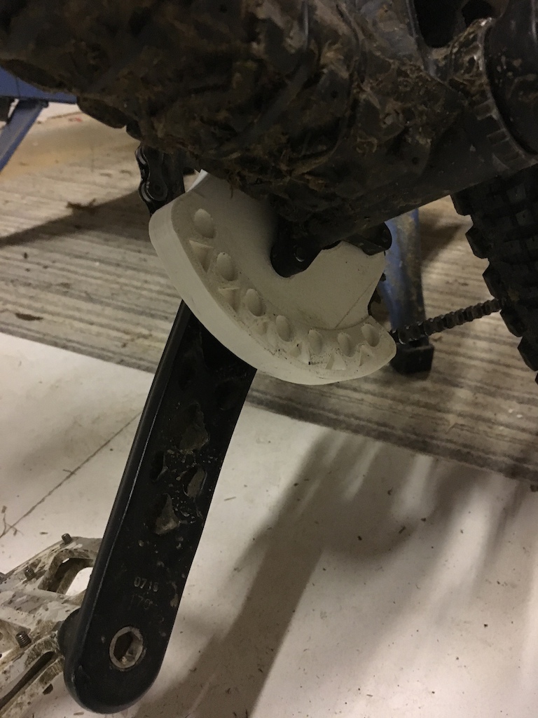
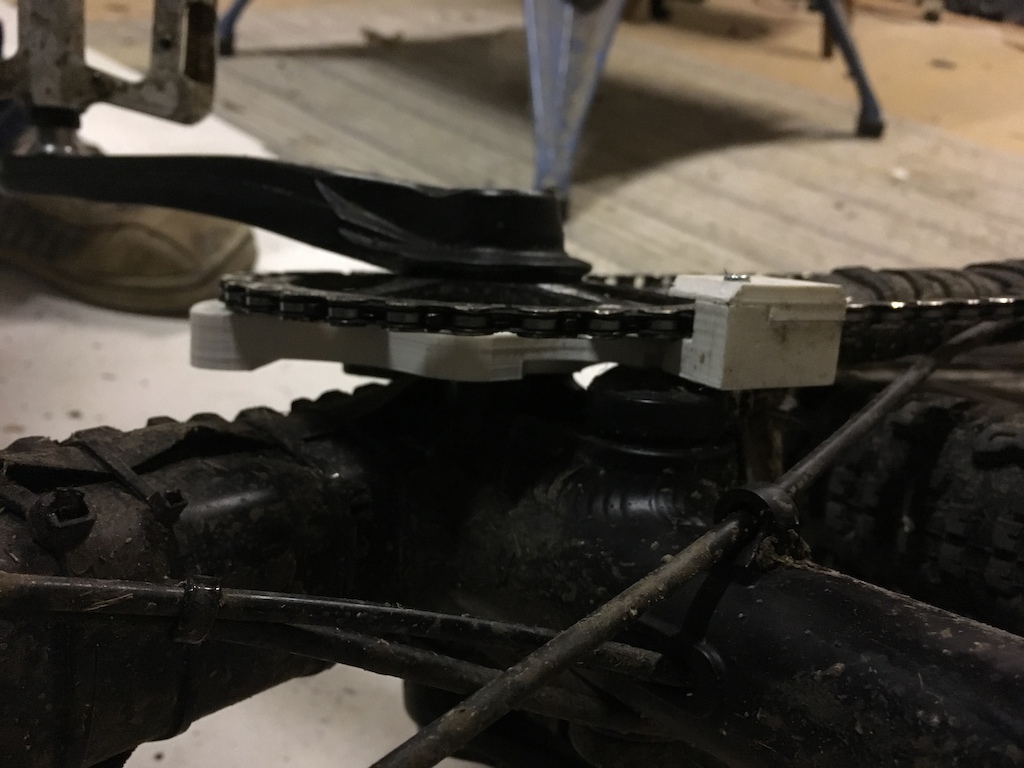
Current project: Lever that fits over the standard Reverb lever to turn it into a paddle type
Resources:
http://www.thingiverse.com – countless free models ready to print including a lot of upgrades for most 3D printers
http://jthatch.com/Terrain2STL/ – terrain maps which use the SRTM3 dataset
http://www.tinkercad.com – Free web based 3D modelling software.
http://www.rigidink.com – a huge range of high quality filaments.wwaswasFull MemberPosted 6 years agoLove the building one – brilliant way of showing the steels going in.
MilkieFree MemberPosted 6 years agoOh some great ideas there! Reverb lever & BB/bar ends. Do you have a Thingiverse account that you are going to upload the files to? 😀
stevehineFull MemberPosted 6 years agoOut of curiosity; where did you get the elevation data for the landscape and how did you go about converting it to a printable model ?
joshvegasFree MemberPosted 6 years agoStevehine.
Lidar data is free from the.gov site.
For all of england.DSM is the lidar data as scanned so everything it hits…. Trees forests… Buildings.
DTM filters out this and “calculates” terrain.
Converting it to something printable i’m not so sure about as i have some nice software to do it with but you probably don’t want to spend 2900 quid a year on it…
muppetWranglerFree MemberPosted 6 years agoNeed to up your game!
[video]https://www.youtube.com/watch?v=tvs3yvEcARA[/video]
stevehineFull MemberPosted 6 years agoAh; I wondered what the difference between DSM and DTM was – thanks (I’ve been looking at the .gov site) – I’ll knock something up to rasterize the data into bitmaps; Cura can convert a grayscale bitmap into a height mapped object and see how I get on …
Cheers !
joshvegasFree MemberPosted 6 years agostevehine – Member
@joshvegasAh; I wondered what the difference between DSM and DTM was – thanks (I’ve been looking at the .gov site) – I’ll knock something up to rasterize the data into bitmaps; Cura can convert a grayscale bitmap into a height mapped object and see how I get on …
Cheers !
Not a priblem. Just wish you could get scotland!
Any free GIS software should be able to output bitmaps for you.
mikeydFree MemberPosted 6 years agoSorry didn’t answer some of the Qs above,
Milkie – yes, will set one up.
Redthunder – with difficulty to be honest. It would take ages to model and would be hard to print due to the amount of overhang. You would have to split it into parts.
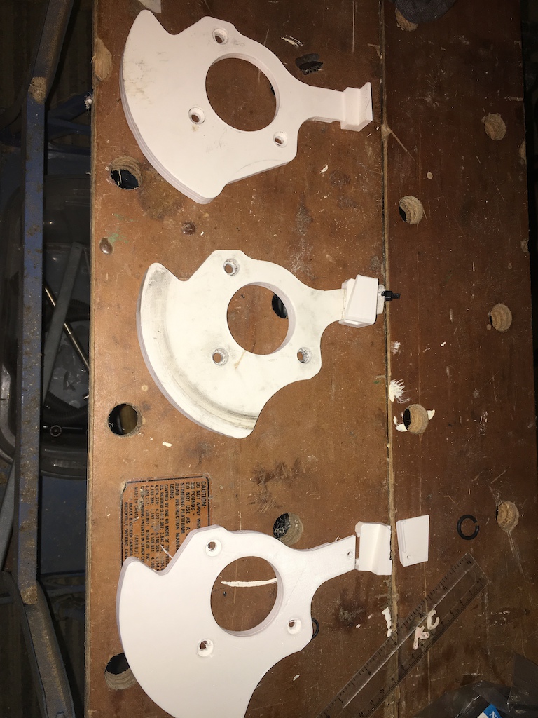
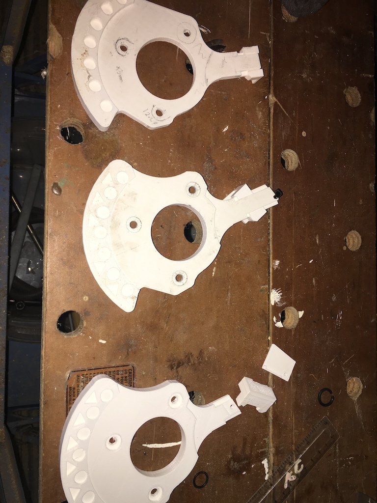
latest attempt at something functional;
Top to bottom; Initial prototype – Test prototype – Working prototype


The initial modelling took 2-3hours in TinkerCAD, with the tweaks in-between taking 30-60mins. Print time approx. 4hrs for each prototype with a 40% fill and 1.4mm shell thickness.
The “put it in a vice and smack it with a lump hammer as hard as you can” test on the first prototype caused it to delaminate slightly, but that was expected tbh.
Will ride this for a bit and see if it needs anymore tweaking then print out of black PETG, probably with 100% infill.
swanny853Full MemberPosted 6 years agoRedthunder- modelling something like that is a job for photogrammetry. Agisoft photoscan is a good place to start but costs money after the 30 day trial. I hear good things about Colmap as free software but haven’t tried it yet.
This is a good review of things:
https://pfalkingham.wordpress.com/2016/09/14/trying-all-the-free-photogrammetry/
AlexSimonFull MemberPosted 6 years agoI’ve been looking for terrain mapping. Thanks for the links.
Did you see MakeAnything’s 3D Relief Map Puzzle that he posted the other day?steviedFree MemberPosted 6 years agoI did something similar on the CNC at work to make a 3D map of the Malvern Hills.
Bought the data (ASC file IIRC) and converted it into machine code with the help of a very clever man off here.
Cost about £35 for the whole of the Malvern area. Took approx 2hrs to machine complete (400 x 100mm)
 stumpy01Full MemberPosted 6 years ago
stevied, I thought of your Malvern relied map when I saw that link to the terrain website.
That finished map looks great.
Does anyone know if it’s possible on that terrain2stl website to change the orientation of the box, so it is a landscape format, rather than portrait.
I’ve been fiddling about with it and some of the scenery I want to create stl files for would fit much better onto a landscape view. There’s a rotate box function, but this doesn’t seem to do what I want it to. It rotates & then goes back to a portrait aspect ratio, rather than landscape.
No big deal, but it would be nice to do it if it’s possible.
mikeydFree MemberPosted 6 years agoNice work Stevied
That jigsaw looks ace too.
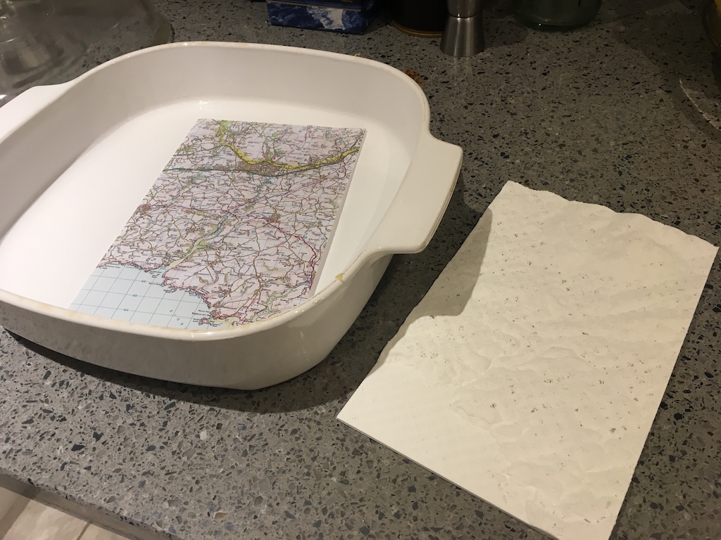
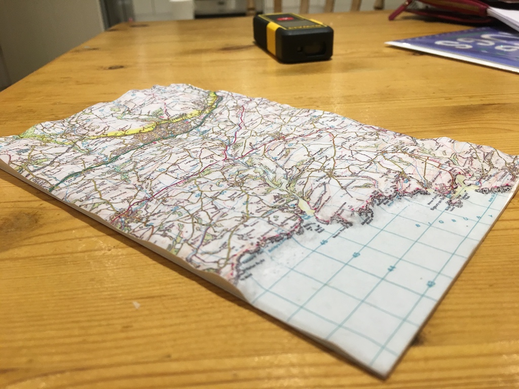
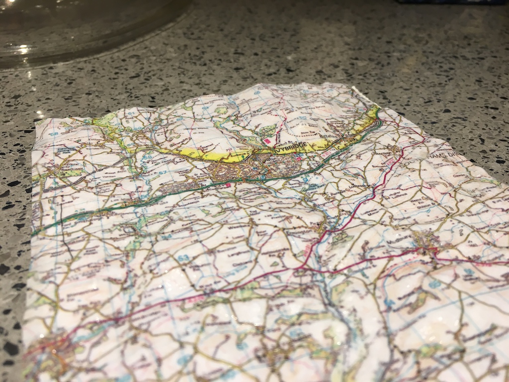
Been trying to work out a way to transfer maps to a 3D relief, the best I’v come up with so far is to print out on a laser-jet onto some thinnish paper, soak the paper then stipple onto the 3D relief. Used a bit of PVA too to keep it down. Fairly pleased with the results, however might try and rig up some kind of vac system (i.e. bin liner and vacuum cleaner) to suck it onto the relief.
AlexSimonFull MemberPosted 6 years agoWow! mickeyd that looks brilliant!
I’ve managed to find the .asc files of my local area, but they are chopped up into squares, so I’ll have to combine them, then work out what it where and then crop again to the areas I want. Quite a bit of work, but at least it’s all free!
I guess the only problem with that print method is that if you’re in a mountainous area, it wont stretch correctly to follow the terrain.
Lasering might work (of some key lines), but I don’t know if the laser goes out of focus as the piece undulates. I know the Glowforge is meant to scan the surface and follow it.


The topic ‘3D Printer Adventures’ is closed to new replies.