- This topic has 12 replies, 4 voices, and was last updated 11 years ago by dannyh.
-
Yorkshire Dales point-to-point advice (again), please……
-
dannyhFree MemberPosted 11 years ago
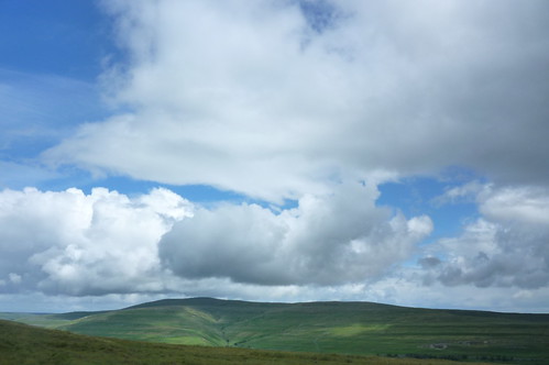
In 3 weeks, a couple of mates and I are doing a 30 mile point to point across the Dales from Horton in Ribblesdale to Bolton Abbey.
We have a basic route that heads NW out of Horton before turning SW to pick up bridleways that end up approaching Settle from the west – I can’t see any real options if we’re going to ride this bit.
We then head east out of Settle to Malham. I can see two basic options here – either NE out through Langcliffe to pick up a BOAT, or directly east out through Upper Settle to pick up Stockdale Lane and a bridleway. I would welcome any suggestions as to which is more fun to ride, and if either is likely to be a real bog snorkel job after all the recent rain.
Out of Malham heading for Hetton I can see two options again. A longer loop NE taking in Mastiles Lane before heading due south on bridleways, or a more direct route across Hetton Common Head. Both routes drop into Hetton on Moor Lane eventually. Again, any help on fun or avoiding really marshy stuff would be great. The Mastiles option also includes riding up Smearbottoms Lane – it may be worth it just for the name………
After Hetton, it’s out through Rylstone onto Rylstone Fell, before crossing to Bolton Abbey with a final drop from Middle Hare Head. I can’t see options on this – so long as it’s not underwater we’ll be riding this bit.
Any help would be great – just to avoid any really dull slogging across miles of knee-deep marshland!
pennineFree MemberPosted 11 years agoFrom Horton take minor lane north through New Houses. At 2nd cattle grid (2mls) turn left on newly opened Pennine BW to main road. Take track to Borrins & follow your (Thieves Moss) option south to Wharfe. BW to Feizor (lovely cafe) then BW east towards Settle. Bear right at top to old A65 at Buck Haw Brow. Road into Settle. Find BW at top of village (steep) to Clay Pits. Follow BW (Settle loop of Pennine BW) over Gorbeck to Langscar Gate (cuts out steep tarmac slog to Stockdale). Left then right on BW to Malham Tarn. Right at road to start of Mastiles Lane. Follow to ford (could be interesting), up hill to gate for Smearbottom Lane & deep puddle. Up this to farm gate & down to road. Follow to top of steep drop (Gordale) & walled track on left. Up this to Weets Top. Take left BW and follow down to Winterburn reservoir. track to Hetton and your route to Bolton Abbey.
Of course there will be wet/boggy bits & draggy grass but this misses most of the gloop. The trail over Rylstone is likely to be very wet I’d guess. Good luck.
martinhutchFull MemberPosted 11 years agoThe up from Borrins is on grass so will be draggy, but I can’t see any alternative if you want to head this way. Likewise splashy over to Thieves Moss descent into Crummackdale. Personally I’d opt for Long Lane instead towards Clapham, then follow good tracks left towards Austwick, cross 2 roads and pick up BW across ford towards Feizor (good cake stop here!). Then either BW to Settle as per Pennine’s, or follow BW north and then minor roads to Stainforth to climb up to join the Settle Loop. If you’ve caked in Feizor and don’t need to actually go into Settle, I’d take this way as the route direct up from Settle can be a bit muddy.
I think Mastiles will be soggy and sloggy across the top section at the moment (although still well rideable). If you’ve still got a bit more climbing in your legs, I’d take the Langscar Gate route, turning off S near the top (ie still reversing the Settle Loop) to avoid the usually v muddy bit down towards the road. When you pick up Stockdale Lane, turn L and head down to the road, down towards Malham then almost straightaway off onto another BW which is a fun, fast descent into the village. Refreshments, then slog up Smearbottoms, off to Weets Top, then as per Pennine’s down to Hetton. After Weets Top there is some fantastic constructed singletrack, followed by a bit of squelch, but it’s mostly downhill so shouldn’t feel too bad.
Rylstone – Bolton Abbey route should be fine. There is a brief squelchy section just after the climb, then it’s all fast single and doubletrack to the road, with one stream to ford. Middle Hare Head will also be mostly fine, with one short damper section.
Enjoy!
dannyhFree MemberPosted 11 years agoThanks for the recommendations – I’ll feed them into the route committee 🙂
I am really looking forward to this little outing now – my work has gone absolutely turbo in the last fortnight and I can’t wait to have a crack at ‘Boys Own’ point-to-point.
martinhutchFull MemberPosted 11 years agoWas out on a large section of your proposed route yesterday – Skipton to Clapham – and was surprised at how dry it was, in particular the Langscar Gate descent and Mastiles Lane between Malham Tarn and the turn off for Weets Top. So disregard this portion of my advice, unless it totally tips down over the next couple of weeks.
Don’t do it into a headwind though. Felt a lot longer than 30 miles yesterday.
ChrisEFree MemberPosted 11 years agoI live here there!
Road Horton to Helwith Br, Moorhead Lane to Sannat Hall, Road to High Trenhouse, BW across Malham Tarn Field Centre to Street Gate. On Mastilles Lane for about 2Km turn right at Mastilles Gate towards Lee Gate Farm. At Farm turn Left to Bordley, turn Right at Bordley Farm BW through Bordley Green and up zigzags on road turn right towards 4 way junction above Winterburn Res. Turn left to Hetton and at village quick right 100yards and left down small BW over river and up to main road. 100yards right and turn off left on BW with LH junction up Rylstone Edge over moors about 5+Km to go straight across road and over fields to woods above Bolton Abbey, down through woods which drops right into Bolton Abbey visit.
Done from memory but let me know if you need a GPX writing for it.
C
dannyhFree MemberPosted 11 years agoThanks to everyone who posted advice – these were all fed into the route committee over a curry and a couple of pints on Friday night.
The final route ridden yesterday clocked in at 37.5miles with about 1,350m of climbing (from memory of what my mate’s Garmin said by the end). There was a bit of everything – my first ever sight of a kingfisher when I nipped for a slash before the start, sunshine, drizzle, rain, hail, sausage butties, a couple of near-mutinies and ultimately three very knackered 30-odd blokes who were already planning the next ride in the car on the way back!
Again – thanks for the help.
dannyhFree MemberPosted 11 years agoHi ChrisE,
We went NW out of Horton before picking up the Pennine BW. We used the western option (Long Scar) before dropping just to the east of Clapham. Then across to Wharfe – missing out Austwick before Giggleswick Scar and into Settle.
Out of Settle it was the NE option – Claypits and Langscar – all the way to the road above Malham Cove. Then picked up the start of Mastiles – turned SW down Smearbottoms before climbing to the Weets. Down from here to the Winterburn reservoir, then back up to Rylstone and across Rylstone Fell and Middle Hare Head.
A really good, ‘long-distance trucking’ kind of ride – nothing technically challenging, but a cracking day out nonetheless. I only had to resort to pushing up the Rylstone climb – lack of fitness more than anything else – I managed the climb out of Settle OK (I was quite chuffed with that). One of the lads pushed some of the Settle climb, but rode the Rylston one as far as the gate, so we called the climbing ‘evens’.
It’s always a bit hard to judge routes from descriptions – even in ‘official’ printed stuff. Some of the stuff towards Clapham was described as ‘rocky’, but as most of my proper MTB rides are done in the Dark Peak, so I was expecting ‘rear tyre buzzing seat of shorts’ steps, huge rocky slabs and coconut sized rock chutes!
Not that I was disappointed in the slightest – it’s good to mix up your riding, and a decent length hack across some moors was a great way to spend a day. I know there’s more techy stuff in the Dales (Old Cote Moor Top to Litton for example), but this was more of a ‘let’s see if we can do this’ sort of a ride anyway.
Cheers for the advice.
ChrisEFree MemberPosted 11 years agoCheers for putting that up, hopefully others will get use from that too. You may well have ridden past my front door (Wharfe). I think the Dales is such good riding but there again I am bias!
C
dannyhFree MemberPosted 11 years agoMy mate Strava’d the ride if anyone wants to do it:
It’s called:
07/28/2012 Horton In Ribblesdale, North Yorkshire, United Kingdom
I’m not good enough technically to put it up as a URL, so hopefully you can find it.
pennineFree MemberPosted 11 years agoGlad you enjoyed the route. Funny you should mention Old Cote Moor. I was walking on there today. Yonder Buckden Pike. Now there’s a techy descent!

Mostly sunshine with the odd downpour.dannyhFree MemberPosted 11 years agoYes, the descent to Litton is pretty picky to start with – the lads had a bit of laugh when we stopped on the top for lunch last year and I walked about 30m down to pick some lines before riding it! I only had one refusal when one of my ruts became an inescapable dead end. Then it’s good when it opens out as well – lot of height to play with, so good variety. I remember nearly blowing out a fast left hander as the trail went through a gateway and took a sudden turn – it would have been a good tumble if I had!
We did it as a ride out of Kettlewell east then north up the Buckden Pike bridleway and across the bogs to the ‘good weather extension’ on the MBR route that we used for the 1st part. We then descended to Starbottom and rode up the road to Buckden(?) before going over Old Cote Moor Top to Litton. We then came back over Old Cote Little Moor to Kettlewell via the right hand branch that takes in the rocky track practically back into Kettlewell.
It was a beaut of a day out – really good, steep stuff a lot of the time – another Dales route I can recommend!
I love the sheer variety you can get in the UK – flowy (mostly) open stuff in the Yorkshire Dales, flowy singletrack on the Long Mynd, clattering down rocks in the Dark Peak – all within a few hours.
Even on our route on Saturday there was a ‘night and day’ change when we hit Rylstone – from grassy limestone slopes to peaty, heather-covered gritstone in the blink of an eye. You don’t get that in the US for example.
All hail the glacier!
The topic ‘Yorkshire Dales point-to-point advice (again), please……’ is closed to new replies.