- This topic has 11 replies, 9 voices, and was last updated 7 years ago by kendonagasaki.
-
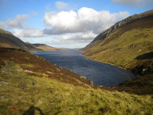
Llyn Cowlyd
-
thebatesbristolFree MemberPosted 7 years ago
Hi all,
Going to Snowdonia at the end of the month, have thought about doing this loop, I’ve heard it’s a good one or not?
I’ve seen a couple on GPSIES (http://www.gpsies.com/map.do?fileId=rmcsctilfjdjwvrt) but have heard there is a slightly shorter route and something about doing it the other way round???
Can anyone suggest a route (.GPX) for me to take and offer any other info or advice. My friends will most likely keep to the trail/DH centres over the weekend so it may be me and the Garmin…
Thanks
Simon
whitestoneFree MemberPosted 7 years agoMy wife and I did this loop a few weeks ago, we actually started from Trefriw as it was easier for us to get to. It’s best described as a classic old style MTB route, there is some pushing and a little carrying where things get too rough or steep but it doesn’t detract from the overall experience. Just don’t expect flowing singletrack, though there is some of that, trail centre riding it ain’t.
The descent to Trefriw is *massive*, a friend who’s good at climbing reckons it’s possibly the hardest road climb in the UK, here’s the Strava segment https://www.strava.com/segments/8567419 , so it’s best done in the indicated clockwise direction.
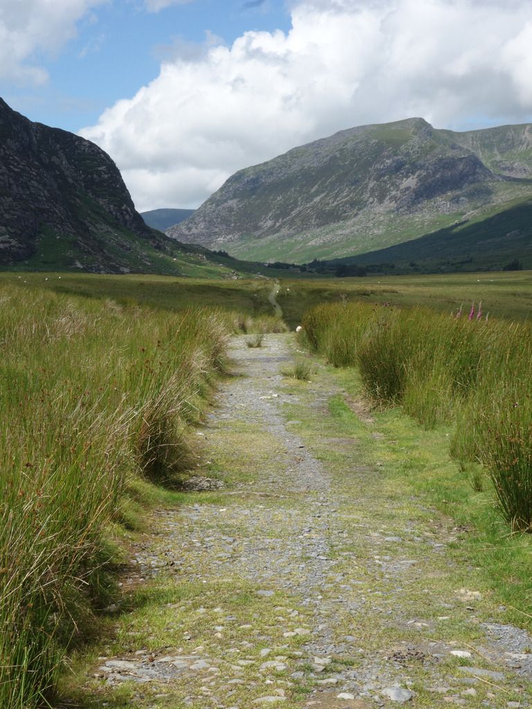
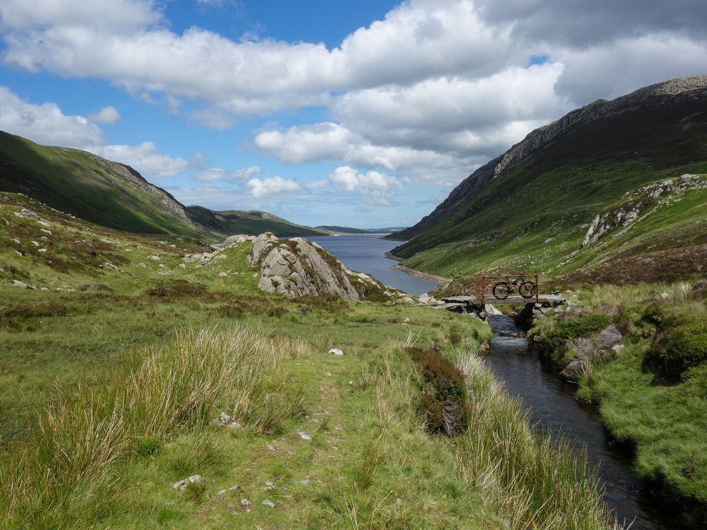
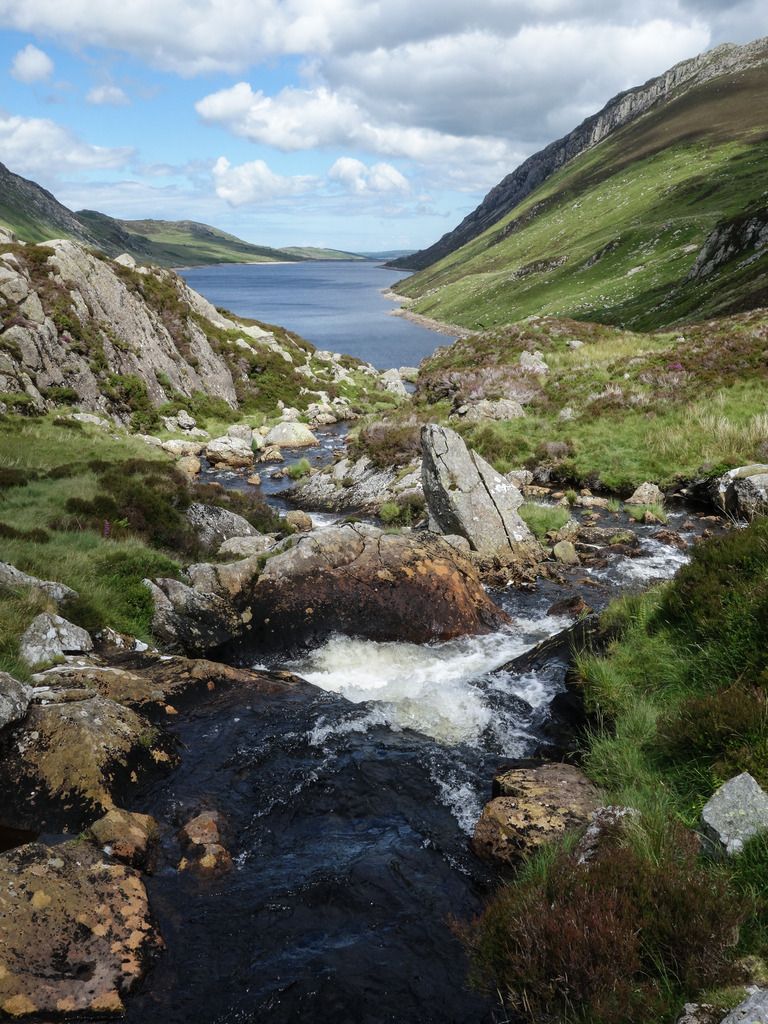
A general description: easy track from Capel to the campsite; steady climb on track from A5 to farmhouse; indistinct and boggy ground to get to water leat; technical with some carrying at the start alongside Llyn Cowlyd; road climb then the big descent and another steady road climb to Crafnant; steep climb out of Crafnant; technical rock fest back to Capel. Not sure how you’d be able to shorten it really, the only other BW from Capel to Llyn Cowlyd is very boggy
I did the ride on a rigid ’cause I’m weird 😆 actually my suspension forks died so I’ve only got rigid forks ATM. I’m not the most technically gifted rider but I managed 95% of the descent to Capel – there’s some steps you need to climb that pretty well everyone will walk. I probably did 85% of the BW beside Llyn Cowlyd but even on a full-suss I don’t think I’d have done too much more as the bits I walked are only really rideable if you can bunny-hop between sofa sized rocks.
tillydogFree MemberPosted 7 years agoVery good, IMHO. I would do it clockwise. It would be desparately bleak in poor wearher, so best have a ‘Plan B’ too. The last quarter will probably take you longer than you expect, unless you are a DH god (not steep, just really techy).
Enjoy!
Edit: what he said^
mrchristFull MemberPosted 7 years agoI would say its a proper mtb route. Tough, great views, some excellent rocky trails, massive climbs and a good feeling of remote riding.
If you do it clockwise you end up with a massive descent on road to finish in Trefiew. It’s better anti clockwise descending into capel with great view across Tryfan and snowdon. The climb out of capel is actually quite fun (if you like tech climbs) and the descent is superb, rocky at the top and the super fast with a few turns down to the lake.
Some people say the trail from crafnant to capel is better as a descent bit it’s only really the top with is steep enough to get any speed up on after that it levels out and is quite dull. A lot of flag stones.
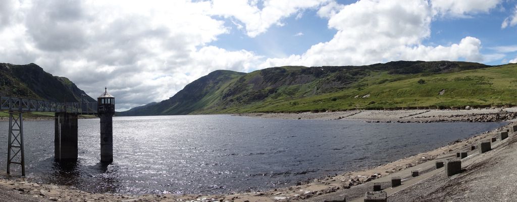
There is a nice cafe on the lake side (closed in winter) too, well worth a stop.
Either way you do it you have a road descent to Trefiew (unless you know the cheeky alternative) so it just a case of deciding to drop from 450m or 150m on road to finish.
dirtydogFree MemberPosted 7 years agoMy advice would be to be to leave the SPDs at home, the section along Cowlyd gets quite technical, if you do wear them expect to be clipping in and out.
Did it anti-clockwise and can confirm the road climb out of Trefriw is a killer, iirc it’s something like 450m hight gain over 2km.
+1 for the lakeside cafe at Crafnant, must be one of the most scenic in the country, might still be open if the weathers nice.
It’s pretty remote so if your doing it on your own tell someone where you are going.
chrisdwFree MemberPosted 7 years agoIt’s not a great route. Much better ways of doing similar trails without all the rubbish bits. The bit along the lake is a pain. When we got to the dam at the end we hike a biked up the hill over towards crafnant and down through the woods. You will need a map for that.And probably a compass. There is a way through. Its not obvious though. But the woods were great fun.
beicmynyddFree MemberPosted 7 years agoIf you are going from the A5 side a tip is to head for the leat that feeds the lake as soon as you can. It saves a lot of pushing through boggy ground.
RorschachFree MemberPosted 7 years agochrisdw….your(sic) doing it wrong.
One of my all time favorite rides (especially if you link it to crafnant and geirionydd)
 tillydogFree MemberPosted 7 years ago
Oh, pictures! 😀
(^Don’t be fooled – there’s not much like this)(Be different in the rain! 😉 )
AristotleFree MemberPosted 7 years agoThe road climb out of Trefriw is fairly brutal. I rode it on a road bike last year.
I did it on a singlespeed mtb too once when I did the loop in question, about 11 years ago -I might have walked the steepest hairpins, though.
whitestoneFree MemberPosted 7 years ago@beicmynydd – we did think about that once we’d got to the leat but weren’t sure if there was a track beside it all the way from above the farmstead. Would make it a lot better, just a bit of a push once you get over the fence.
kendonagasakiFull MemberPosted 7 years agoWe started in Capel Curig and rode it clockwise. We also once started at the Marin Trail car park and rode it anti-clockwise finishing back via the Marin Trail.
I would always ride it clockwise from now on as the climb out of Trefriw is a killer!
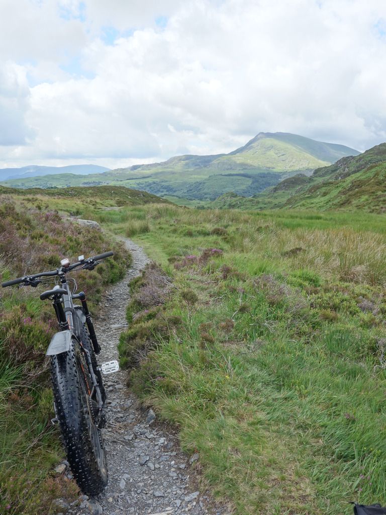
Photos from this years ride –

The topic ‘Llyn Cowlyd’ is closed to new replies.