- This topic has 21 replies, 10 voices, and was last updated 9 years ago by oldnpastit.
-
Getting to Afan from the other side of the hill?
-
oldnpastitFull MemberPosted 9 years ago
I’m going to Afan this weekend; we’re staying in Blaengwynfi which has a hill between it and Glyncorrwg. Is there a way to get over the hill, rather than going round on the road(*)?
Thanks!
(*) I’m single speeding, so I don’t much fancy spinning along the road more than I have to!
snownrockFull MemberPosted 9 years agoOS Maps seem to show plenty of bridleways and fire roads over/round the hill, but they are always so unpredictable round here you never know until you try.
martinhutchFull MemberPosted 9 years agoIsn’t there a dedicated cycle trail alongside the river all the way to Glyncorrwg? Nice warm up for the Whites climb. I wouldn’t want to add too much extra climbing to a day at Afan…those valley sides are steep!
oldnpastitFull MemberPosted 9 years agothose valley sides are steep!
Better not be too steep, I’m on 32:18, aka 51.5″ !
(I’m sure last time I went there was only one spot that was completely impossibly SS).
KlunkFree MemberPosted 9 years agotheres never any need to use the roads at afan when on a bike there’s a low level flatish cycle path that connects all of Afans trails with Glycorrwg/Cymmer/Blaengwynfi/Pontrhydyfen you can spin out on that 😉
davidjeyFree MemberPosted 9 years agoIn the old “Skyline” days it used to be possible to get up from Blaengwynfi onto the top of the hill and pick up the back of skyline. However even back then it was a hell of a climb (great descent though if you were going the other way!!!) and required good navigation at the top. I’ve no idea what’s going on that end of the hill now – isn’t there a windfarm going in….?
Anyway, do what everyone else says – ride down the cyclepath to Cymmer and on to Glyncorrwg. Only about 20-30 mins spin I would have thought.
oldnpastitFull MemberPosted 9 years ago@snownrock – yes, you’re right, there’s a bridleway that looks like it goes all the way (slightly roundabout route). Might be a bit of a struggle going back from Glyncorrwg, as it’s about a 15% gradient. There’s also a footpath with a more direct route.
Thanks to others for the low-level off-road route, that might also be a good option if my legs have given up 🙂
martinhutchFull MemberPosted 9 years agoW2 has well over 4,000ft of ascent. Pretty much everything was about to give up for me after that. I think I would have ceremonially topped myself by ordering a double-sized helping at the Glyncorrwg caff if I still had the prospect of climbing up and over the lump opposite.
deadkennyFree MemberPosted 9 years agoI thought there’s a fair bit of “no bikes!” in many of the FC areas that cover the hills between. I recall strict no bike signs on some of the FC entrances when driving over to Treorchy.
But yes you can ride easy up the disused railway between the lower visitor centre down by Penyhdd/Y Wall and up to Glyncorwgg. Just the bit between Cymer to Blaengwynfi to deal with, or maybe there’s a cycle path. Long way round to Glyncorwgg but less of a huge hill in the way.
molgripsFree MemberPosted 9 years agoI thought there’s a fair bit of “no bikes!” in many of the FC areas that cover the hills between.
Now I’m not one for civil disobedience and I almost never ride cheeky trails but the FC can f right off if they are putting no bikes signs all over a vast expanse of empty desolate forestry.
davidjeyFree MemberPosted 9 years agoJust the bit between Cymer to Blaengwynfi to deal with, or maybe there’s a cycle path.
There is indeed a cycle path. It’s easier to find from the Blaengwynfi, a bit more of a faff from the Cymmer end, so pay attention on the way there to ensure you can retrace your steps on the way back! If you get lost, find/ask the way to the fire station and you’ve as good as found it….
missnotaxFree MemberPosted 9 years agoIn all the snow last year, a mate and I made the call to get down quick from the top of Skyline as various bits of bike were freezing up etc. We managed to descend from the top of Skyline, via fireroads, into the wrong valley… The car was at Glyncorrwg! 🙁
Took flipping AGES to ride back around on the road, on my old not-very-light Orange 5! I hope you’re not staying wherever we ended up as that was quite a slog…!
snownrockFull MemberPosted 9 years agoI thought there’s a fair bit of “no bikes!” in many of the FC areas that cover the hills between. I recall strict no bike signs on some of the FC entrances when driving over to Treorchy.
Pretty sure it’s motorbikes, not pushbikes. FC land is open access anyway isnt it?
deadkennyFree MemberPosted 9 years agosnownrock – Member
Pretty sure it’s motorbikes, not pushbikes. FC land is open access anyway isnt it?There were a few spots along the A4107 around the Bwlch with crossed out symbols on everything, with what I’m sure looked like mountain bikes & horses at least.
Trying to look on Street View, but the signs are blurred out by Google.
FC open access, maybe only to walkers. Certainly not bikes. One near me has been an issue with the land owner and bikes, at one point a few years back there were threats of getting the police in (who were not interested as trespass is not a criminal offence). FC in that case, like many places just do the land management, but they don’t own the land.
Anyway, OSM’s marked routes…
http://www.opencyclemap.org/?zoom=13&lat=51.66362&lon=-3.66255&layers=B0000
oldnpastitFull MemberPosted 9 years agoWell, it turns out it *is* possible. It’s quite a push up to start with, but then levels out and is a really nice little bridleway with some slightly gloopy sections. You then drop down towards Glencorrwg across an enormous trackless boggy hill before picking up the bridleway again towards the bottom.
Watch out for the troll who lives under the bridge just before Glencorrwg, as he has some weird but very fixed ideas about public rights of way.
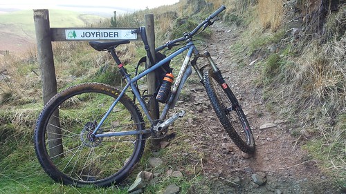
 [url=https://flic.kr/p/p81Gtd]20141115_140923[/url]
You could also get some of those new-fangled gears?
Yeah, I think that might be quite a good idea. I managed to score a 30t 104bcd chainring from the lovely people at Skyline Cycles which made it a bit more bearable. But I think I’m just too old now for single speed!
philwarren11Free MemberPosted 9 years agoI was about to type a massive reply on how to get there but see you’ve already ridden it lol.
Its not the FC putting the signs up, its the windfarm people Vattenfall. Its for safety reasons because of the machinary used.
oldnpastitFull MemberPosted 9 years agoIts not the FC putting the signs up
No, it wasn’t either the FC, or the windfarm people. We encountered an actual original troll, the kind that lives under a bridge and eats goats. Or possibly an angry sheep farmer. But probably a troll.
deadkennyFree MemberPosted 9 years agoWas thinking he was referring to the signs I saw, though they were on FC signs. I could be wrong, but I remember at the time seeing a mountain bike with a big cross through it at some of the fire entrances off the road. Would make sense if there’s concern about the windfarm stuff. Though that’s all over by Skyline side isn’t it?
oldnpastitFull MemberPosted 9 years agoWe were briefly on Skyline up on the eastern loop (where it’s closed off now). Didn’t see any signs, or windfarms. Lots of evidence of some very enormous machines being put to use.
The topic ‘Getting to Afan from the other side of the hill?’ is closed to new replies.