Hi,
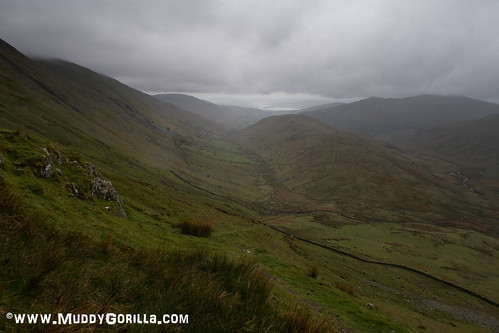
Wow, I think that’s mine. It’s a Garmin Etrex 20 I think. I looked at it going through Limefitt Park but when I’d got to about Lowther Brow at (GR 424056) I noticed it’d fallen off. This is a photo looking back down the valley taken a bit later [url=https://flic.kr/p/US1dXt]Troutbeck Park[/url] by Iain Francis, on Flickr I just couldn’t bring myself to retrace my steps as it wasn’t quite as easy going as I’d remembered. Many thanks for posting about it. If you let me have your email I’ll send you the cost of postage etc.
I’ll PM my address to you if that’s OK?
I wasn’t too worried about the losing my navigation as I’d got a phone to fall back on but not a map or compass stupidly. But after a tedious accent up Park Fell I found myself in the middle of a flat mossy bog that was almost impossible to cycle over. I couldn’t see further than about 50m and had no idea which way to go so resorted to my phone but it was so wet I couldn’t get past the start screen. Arrgggh. Anyway it cleared up after that and the descent after Loadpot Hill down to Howtown was a blast. The ‘Marion’ on the start up screen is my better half.