- This topic has 21 replies, 16 voices, and was last updated 8 years ago by trademark.
-
Corrieyairack Pass; Scotland MTB The Wild Trails…
-
crimsondynamoFree MemberPosted 8 years ago
Has anyone ridden this recently and is it good fun?
I did the Invergarry Forest Circuit two days ago and it was absolutely horrendous. At 6 years old I think the guidebook is too old to be trustworthy.
scotroutesFull MemberPosted 8 years agoDo it in the Laggan to Fort Augustus direction. The water bars are rideable, there’s a short steep climb and a long descent.

I’m pretty sure the book was written before the track was resurfaced which has taken away some of the “character” of the ride. Still stunning scenery though.
eat_more_cheeseFree MemberPosted 8 years agoGood fun: no, not really
Good views: well maybe on a good day
Means of getting from Laggan to Fort Augustus: great routestevenmenmuirFree MemberPosted 8 years agoI can’t comment on the Corrieyairack Pass but the Invergarry route was the same four years ago. It was especially annoying as we chose thinking there wasn’t going to be much if any hike a bike.
Fat-boy-fatFull MemberPosted 8 years agoThey’ve resurfaced the pass? About time. Rode it Laggan to Fort Augustus about 4 years ago and the slog up was unrideable due to the path being massively eroded apart from the huge water bars. Might be worth another look now. The ride back from Spean Bridge to Laggan via valleys is one of the nicest big open country rides I’ve ever done.
BadlyWiredDogFull MemberPosted 8 years agoWe did it in March last year in a linear sort of way from Fort Augustus down to Roy Bridge. It was pleasant enough, quite atmospheric, lots of impressive pylon works. Fun? Some of the bits down the glen below the pass itself were mild;y entertaining, but I wouldn’t have said it was an unmissable classic. I remember it as a good day out with some ace views, but the riding itself was so, so.
crimsondynamoFree MemberPosted 8 years agoI’ll be doing an out and back from Ft Ogs. I’ll see how far I can get in c.3hrs then turn around.
If I can actually turn the pedals that will be a massive improvement on Glengarry, which was at best a dreadful advert for Scottish mountain biking and at worst a dangerous recommendation.
Those water bars sound like good practise for bunny-hopping on flats rather than cheaty spds.
whitestoneFree MemberPosted 8 years agoThe Glen Garry loop would be a poor walk let alone a bike ride. Not done the Corrieairack but it’s on the HT550 and there was little comment about it from those who rode it this year.
Most of the other routes in The Wild Trails book are good so quite how the Glen Garry loop got in there is anyone’s guess. The first book are more “old school” style XC routes, the second volume has more technical routes.
stevenmenmuirFree MemberPosted 8 years agoI really enjoyed the descent and the initial climb was fine but what’s the point of a guide book if it says absolutely diddly squat about 4-5km of hike a bike.
roverpigFull MemberPosted 8 years agoI’ve done it from Ft Augustus as part of an event and really enjoyed it. But then I enjoy climbing. According to Strava, from the start of the trail to the summit it’s 8.1 mi and climbs 2,380 ft (making it a category 1 climb). It took around an hour and a half to get up (although it’s been done in under an hour!) and about 25 minutes to get down to the tarmac at Melgarve, so you should have plenty of time 🙂 The descent was fun, but some of those water bars are well beyond my meagre skills.
scotroutesFull MemberPosted 8 years agoThe water bars are not the normal type of things.
FWIW it was resurfaced in an effort to prevent more damage to the underlying road surface which is actually a Scheduled Monument.
krixmeisterFull MemberPosted 8 years agoMostly what’s been said above (esp @ScotRoutes). But if you want a nice “grand day out” challenge, you can do a big loop. Either direction works, but I recommend:
Fort Augustus -> Gairloch via the Great Glen Way
Gairloch -> Roybridge and into Glen Roy – check out the parallel roads
Glen Roy -> Melgarve
Melgarve up and over the Corrieyarrick back to FAscotroutesFull MemberPosted 8 years agoAh – I’ve thought about that Glen Roy to Melgarve track. Worthwhile then?
esselgruntfuttockFree MemberPosted 8 years agoMostly what’s been said above (esp @ScotRoutes). But if you want a nice “grand day out” challenge, you can do a big loop. Either direction works, but I recommend:
Fort Augustus -> Gairloch via the Great Glen Way
Gairloch -> Roybridge and into Glen Roy – check out the parallel roads
Glen Roy -> Melgarve
Melgarve up and over the Corrieyarrick back to FAWe did the opposite about 15 years ago! The descent from the col to Melgarve was pretty good then, rocky but 100% rideable on HT’s. We started/finished at Laggan hostel, about 60 miles? The killer was the headwind heading back (NE) up the side of Loch Lochy & we’d ran out of food/drink!
[url=https://flic.kr/p/7XsWKQ]Start of the Corrieyairack[/url] by jimmyg352, on Flickrseosamh77Free MemberPosted 8 years agodone laggan to Fort Augustus before, must be about 3/4 years ago. was about 90% rideable, maybe more.good rooad ride in to the bothy, and then just before you get to the zigzigs it started to get pretty erroded largely ridable though, depending on how soggy it gets, then you’re pushing up the zigzags. once up it was just fire road really, fairly rocky to begging with then it’s fine, and then there was some sandy bits that sent me over the bars about 3/4s the way down, 100% ridable on the down there(it imagine all ridable going down the zigzags to the bothy as well, potential for some unexpected otbs just after the zigzigs if it’s soggy).
All in all, it’s alright was touching the cloud at the top when I done it, view wise, not the greatest if the truth be told. just a case of following the track and the pylons. Glad I did it, but I’d be unlikely to be in a hurry to do it again, not saying I wouldn’t.
dohFree MemberPosted 8 years agoDone it about 5-6yrs ago in May had to push my bike through big snowdrifts at higher levels in shorts and t shirt then spent a great night camping and drinking whiskey and nursing my sunburn at the top of the dam lower down.
Went over again as part of the c2c 2yrs ago in July and had a very hard time in gale force winds and near zero vis half way up. Almost hypothermia by the time I reached the bothy at the other side and managed to dry out and warm up.
It is a big hill with no worthwhile payoff other than it is big and you can cycle up it. The route has some nice views and a few meters of exciting track but nothing else. took the old route I think the pylon road would be better to take now if you just want to get over as quick as possible.epicycloFull MemberPosted 8 years agoI’ve been stranded overnight there in a blizzard at the end of July many years ago. Luckily I was prepared.
It’s basically just a big climb, but because of weather it should not be underestimated.
The views can be fantastic, plain ordinary, non-existent, or very atmospheric if there’s mist.
It’s worth doing at least once.
I’m intending to go over it some time in the next week or so, but I’m waiting for clear weather because I’ll be on my road bike.
crimsondynamoFree MemberPosted 8 years agoI did an out and back today from Invermoriston. I got as far as Corrie Yairack itself (3hrs from start point) then turned around.
It was lovely weather and a good workout, but unfortunately I took the pylon road up to the top of the Pass, where a workman pointed out the error of my ways. Thankfully I was only about 10ft away from Gen Wade’s road at this point. The workmen were in the process of removing their road. It looks to to be filled in all the way from Laggan to the summit and now they’re working their way down the north west side. Get your Strava runs in quick!
kcalFull MemberPosted 8 years agoUsed to do it regularly as part of the Corrieyairack Challenge (from F A over heading E), could never have the legs by the top to get all the way from bottom to top without walking. Descent on the other side to melgarve was always entertaining, water bars, and by the time I stopped doing it – about 2005 – there was a huge water channel down the middle that made it more of a bobsleigh run than anything else. HT was all that was needed (and legs on way up, arms on way down).
More recently did it (again W-E) as part of a C2C, around 2010, it was a bit smoother but waterbars were pretty intimidating and still had some massive sidewalls. Walked a lot more (on a rigid SS was my excuse).
poahFree MemberPosted 8 years agorode it on a ridged orange C16R about about 20 years ago – good fun
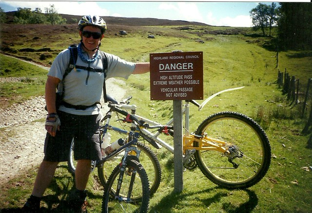
trademarkFree MemberPosted 8 years ago@ Esselgruntfuttock, THAT’S MY MARIN MV and I took that pic with your camera!
What memories that brings back! Cheers.
Just as we thought we were at the end of the ride we (you) realized that there was still 12 miles (into a strong headwind) to go! 60 miles turned into 72, ha ha, Steve wasn’t best pleased 🙂
Excellent ride though.

The topic ‘Corrieyairack Pass; Scotland MTB The Wild Trails…’ is closed to new replies.